My quest to use every day I had available to clock up walking miles continued. I was dropping TJF at College (and picking her up later) and I reckoned I could fit in a walk. With heavy showers forecast in the west, I headed east to the Cotswolds. When Wales was closed I spent a while poring over maps, looking for alternative English walks. Bredon Hill was one of those so that’s where I headed.
I thought I could fashion a walk from Eckington Bridge over the River Avon. This would give me a nice contrast between the higher ground of Bredon Hill and some riverside walking. Eckington Bridge was very impressive as were the views along the calm stretch of the Avon.
Being midweek I had this stretch and most of the rest of the walk to myself.
The huge meadow full of spring flowers was a delight, if a little wet after recent rains.
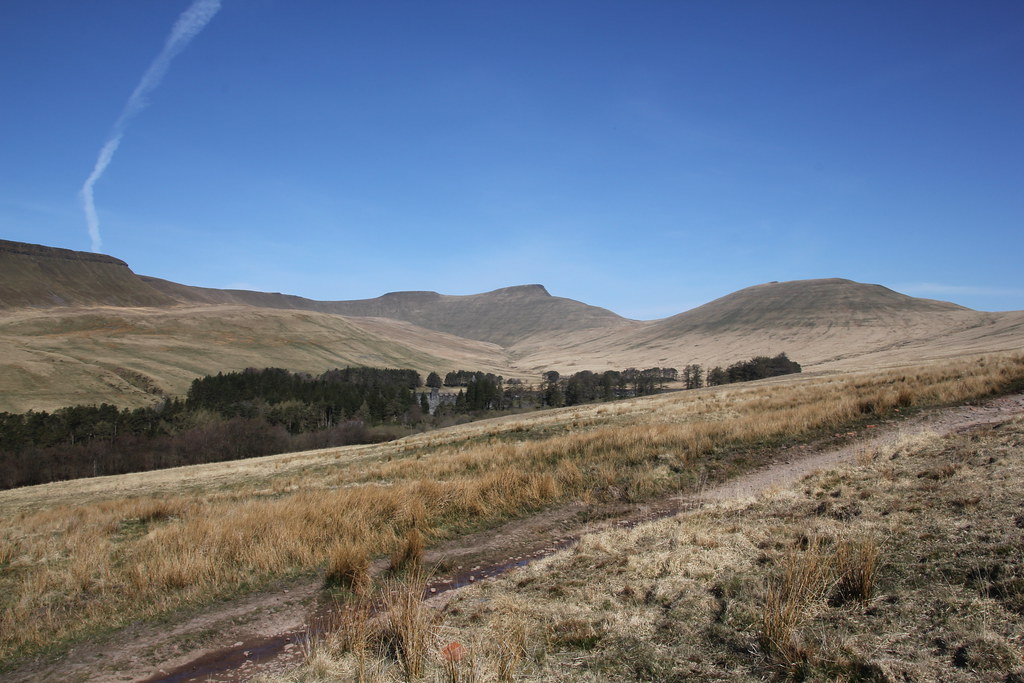
My first clear view of my target hill.
At Nafford I crossed a large weir and locks on the Avon. Its a clearly a river popular with the boating fraternity but it’s been heavily tamed to make it navigable.
I wasn’t aware how long a river it was, winding a course from the Northamptonshire/Leicestershire border all the way to Tewkesbury.
The locks and weirs were an interesting diversion.
The climb up Bredon Hill took me past Woolas Hall and its parkland, very nice it was too with lots of new born lambs for company.
Views across the Severn valley and Vale of Evesham to the Malverns.
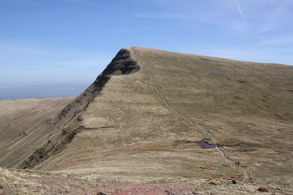
The summit of Bredon Hill and its tower.
Those sheep I was telling you about.
Rain falling on the Vale of Evesham.
It was cool and windy on top but I managed to find a sheltered perch on the edge behind a wall for the customary lunch and brew.
The weather was starting to look threatening but again I got lucky and despite the numerous storms around I stayed dry.
The walk along the grassy edges was excellent and with more time I’d have pressed on further.
Dropping down towards Comberton Wood with the flowering gorse for company.
The bluebell displays had been a little disappointing so far this year. As I entered the wood and Cames Coombe I had my reward.
A spectacular spread that, as always, the camera (or phone in this case) just doesn’t do full justice to.
It was possibly the soggiest bit of woodland I’ve trodden in for quite a while but worth every squelchy step.
Time was pressing and it was a brisk walk back to the car. Through Great Comberton and its church.
And along what was a really nice stretch of path above the Avon back to Nafford.
More views across the flower meadows to Bredon Hill.
This time choosing to walk directly through the meadow to Eckington Bridge. A really enjoyable 10 mile stroll.
And the post title? The only other time I’ve walked on Bredon Hill was on a Secondary School field trip when I was about fifteen. Gives away my age there!
With a new job seemingly in place I was down to my last couple of days of freedom. The weather was still in uncertain mode, plenty of showers but I was determined to make the most of every chance I had.
The day after my birthday trip I’d been up Merbach Hill to see if the bluebells were out. They were, but in nothing like the display of last year so on a grey day I took no photos. Possibly the cooler spring was holding them back or reducing their numbers.
The day after looked more promising albeit still with showers forecast so it was time to revisit another old favourite, Ysgyryd Fawr. My new preferred route is from Llanvihangel Crucorney. Its a longer more varied route across the fields to the base of the hill and more importantly you can park for free!
Things didn’t look promising when I set off with dark brooding clouds and a spit of rain.
However there was blue sky so I was hopeful I might see the sun. Fortune favours the brave.
These dead trees (I’m guessing they may be Elm’s killed by the ravage of the disease) are a stark and evocative sight on the way up
As I climbed the weather brightened and my hopes for a dry sunny walk improved. A couple of calls from my agency and it appeared my return to work would have to wait a few more days while the paperwork was sorted out. A few more weekday walks then!
When I reached the summit there was plenty of blue sky and sunshine mixed with dark brooding clouds. A perfect day for clear views.
Looking along the ridge to Abergavenny and Blorenge.
The main Black Mountains range.
The Sugar Loaf and Bryn Arw.
Last time I was up here the summit path was very badly eroded. Since then it appears they have been doing path repairs. I used to find these gravel paths a bit unsightly but I should trust that these people know what they are doing. Similar paths in the Black Mountains are now grassing over around the edges, narrowing into what look like more natural paths. Lets hope the same effect is achieved here on this very popular and busy summit.
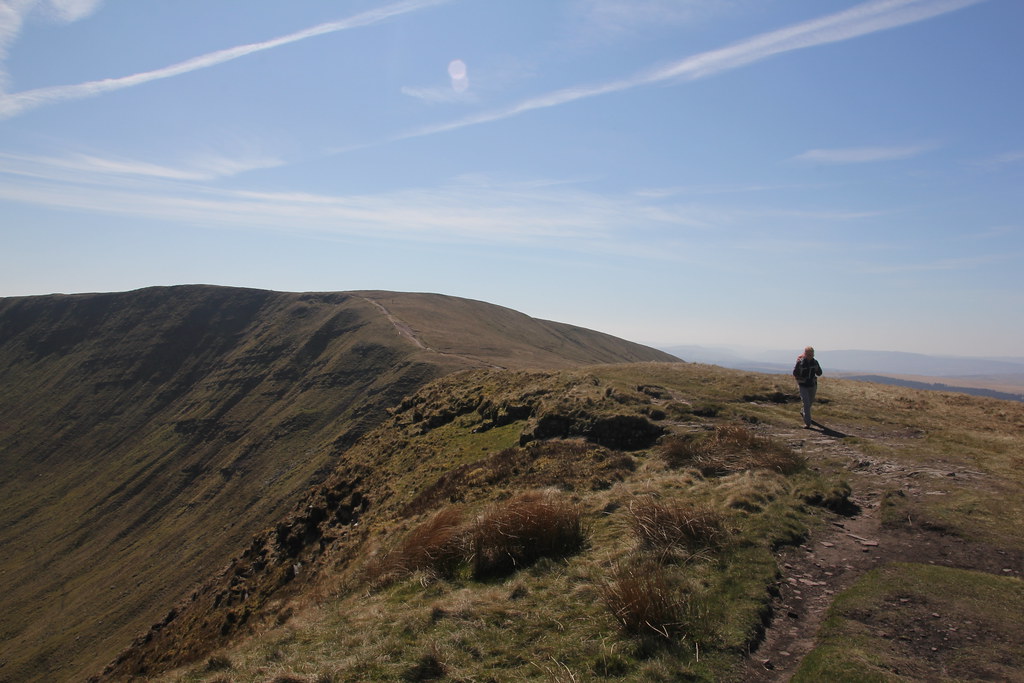
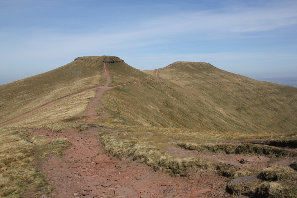
The walk along the ridge was, as always a delight. One of the most prominent peaks in this corner of Wales.
I returned along the eastern flanks to stay in the sun while it was still out. There were impressive, if small, patches of bluebells on display among the sparse trees.
To complete a circular I followed the Beacons Way for a while across the wide open fields. The weather had really delivered a huge slice of luck for me and this stretch in abundant sunshine had me reaching for sunglasses.
Looking back to Ysgyryd Fawr.
Out to the Black Mountains.
The gorse has started to flower now as well and makes a great foreground to any photo.
Back to Lllanvihangel and its church just before the heavens opened. Lucky indeed!
After a drive home in glorious sunshine from my Snowdonia adventures, the British weather does what it always does and the next 24 hours were highlighted by ceaseless rain. A chance for a day off to prepare for my birthday outing. Mark has a tradition of climbing hills on his birthday, a tradition I’m keen to follow. This year with all the COVID stuff we’ve made extra effort to try and meet up on birthdays as an excuse to keep the bonds of friendship strong
We’d agreed to meet a few friends up north and after some debate and booking into a hotel to break up the journey we settled on the Forest of Bowland. I should point out that we weren’t able to break up ALL the journey. We were still not allowed to stay in a hotel for anything other than “essential” reasons in England but we could stay in a hotel for leisure purposes in Wales. So we stopped off in Wrexham as the nearest place “over the border” as it were.
It was rather chilly and blustery when we parked up. As breakfast cafe’s were still shut I set up my own “pop-up” breakfast stall to cook up some fried breakfasts. Excellent start to the day.
Once we had everyone we gathered we set off, first along a splendid little edge right alongside the road – Baines Cragg.
Looking back to where we parked up and across what would be our descent route, Wards Stone, highest point in the Forest of Bowland, behind.
A surprising and very pleasant start to the hike.
The bluebells were out but they were in a private woodland. Better displays to come in walks later that week – stay tuned!
We were taking the rather fine path that runs along the base of the slopes below Clougha. It takes you over a pretty high bridge carrying water from Thirlemere to Manchester.
The path up to Clougha was greatly enlivened by a Slow Worm (a lizard rather than a snake or a worm). Very exciting to see these out in the wild.
The path up through the woods is rather nice.
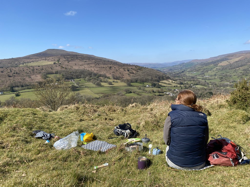
We decided an early lunch stop was in order while we had some shelter among this collection of rocks.
My Birthday was greatly enhanced by home baked cakes provided by both TBF and TYG. I stuffed my face through the day as did my willing helpers.
Looking back into Windy Clough.
It’s a fine path up to Clough which has its own fine edge of gritstone.
The weather was a little grey and chilly but when you’re sharing your birthday with good friends that’s no matter. It was just great to be out with them and sharing my day.
Happy band on the summit.
Looking across to the Yorkshire Three Peaks.
Another stop was in order for second lunch so we diverted to look at the Andy Goldsworthy sculptures.
Amongst the quarries were able to find shelter again for another chance to chat, banter and eat more cake.
Zoom shot of the Three Peaks.
Sadly we were hit by a heavy shower and decided we really couldn’t be bothered to walk up to Ward’s Stone as planned. This set back was easily overcome by the sight of J making the worlds most pathetic and embarrassing attempt to put on a pair of waterproof trousers. It must have taken 10 minutes and the rain had pretty much stopped by the time she’d finished. You had to be there I guess.
We headed over Grit Fell and then headed back down towards the cars, creating a kind of figure of eight route.
Views over Morecambe Bay.
The path down through the heather was another fine one. Other than the odd person looking at the sculptures and near Clougha, this area is pretty much devoid of people.
We’d spotted what looked like a great spot for afternoon tea (that’s UF confirming it was out of the wind). Sadly just as we settled down with a cuppa it started to rain again and it was a rather rushed affair. All too soon we were back at the cars and saying our goodbyes. It been a surprisingly long walk, over 9 miles but time flies when you’re having fun. It had been a memorable birthday and a I hope to try and do the same every year now.
Second day of my little north Wales holiday. Much like the previous day the forecast was sunshine and showers and much like the previous day things didn’t look all that promising. Dark clouds covered all the summits although at least I only had a 20 minute drive to park up. I had an idea for a long circuit of the northern Carneddau to bag a whole host of unclimbed summits. I guessed (correctly as it turns out) that the higher summits would retain their cloud cover and settled on a day on the lower summits and the fine looking ridge that stretches out to the west of the Yr Wyddfa massif.
I headed to Llanberis and after a mini-shopping trip and visit to the legendary Pete’s Eats for breakfast I set off for the hills. The forecast seemed to indicate an improvement in the afternoon so I set off to explore the lake shore and Dolbadarn Castle to eat up a bit of time.
Nice to have the castle to myself.
Fine if cloudy views up towards the Llanberis Pass.
And over Llyn Padarn.
The climb up through the woods was really pleasant, taking me up to to the Llanberis Path to Yr Wyddfa. I caught a heavy shower on the way but again, much like yesterday this was the last rain I saw.
Moel Eilio, my high point target for the day.
As the weather still seemed a little uncertain I chose to do the long walk along the valley first, hoping that the main part of the ridge would be in the afternoon and better weather. This is my first summit of the day, Moel Cynghorion.
The sun was starting to break through and the clouds seemed to be breaking up.
Looking up the Maesgwm valley.
The downside of this way round is that (it seems) very few people climb Moel Cynghorian from this direction. There was no path and the route was essentially a thousand feet of steep, spongy, grass and moss.
It was hard work and would be much better as a bouncy descent route. My progress was greatly helped by the improving views of my route to come.
It came as some relief to reach the lonely summit.
An impressive spot with steep grassy edges on two sides with views across to the famous climbers crags of Clogwyn Du’r Arrdu.
The ridge from here is exceptional, even if the weather was starting to look gloomy and threatening again.
The Nantlle Ridge and Mynydd Mawr.
There was a brisk wind and shelter was at a premium but I managed to find a wall for protection at Bwlch Maesgwm and stopped for first lunch, looking back to my first summit and ridge.
Maesgwm valley, this time from the top looking down.
Onwards and upwards to the main part of the ridge. The steep climbs greatly eased by the presence of paths. A great view back to my ridge and three peaks from the day before.
Looking back to Moel Cynghorion and its ridge of Bwlch Carreg Yr Gigfran from the next summit on the ridge, Foel Goch.
And my next objectives, Foel Gron and Moel Eilio.
A dark and brooding Mynydd Mawr.
Nantlle Ridge and Moel Hebog range.
The next section was the highlight of the day if not the whole trip. Foel Gron has some tremendous earthy cliffs dropping down to Cwm Dwythwch and its cradled lake. The main path runs a few yards away but there was a thin grassy path that stuck right to the edge of the cliffs.
The views were superb as the cloud base began to lift although the highest peaks were still hidden.
Cwm Dwythwch with the Glyders range behind, Tryfan just visible, right of centre.
Approaching Moel Eilio.
The vast Dinorwic quarries eating away at Elidir Fawr.
Looking back along the edges of Foel Gron.
The summit was breezy but the views magnificent. Looking out over Caernarfon to Anglesey, the castle just about visible if you zoom in.
A second lunch was in order if only I could find a spot out of the wind. Tucked into a very narrow ledge just above the cliffs of Moel Eilio was perfect. As longs as I didn’t drop anything! Easy to say when you are genetically disposed to clumsiness.
Hopefully showing how close my feet and my stuff were too the edge!
As I sat, ate and drank the cloud continued to lift and the views across the entire range improved by the minute. A zoom shot to show Tryfan revealing itself above the col between Y Garn and Glyder Fawr.
Another view back to the Nantlle Ridge and Moel Hebog.
And finally the summit of Yr Wyddfa appeared.
One of those days when you just want to sit and look at the view forever but I still had a decent walk left and a long drive home.
The long ridge of Braich y Foel was my route down, easy angled (apart from a surprising steep nose at the end) with expansive views. It would make a much better route of ascent and a better way around these hills than my choice.
Yr Wyddfa and the first three peaks of my round.
Panorama shot (click to enlarge)
A close up of the long edge that shadows the Llanberis path to the summit of Yr Wyddfa. I took this as I’ve always felt that this route to the summit of Wales must be a grinding drag of all the paths, whereas if you stuck to the edge it would make an excellent walk. I must try it someday.
A wider shot to show just what a long route its is. Yr Wyddfa is the snowy peak in the background and the start point in Llanberis is a couple of miles to the left.
Elidir Fawr, Llanberis and Llyn Padarn.
It was a very pleasant walk down through the lanes and fields and finished off with a fine walk along the lake shore, much sunnier than when I’d set off in the morning.
I reached the car after another wonderful day out in the mountains, pleased that I’d taken my chances with the weather and it had been relatively kind to me. The long drive home through the sunny mountains of mid-Wales was a fine finish
Another 11 miles and another 3,500 feet of ascent, another three new Nuttalls bagged.
I’ve been trying to make the most of my time off before I get back into work. The forecast towards the back end of last week, while uncertain had some promise, sunshine and showers with the latter easing in the afternoon. Having discovered I was now allowed a hotel stay for leisure as long as it was in Wales, I decided on a two day outing to Snowdonia. There were several areas I’d still never walked in and hills on lists to be bagged.
Footnote – I’m still bemused by the lack of coordination between the national and devolved governments over COVID (I wasn’t allowed to stay in a hotel in England unless for “essential” reasons)
Anyway, my first route was the Moel Hebog range. I parked up at Beddgelert Forest (it was free!) and the signs were not good. Snowdon had completely disappeared into a hail storm which was also battering the car. I paused to think and it stopped so I hit the forest tracks and hoped for the best. As I started the climb towards the col below Moel Lefn there was another very dark cloud and a sprinkling of snow and hail (you can see in the photo below). However there was blue sky and the Snowdon range had re-appeared and was looking very wintry and dramatic.
It was the last time I needed a cagoule that day 😀
I wasn’t sure how good the paths would be but of course in these days of increased popularity of hillwalking there was an excellent clear path the whole way. The first stretch took me through old mine workings with tunnels and some very deep holes.
The summit of Moel Lefn, the first peak in the triumvirate.
As I climbed the views just got a better and better. Looking to the north where the weather was rolling in from looking very promising and even though there were plenty of clouds, the air was strikingly clear and I hoped the worst would be the odd heavy shower.
Looking to the Nantlle Ridge – a superb walk in itself.
Looking across to the Snowdon range.
The clouds casting shadows on the mountains was a real feature of the day
Back down my route of ascent.
Western end of the Nantlle Ridge.
Out over the Llyn Peninsula.
My first look at the big daddy of the group, Moel Hebog, with Moel yr Ogof to the right.
I managed to tuck in out of the wind on Moel Lefn for first lunch. It was pretty much winter up there and I was glad of my winter down jacket to keep warm.
The views were just magnificent.
The walk onto Moel yr Ogof was easy and much grassier than I’d anticipated. I didn’t stop on the top for long so I forgot to look for Owain Glyndwr’s cave.
The hills of the Llyn Peninsula, Carn Fadryn just left of centre, Yr Eifl to the right.
Moel Hebog looming large as I approach Bwlch Meillonen.
Just before the col there is this dramatic small and steep gorge to negotiate. Its a wild and wonderful spot.
A look at the very steep thousand foot climb ahead of me!
Moel Siabod framed and prominent by the rest of the range.
Looking back to Moel yr Ogof, the small gorge I’d walked through very obvious
It was a long and steep plod to the top and really cold and windy. After a few abortive attempts I managed to find a sheltered spot for lunch overlooking Cardigan Bay.
Moel Hebog’s relative isolation from the main Snowdonia ranges and its proximity to the coast give it an exaggerated sense of height. The view to the SE over Beddgelert and Llyn Dinas towards Moel Siabod is just superb.
Looking back to the Moel Eilio ridge west of Snowdon. On my list of possibles for the next day.
Trig Pillars provide a fine foreground to mountain panoramas.
I had to find my way back to the car but it was still too early to follow the main direct path down towards Beddgelert. I had an idea I could also tick off Moel Ddu but it was a long way with a low col and leave me a long walk back to the car. I’d noted there was a small ridge called Bryn Banog between there and Moel Hebog so I settled on that.
It was a very steep descent down to the col but the weather was pretty settled by now and the views still fantastic.
Despite Snowdon always being visible, it was Moel Siabod that grabbed the attention.
The lonely reservoir of Llyn Cwnystradllyn.
Moel Ddu from Bryn Banog. Good call to leave it for another day. It still looked a long way off.
The Moelwyns and Cnicht, another fine range of mountains.
The short grassy ridge of Bryn Banog was a real delight and an excellent little find. I doubt many people walk it although there was a thin grassy path.
Grandstand view of Moel Hebog and its craggy east face.
More sunshine and cloud shadow views of Snowdon. There seems to be a campaign to refer to it by it’s traditional Welsh name so Yr Wydda it is!
With such a stunning weather, a final afternoon stop was needed before heading down. I was following a wall along another little walked ridge and found a sheltered spot to enjoy the mountain views.
After descending to the forest tracks in the valley (via possibly the wettest and soggiest field of grass I’ve ever walked through!) all that was left was the long few miles back along the valley above Beddgelert to the car. Rather than being a grind it was open paths and natural mixed woodland most of the way and was a real delight.
Moel Hebog itself was hiding its light behind the trees until I crossed the Welsh Highland Railway (sadly not operating due to COVID). It gave me a superb final shot before the last mile back to the car.
What a superb day and a cracking little range of mountains. Three new Nuttalls ticked off. I was pretty tired though after 12 miles and 3500 feet of climbing over terrain rougher than the south Wales mountains I call home. My gamble with the forecast had paid dividends and I only had a 30 minute drive to get “home” to my hotel room and fish and chip supper.
I’ve been working my way through all my favourite walks now that I can walk the Welsh hills again. This circuit of Hatterrall Hill was always a good one when a half day walk is needed. This one after a late start and a need to be back in time to pick up TJF from college.
Parked up outside the famous (to me anyway) wonky church at Cwmyoy.
Views across the southern end of the Vale of Ewyas to Ysgyryd Fawr.
Over to the small summit caused by one of the landslips – I’d be there later.
This shot makes it look like a warm and sunny spring day.
Approaching the trig pillar en-route to Hatterrall Hill summit.
This shot shows that it was far from a warm, sunny spring day. There were storms all around and I was lucky to be in a sunny patch – for now.
I took my chances and stopped for lunch before any of the deluges reached me.
I managed to tuck in below the trig pillar, out of the wind and watched the storms sweep across south Wales and the Shire.
It wasn’t a day to hang around too long and push your luck so I pressed on around the circuit.
The upper reaches of the Vale of Ewyas towards the Gospel Pass.
Ysgyryd Fawr.
And the little summit mentioned earlier. A steep scramble (or easy path to the right side) takes you to the top. In my case just in time to be pelted with hail stones and rain.
As is the nature of these sorts of days, the rain/hail only lasted a few minutes before the sky was transformed into a deep blue.
I had a few minutes to spare before heading to pick up TJF so sat down to enjoy the sun and dry off a bit.
Its nice being able to walk during the week when you have the hills to yourself. I’d only seen one other person on this little 3 hour outing.
Over all too soon, although just as well as the showers increased in frequency and ferocity as the day progressed.
Another day and another forecast of morning sunshine and afternoon showers. Rinse and repeat then, early start and breakfast on the hill.
A stunning morning, crystal clear sharpness to the air and warm sunshine (out of the wind anyway)
Just a delight to be out and about on a morning like this.
Ysgyryd Fawr showing itself.
Sugar Loaf rising above us.
Never noticed this little pond before. Provides a nice foreground to the Black Mountains behind.
The forecast was for showers to move in by late morning but so far there was no sign of anything in the way of significant clouds.
We took our usual and now preferred route, following the balcony path that cuts up and across the NE slopes of the Sugar Loaf.
Clear views all the way to the Beacons.
The short rocky ridge that leads to the summit.
The summit was unsurprisingly busy – its a very well known and easily accessible peak – but also chilly in the wind.
I reckoned I could find a much better spot for breakfast just below the top, out of the wind with not a soul in sight. Another cracking hill breakfast was in order.
We’d planned to head back to the car straight after breakfast but the weather seemed set fair so we extended the walk.
The Sugar Loaf radiates out several ridges to the SW so we followed the one marked as Rholben on the map down towards the outskirts of Abergavenny.
Downside it involves a significant descent and then re-ascent to pick up one of the other ridges back towards the car. Compensation provided from the stunning open woodlands and their spooky moss covered trees.
Both the ridges (the second one marked as Deri) make for superb easy walking on grassy paths that always put a spring in my step.
The clouds were gathering but not before we’d squeezed in another stop for a brew.
A great view of Ysgyryd Fawr from here.
Storms passing us by.
Looping back round, we completed this ridge (first time I’d ever walked either) back to the car.
Like the previous day we broke away from our standard route of a walk to explore something new that delivered another great day.
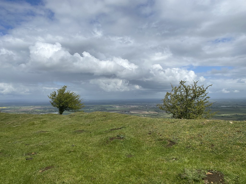
Our nearest local hill walk is Merbach Hill. Its appeared many times on this blog and has in the past 12 months been a godsend as restrictions on how far you could travel became common place. It tops out at just over 300m but you can drive pretty much to that height with a short walk along the lane from the burial chamber at Arthurs Stone, always our preferred route. This is perfect when you need a short walk but we’ve never walked up from the Wye Valley, from the bottom as it were, to make a proper half day of things. The weather recently seemed set in a pattern of bright, sunny mornings and afternoon showers so we took our opportunity to tackle such a route with a view to having breakfast somewhere up on top.
When following what are likely to be little used footpaths and rights of way from the OS Map you never know quite what your are going to find. I’d planned what I’d hoped would be a nice circuit but things didn’t start well with an overgrown stile off the road and an initial woodland path, poorly marked and covered in what looked like carelessly felled trees.
From there, things improved considerably. Paths were clear and well marked taking us around some wonderful open fields full of spring lambs.
The skies looked a little threatening but added to the atmosphere on what was a warm and sultry day. Luckily they never amounted to anything and we stayed dry.
The trees are starting put on their summer display of foliage.
The last of the steep slopes towards the top of the ridge.
Expansive views over the bucolic Herefordshire countryside.
Before long we were back on the familiar territory of Merbach Hill Common.
Last year there was a superb display of bluebells up here. This year we were told by a nice lady on the way up that the purple orchids were blooming. They were magnificent (even though my attempted photo isn’t that great). I’ve been up there again today and they were even better and more of them. Much better than this years slightly disappointing bluebell turnout.
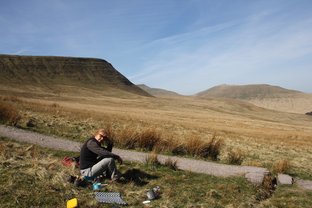
We found a sheltered spot and settled down to cook breakfast – well I did anyway. TBF is more of a healthy fruit type breakfast person.
For me this time it was Quesadillas (fried corn tortillas packed with cheese, spring onions, chilli and chorizo).
Lounging in my lightweight backpacking chair.
More open meadows and open woodland on our way down.
We were following what was marked on my map (but not on the ground) as the “Three Rivers Ride” linking together the Lugg, Wye and Usk rivers for horse riders.
We were enjoying seeing a different side of a route and hill we’ve walked many times.
Indeed its very surprising that its taken us so long to try such a route out.
We’d parked by the church at Bredwardine and the final stretch took us through pleasant woods by the Wye and back to the church.
A great little 6 mile outing. No parking hassle, no crowds, just 15 mins drive and back home just after lunch. Perfect.
Going back a couple of weeks again. That’s the problem with being off work in nice weather. I’m out and about more often than I can find time to write them up. Its a tough life.
I’ve been enjoying revisiting all my favourite Welsh walks since they opened the border. Bryn Arw has always been a favourite, either as a post work walk on my way home from Bristol or when a short simple walk is needed.
A bright Sunday and time to head out early and cook breakfast in the sunshine. Best time to be out.
Thinking back, the last time I walked this small charming hill was the day when the very first lockdown was introduced. I was up early around 6am, on the summit by 7am and home and back at my desk for work by 9am. The talk of lockdown was gathering pace so later that day I drove the 400 mile round trip to Lancaster to bring TJS home, by the time we were back Lockdown was in effect. It was an interesting day to say the least.
Back to this day and it was a gorgeous morning, all blue skies and sunshine albeit with a keen and chilly wind. The Sugar Loaf looks particularly fetching from Bryn Arw so no apologies for it appearing in many of this post’s photos.
Ysgyryd Fawr is also very prominent from here although the early morning position of the sun not highlighting it at its best.
It’s a steep little climb, but once up its a wonderful easy walk along its grassy ridge. I must have been up here a dozen times now, maybe more, and I have never seen anyone up here. One of the best kept secrets in this corner of Wales.
Several views looking across to the Black Mountains.
The Sugar Loaf.
The hill fort of Twyn y Gaer.
A distant view of the Brecon Beacons summits.
Time to eat! We had to hunt around a bit before finding a sheltered spot in a small hollow lined by gorse bushes. Not a bad spot and view to eat breakfast.
And the classic Bacon and Egg butty to complete the occasion!
Being out in the hills is more than just exercise. Sitting in the warm sun soaking up the views is just as important.
When they are this good, the sitting and eating is as important as the walk itself.
A final Sugar Loaf shot as we headed back to the car and an afternoon sat in the sunshine in the garden, exercise box ticked for the day.
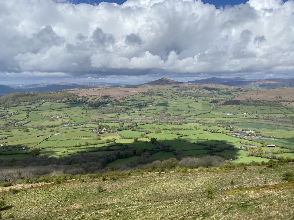
While I’ve been enjoying the life of Riley and not working I’ve been grabbing every opportunity to hike the mountains and enjoy our newly restored freedoms. As TBF no longer works on Friday’s we had plans to use those days to good effect. A glorious forecast a couple of Friday’s back gave us our first chance to test the plan with a trip into the Brecon Beacons.
The classic round from the South seemed in order and we were away early as its busy and popular even on a sunny weekday.
All going to plan until we arrived to find the local forestry operations had decided to close not one, not two but ALL THREE of the car parks in the area. No warning on the approach roads, just at the car park entrances. In addition they deemed it necessary to close most of the forestry roads AND the Taff Trail. The only work going on was in the top car park which I guess was fair enough to close that one but there was no reason to close the others.
We got lucky and managed to grab the last space where the Taff Trail leaves the road but even then we warned not to walk it. We decided to hell with all that and just walked in anyway (there were no obstructions, danger or machinery in operation and nothing more than what we all walk past hundreds of times).
All dressed up in “Health and Safety” terms but the truth is they were just too lazy to have managed plan in place and only close off those areas they were actually working in, much easier to close everything just in case. This was a Friday and with another sunny day forecast for the Saturday I dread to think of the chaos if they didn’t open the car parks the next day. Cue cars parked on verges, in passing places and lots of traffic problems. Again, much like my thoughts from the previous day, how is this allowed to happen. These car parks have been effectively closed and off limits due to COVID for several months yet they wait until the rules are relaxed and the weather improves before they close off one of the busiest and most popular areas of the National Park. Sigh!
Anyway, nothing better than a stunning walk under blue skies to calm frayed and angry nerves.
This time we decided on the route the opposite way round to normal and headed up the thin paths up to Fan y Big, views opening up as we climbed.
Much like the day before it was warm in the sun but there was an increasingly strong NE breeze blowing that made choosing stops a very selective process.
It was a little hazier than the day before with more in the way of cirrus clouds but still stunning.
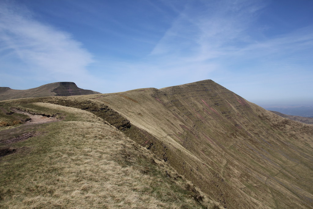
The classic view of Cribyn, Pen y Fan and Corn Du from Fan y Big
TBF posing on the overhanging rock on Fan y Big.
Cribyn from “The Gap”
Cribyn Summit Ridge.
TBF admires the views from the summit.
Lunch time was proving a challenge as the wind seemed to search us out wherever we sat.
There is a very prominent level grass shelf halfway down Cribyn towards Pen y Fan where I’ve often thought about a wild camp. I’m told its well known and referred to as “Dai’s Terrace”. Just under the cliffs of Cribyn we managed to find a sheltered spot although not a spot to drop anything!
I’m not normally in this part of the route until later in the day but this time we were early enough such that the NE face of Pen y Fan was lit up by the sun.
Looking back to Cribyn, the terrace where we had lunch clearly visible about 2/3 the way up.
The climb up Pen y Fan is long and steep. I always brighten it by following the extreme edge away from the main path that gives superb views over the face.
Looking back over our route so far.
The long ridge from the car park to the north.
As it was Friday both Pen y Fan and Corn Du were relatively quiet. Had this been a weekend its not uncommon to see over a hundred people on the summit and a constant stream of people heading up from the Storey Arms.
Corn Du from Pen y Fan.
And the reverse fixture.
Looking down to Llyn Cwm LLwch, a popular wild swim with a mermaid legend to boot. I’ve not walked that route for many a year.
Looking back to the twin crowing summits of the Beacons.
As soon as you head down the long edge above the Neuadd Reservoirs (or what’s left of them), you lose the crowds.
It’s a stunning walk but the wind had become ferocious by now and I was struggling to find any shelter for afternoon tea.
I figured the steep path that runs straight down to the valley bottom would afford some shelter from the forest.
An so it proved. We could hear the wind roaring through the trees but a ground level it was calm and very warm in the sun.
I mentioned the reservoirs before. There used to be two but both have been empty of water for many years. The smaller lower one has now been completely drained and the dam removed. This is all that remains. The dam is still in place for the upper one but I have no idea if they will remove that or whether it will ever be re-filled.
All that was left was to repeat our highly dangerous and risky walk back past the very small piles of logs next to a 20m wide open track to end a day that started with annoyed frustration but delivered a superb day out in some long missed mountains.
I spend alot of my time surfing the web looking for ideas on places to go, walking routes, travel ideas and tips to plan the perfect holiday or day out. (I'm a project manager I like to plan). I thought it was time to share my own experiences and contribute to the vast amounts in information that's already out there.
I'll also add in some gear and tech reviews and when something irks me I may even use this forum to have a rant - I do that pretty well I'm told.There are a few pages at the top that give a bit of background to what I like to get up to and what you can expect to see in my posts. I'm not exactly a creative writer but I hope some people will find my stuff useful or inpsiring or at least enjoy some of my photos.