Back a couple of weeks to a time when we thought summer had arrived. Looking out a dull skies and forecasts of heavy rain for the next few days I need to remind myself what it looked like.
Another forecast of early morning sunshine had us out early for breakfast in the hills.
Our chosen spot this time was Castell Dinas at the bottom of the Y Grib, Dragons Back ridge in the Black Mountains. Its only a short walk from the car and its been difficult to get up here recently as the main road has been closed for a couple of years after a landslide.
We found an elevated perch on one of the old earth wall remains and enjoyed our feast in the warm sunshine. Idyllic.
Breakfast with a view like this can’t be beaten.
Cooking up the feast for me! (TBF prefers a banana and, well, that’s about it)
While we sat there we had one of those rare odd moments of unfriendliness you get in the hills. A guy walked past and decided, for whatever reason, that he absolutely needed to walk along the same narrow little perch we were sat on (his two companions walked a discrete distance away). Despite the fact he pretty much trod on our stuff and us, and came close to knocking the stove over, I still, as I always do, I said a cheery good morning. He didn’t acknowledge or reply. Obviously he had taken offence at where we were sat or possibly that we had quite a bit of stuff spread out, who knows! Of course we always clear up afterwards and leave no trace. Odd chap.
Can’t let an odd moment like that distract such a glorious morning and we lingered for ages as its such a grand spot with great views.
I’m not sure what these trees are (Hawthorn?) but they were in bloom all around the walk and were quite striking, visible as swathes of white across the hillsides.
Time to move on and climb some hills.
Looking back to our breakfast castle.
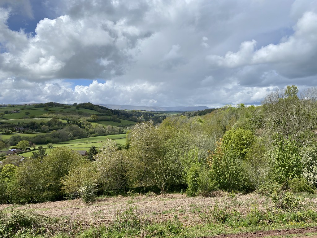
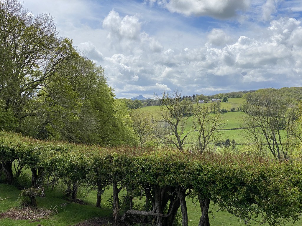
The Y Grib ridge is as fine as the Cats Back ridge on the other side, albeit without the rocky outcrops. Mynydd Troed’s shapely outline behind and a distant Pen-y-Fan behind that.
Its a nice easy way to gain height to the main ridge of the Black Mountains, especially on a morning as fine as this.
The broad valley that separates the main Black Mountains range from Mynydd Troed and Mynydd Llangorse.
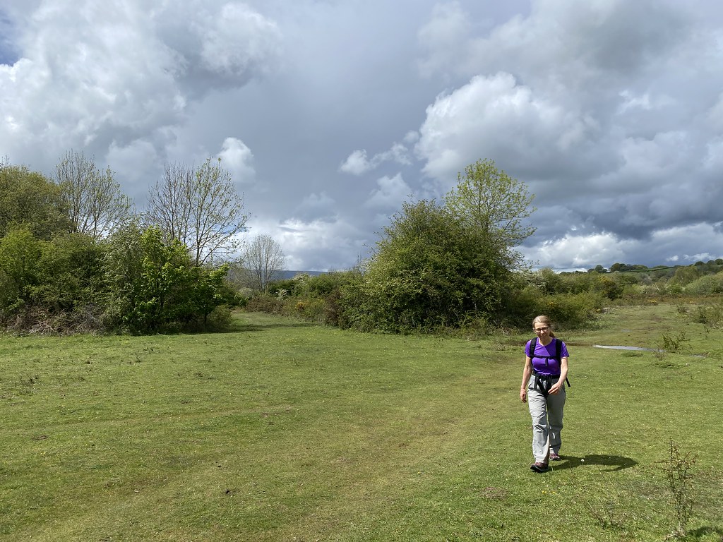
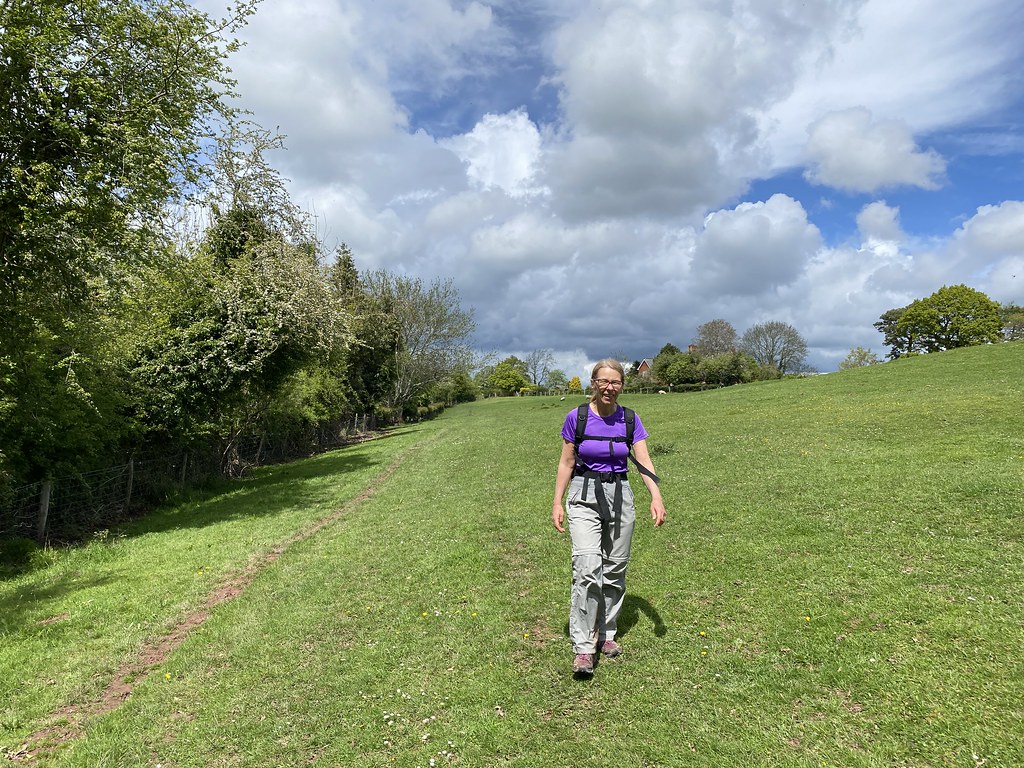
TBF enjoying the ridge.
Approaching the top. I camped up here in the summer heatwave 3 years ago.
And finally onto the main ridge and the path to Waun Fach, highest point of the Black Mountains. The conservation teams have done a wonderful job with this path. What used to be a boggy muddy trudge is now a perfectly engineered gravel and stepped route that’s a joy to walk on.
We were joined by several gliders from the nearby air strip.
You may have noticed the bank of clouds out to the west in the previous sunny photos. Well, they were on their way (as forecast, hence the early start) and duly arrived as we headed down towards Mynydd Llysiau.
Whilst we lost the blue skies we had odd patches of sun and it was still warm and dry and perfect for walking.
Looking back to Pen Allt Mawr. The trees in the middle were awash with white flowers but its doesn’t really show in the photo.
It’s a long descent all the way to the bottom of the valley for the return via Mynydd Troed. The steep climb enlivened by more of the white flowered trees.
Looking back across the valley to Pen Allt Mawr.
The ridge of Mynydd Troed is fine and long climb and one that I’ve never seen anyone else on.
Sadly, three years ago it was badly damaged by fires and the recovery is slow progress. The grassy path recovered quickly but elsewhere the bilberry bushes and heather have not yet started to grow back and all that seemed to be growing is a reddish moss.
This is a photo from roughly the same spot a short while after the fires a few years back.
The reddish moss was abundant here.
And again this is what it looked like in the aftermath of the fire.
I can only hope that it recovers in due course and when it does it will be interesting to see what nature comes up with.
This is what the ground cover was like before the fire.
View out over Llangorse Lake to the Brecon Beacons and a distant Black Mountain.
Castell Dinas and the Dragons Back ridge.
We managed to find a sheltered spot for a final brew of the day before heading down.
Two photos looking out over our morning section of walk. This one taken with my DSLR.
And this one with my iPhone that picks out the white flowering trees to much better effect. Its a more dramatic photo but looks overly processed compared to the more natural look of the DSLR image.
A very short walk to the car from the summit but also very steep indeed! That black cloud actually dropped a little rain on us but not enough to dampen another superb day out.
A good workout as well, 12 miles and 3,500 feet of ascent.
The Bank Holiday Monday was another superb day of cloudless skies and glorious sunshine. A day to take in a walk to Arnside and over the Knott.
We had some practicalities to sort. DB Snr was completing his DoE Expedition and we had no idea what time he might finish and need collecting. We also had our eyes on pies for lunch and wanted to make sure there were still some left when we arrived in Arnside. We dropped a car in Arnside (ready for the “come pick me up” call) and returned to Silverdale for a rushed get-ready session.
The classic route is around the coast but with with pie-shortage worry at the forefront of our minds we chose a more direct route, past Arnside Tower and through the woods at the base of Arnside Knott.
The plan worked well and there were pies left to scoff. We found a nice grassy bank ovcerlooking the Kent for our lunchtime feast in the sun.
The tide was out and were hoping to maybe see a tidal bore. Overhearing someone talking to the official looking people, confirmed that the tidal range was too low today for that.
We consoled ourselves with a view of train crossing the bridge – small pleasures.
It looked like DB Snr was closing in on his pick up point so Mark left us to fulfill the taxi duty (in fact he was still several hours away and we were back home before he was!). The rest of the party (minus DB Jr who headed home) went up Arnside Knott.
It was a hot climb in the sun but the views were glorious.
Over the Kent estuary towards the Fairfield Horseshoe.
Slightly further north towards the Howgills.
Farleton Fell and Hutton Roof
I love the colour contrasts in the photos between the green fields, blue sky and sandy estuary.
We made it to the summit of Englands smallest Marilyn.
After all that ascent (500 feet!) it was time for a rest and brew. There are many paths and trails around the summit but Mark had recently taken me on small path perched above the edge with superb views. Not a bad spot for cuppa, looking out over the bay and Silverdale to the distant Forest of Bowland.
Arnside Tower below us.
Happy people enjoying a top notch Bank Holiday Monday.
Views back from this excellent little path.
We took in the views from the toposcope but there was a large family group there so we didn’t rest too long.
The views are pretty decent though.
I’m not sure I’ve ever seen the bay at Silverdale looking quite so beach-like. Normally it seems to have many more dry/wet patches and numerous channels etc.
Love this photo – happy hikers enjoying the last moments of a great day out as we walk across Heathwaite.
And last shot near to home of the Monkey Puzzle Trees in a nearby garden.
A wonderful weekend, sadly over all too soon. As always a huge thanks to our good friends for making us welcome and giving us a holiday break in these challenging times. They even booked the weather! 😀
Half term week and with campsites likely to be heaving and expensive (or both) we needed a plan. Luckily our great friends in Lancaster offered their home as a weekend base (well actually I kind of invited myself but you get the idea!). As an added bonus our other camping friend J-Dog (don’t ask – I have no idea where her kids got the nickname from) was coming as well, sadly without said kids in tow, almost the French camping gang back together.
So there followed a weekend of doing lots of stuff without doing anything in particular – which is just how I like these weekends. Local walks, garden time and plenty of food and drink. On top of that we all get on so well and are easy in each others company so many laughs were in order.
We took an extra day to drive up on Friday and after a fine lunch at a Garden Centre arrived in time for evening stroll across The Lots and through to Woodwell to look at the pond and its newts. The white flowers of wild garlic taking over from the Bluebells. Absolutely stunning although as Mark commented the aroma of Garlic is quite overpowering after a while.
Saturday was warm and largely sunny so we took another walk around The Lots and back through the village. My actual recollection of the day is a little vague if I’m honest but that’s a good thing – I think?
We did spend a lot of time in the garden playing our favourite game of Kubb as well as being enticed in to riding the Flicker – a sort of three-wheeled scooter. I have less than fond memories of the one we bought for TJF. It took an age to put together, and she rarely used it. TBF however seemed to like this one, getting the hip-wiggling just right to make it move. I watched on as she had fun, refusing point blank to get involved (from the person who once broke his hand falling off a pogo stick into a pond).
This is the view from the garden – hard work sitting around and looking at it while drinking cold beers.
Sunday was glorious, clear sharp blue skies and warm sunshine. After another endless breakfast we set out for another short walk. This time across the fields….
Through the woods…..
Down to the coast…..
And Jenny Brown’s Point.
That endless stretch of close cropped grass was just begging to be sat on and a brew made – so we did! Fabulous spot laze away an hour.
Looking out over Morecambe Bay and Quicksand Pool.
And back towards Lancaster and the Forest of Bowland.
As we wandered back there was a sort of mini-tidal bore with water rushing several directions at quite a pace across the sand banks and channels. Reminder of what a dangerous place the bay can be if you get caught out in the wrong place at the wrong time.
Back along the coast via Jack Scout.
Via the village cafe to stock up on freshly baked pies for lunch with more sunny views across to Fareleton Fell in the distance.
This evening’s sport-related entertainment was basketball – I’m not quite sure why we were forced to wear the ridiculous hat but it fitted the rather jolly mood.
Rather pleased with this finger tip action shot.
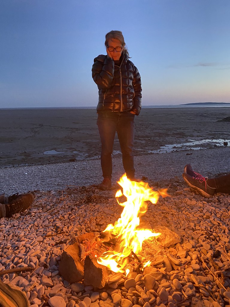
To finish off the day we went for an evening stroll down to the beach to watch the sunset, drink beer and light a fire.
Collecting firewood, which looked a bit sparse but we collected more than enough for a decent blaze.
The lack of clouds meant it wasn’t an especially spectacular sunset but it was mild, calm and peaceful.
Not a bad little driftwood fire.
Shiny, happy people, laughing.
After collecting one of the DBs from a DoE expedition, Mark came down to join us and enjoy the warmth of the fire and the chill of a beer or two.
TBF keeping warm with a combination of winter duvet jacket and fire.
And a real favourite pic of the weekend. A great way to finish a truly great day. More to come….
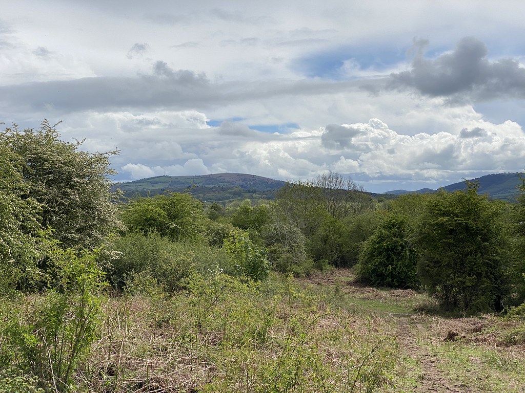
When we drive up north we often take the scenic route up through the Welsh borders. Just beyond Welshpool are a group of small steep hills rising out of Severn Valley that have always caught my eye. Me and UF have been discussing a day out on them and while the Funsters were away we decided to head out and play.
Our original plan had us completing the walk and then heading to the pub afterwards for a meal and a pint. The Admiral Rodney sits nearby and looked like a fine country pub with great reviews. Sadly they were fully booked in the evening (first weekend after lockdown restrictions on eating out eased). However they did say lunchtime would be no problem so we just re-structured the plan. We met up in the car park in Criggion and decided to walk up Breidden Hill first before heading back down to the pub for lunch.
Forecast was mixed for the morning, better in the afternoon and we were doused with a shower as we reached the top. The views even in the rain were superb and promised great things for the afternoon. After all the recent rains the Severn looked like it had burst its banks in a few places.
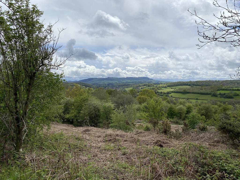
Even though relatively low in height, these hills position over the Severn Valley and the Cheshire Plain give them an exaggerated feel of altitude. As you can see, even in the midst of a rain shower the views are extensive.
This is Admiral Rodney’s Pillar on the summit. Some Victorian bloke who won naval battles in the American War of Independence. Not quite sure what his connection to the area was but its a fine monument with a great view.
The surrounding hills and bumps of the Breidden Forest were a mix of woods, grass and bluebells.
Adding interest for our descent back down to the bottom and our appointment with lunch and beers at the pub.
And very fine it was too. Great food and a couple of pints of Butty Bach beer to add to the spirit of things. It felt great for another small piece of normality and only a shame it wasn’t quite warm enough to sit outside. When we returned outdoors ready to continue our route the weather seemed to improving.
Trouble is, a large two course lunch and couple of pints are not terribly conducive to swift walking progress (although UF made rather a bigger deal of things). Especially in the Breidden Hills where up and down are the order of the day.
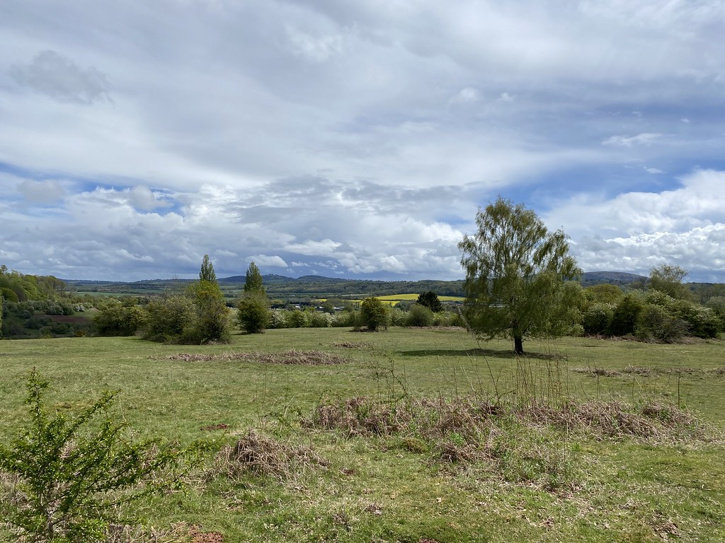
Onwards and upwards to the next summit of Bulthy Hill, the gorse adding a splash of colour.
Breidden Hill.
And on to the next one, Middletown Hill. Looking back from near the top to Bulthy Hill and beyond to the rain storms over the Cheshire Plain.
Middletown Hill summit where we stopped for more refreshment and to let the beer/lunch combo settle a bit.
Looking out over the Shropshire Hills.
An onwards to the last and highest summit in the range, Moel y Golfa.
Sunshine over Breidden Hill and Forest.
Oh, and I forgot, the Volcanic reference in the post title refers to the fact that Moel y Golfa and Breidden Hill are the remnants of an old Volcano, while the other hills are the ash and cinder cones that formed around it.
Looking back to Middletown Hill.
The only downside to this route is there is no direct right of way between Middletown Hill and Moel y Golfa. Strictly speaking you have to walk right down to the bottom of the hill to pick up the path all the way back to the top. About a third of the way down, my map showed a path, on the ground lots of signs saying “no footpath”. The pedant in me says that’s not correct as there was a path, just not a right of way. Regardless we snuck through and saved about 200m of descent and re-ascent. I’ve since learned that you can cut across fields from the col as its recognised as an unofficial path. Once on the top the views were spectacular.
Another summit and another monument, this one to some Traveller type who frequented the area.
This is a feature called the Roundabout where the Severn twists and turns almost back on itself leaving a neck of land only a few meters wide that will surely cut through at some near point in time, geomorphologically speaking.
Distant view of the Stiperstones.
And Corndon Hill above Churchstoke (another on my list of post-lockdown hills to revisit)
Cadair Idris, the Dovey Hills, the Arans and the Berwyns visible in the distance.
Breidden Hill has a quite enormous quarry dug out almost from top to bottom. Its something of an impressive if rather ugly scar when viewed from the west but walking around these hills you barely notice it other than from here.
Long Mountain. Certainly very long but pushing it a bit to describe it as a Mountain.
The descent of Moel y Golfa was very steep indeed with a couple of surprising little rocky steps to keep us interested. It would be something of a challenge in snow or icy conditions.
To complete the walk we had a wander around the lane at the bottom and then through Breidden Forest. The weather was now stunning, much better than forecast with abundant blue sky and sunshine.
The forest was wonderful in the evening sunshine. Easy grassy paths with bluebells dotting the open meadows.
I had an idea I could return to the top of Breidden Hill until I realised it was already past 7pm and we still had a bit of walk left and a long drive home.
I settled for enjoying these fine woodland glades.
And grassy paths.
When planning the walk we’d invited a few others who for a variety of reasons couldn’t join us. Before setting off we’d remarked that perhaps these hills were not worth the long drive. As we neared the end of the walk we agreed that this small and perfectly formed range of hills were well worth any effort to reach them. The combination of summits, ridges and forest (and a nice pub with fine food and beer) was and is irresistible.
As a final point I’d always wondered whether you could extract a full days walk from these hills. Nine hours after setting off (admittedly with two hours spent in the pub) and with 12 miles and 3500 foot of climbing I think I can safely say it was a very full day’s effort.
Always great when a speculative plan pays such huge dividends. Another for the book (Small Hills etc etc) and another favourite that needs a regular repeat.
When we first moved to Herefordshire and when the kids were small, Ewyas Harold Common was a popular outing. Near to home it made a great spot for a short winter walk or a in warmer months for a laze and a picnic. Its been a number of years since we’ve been up there to the extent I don’t think it’s ever featured on the blog. Another short walk between the heavy showers gives me a chance to put that right.
To make a decent walk of it we parked up in Pontrilas and walked along the Herefordshire Way into Ewyas Harold village following the Dulas Brook. In truth that part wasn’t great with very muddy fields and a Sewage plant to cope with.
Ewyas Harold Village is very nice though as is its church.
On the way to the common we passed a field of Alpacas – not the inflatable variety (private joke between me and the DBs)
Garway Hill from the common.
And Craig Syfyrddin.
Despite the threatening weather all around it was warm and sunny as we walked across the common.
A distant view back to one of the many stunning stone cottages up there, this one I’ve always had down as one of my dream homes.
Wouldn’t be a bad place to live with views like this.
What I had forgotten was how astonishingly wet it can be up here. There was standing water and extensive patches of deep cloying mud everywhere. After a while it became somewhat tiresome trying to circumnavigate them all.
A glimpse to a stormy looking Black Mountains.
Ysgyryd Fawr poking out above the trees.
Things improved (from a mud perspective) once we left the common.
The walk over the fields and down to Ewyas Harold was much nicer and drier.
Back onto the Herefordshire Way and return to the car. Perhaps next time I’ll pay a visit in a dry spell!
Short outing to try and beat a very dark and showery day, which we almost did until the last half hour or so. We’d enjoyed a long walk around all the Kington area hills a few months back and thought a visit to Stanner Rocks would work as a walk to fill a couple of hours.
Parking up in the quaintly named village of Burlingjobb we first headed up Old Radnor Hill. Its been eaten away by vast quarry but on the southern side you’d hardly notice. Its a fine are of open access land with great views across to Hergest Ridge and Hanter Hill.
You can see from the photo below just how bad the recent fire was on Hanter Hill.
Looking across to Stanner Rocks.
The path across to Stanner Rocks has been somewhat affected by the main road. For that, read that they put in a new stretch of tarmac slicing through a right of way with a cutting with no evidence they re-routed the path. A little light trespassing had us back on track.
Just as well, as the path through Red Wood was splendid. The gnarly trees supplemented by….
More displays of bluebells!
Still not quite up to the mark of Bredon Hill, but damn fine nonetheless.
Always a delight to discover a new stretch of path that delivers more interesting vistas.
Up on to Stanner Rocks which now they have cleared the trees has marvellous views over this little known corner of the Welsh hills.
It was pretty chilly and windy up there so we had to rest for our routine cuppa down in the trees. Enlivened by me stirring my tea with a bracken stalk as I’d forgotten a spoon.
On the way down, even more expansive displays of bluebells.
We had a short few minutes of heavy hail and rain while we walked along the base of Worsell Woods (much better than the path over the top) before emerging back into weak sunshine on the lane back to the car.
With my new job sorted I had one final (working) day to enjoy some hill time. A very uncertain forecast for heavy showers had me thinking smaller Marches hills rather than the Black Mountains. My Jarrold walking guide had a route I’d not done before from Mortimers Cross up Croft Ambrey Hill fort.
We set off across the fields initially to the tiny village of Lucton.
Upwards through the woods on lanes and forest tracks towards Croft Ambrey. Some more bluebells to enjoy, not quite as extensive as Bredon Hill a couple of days before.
The path emerged from Ladyacre Plantation onto Yatton Hill where the views really opened up.
There was a long level stretch that was the real highlight of the walk.
More bluebells in the meadow below the summit of Croft Ambrey.
Its not well walked and it took a bit exploration to find a way a way through the ancient earthwork walls.
Up onto the summit where we stopped for snacks and brew of tea.
A view over the numerous hills of the Marches.
Starting our way down.
Looking back to Yatton Hill on the left and the lovely high level path we’d walked earlier.
The village of Yatton far below where we were heading next.
North towards Wigmore and the Shropshire hills.
These two trees in the field boundary at the bottom of the hill caught my attention. Shady side.
Sunny side.
Looking back across the fields.
And to towards Croft Ambrey.
The final stretch of the walk was along some easy if uninteresting paths back to the car. It included a couple of road sections. The final one, the B4362 back to Mortimers Cross was pretty grim. A busy road with lots of blind bends and people driving too fast, too inconsiderately, or both. Anyone looking at this route, I’d take the Mortimer Trail back to Lucton and return over the fields to the start and avoid the road. Still a really fine walk to fill my last afternoon of freedom.
I spend alot of my time surfing the web looking for ideas on places to go, walking routes, travel ideas and tips to plan the perfect holiday or day out. (I'm a project manager I like to plan). I thought it was time to share my own experiences and contribute to the vast amounts in information that's already out there.
I'll also add in some gear and tech reviews and when something irks me I may even use this forum to have a rant - I do that pretty well I'm told.There are a few pages at the top that give a bit of background to what I like to get up to and what you can expect to see in my posts. I'm not exactly a creative writer but I hope some people will find my stuff useful or inpsiring or at least enjoy some of my photos.