An overcast day and a late start had us looking for a walk close to home. Ever keen to try something new, we headed to Mordiford just east of the city to connect a series of riverside and woodland paths into a circuit. I’ve looked at this area on the map for a while so I was interested to see how it worked. Sometimes, lesser frequented paths can be disappointing, poorly marked, overgrown or just not there. Pleased to report that this one was excellent with no issues at all.
We set off along the levee above the Lugg before heading down to the banks of the river. As ever, looking for possible summer river swimming spots.
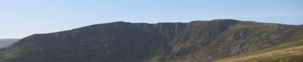
Looking back to West Wood where we’d be later on.
The Lugg is a pretty little river and in many spots provides a fine swim.
This is where TBF normally swims after work. Bit chilly this time of year for river swims.
A nice little stone bridge over the Lugg into Hampton Meadow.
Hampton Meadow is rather nice. We did note that its home to nesting birds including the increasingly rare Curlew. They therefore ask you nicely to avoid crossing it in spring and early summer so this walk is for Autumn and winter.
After 3 miles my GPS was telling me we’d done a grand total of 8 feet of ascent so it was time for more of a workout. We passed a superb looking house in Cockshoot and headed up into the wooded hills above Mordiford.
Despite my reservations this part of the walk was delightful. A mix of woodland and open fields with expansive views over the Shire to the Black Mountains.
And the collection of wooded hills in the east of the county.
After dropping into Mordiford we headed out on the Wye Valley Walk through Orchards and more open fields. The trees now in full autumn glory with the sun occasionally lighting them up to great effect.
The return to Mordiford was through the woodland of Fownhope Park and the previously mentioned West Wood.
All the paths and tracks marked on the map were exactly where they should be which was a relief.
It was getting late as the walk had become longer than I’d planned, the route being much more enjoyable than I expected.
The late afternoon sunlight in the trees was enchanting.
We put in extra short loop back through the orchards to avoid a few hundred yards of busy main road.
Really good new route and one I’ll be returning to, especially in the autumn when the trees are in fine form.
Time for another get together with our hiking friends of long standing. Something we try to do regularly now, having been through COVID and all feeling a little more isolated. Peak District is about as central as it gets for our widely distributed little gang and this time we went for the Eastern edges around Hathersage. Too far for a day out for us so we did an overnight in Chesterfield as a precursor.
We met up at the Longshaw Estate car park planning a walk around the many edges and tors, and finishing off with a walk through the estate. Weather forecast was a little uncertain with rain heading in after 3pm so we went for the high ground first. We weren’t prepared for just how windy it was and the walk along Burbage Edge was brisk (helped by an unexpected sprinkling of rain).
J-Dog was hassling pretty much from the off for a stop for a cuppa but the wind was fierce and stops with shelter were in short supply.
Higger Tor is circular rather than an edge we managed to find a sheltered spot hunkered into its many rocks.
Despite the forecast for grey skies, we struck lucky and we were treated to the odd patch of blue sky and watery sunshine.
I’ve walked up here many times (although not for at least 20 years) but I don’t think I’ve ever actually walked over either Higger Tor or Carl Wark which is something of an oversight, both being excellent and interesting outcrops.
Packing up after early afternoon tea.
Looking back to Upper Burbage Bridge and Burbage Rocks. Expansive blue sky but it didn’t stay long.
Sunshine on the first rocks of Stanage Edge.
Scrambling on Higger Tor.
Crepuscular rays over easter Derbyshire.
Higger Tor from Carl Wark.
The rocks of Carl Wark
We headed over to take in more rocks (here looking back to Higger Tor and Carl Wark.
And Burbage Rocks. Hard to imagine that just over the skyline is the industrial sprawl of Sheffield.
Onwards to Over Owler Tor.
Withe fine views out over the Hope and Edale valleys.
Over Owler Tor from the other side.
On to the next set of rocks at Millstone Edge. Pretty high by Dark Peak Standards.
After a risky crossing of the main road on a blind bend we made another stop for a brew before the rain set in, which it promptly did. Not really photograph weather from this point down into the impressive Padley Gorge and back up to the Longshaw Estate. Have to make do with this fungal masterpiece.
And one rather damp and grey looking shot of the normally lovely mixed, open woodland and heath of the Longshaw Estate.
Even though we met early (for us) at 9:30 the day was over all too soon. Except we had one final treat in store. Hathersage, despite its small size supports not one but two well rated curry houses. What better than to finish off a fine day with an Indian Meal and this one, was especially good with some new flavours we hadn’t seen before. Everyone was asking when the next walk and curry outing would be.
A forecast of sunshine and showers, less wet in the east had me scouring the maps for somewhere different to walk. With all the recent heavy rains I figured a bit of riverside to see what the Wye was like was in order. I came across Erwood between Hay and Builth Wells which has free parking, a tick in the box for River Wye views and what looked like easy access to the quiet Llandeilo Hill (where I’ve walked a few times before) but from a different direction. Plan formed.
The riverside path wasn’t very riverside to start with only the sound of the rushing water through the trees. It did have some nice views over the fields to the higher ground by way of compensation.
The path did drop down the river and in fact passed right by the water. The Wye, normally quite benign was a raging torrent. Not exactly a day for a wild swim.
In fact the path at this point was only a matter of inches above the water. Had the river been any higheer we wouldn’t have got through (and probably wouldn’t have done 24 hours earlier).
Satisfied with our river views we headed upwards into the low hills above. Showers seemed to be in short supply, sunshine and blue sky were in abundance.
The grassy paths between the retreating bracken were wonderful if a little damp.
The pretty tarn of Henlllyn Mawr.
Bracken is a real pain in the rear through the summer, but it does provide a nice splash of golden colour as it dies back in the autumn.
This area is marked with numerous small outcrops like this one that creates further contrast and interest within the rest of the slopes.
Another small un-named tarn.
We stopped for first lunch here. A gorgeous little quiet spot with wide ranging views across to the Black Mountains.
The hills above Builth Wells.
And the distant Brecon Beacons.
Our route for the next hour was towards the highest point of Llandeilo Hill in the distance.
Looking back on our idyllic little lunch spot.
Looking down to the village of Aberedw.
We had more wild ponies than people for company on this walk. We only saw two people the whole day once we left the riverside path.
We cut back towards the river via another little tarn also named Henllyn. These green paths are a feature of these hills. Sadly many (including this one until this point) have been badly trashed by trail bikes. This path was just three or four eroded ditches of mud and water that are difficult to walk along. Something needs to be done about this plague of indiscriminate destruction although I’m not sure what.
Luckily it was only a mile so of trashed paths and most of the walk was on pristine grass and delight to walk across.
Black Mountains living up to their name.
Storm clouds gathering behind TBF although it didn’t actually rain all day, at least not on us.
The Begwyns.
We had our only minor inconvenience of the day heading for this this hill – Twyn y Garth – as it looked like it might be nice. Sadly the right of way had fallen into disrepair and there were no stiles and barbed wire where the path went so we had to abandon the idea.
Turned out to be a good thing. We followed quiet lanes and came across this little church in the middle of nowhere at at Llandeilo Graban.
And this rather gorgeous little spot for second lunch overlooking the Wye Valley (once a group of noisy trail bikers had passed through).
Looking back to our hills from earlier in the day
A fine little circuit that I’ll be doing again. So much for me grumbling about a grey autumn in my last post!
I spend alot of my time surfing the web looking for ideas on places to go, walking routes, travel ideas and tips to plan the perfect holiday or day out. (I'm a project manager I like to plan). I thought it was time to share my own experiences and contribute to the vast amounts in information that's already out there.
I'll also add in some gear and tech reviews and when something irks me I may even use this forum to have a rant - I do that pretty well I'm told.There are a few pages at the top that give a bit of background to what I like to get up to and what you can expect to see in my posts. I'm not exactly a creative writer but I hope some people will find my stuff useful or inpsiring or at least enjoy some of my photos.