Day 3 and with a larger group of us we spent the usual happy hours discussing route options of which there are plenty in the Glencoe area. Eventually we settled on a classic – one half of the mighty Beinn a Bheithir (assuming that the huge day that takes in both Munros would likely be too much seeing as we spend so much time sitting around and nattering).
The forecast was for the best weather of the weekend and the morning was certainly stunning.
The view Of Beinn a Bheithir across the loch from the cottage was majestic.
Just as well that the views were so grand. Gave us something to look at while the Tower Captain put in a quite extraordinary faff such that he was 30 minutes behind everyone else in being ready.
We parked up in Ballchulish (leaving another car at the other end) and decided to take on the ridge up to Beinn Bhan as our approach route.
Sgorr a Choise looking rather good – a small hill very much on my radar for another visit.
Reaching the ridge proved hard work, steep grass, followed by a struggle to find the path promised in the SMC guide amongst the heather and bracken. We eventually reached the open ground and the views were magnificent.
Although the endless blue skies had been replaced by a good deal of cloud out west.
Inland to Glencoe, the Aonach Eagach and Bidean still looking sunny.
A sunny interval deemed it necessary to stop for first lunch!
Still a long way to go to the first of our two summits.
The path along the ridge was excellent and progress was as swift as a large chatty group can manage.
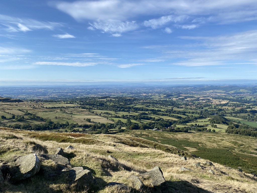
More superb views into the heart of Glencoe.
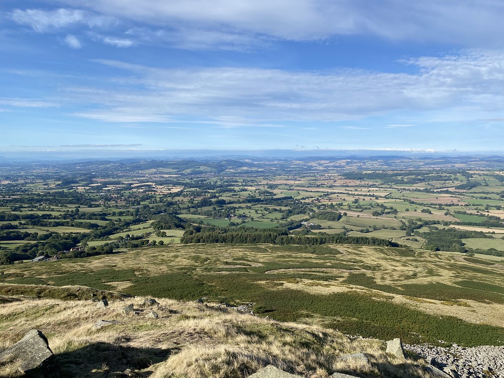
We finally reached our first top of Sgorr Bhan, here looking on to Sgorr Dhearg the first of the two Munros in the massif. This edge forms a beautiful, perfectly curved cornice of snow in winter conditions.
The Professor happy to have another top ticked off.
Clearly you can’t reach a summit and not have a stop!
Looking out to the mighty Ben Cruachan.
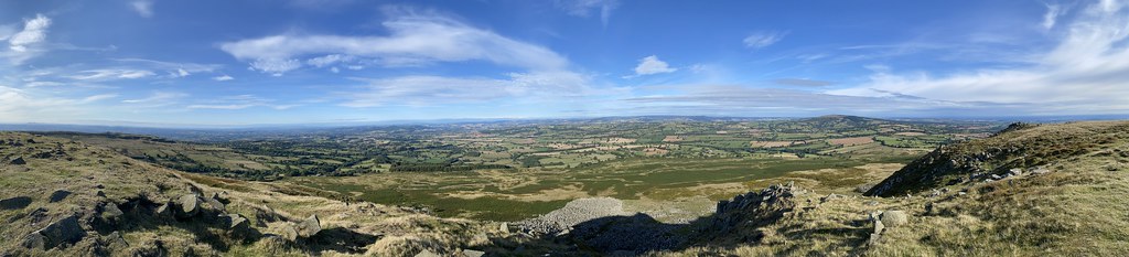
Panorama of Glencoe and the Southern Highlands.
The distant Paps of Jura on the skyline and I reckon, Arran to the left.
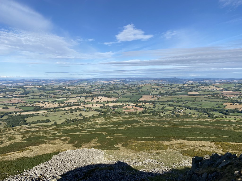
Time to move on. Looking back to Sgorr Bhan.
Sgorr Bhan and the Glencoe mountains.
We reached the top of Sgorr Dhearg where the weather took a little turn to a cold wind and a light drizzle. Views out over the second munro of Sgorr Dhonuill with the Isle of Mull on the skyline.
We decided that the central ridge down to Meal a Chaolais looked very fine and I recalled a descent a few years back with TBF when we picked up a path that took us all the way down to the road (just as well as it got dark about halfway down!)
To prepare ourselves for that descent we had another brew stop!.
Looking across to Sgorr Bhan.
The ridge was superb, rocky near the top, grassy and easy going further down.
The weather began to improve again and the views out over Loch Linnhe and Loch Leven breathtaking.
We’d picked up the thin path that I recalled from the previous trip and all was progressing well.
We decided to split up at the end of the ridge, one group heading down to collect the car, the rest of us to follow the path down to the road.
An excellent plan with no major flaws. Other than the fact that just after this photo, the path simply vanished, Despite several wandering attempts to relocate it, we failed.
Anyone who has climbed this beast knows that its very well protected by dense forests and very steep slopes. Straying off any kind of path risks dense undergrowth, steep slopes and general purgatory. The descent turned in to an hour’s battle through tussocks, thick grass, heather, steep slopes, gorges, bog and dense forests. I tried to keep spirits up by stating I’ve been down many worse descents but in truth it was one of the very worst I’ve ever done. The forests are slowly being cleared and I’d hoped that the endless stream of munro baggers would have forged a path but no such luck. It wasn’t much compensation. but our colleagues who took a different route had much the same problems as we did. It was a mighty relief top reach the forest track and a stark reminder not to trifle with a forest cloaked Scottish mountain! We also managed to pick up some nasty unwanted guests from the undergrowth including one big bugger trying to bury himself under my watch!
Didn’t manage to spoil another superb day in the mountains.
First order of business on our second day was to collect TBF from Fort William. Work commitments meant she couldn’t travel up with me. With a bit of negotiation with work she was able to secure enough free time to join us for the long weekend. I treated her to first class train to London and a trip on the overnight sleeper. We were a bit concerned about a nasty insect bit she’d picked up which had swollen to the point her ankle bone had pretty much disappeared. Luckily the overnight rest had done the the trick and all was good for a days walk.
We’d settled on the Corbett of Mam na Gualainn above Loch Leven as a suitable second day, leaving a car at each end to make a traverse. After some heavy showers first thing it was a gorgeous morning by the time we set off from Kinlochleven.
We followed the West Highland Way through the forest, a very pleasant stroll through mixed woodland with views opening out along Loch Leven to the Pap of Glencoe, looking very pointed from this direction.
A clear day was giving some great views over the loch and down to Kinlochleven.
Taking a short break for views and sustenance.
As we emerged from the forest we got our first view of our objective (well its western outlier of Beinn na Caillich anyway). Everything was looking especially magnificent.
We’d taken the east to west traverse to take advantage of the excellent stalkers path that runs all the way to the summit ridge (once you find the start which is couple of hundred metres further west than the OS map indicates)
After the steep initial zigzags the ridge levels out a bit before the final steep climb onto Beinn na Caillich.
Our first sighting of the highest point at Mam na Gualainn with Moidart and Ardgour beyond.
Loch Leven, The Pap of Glencoe and the mighty Beinn a Bheithir.
Looking east the Corbett of Garbh Beinn catches the eye above Loch Leven. Little climbed as it sits largely un-noticed behind its more well-known neighbour, the Aonach Eagach.
A collection of Mamores, left to right, Stob Ban, Sgurr a Mhaim, Sgurr an Lubhair and Am Bodach.
Looking east if you look closely you can see the pointed view of Schiehallion.
Panorama of the Mamores and Glencoe mountains.
Not a bad place for a lunch stop.
Plenty of work still to do so time to head off along the ridge to the main summit.
Looking down to the narrow section of Loch Leven and its fine looking campsite.
Stob Ban catching the sunshine.
The ridge was a sheer delight. grassy, easy walking but steep drops on both sides giving a real sense of height and scale.
And of course magnficent views of the mountains.
The dark brooding clouds over the higher summits to the north merely added to the grand spectacle.
Beinn na Caillich, Loch Leven and Garbh Beinn.
We reached the summit but didn’t linger too long as there was a cold wind blowing and the sun had gone in for a time.
Time was also pushing on but the descent handed out some superb coastal views. Always my favourite.
Looking out to the north west highlands, Gulvan in the centre of the photo.
The stalkers path down was a bit of soggy, boggy mess but compensation was provided in the form of some spectacular views.
Booming clouds contrasting with broad patches of late afternoon sunshine.
Every time I paused the view had subtly changed. Here a lone tree providing some foreground.
Garbh Beinn, the Pap of Glencoe and Bidean nam Bian.
Panorama taking in our Corbett and a full spread of Glencoe mountains overlooking Loch Leven.
The huge massif of Beinn a Bheithir.
The light was changing every few minutes hence the succession of photos!
Setting sun.
Bidean nam Bian.
A very autumnal looking Pap of Glencoe. The walk down had been wet underfoot but superbly entertaining visually.
I managed to find time to jog down to the lake shore for a final few pictures at the waters edge.
A superb finish to the day.
A much longer day than we thought at around 11 miles but one the best Scottish days I’ve had in recent memory.
Last year me and a few hardy souls joined UF on one of his munro-bagging trips to Scotland. Despite the poor weather we had a great time and agreed a repeat was in order. We found a splendid house in Glencoe and made grand plans for some serious walking as the forecast for the weekend looked much better than the previous year.
It rained heavily overnight after we arrived and the forecast was for it to clear from the north-west. Driving in that direction to gain maximum advantage we settled on Gulvain (or Gaor Bheinn to give it its true Gaelic name) out to the west of Fort William.
Its a shy and retiring mountain. For that read, its a 5 mile walk just to get to the bottom of the ridge, another 3 miles to the summit – and then back again! A Munro that takes some getting to. We set off into the damp morning having made what for us was a relatively early start, hitting the track just after 9. Even at this point above we’d been walking for the best part of an hour before our first glimpse of Gulvain’s south top (the main top still hidden)
The upside to this long walk-in is that Gleann Fionnlighe is a fine approach amongst little climbed smaller mountains with waterfalls to add interest.
I’d toyed with idea of cycling in and indeed you can make it pretty much to the bottom of the mountain on two wheels. However my companions don’t really embrace cycling so I’d have either had to wait for them for an hours at the start and end of the day or walk the whole route solo. On foot it was then.
The fine track ends at the base of the mountain and even though there is no marked path on the map, there is a pretty decent path all the way up the relentlessly steep SSW ridge.
As we started the climb we saw our first patches of blue sky and we were encouraged that promised improvement in the weather was close at hand.
Sadly as we climbed the clouds seemed, if anything, to be descending and then without much in the way of surprise (this is Scotland after all) it started to rain, quite heavily, for a good 20 minutes.
Searching for optimism and “blue-sky thinking” I confidently predicted that often, a heavy shower can be the precursor to a spell of much clearer and sunnier weather.
The rain stopped and fleeting patches of blue and watery sunshine began to appear.
The steep angle began to ease and Gleann Fionnlighe opened up below us looking rather magnificent.
As we neared the first notable summit (point 855) the blue skies opened wider and sunshine bloomed.
The mountains of Moidart and Knoydart started to appear.
The going always seems just a little easier when the sun is out and the views grand.
We reached point 855 in glorious sunshine and got our first view of Gulvain’s elusive summit, here to right of its nearer south top.
Looking south with Loch Sheil in the distance.
We found a perch out of the wind looking towards the far end of the massive Loch Arkaig just visible in the distance. It looked like we timed our arrival to perfection.
There was still plenty of miles and effort left as we tore ourselves from the repast and continued on.
From the south top we gained our first view of the long ridge to the summit.
It’s a superb high level traverse, here looking back to the south top. Our timing wasn’t as good for the summit as it was covered with a cap of cloud while we were there.
We would have lingered for it to clear but as we’d been acutely aware all day we now had to repeat the 8 mile return walk, including a second ascent of the south top.
As we approached the south top again, of course the summit began to appear from the clouds.
It’s a long descent (they always seem to take much longer than you think) but the views along the glen were superb.
We broke up the descent with another stop for second lunch.
Zoom shot to the western Mamores of Lochaber.
The weather had by now settled into a pattern of sunshine and a regular sprinkling of light showers, never heavy enough to warrant waterproofs.
We eventually reached the relative ease of the main track and faced up to the 5 mile walk back to the car.
Gulvain’s southern end and our ascent route.
A long day means a late finish which in turns delivers some of the best views of the day in low sunlight and clearing showery conditions.
Final view of our mountain for the day.
The ever changing light delivered some stunning views to keep us entertained on the walk back.
The regular showers also gave us plenty of rainbows to admire.
As we reached the car we had a bit of a show from one of the steam trains that trundle from Fort William to Mallaig to traverse the Glenfinnan viaduct (its a Harry Potter thing I think). A very long day of 16 miles although I’m very sceptical that my OS Maps App says almost 6,000 feet of ascent. I’d say even being generous no more than 4,500 feet. Whatever, it was a very long but rewarding day and an order of magnitude better than any of the days we had the previous year.
We were even treated to a fine blazing sunset, this one taken from the car while we waited at the roadworks.
This one taken from the front garden of our holiday house. A grand day celebrated in style with a meal at the Clachaig. Top drawer!
The day of the Queen’s funeral and we decided to mark the event with a walk. Seeing as I’m a contractor then extra day off cost me a days pay so I needed some kind of compensation.
We headed for a short classic from Aston on Clun to take in the mighty Burrow and Hopesay Hill.
We parked up as always at the village hall (busy with people gathering to watch the funeral). Onwards and very upwards onto Burrow, a really steep little bugger it is.
Great views over the Marches.
And onto the splendid summit with its open grassy groves and trees.
We sat down for a fine breakfast and a cuppa – well I’d have had a cuppa had I not forgotten my sugar (I know I should give up sugar in tea but its a vice I just can’t do without).
Looking out to – I think – Corndon Hill and Mid-Wales.
Onwards and down through the old iron age ramparts, views north towards the Long Mynd and the Church Stretton Alps.
Down to Hopesay and back up towards a new small hill to climb – Wart Hill.
Another steep little bugger.
Its shrouded in dense forest so views are at a premium but it was quiet and unspoilt.
Looking out what I think is the Malverns on the skyline.
It was nice level spot for a sit down, if not for a sugarless brew.
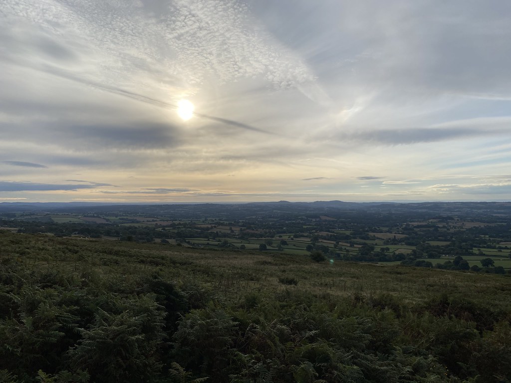
The forecast had been for blue skies and sunshine but it had been largely overcast all day but at least it was dry.
An easy finish over Hopesay Hill before dropping down to Aston, the car and back home. Map below not exactly the route we took in the middle part of the day but close enough!
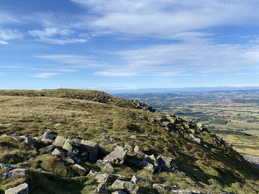
For those of you in the Shropshire “know” there are two Clee Hills. The Brown Clee (which I walked up many years ago and found not terribly interesting as a walk or a summit) and the wonderfully named Titterstone Clee Hill further south. I’ve driven over Clee Hill many times as a kid on my way to my nans caravan but I’d never actually been to the top of Titterstone. Time to put that right.
I was up early to take TJF to work so I was parked up in the village of Cleehill (note just one word) just after 8am.
It was a decidedly chilly morning, not really shorts weather so it was a brisk walk to start the day.
Panorama looking south from the toposcope near the car park.
I was fashioning a route on the fly, trying to string together a few paths, some that existed on the ground and some that didn’t – hence the rather random pattern on the route map near the start. Once I was up near Whatsill things improved in terms of both paths and weather as the sun started to come out.
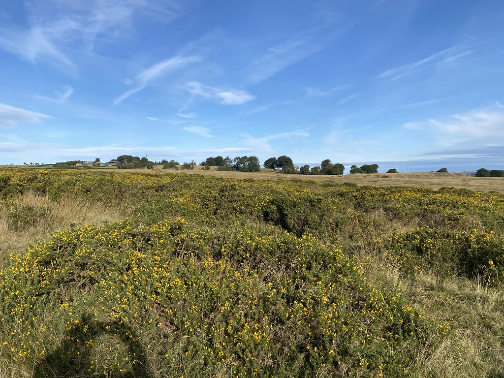
Its an odd landscape of grassy gorse, farmland and quarries.
And the odd small pond housing a few geese.
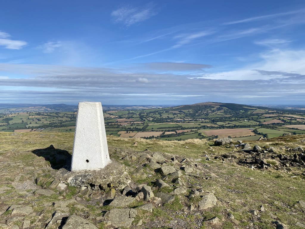
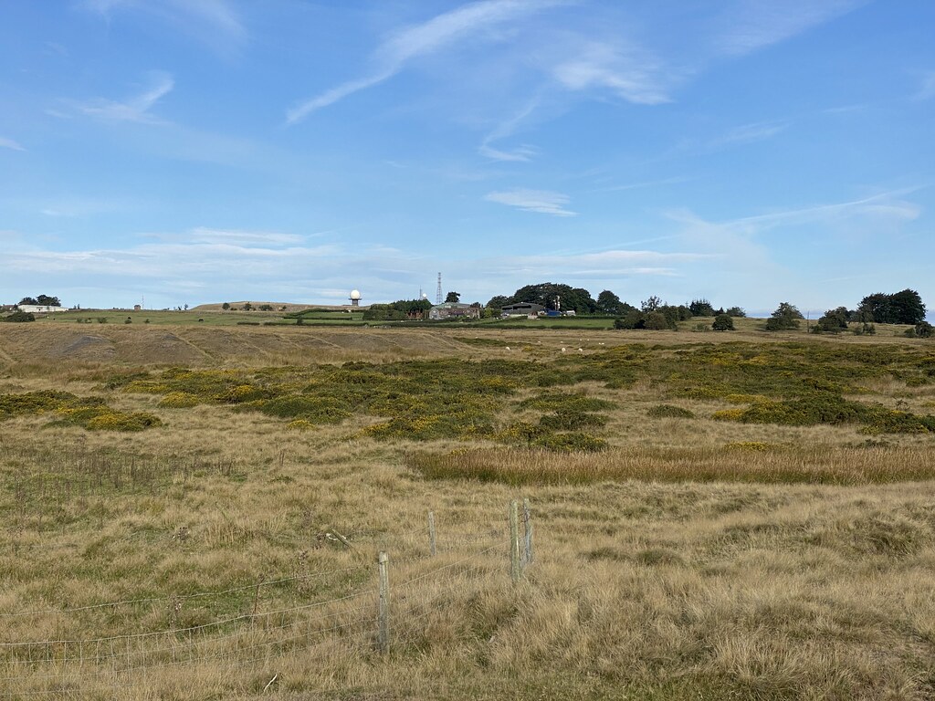
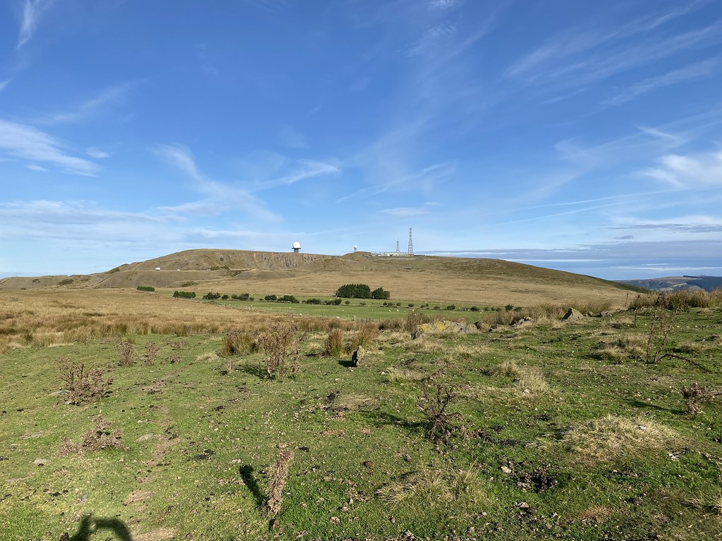
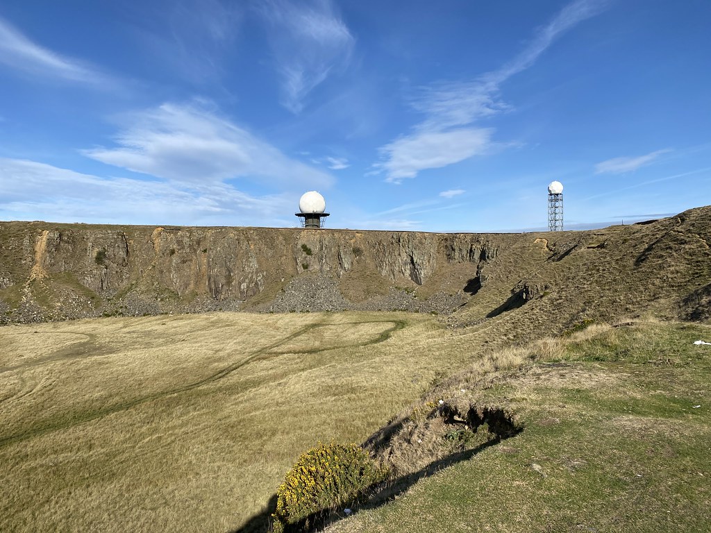
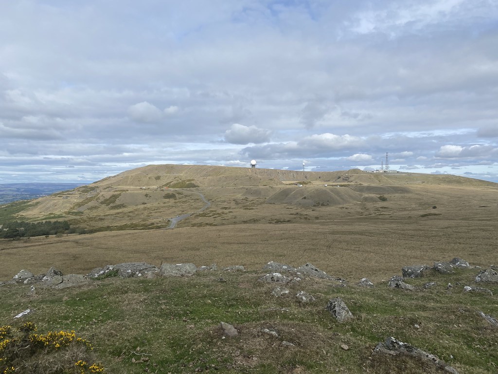
My main objective of the highest point crowned by the distinctive Radome. Its visible from some distance as this Clee is a lot more distinctive both in terms of shape and decoration than its higher neighbour.
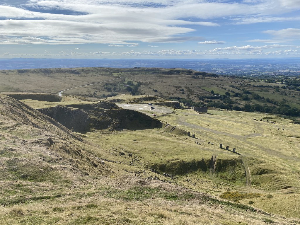
I had no idea from my many road journeys through Cleehill that the quarry up here was so expansive.
The equipment up here is part of NATS (National Air Traffic Control Systems) – I’ve always wondered what it was for.
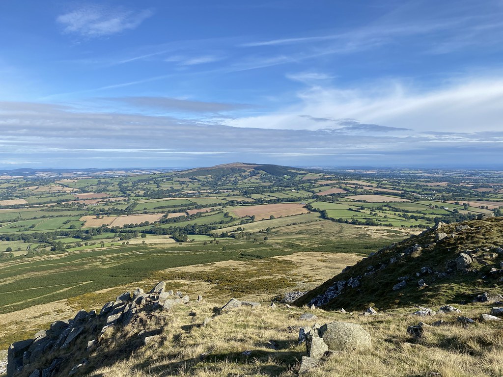
On reaching the top the sun was out in full force and the views were magnificent. This is the Brown Clee, highest point in Shropshire (Titterstone Clee Hill is 3rd highest after Stiperstones)
Over the town of Ludlow, The Marches and out to the Black Mountains and Brecon Beacons.
Pano from south to north looking west.
The Long Mynd and the Shropshire Hills.
A chatty guy I met on the top claimed it was recognised as the finest view in England. I’d debate whether that’s true as there must be loads of competition but it is pretty damn fine.
Looking north, Snowdonia just about visible on the distant horizon.
Looking back to the summit. Interestingly I messaged my friends with some smug photos, and the Peak District, not all that far from where I was as the crow flies is was apparently a pretty dreary and wet drizzly day.
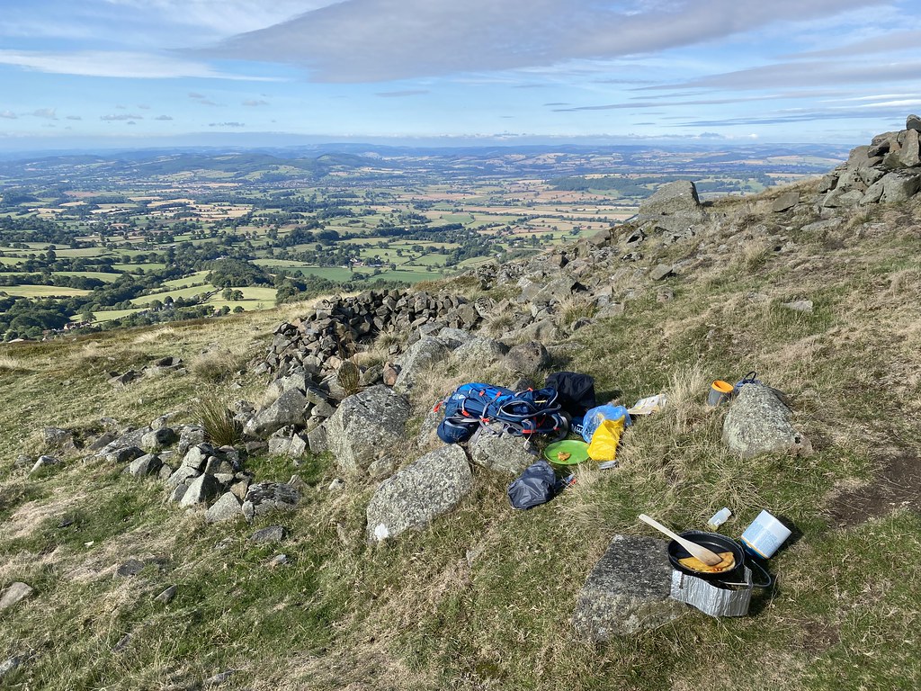
Time for a quesadilla breakfast on the top.
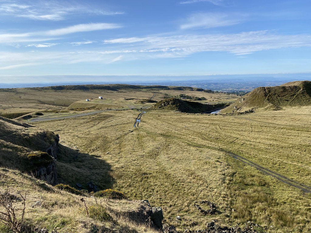
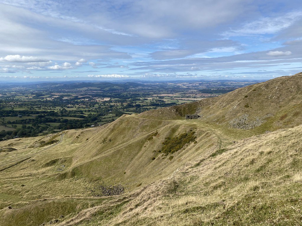
The quarries and industrial remnants on the western side of the summit. These scoops taken out of the hill are I assume what gives the peak its name of the Giants Chair.
Time to head down along the exposed edges of the quarry.
I managed to fashion a route via thin paths through what must be little walked terrain and. back down to the car.
A long missing box ticked and back home for lunch. I’ll be back here again to keep checking if this is indeed Englands finest view!
Back to mid-September and the what felt like the last knockings of Summer.
Rather than a walk we took on a longer bike ride for a change. There is a cycleway along an old railway line through the Clydach Gorge near Abergavenny that I’d been keen to try so we parked up at Llanfoist and set out.
Its a long steady climb along the gorge, initially through woodland but finally emerging onto the open slopes with some grand views of the extensive quarries.
There are some impressive small gorges and viaducts that make for a very interesting ride as well as several industrial remnants, old stations, platforms and the like.
We stopped for a short break on a bridge overlooking Cwm Dyar.
There were a whole group of people in wet-suits and climbing gear. I think they must have been canyoning rather than caving (there are several caves in the area) as they didn’t seem to have lamps.
The viaduct was spectacular but we wanted a quieter spot for a cuppa and a snack.
Just after the bridge the metalled track turned to grass and we found a nice little bench with a fine view to enjoy the surroundings. The only complaint about the route is that despite it being a signed and official cycleway there are several kissing gates which are not easy to get around with bikes, especially a heavy electric bike.
Past Brynmawr, the track turns and heads out across the old coal mining areas towards Blaenavon.
I’d expected this to be a wasteland but in fact it was lovely. Grassy fields, easy cycling and expansive views.
I really enjoyed this stretch.
You’d hardly know that this was once an industrial heartland of coal mines and steelworks.
I’d thought it would be an easy ride to the top of the pass near Blorenge from Blaenavon. It wasn’t! 500 feet of steep road had me panting while TBF pottered behind me in electric mode.
Still, the views from the top were superb while I lay on the grass and recovered.
Then the best bit – 2-3 miles of downhill to pay me back for all that effort.
Looking out towards the Severn Valley and Forest of Dean.
Ysgyryd Fawr.
The last stretch was along the Monmouthshire and Brecon Canal. The tow-path makes a fine warm down after all the effort.
A grand day out of around 20 miles and 2,500 feet of uphill (and downhill).
You can see from the profile why I would never contemplate doing the route the other way round – that is one long and steep climb well beyond my meagre cycling capabilities!
Momentous changes for the Prof. Having secured his First Class Masters Degree in Physics it was time to for his next assignment. Off to Liverpool University for his PhD in Particle Physics.
He’d sorted his accommodation (a nice if small studio flat in a smart city centre complex) so we took him there to dump all his stuff. Keen as always to make something of a day of it we headed to the coast and the Formby Hills.
Not hills in the traditional sense but a series of substantial sand dunes near the huge beach to the north of Liverpool that runs from Crosby all the way to Southport and beyond.
It’s a fine beach and despite the grey skies and chilly breeze there were lots of people out walking and families with kids playing on the sands. No-one swimming in the sea though!
We walked a mile or so up the beach from the Lifeboat Road car park to the Victoria Road car park.
We then decided to explore the dunes.
They are quite substantial as you can see from the photos and spread for a few miles up the coast.
I like to think this photo was taken from the summit! You can see from the people on the beach that we were quite high up considering they are just huge piles of loose sand.
Uncle Fester has been to the daddy of European dunes (the Dune de Pilat near Bordeaux) and was singing its praises. Whilst the Formby Hills can’t match its height they are impressive and fascinating in their own way.
They are actually much firmer than they look and quite easy to walk along the ridges if that’s the right word.
Fine views along the coast to the south.
And north.
Behind the dunes is a mix of forest and heathland that made for a fine return walk. The forest is home to red squirrels but we didn’t see any. I also learned that much of the area was given over to Asparagus farming many years ago but has since declined and consigned to history. The things you learn out walking!
It had been a fine and sunny day up to early afternoon but the clouds gathered, and as we sat and had a cuppa by the car it started to rain and continued for the rest of afternoon and our drive home.
Always good to see somewhere new and a bit different and good to see the Prof off to the next chapter in his life.
After all that French and Italian fun in the sun. It was back to the normality of the UK.
Our first weekend back home and we took a long bike ride around our local lanes.
Even though it was overcast it was still warm enough for a quick swim in the Wye at Bredwardine.
Following weekend we took a short stroll from Longtown.
A route we discovered while sneaking out during Lockdowns.
It can be a muddy trudge in winter but at this time of year its easy going.
However this time of year is also peak bracken growth. We decided we couldn’t be bothered to thrash through to the ridge of the Black Mountains and settled for the path that runs the line between the farmland and the open fell.
This gives time for an extended lunch stop and brew which is always a much better use of time.
The skies even cleared a little to reveal some blue skies and watery sunshine.
A simple day to ease ourselves back into the UK scene.
Passing Clodock Church on our way back to the car.
The bugle is playing. Its the last post from our epic summer trip.
We were camped a short walk from the town of Kayserberg so on our last day we decided to take a wander around.
Like most of the other towns in the area its picture postcard pretty with a very Germanic feel.
The narrow street leading into town from the campsite.
The small river Weiss that runs through the town.
The area around the Pont Fortifié.
The little hexagonal chapel of Notre-Dame du Scapulaire.
Google Maps says this is the Puente de Piedra but sounds wrong to me – Spanish?
I liked the green shutters on this house.
The main street.
The bakery where I bought our breakfast pastries from.
Not sure whether the coloured buildings are part of some coordinated plan but its very alluring.
Houses backing onto the river.
A view of the main square with the Château du Schlossberg on the hill behind.
The main street.
The main church of Eglise Sainte-Croix.
And a close up of the Church tower.
Every side street was charming and colourful. Even on a hot day it was lovely just to wander about and now that the tourist season was winding down, relatively quiet.
Time for lunch at one of the many street cafe’s. I’m pretty good at recalling my food exploits but this one, I don’t have a clue what we ate other than it was very nice!
View from my seat at the restaurant.
One of the striking buildings.
And some kind of odd looking display of flowers and carved wooden people.
Everyone else wandered back to the campsite while I went up to the castle.
I was pleased to find not only great views over the town, the Vosges mountains and the local vineyards but that it was free to climb the tower.
Wine is big business and there are huge swathes of vines all across the valley floors and far up the hillsides.
Having enjoyed my little trip I rejoined the rest of the family. We tried a drive out to visit another castle but arrived to find it was an hours walk up the hill. It was hot and dark clouds were building so we thought better of it.
Back at the campsite the local fire brigade were cooking up the local dish of Tarte Flambee. A kind of very thin and crispy creamy-based pizza. They do this to raise money for their facility and I was more than happy to contribute. Very nice it was too.
And, well, that was it. We packed up in the rain the next morning and made the very long journey all the way through France and the tunnel back home. It had been an amazing trip and we packed in quite staggering amount of stuff. Kind of need a post-holiday holiday but that’s a good thing in my book. Plans are now underway for next years trip which will have a similar feel but with a different slant. Watch this space in the next couple of months.
It was still pretty hot down in the valley so the Prof had the excellent idea to take a picnic up into the Vosges mountains.
He directed us to Le Hohneck, the second highest point in the Vosges mountains and what a superb viewpoint it was.
Not sure if it compares to anywhere else I’ve been. High bare ridges and deep forested valleys with the odd lake (mostly man-made I think). You can see the highest point in the range, Le Grand Ballon, just left of centre.
We enjoyed a fine picnic although to be fair, at over 4000 feet up, it was turning a little chilly as the sun went down.
This huge hut must be for the winter ski season as it looked very closed up. It did make a fine photo subject for the sunset though.
We scoffed most of what was left from our Italian Deli food stocks while enjoying the sunset (and wishing we’d taken a fleece up with us!)
I was happy though and thanking the Prof for an outstanding idea.
With a scattering of clouds the sunset was superb.
I imagine it would have got even better had we been able to brave the cold a little longer.
However the family were starting to grumble about the chilly air so we had a bit of wander about back to the car.
This deep valley and its surrounding ridges looked perfect for a walk (rather than driving to the top as we had done!)
Stunning skies set off by the mountain hut.
A glimpse of a distant lake in the valley below. Heading back down we contrived to hit a small deer with the car which was a sad end to a great day.
The sun was setting on the day and beginning to set on our epic trip. Just one final post to come.
I spend alot of my time surfing the web looking for ideas on places to go, walking routes, travel ideas and tips to plan the perfect holiday or day out. (I'm a project manager I like to plan). I thought it was time to share my own experiences and contribute to the vast amounts in information that's already out there.
I'll also add in some gear and tech reviews and when something irks me I may even use this forum to have a rant - I do that pretty well I'm told.There are a few pages at the top that give a bit of background to what I like to get up to and what you can expect to see in my posts. I'm not exactly a creative writer but I hope some people will find my stuff useful or inpsiring or at least enjoy some of my photos.