Onwards to Easter and we’d managed to invite oursleves over to see the Silverdale Massive for a long weekend.
We didn’t venture very far from home (theirs) but that suited us just fine. Whenever we visit we always seem to make grand plans but almost always settle for an easy pace of life, lots of sitting around, chatting, drinking tea, eating (a lot) and plenty of easy paced walks around this stunning local area.
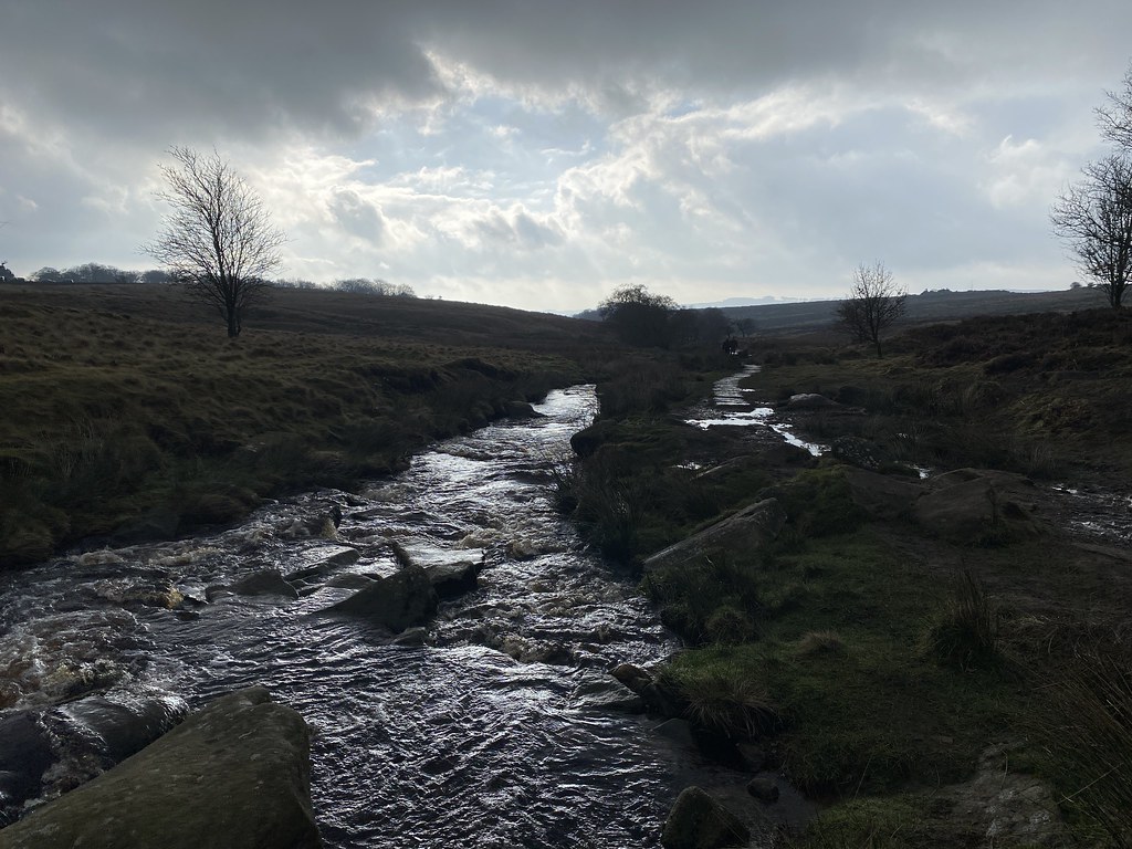
We headed up a day early so on the Thursday me and the Prof worked from their house and snuck out for a short walk to the Pepperpot.
Past the Cove and The Lots (don’t recall those dark skies) and a cafe lunch in the village. In the evening we went to the Pub for a quiz and three fine pints of Banks’s Mild – a real taste of home for me and a thoroughly enjoyable evening.
Friday was the classic walk around the coast to Arnside. We had planned to have lunch there but a very heavy shower had us diving for cover in the small Bob-In cafe at New Barns and were very lucky indeed to grab a table. When we emerged the weather was glorious and stayed that way for the rest of the day.
No visit would be complete without a walk top the top of Arnside Knott.
The views from the top as wonderful as always.
TBH and Mark approaching the top.
Fine views across the Kent Estuary.
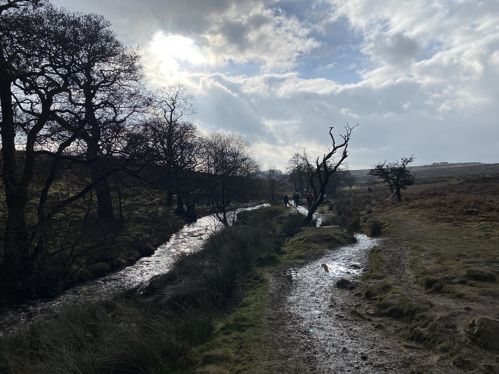
Next morning, me TBF and The Prof went for another walk to the Pepperpot. Not quite sure where everyone else was. This was the tree all the kids used to climb in when they were small (and not so small)
Considering its limited altitude, its a superb viewpoint with spectacular views over Morecambe Bay.
TBF and The Prof.
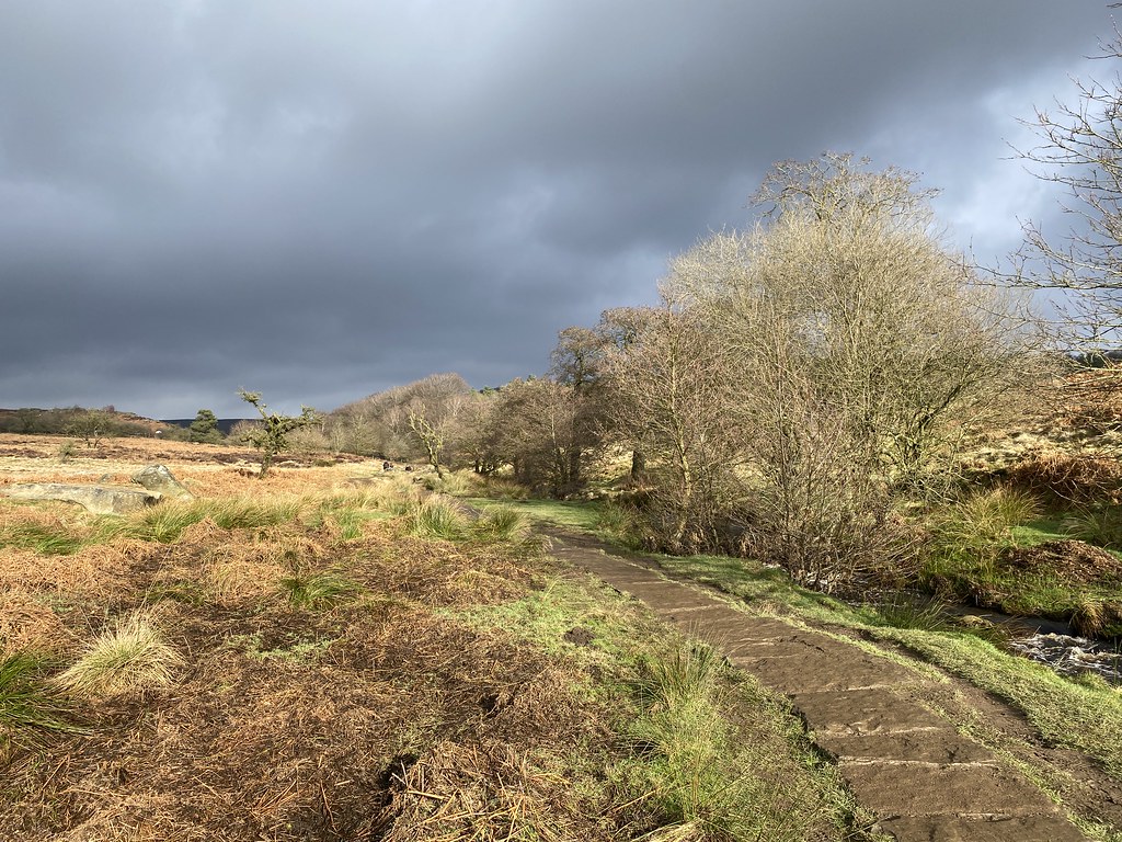
The same continuation by The Cove.
And back by The Lots and home for another lunchtime feed
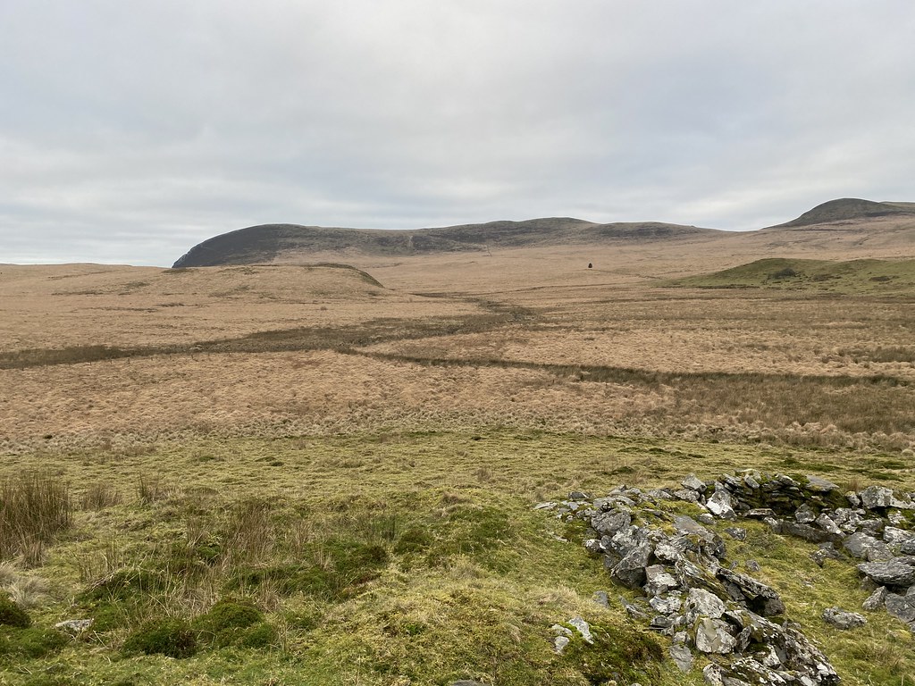
After lunch and exercise was needed so we were taken on a special excursion. Past Woodwell.
Up on to Heald Brow.
To see a fantastic fossilised Nautiloid. I should have put something in for scale but I’m guessing it was nearly a foot long and hugely impressive.
Down from Heald Brow and along the shore to Jenny Brown’s Point.
A gorgeous, warm, sunny afternoon was in full effect now.
Mark strolling out across the grass.
Yet another of my favourite places in this corner of the world.
A great finish to the day.
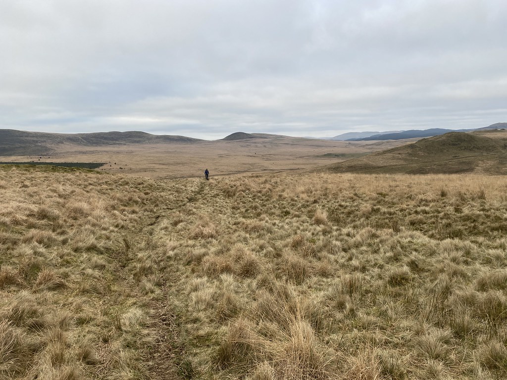
Next day and Mark took us on a wander to yet another new place I don’t think I’ve ever been to, even though we’ve been here many times. Stopping off on the way at Lamberts Meadow, one of Marks favourite spots for insect hunting.
I think the place he took us to was called Myers Allotment. Hopefully he’ll correct me when he reads the post. He said it had a superb view over Leighton Moss wetland nature reserve and he wasn’t wrong.
So far we hadn’t needed to use the car but on the Sunday afternoon we headed out a little further. Mark has posted a few times about the coast near Heysham and I was keen to take a look. We started off at the lovely little church of St Peters.
The views across the Bay were very fine.
Sadly it was closed for renovations so we couldn’t take a peek inside.
Clearly I need to come back for another look.
Just above the church are the ruins of St Patricks Chapel.
Its well know for these “graves” carved out of the rock. They looked a little too small to contain bodies but we read on the signs that they kind of broke up the bones to make them fit. Rther grisly don’t you think.
It was a cold and chilly afternoon but there were a few brave souls playing on this lovely little cove below the chapel.
And the Nuclear Power Station along the coast.
My mental picture of Heysham is of the Power Station so it was rather nice to discover the coastline is very fine indeed and lots to keep the interest.
Onwards and we parked up in Morecambe for a stroll along the Prom
Once down at heel, they have clearly spent some money on the waterfront and whilst still in places a little tired is a wonderful walk. I really enjoy an old Victorian Seafront and I loved this walk.
Apart from the fact it was very windy and bitingly cold.
Best way to deal with the bracing weather is for a slap up fish and chip supper in a local establishment.
The food, the staff and the company was marvellous and a very enjoyable way to end the day.
Almost the end, a decent sunset from the walk back to the car and an even better one as we arrived back in Silverdale (although we’d missed the very best of it during the drive).
The last day was wet and miserable so we indulged in more drinking, chatting, eating and playing board games. Fabulous and memorable weekend and as always, a huge thanks to our hosts for putting us up, feeding us and generally making it a special Easter.
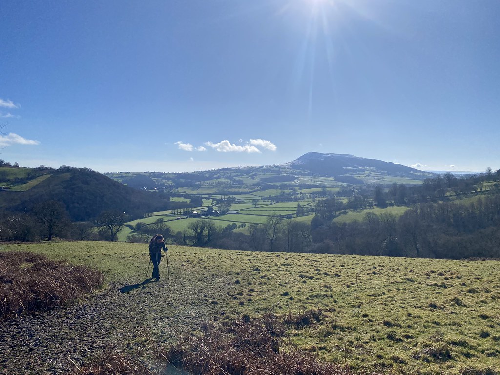
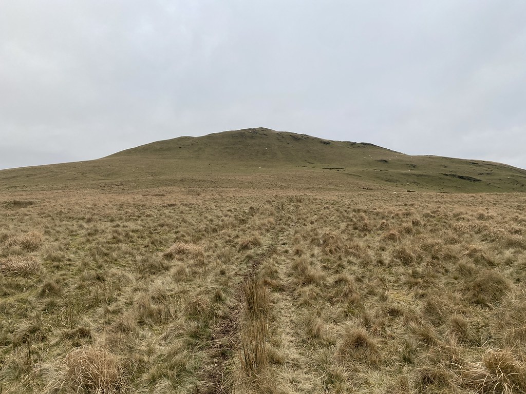
The day after my short walk on Bryn Arw was much better.
I headed for the Church Stretton Alps as I realised I hadn’t been up that way for quite a while.
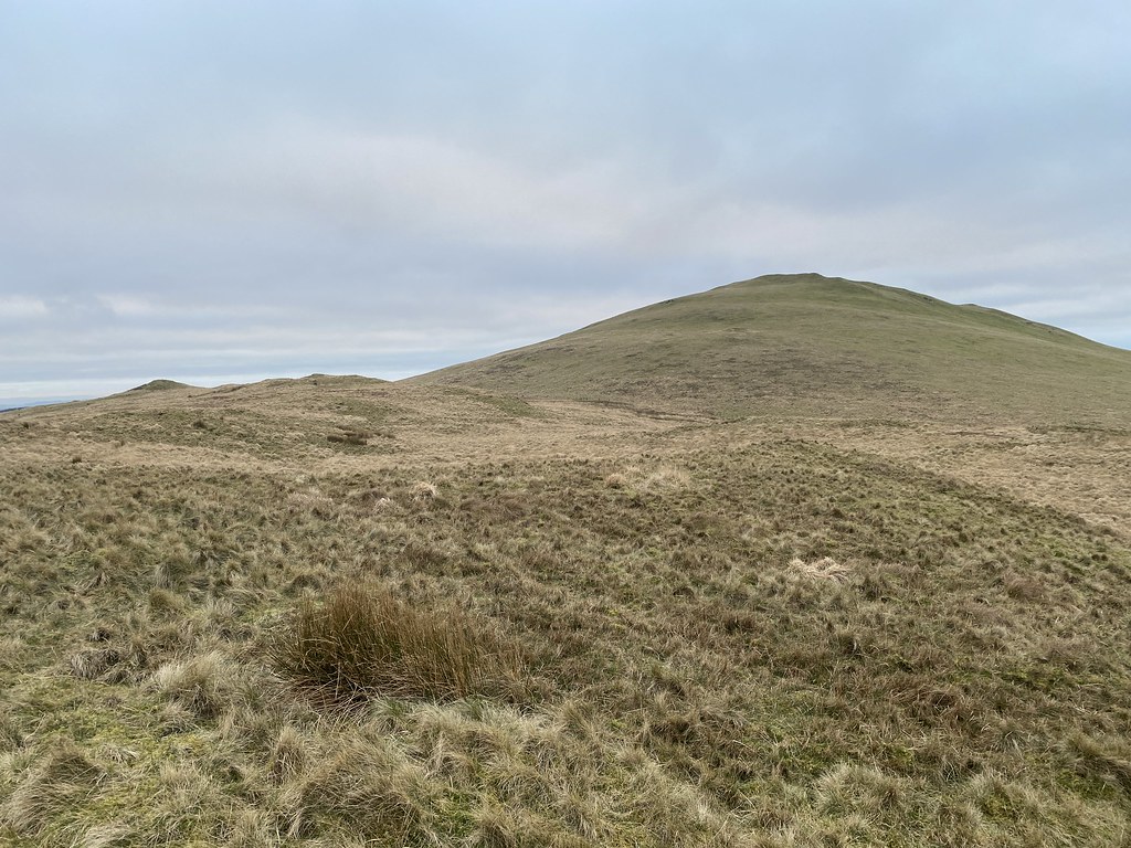
It was a bright and dry day if a little overcast. I started off by climbing up to Ragleth Hill. Great views over to Caer Caradoc, Hope Bowdler Hill and the distant Wrekin.
Ragleth is one of the lesser known hills around these parts and is alway quiet. Its a lovely grassy high level stroll.
Views across to the Long Mynd.
What isn’t a stroll is its brutally steep southern end. Luckily I was heading down it this time rather than up.
I wandered through the pleasant hamlet of Little Stretton, sadly too early for a lunchtime pint in one of its two cracking pubs. Ragleth Hill from the path that heads back towards Church Stretton.
There is quite a bit of up and down on the retrun path to the main town. A circuit of the Church Stretton Hills is no easy day out.
Cardingmill Valley.
On the first day of the two week Easter holiday it was rammed, cars queuing to park up, even though it was a decidedly chilly and windy day.
After crossing the valley (and one of the muddiest fields I know) it was time for the main event – the painfully steep climb to Caer Caradoc.
The first part is a real lung buster but once that’s over its another wonderful high level stroll to the top.
Hope Bowdler and Willstone Hills – heading that way later.
The summit is an iron age hill fort and is studded with volcanic rock tors. Its a magnificent mini-mountain.
Looking back down the ridge to Church Stretton.
It was really windy on the top and I had to hunker down in one of the ditches with a down jacket on to keep warm. It was still March after all. However the sun was really starting to break through and the views were sensational. The Lawley, The Wrekin and the Cheshire Plain here.
And over to the Long Mynd.
The weather kept on improving as I walked down the steep east side and crossed another rather soggy field to climb Willstone Hill.
The Lawley catching the sun and the distant Wrekin always present on the horizon.
On Willstone Hill there is a small tor called the Battle Stones. Never walked to this point before so I’m glad I did.
A fine foreground to the photos.
The weather just better and better as I walked back towards the car over Hope Bowdler Hill.
Shropshire Hills Pano.
Another lovely grassy stroll along the crest of Hope Bowdler Hill.
Trying hard to smile.
Another pano showing the extravagant blue skies that replaced the grey ones from earlier.
Caer Caradoc, now bathed in sunshine looks magnificent from this direction
Church Stretton and The Long Mynd.
One of the small tors on Hope Bowdler Hill.
The two Clee Hills, highest and third highest points in Shropshire.
The Gaer Stone.
One last look at Caer Caradoc.
A long day at almost 12 miles and 3000 foot of ascent but a stunner, especially the last couple of hours. A rare sunny day in a bleak and grey winter.
Another weekend and another bit of time to myself with the Funsters off down for an open day at Winchester University.
The weather on the Saturday morning was grim, gloomy and wet, but the forecast promised a brighter afternoon with showers.
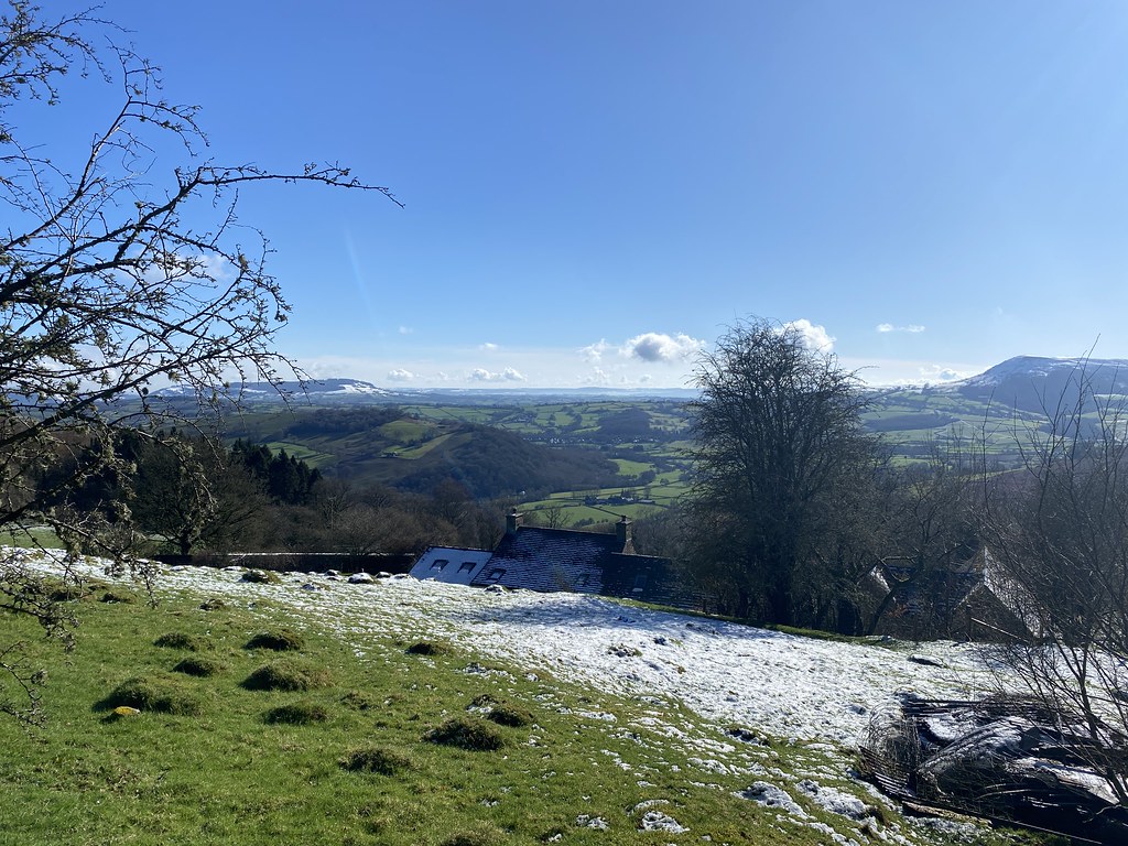
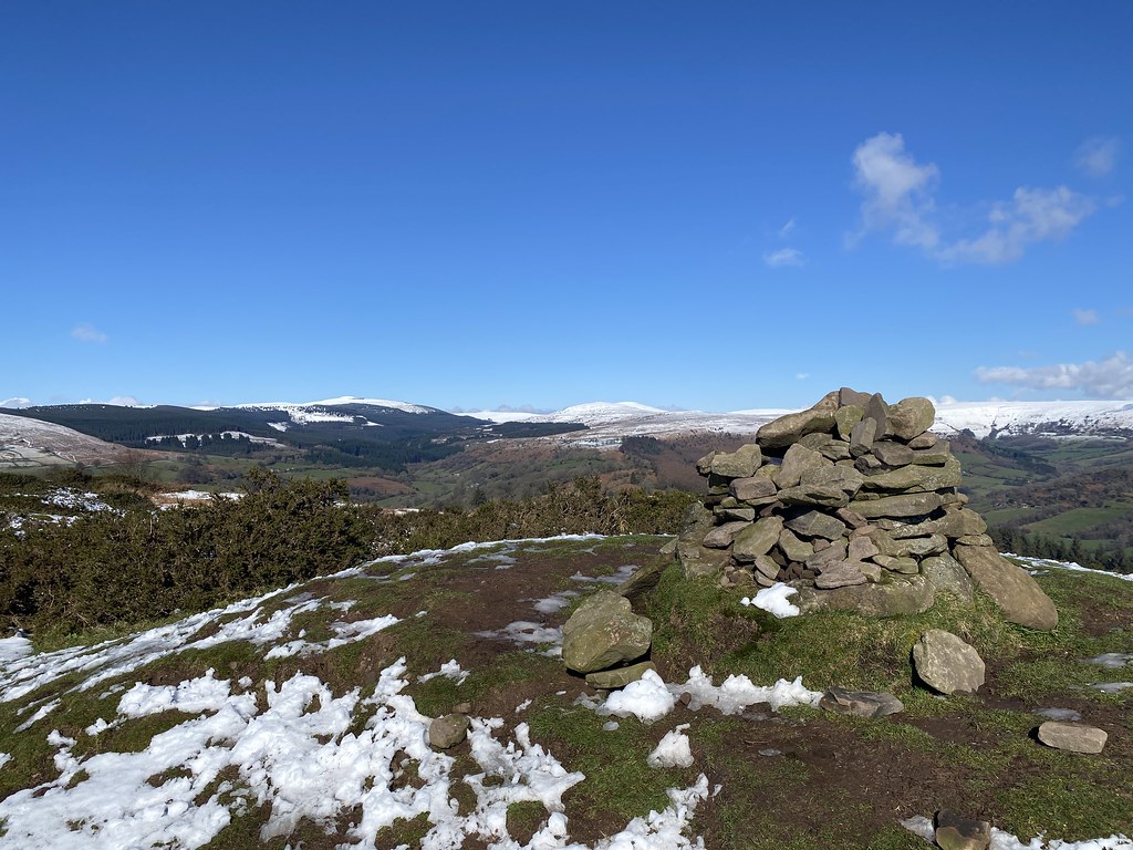
Bryn Arw is a favourite short walk for this sort of day although I realised I hadn’t been up for a while (the car park also serves as a jump off point for the Sugar Loaf and its become way more popular since COVID).
After such a gloomy start to the day the car park was empty. Most of the new converts to the outdoor world have yet to discover the delights of accurate weather forecasts so it seems.
Having said that, I struck way luckier than I ever thought with pretty much unbroken sunshine. Great view of Ysgyryd Fawr from the end of the ridge.
What the photos don’t show is just how ferociously windy it was. Hard to stand up and definitely not a day to stop for a brew.
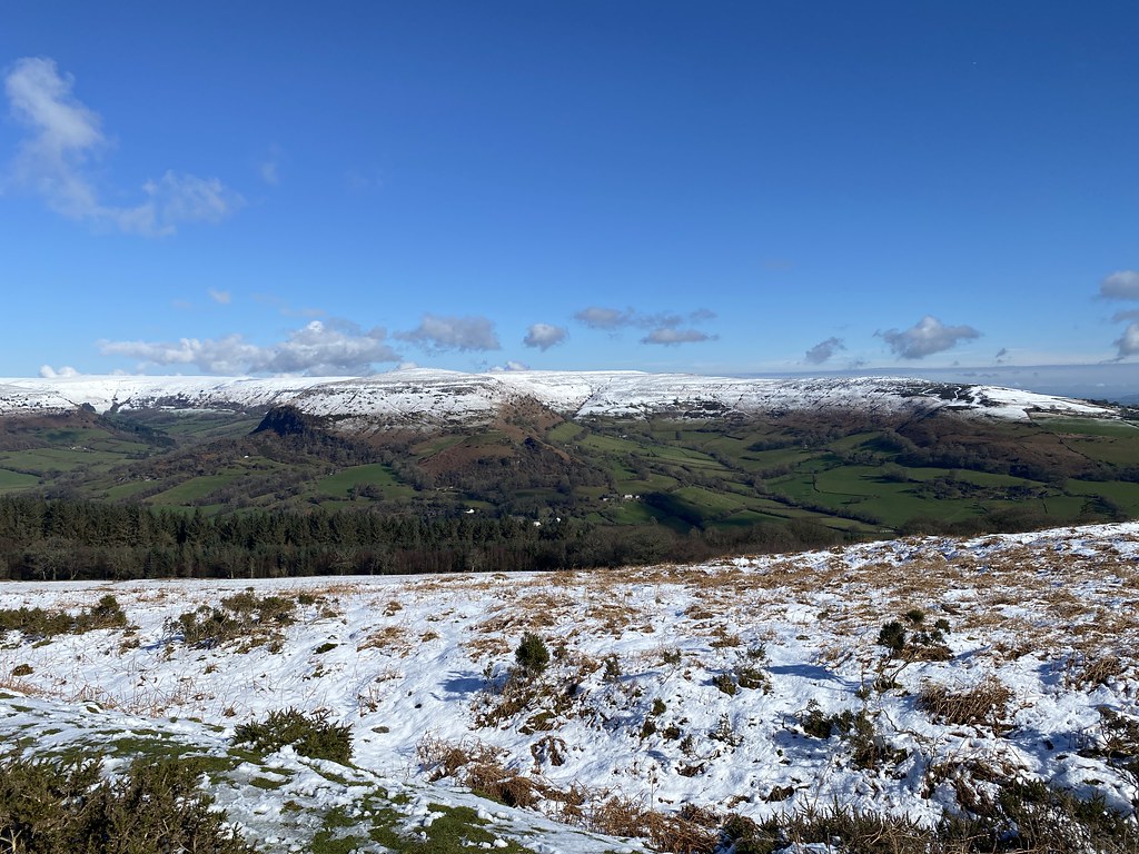
Sugar Loaf and the skies beginning to darken again.
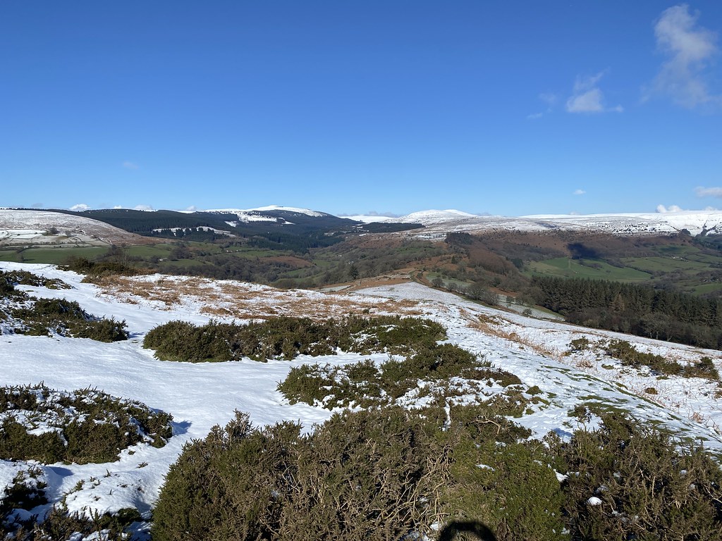
Looking south along the ridge towards Blorenge.
North west over Herefordshire.
North over the main Black Mountains.
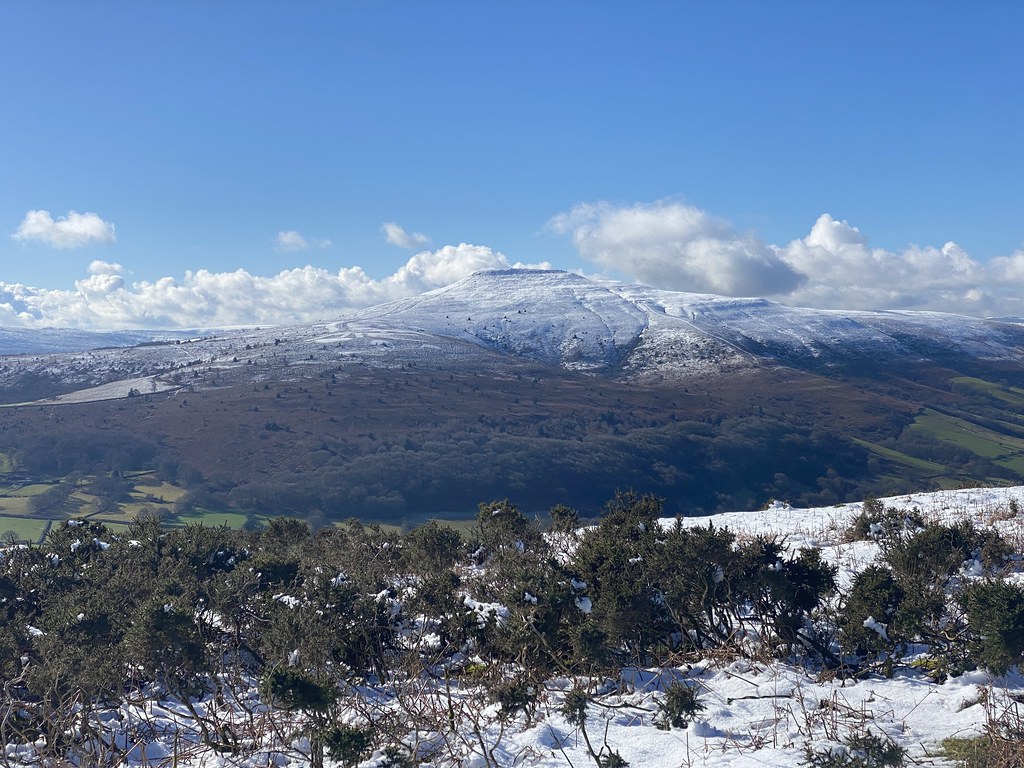
The summit cairn and a more distant Ysgyryd Fawr.
Hatterrall Hill before I raced the rain back to the car. A brief outing, lucky to catch the only real spell of sunshine during the day. It was good to be back on this fine small hill.
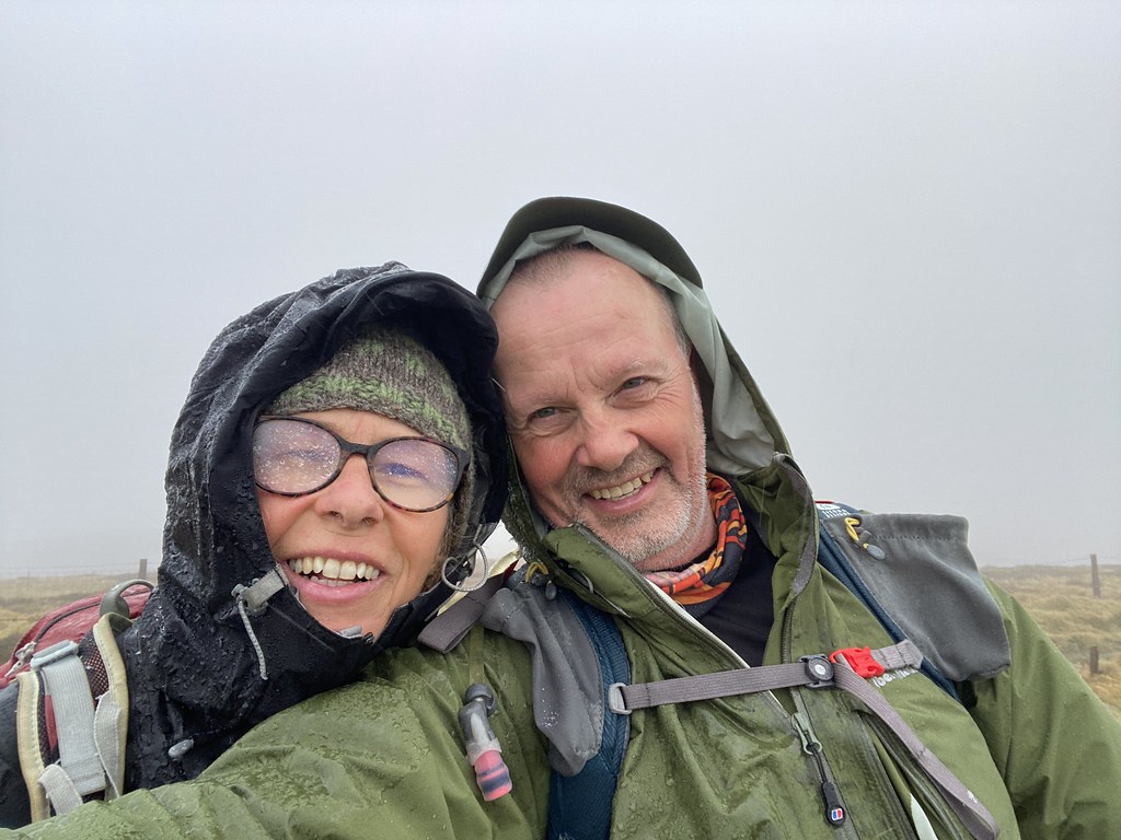
Since I started my blog over 13 years ago, one of the real pleasures has been striking up virtual friendships not only in the UK but as far aways as Colorado and Washington State in the US and Queensland, Australia. Its always a nice lift when someone takes the time to read my posts and writes a nice comment (just one negative one!). I’ve never actually had an opportunity to meet up in person but that’s now been put right.
Since coming across the Treks and Tors blog some years ago I’ve been able to learn a whole load of stuff about Dartmoor and the coastal paths of the south west and even been able to plan some of my own walks in that area that were all superb (apart from one utterly miserable wet day when the forecast sold me down the river). This year I was finally able to meet up with its author/owner (whatever the write title is for a blogger). Steve and his partner Linda were on a trip to south Wales and this time I was able to join them and show off a bit of my home patch.
Steve and Linda were wonderful company and we were immediately chatting away like we’d known each other for years, which, in a way, we have I guess.
We’d discussed some routes beforehand and had settled on a round of the Grwyne Valley, taking in the highest points in the Black Mountains. We’d set off early s the forecast had been for an ok morning but deteriorating later. Sadly the weather was looking grim as we approached the top of Pen y Gadair Fawr, enveloping us in cloud and heavy drizzle.
A group summit photo and I look a lot happier than when I take my selfies!
We thought we were in for a bit of a soaking but as soon as we left the top the rain stopped and it brightened up a little and even gave us some views over the Black Mountains.
It wasn’t a day for long stops so we covered the ground pretty quickly. Its kind of re-assuring that people who share you own passions for the outdoors and walking make such easy and fun company. Had I been out on my own on a day like this it would probably have turned into a bit of dreary route march (or more likely I wouldn’t have gone out at all). As it turned out I look back on the day with great memories of a fine day in the mountains with new friends. We had a good laugh at many points and I was particularly reassured that both Steve and Linda also “go to the pictures” when heading out to watch a film (and not go to the Cinema as the young people now say and roll eyes when I use the correct term!)
My only regreat is that I was so busy enjoying the walk I didn’t take all that many photos. Steve took a lot more so you might get a better idea of the walk from his write up of the day here.
Steve is very much a man for a post walk pint so after we finished the walk we headed down to the wonderfully named Llanvihangel Crucorney and The Skirrid Inn. Its supposedly the oldest pub in Wales and what a fine old place it is, all old slate walls and character (and a fine pint of Butty Bach). Surprising therefore that its the first time I’ve been in despite living in the area for 22 years
Steve and Linda were off back home to Devon so we bid our farewells and parted company. Really hope we can meet up again either in my patch or theirs. A really great day out.
As expected the forecast for the next day was much worse and the weather actually much better!
Just a few photos from a very short solo walk on my local Garway Hill.
Very muddy and wet up there still at the start of March. I would be hoping the recent nice weather would dry things out but its been raising at home all day today – again!
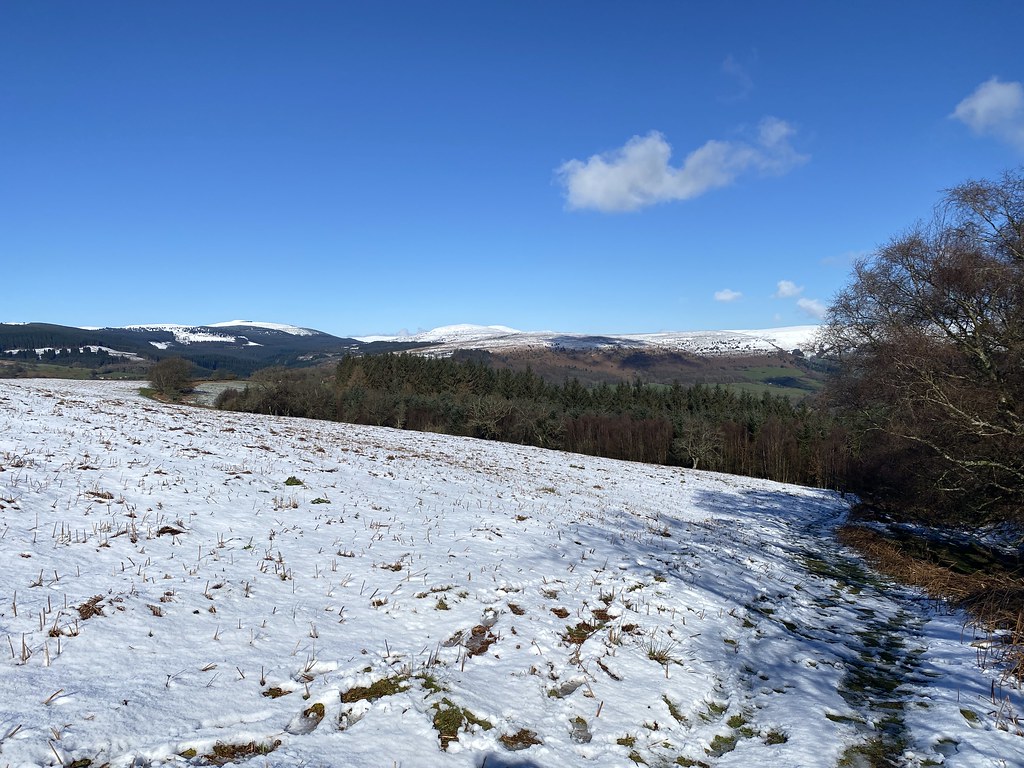
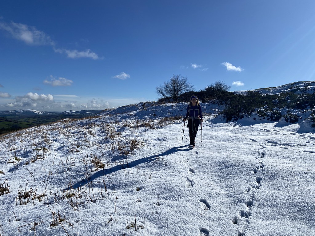
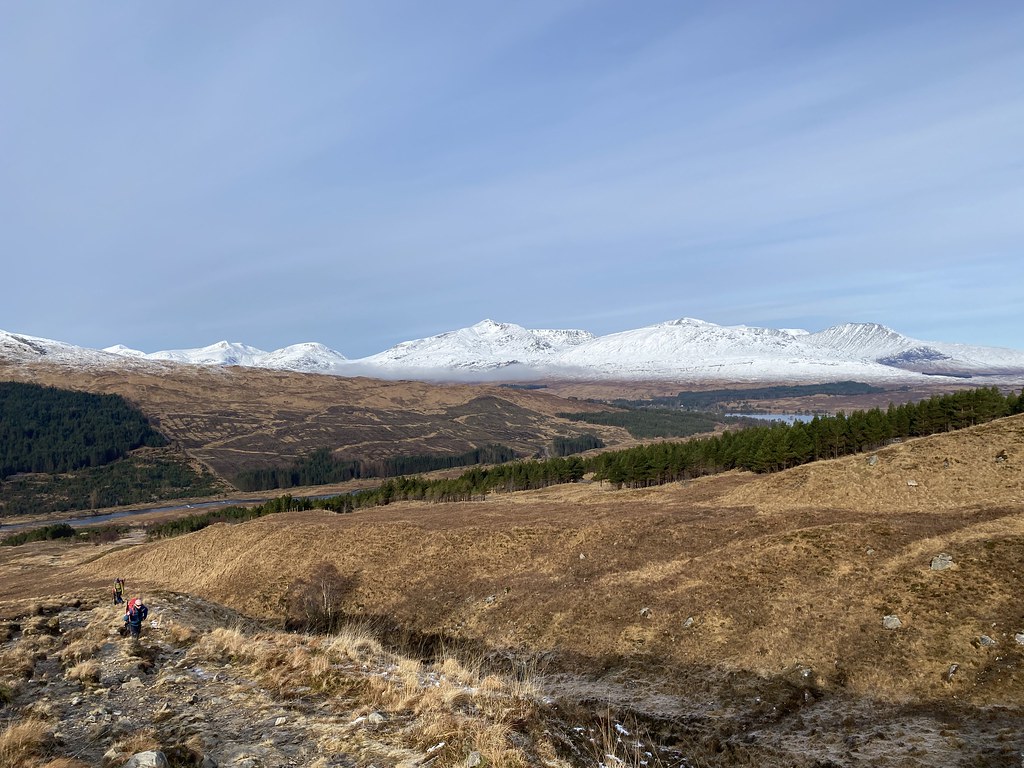
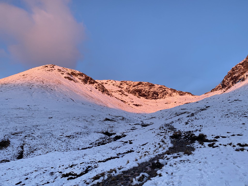
Back to early March and after our adventures in Scotland and all that snow, we had a little more of the white stuff in our backyard.
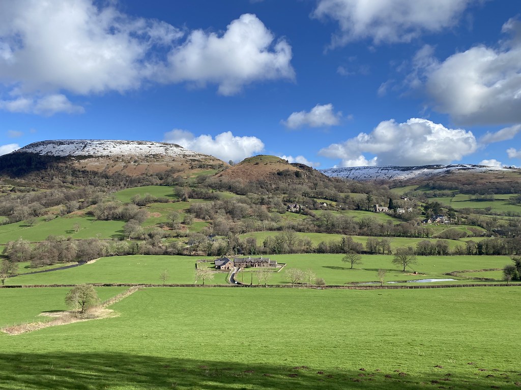
We headed out to find some snow in the Black Mountains on a gloriously clear and blue sunny morning.
Its been a rare event over the past few months (longer in fact) to have such a glorious day.
Ysgyryd Fawr dominates the start of this walk.
Distant views of the Bristol Channel and the Mendips on the skyline.
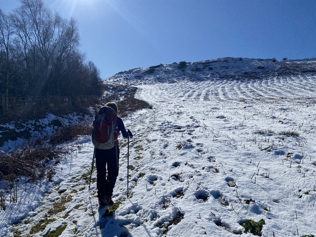
We were heading up to the hill fort at Twyn y Gaer. The Black Mountains looking quite white.
TBF enjoying the snowy walking.
The summit view from Twyn y Gaer.
Across to Hatterrall Hill at the southern end of Black Mountains – the ridge we can just about see from home.
Highest peaks of the Black Mountains.
The Sugar Loaf.
In truth, the snow cover was pretty thin and melting quickly. It was mostly all gone by the end of the day.
Still, it was nice to hear the crunch of crisp (and slop of wet) snow underfoot.
The village of Cwnyoy and its wonky church.
The green fields were lush (and wet) after a winter of ceaseless rain.
We scrambled up onto the small peak above Cwmyoy, created from an ancient landslip.
Its a favourite spot of ours for a lunch break when we are in the vicinity.
Our plan was to walk the usual circuit around Hatterrall Hill but TBF was out of sorts with a cold and I was suffering with a bad back so we decided this was more than enough for the day.
We took a leisurely stroll down through Cwmyoy on our way to the car.
Stopping to admire this fine and ostentatious feathered specimen.
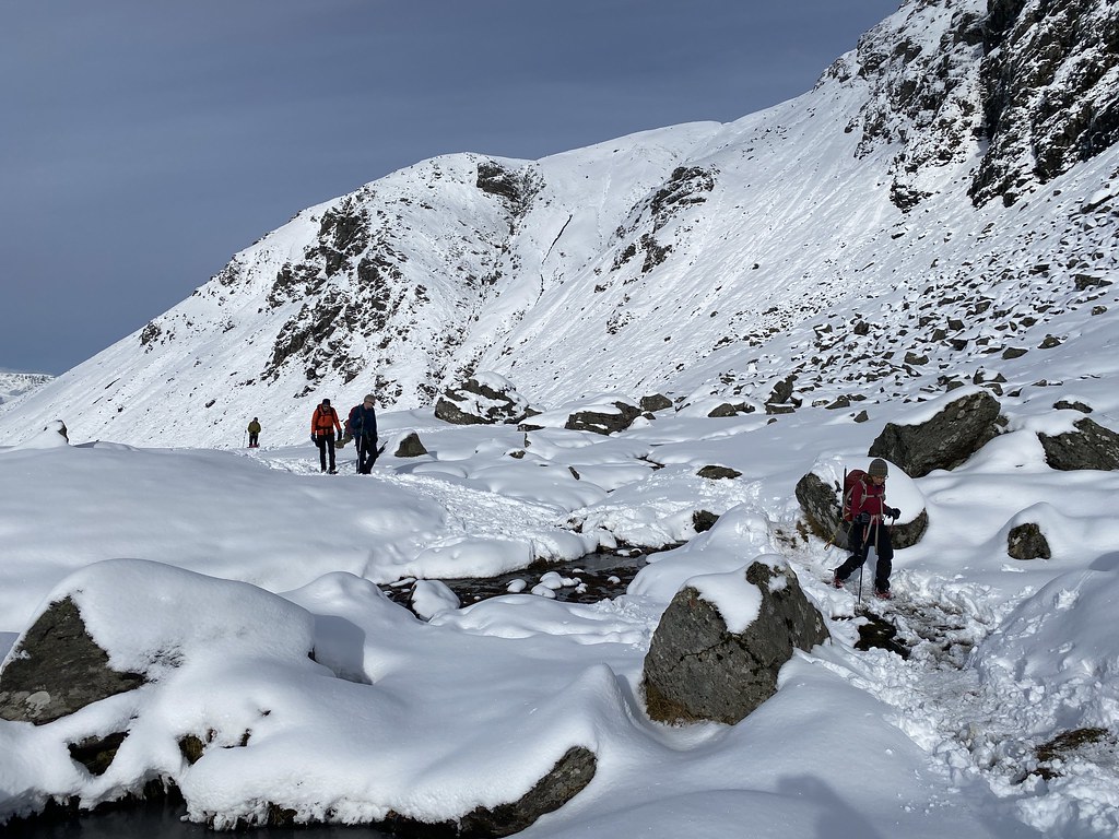
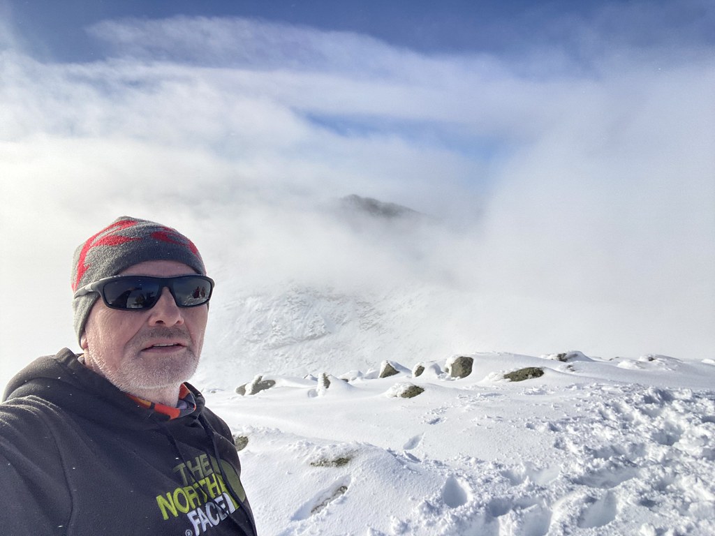
After the long day and exertions of Ben Cruachan we wanted a something a little easier for our last day in Scotland (easier is a relative term in Scottish winter conditions)
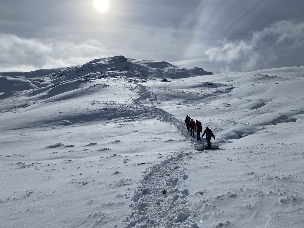
The weather was stunning and the forecast settled and we agreed on Ben Dorain. Its sits directly above the hotel (no need for any driving) and as its very popular, we guessed it might have a trail stomped out through the deep snow.
The ground was frosty but the sun warm as we started out for the long climb through Coire and Dothaidh up to the ridge.
The views out over the south-west highlands was magnificent.
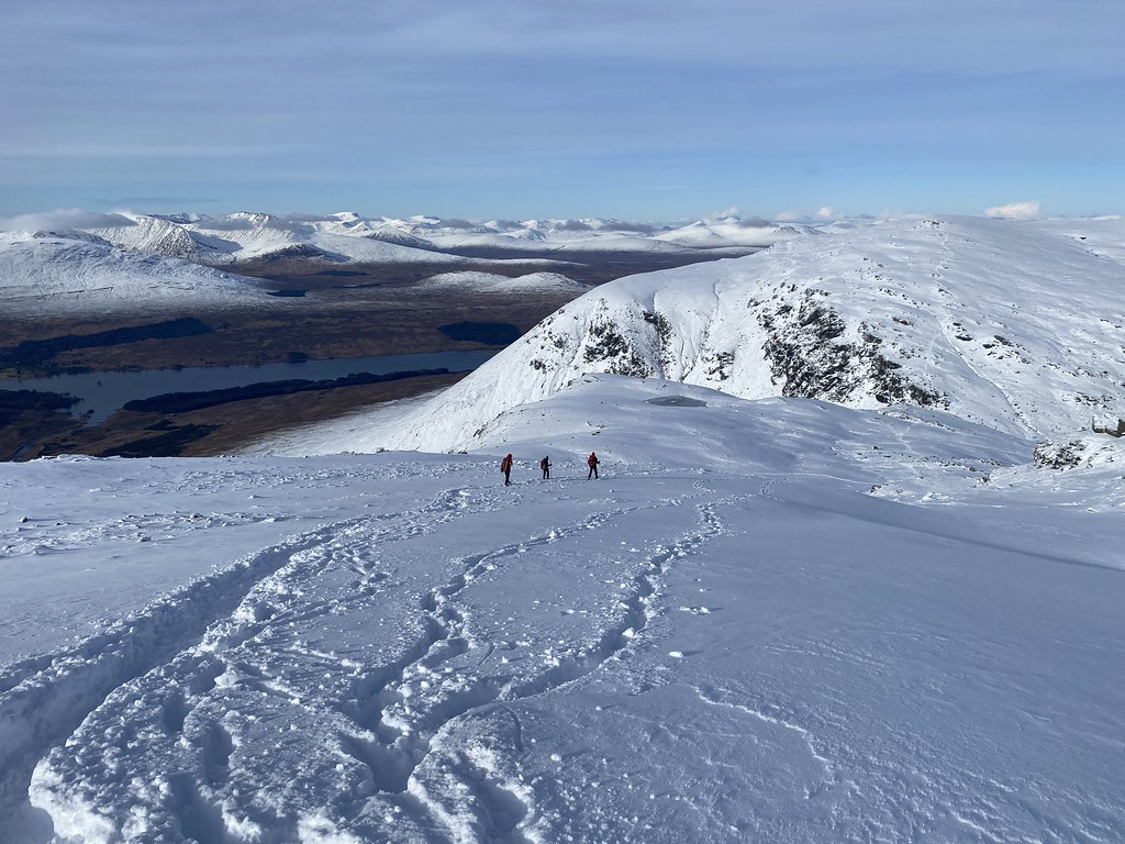
Other than one short steep stretch where the party ahead of us had been sliding about on the snow and obliterated the trail (thanks!) it was easy going to the col.
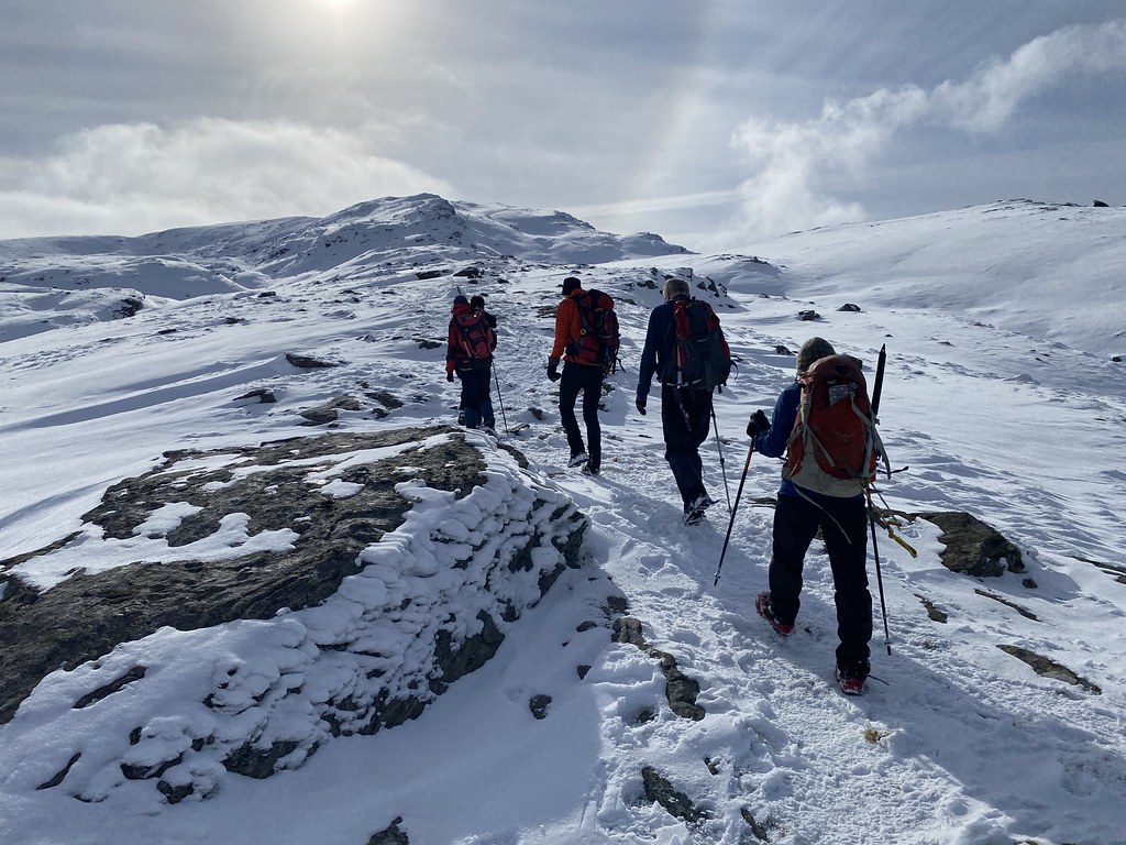
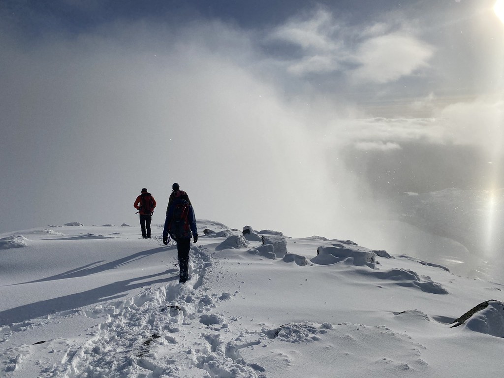
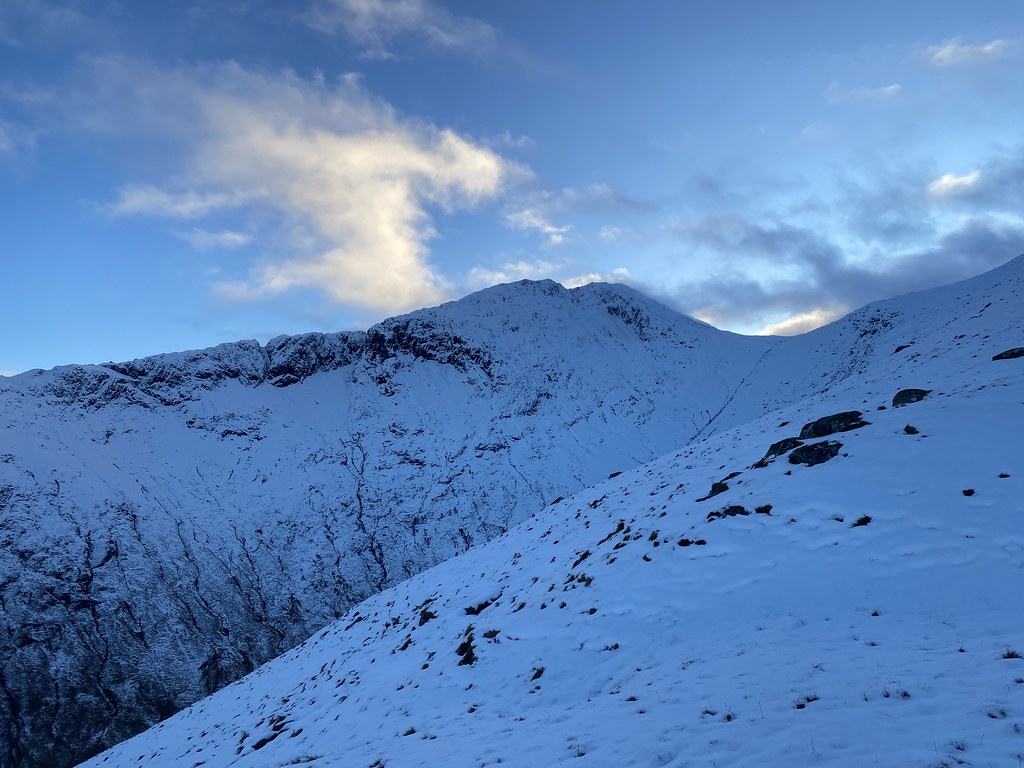
From there it was a winter wonderland!
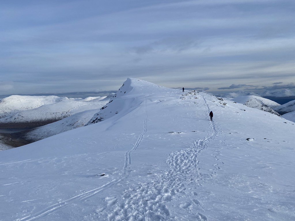
Our guess was correct and there was a deep and compacted trail through the snow that made the walk along the surprisingly long ridge an absolute delight.
TBF with Beinn an Dothaidh behind.
Ben Dorain looks fairly simple in terms of its topography from afar. On closer inspection it has a long ridge with several small spurs and corries/depressions holding deep snow. It would have been a hard work breaking trail up here the day before.
With this excellent trail (compacted and frozen so micro-spikes were very handy) we just strolled to the top,.
As we climbed the views just got better and better. Mountains as far as the eye could see, interspersed with lower clouds.
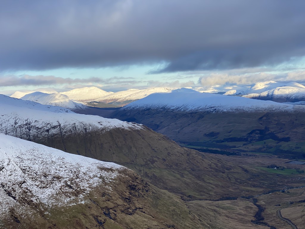
Glen Orchy and Ben Cruachan, our mountain from the previous day.
A look along the long ridge to the top.
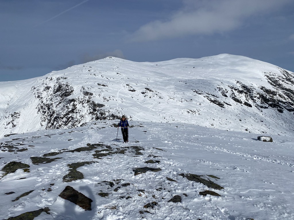
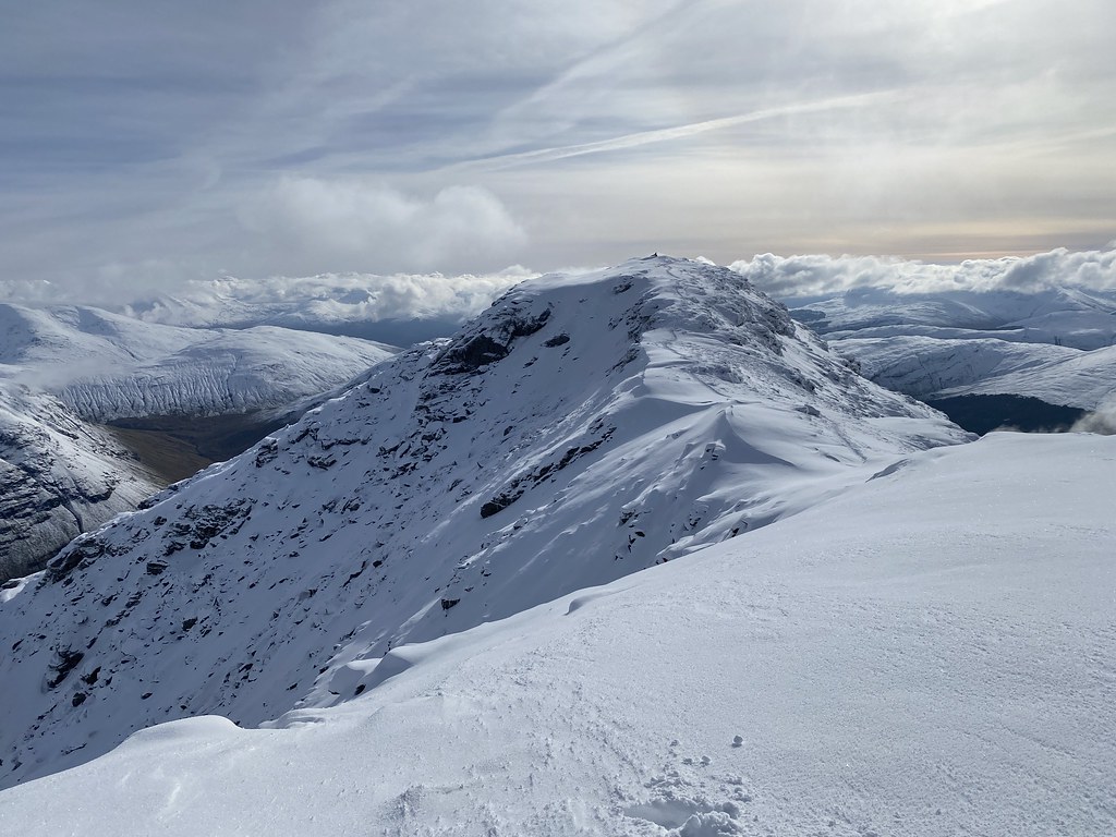
I’ve been up here a couple of times before, both in dense cloud. When you arrive on the subsidiary top of Carn Sassunaich, you’d have to check the map closely to realise that despite the massive cairn, its not actually the highest point, seen here beyond. Indeed on my first visit I’m not 100% sure I did go to main top!
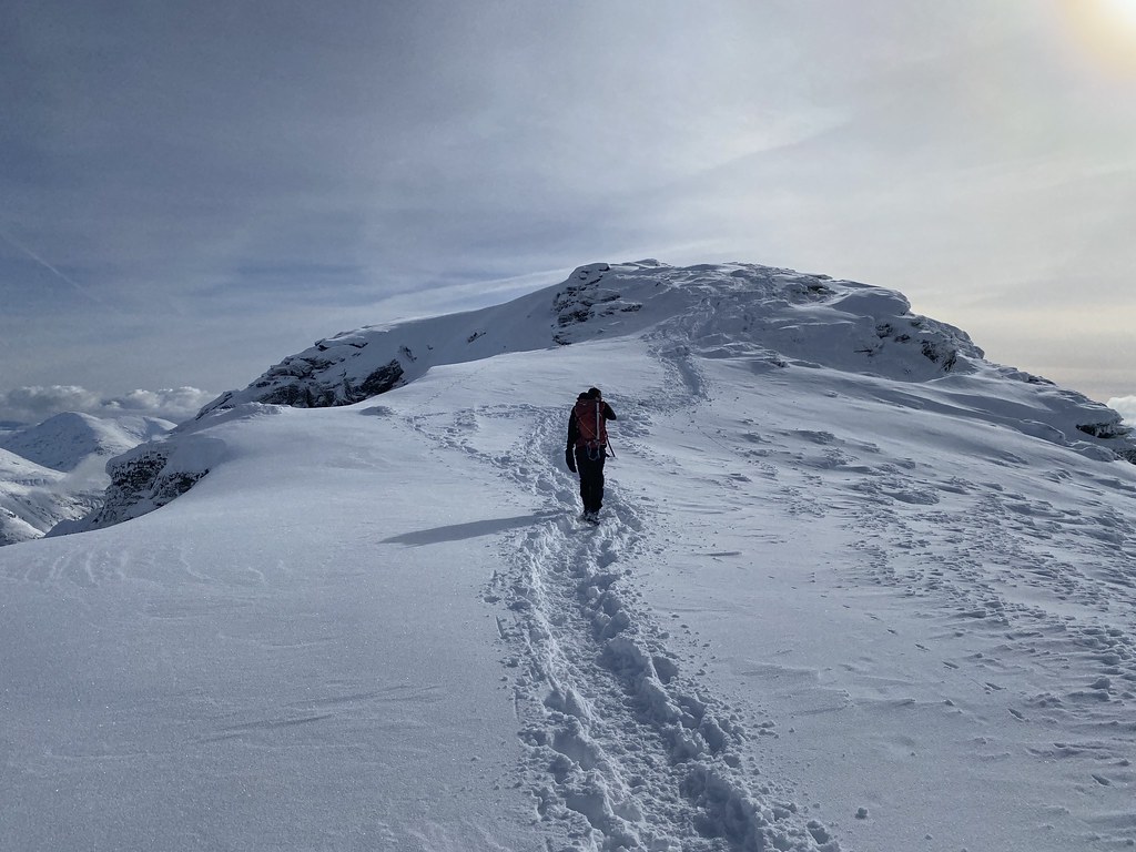
Its a nice albeit short ridge across to the summit.
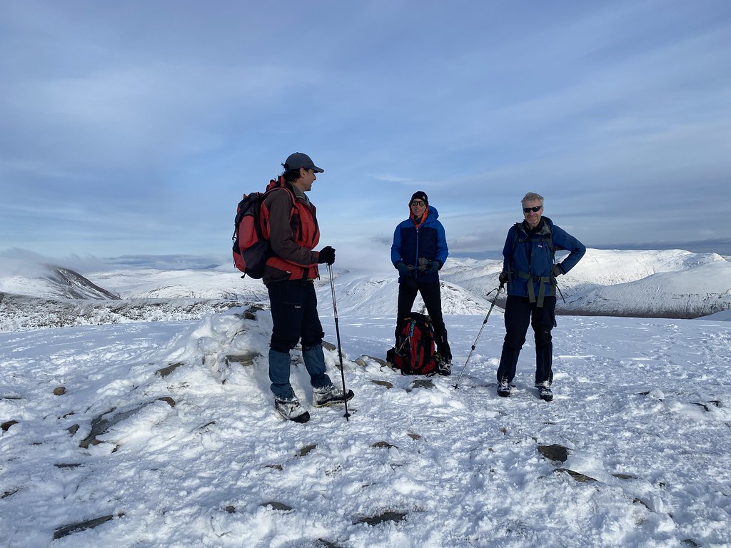
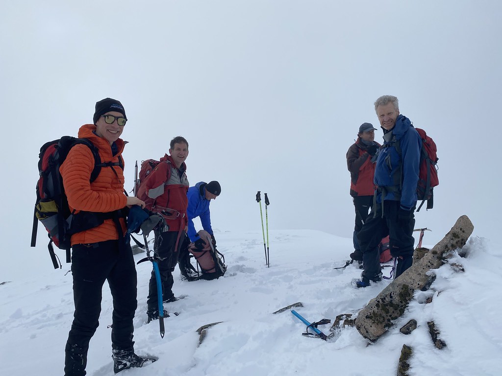
Here’s Danish Matt approaching the final climb.
And a team photo (minus me) on the summit.
Its pretty steep on all sides so the views are airy and spectacular, well at least I know that now having been to the top on a clear day at last.
We lingered on the top for an extended lunch and spent a while wandering about and taking in the amazing vistas.
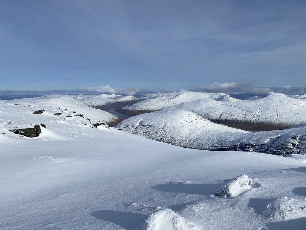
East over towards Glen Lyon, Glen Lochay and the Ben Lawers range.
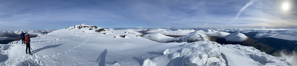
Panorama looking east.
And one looking west.
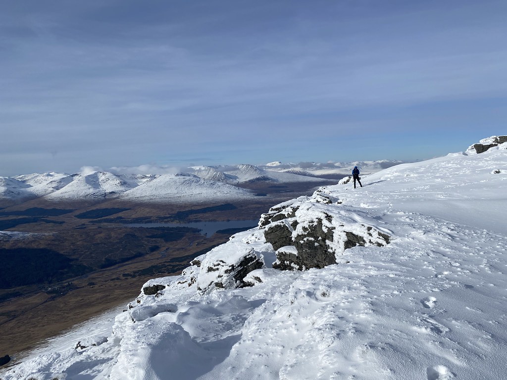
The edge that faces west is quite dramatic looking out over Glen Orchy and Loch Tulla.
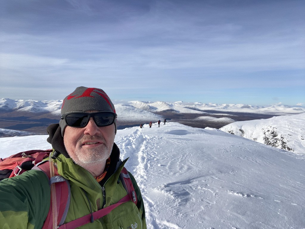
Very much satisfied with our lot and our choice of summit we began the route down. Summit selfie (well a Carn Sassunaich selfie anyway).
The walk down was as much a delight as the walk up as the sun began lower and change the lighting.
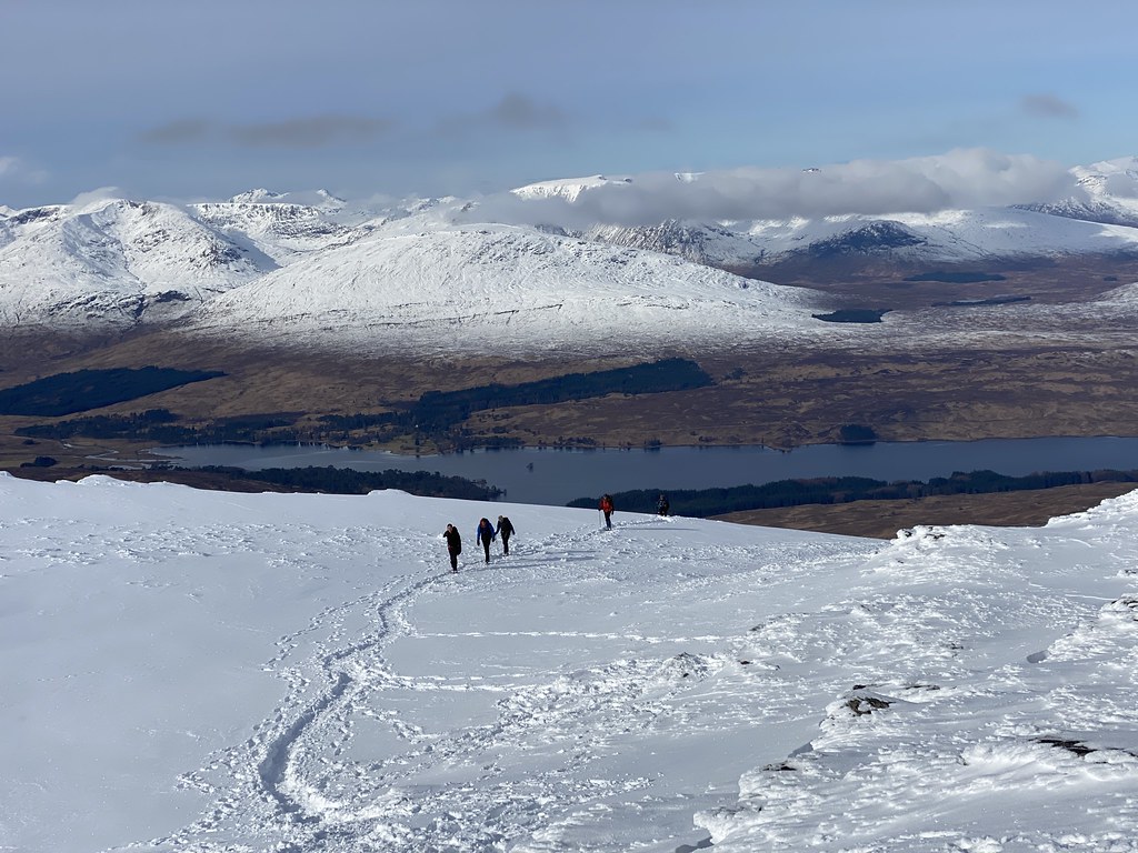
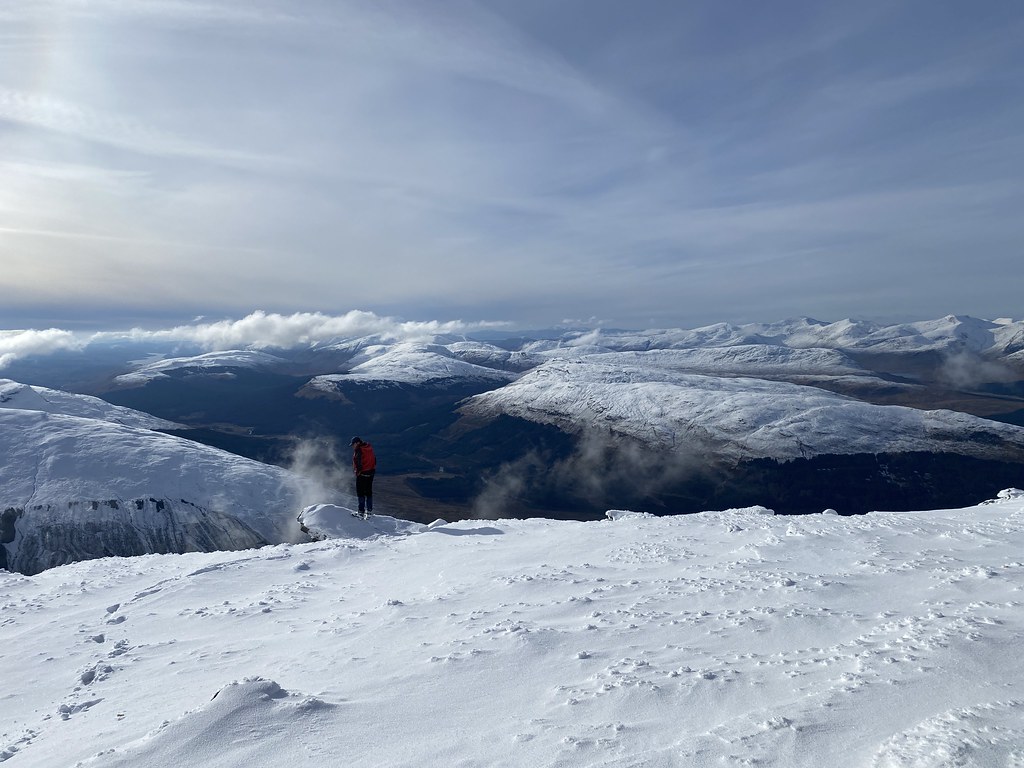
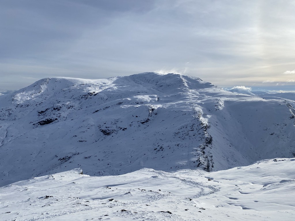
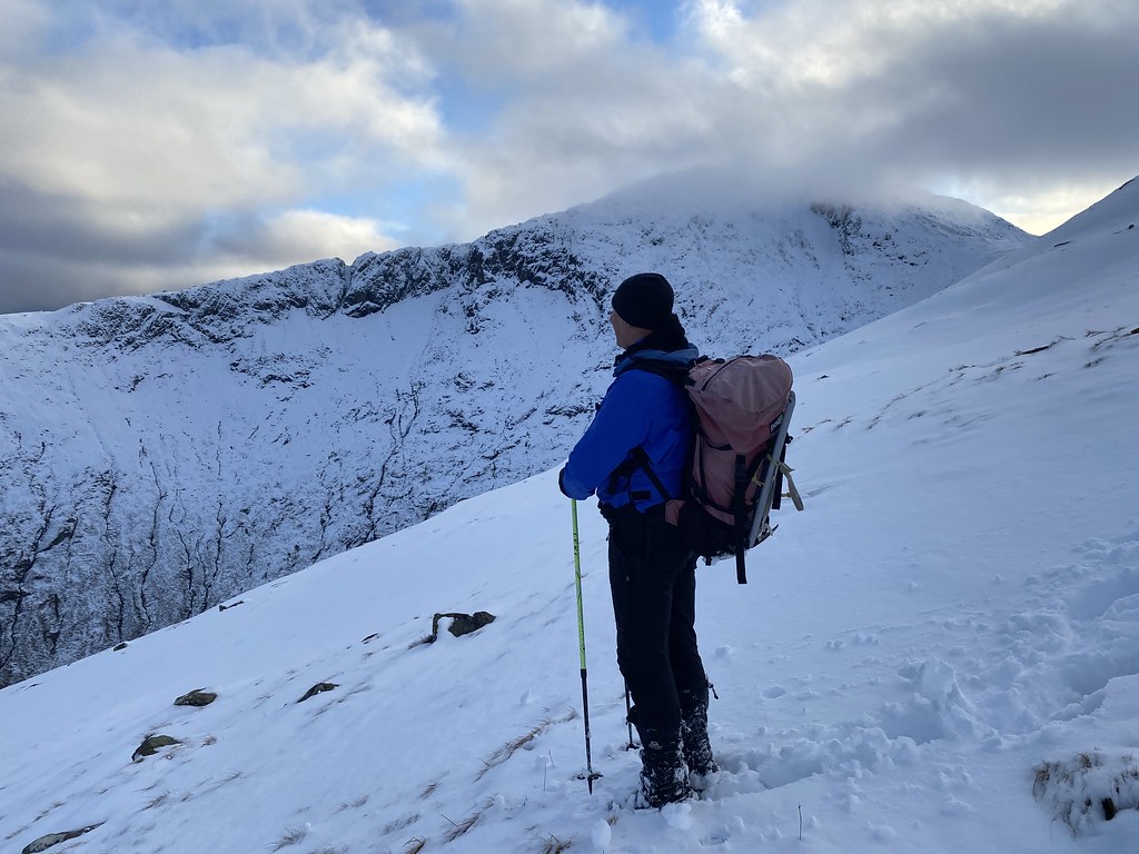
We felt we had enough time to tackle Beinn an Dothaidh. It was a tougher climb as its less popular and the trail hadn’t be stamped out quite as well. Looking back to Beinn Dorain from the way up.
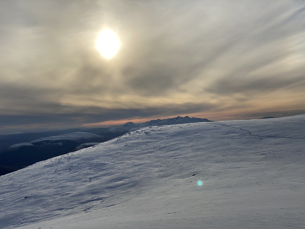
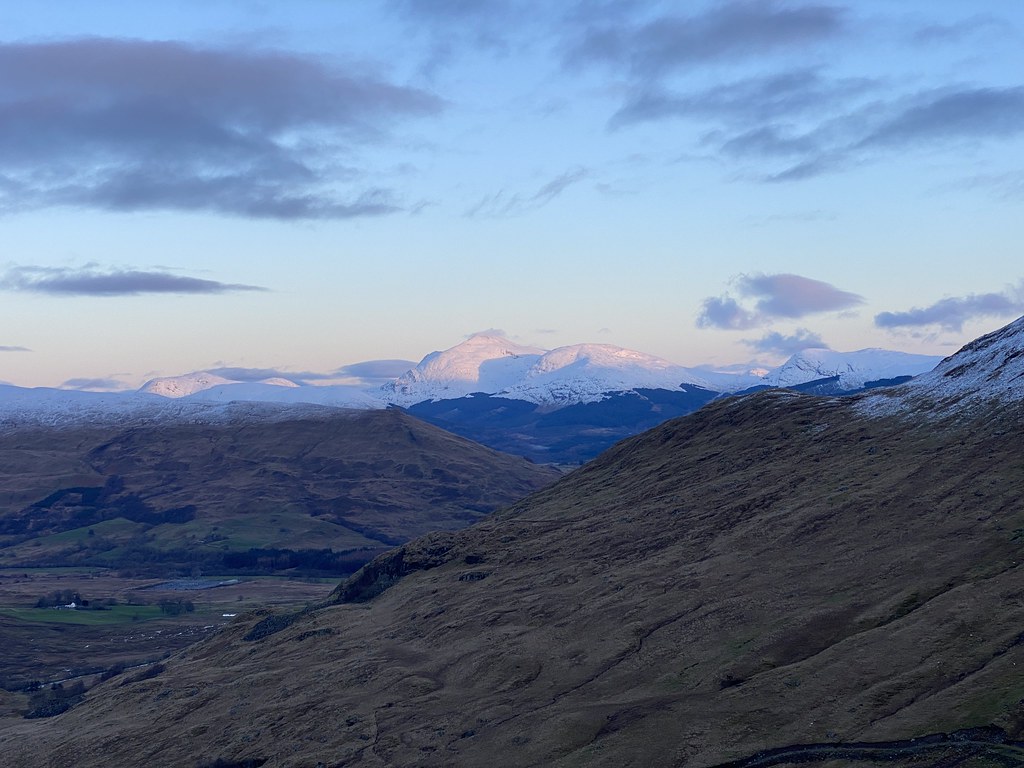
Well worth the extra effort as the view over Rannoch Moor to Lochaber and Ben Nevis (close to the left edge of the skyline in the above photo) is stupendous
There had been a thin veil of cirrus cloud all day and as the sun went down it lit those clouds up to dramatic effect.
Happy lads on the summit.
Highest point of Beinn an Dothaidh.
One of its other summit points and the best one for views.
The light was fading fast and we had to head down. The temperature was dropping fast and its no place to get caught out in the dark.
Magificent skies as we headed down to the hotel.
Sunset over the the south west highlands.
One final treat with a period of pink Alpenglow as the sun finally set for the day.
Map of the route – well, sort of. Just ignore the leg off to the north (from a previous trip), I couldn’t be bothered to do an up to date version.
The walk ended on a bit of a downer. Danish Matt slipped over within sight of the hotel and looked in a good deal of pain, saying he felt something “go”. A visit to hospital the next day confirmed he’s broken a bone in his foot. In one way unlucky that it happened so close to the end of the walk, but look another way and lucky it didn’t happen much higher up where the situation would have been much more serious.
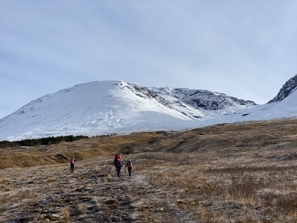
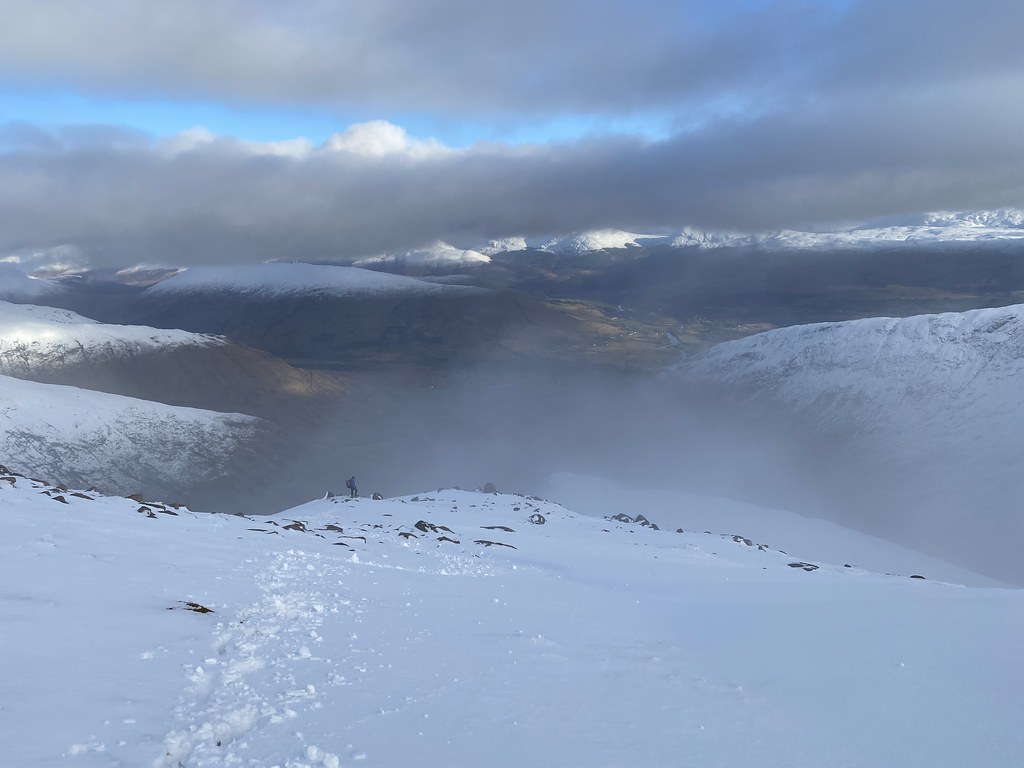
Next day of our Scottish adventure and the usual round of endless discussions around where to go. My mate JC suggested Ben Cruachan which I haven’t done for years. Its a big bugger so we went for the shorter and lower eastern side and the Dalmally horseshoe.
Even though its a shorter day, you start at sea level and its still a substantial undertaking of 8 miles and 3,500 feet of ascent.
Our group 6 set off on the track into the heart of the horseshoe. The Hydro track went much further into Coire Chreachainn than the map showed which was helpful.
After which the real work began. Steep grass and then ever deepening snow. The forecast was for the grey skies to clear and as we climbed things looked promising. However the grey skies soon returned.
It was a very long climb and in deep snow with no new tracks to follow it was tough going.
JC puts a happy perspective on things.
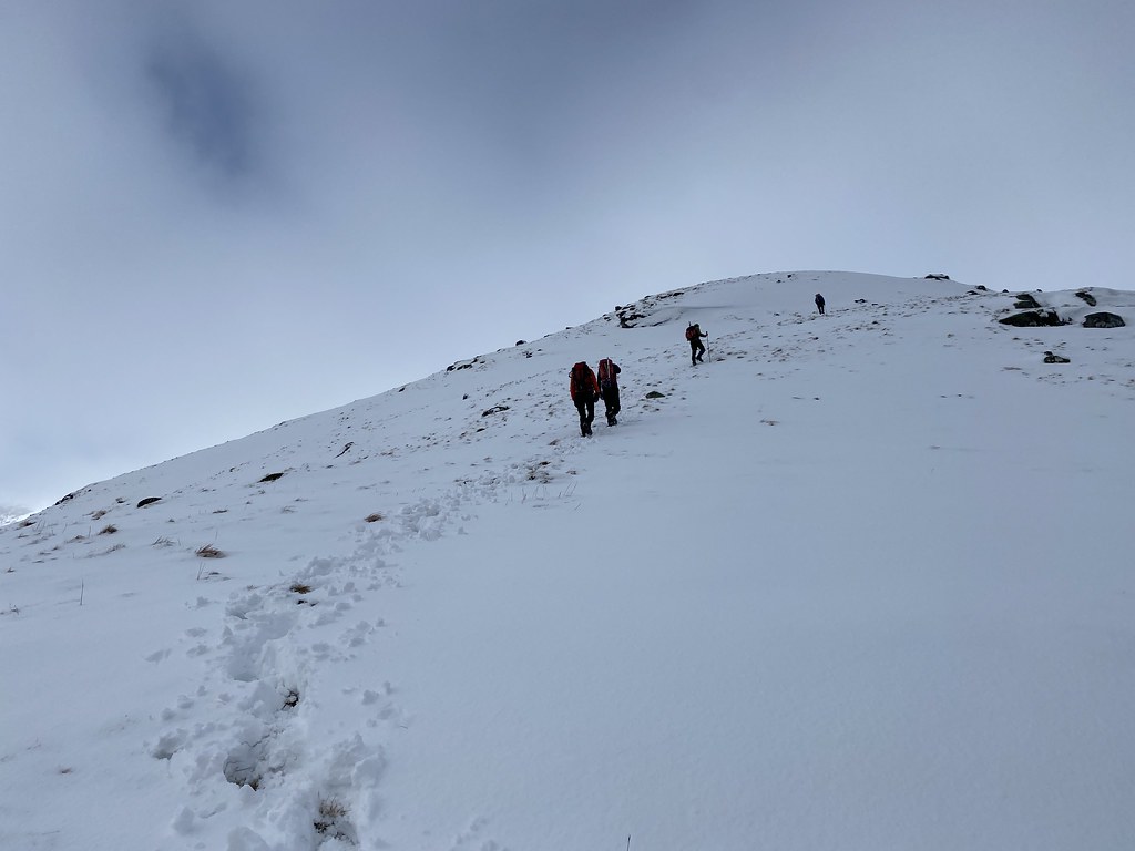
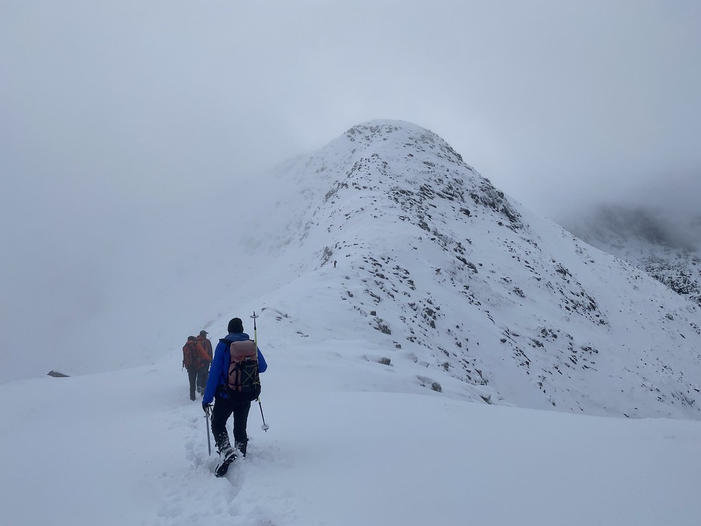
Approaching the first top of Sron an Isean.
The happy gang on the first summit.
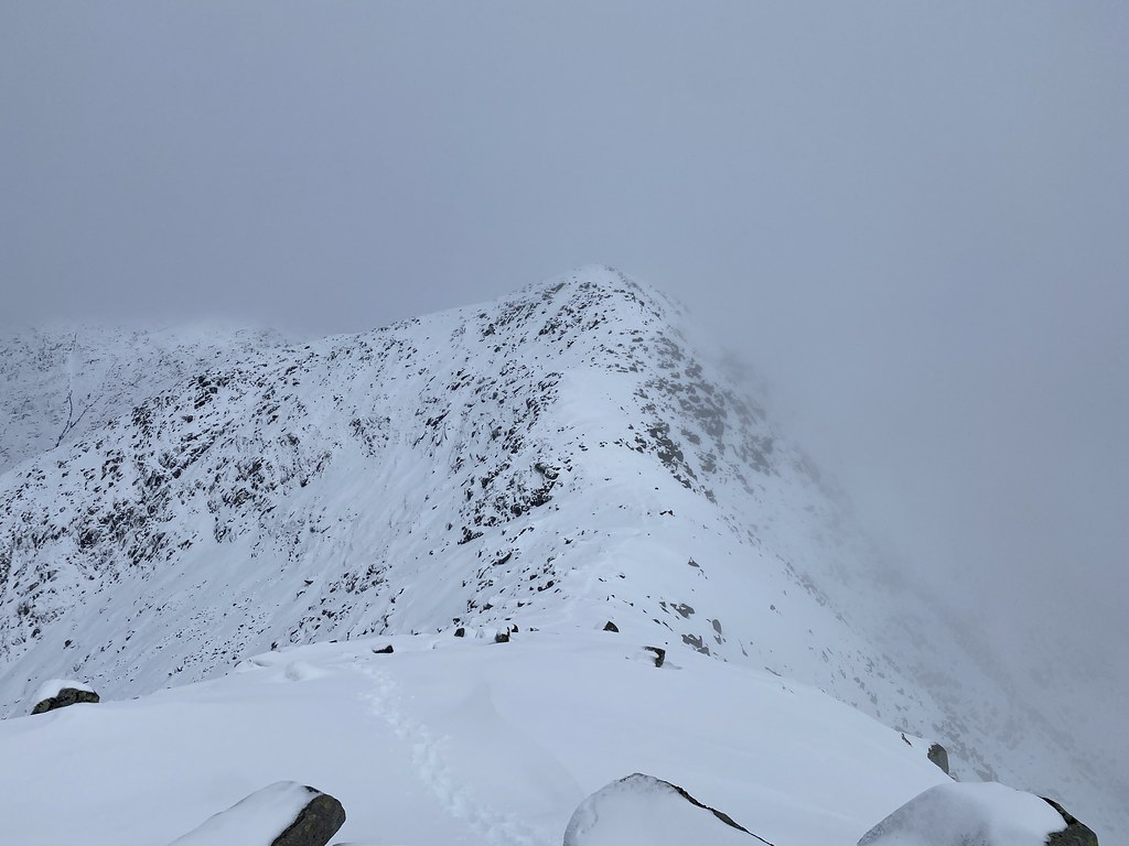
The weather was still overcast and we were in and out of the cloud. We still had some decent views and in this grim spell of weather it was at least dry which is always a win in Scotland.
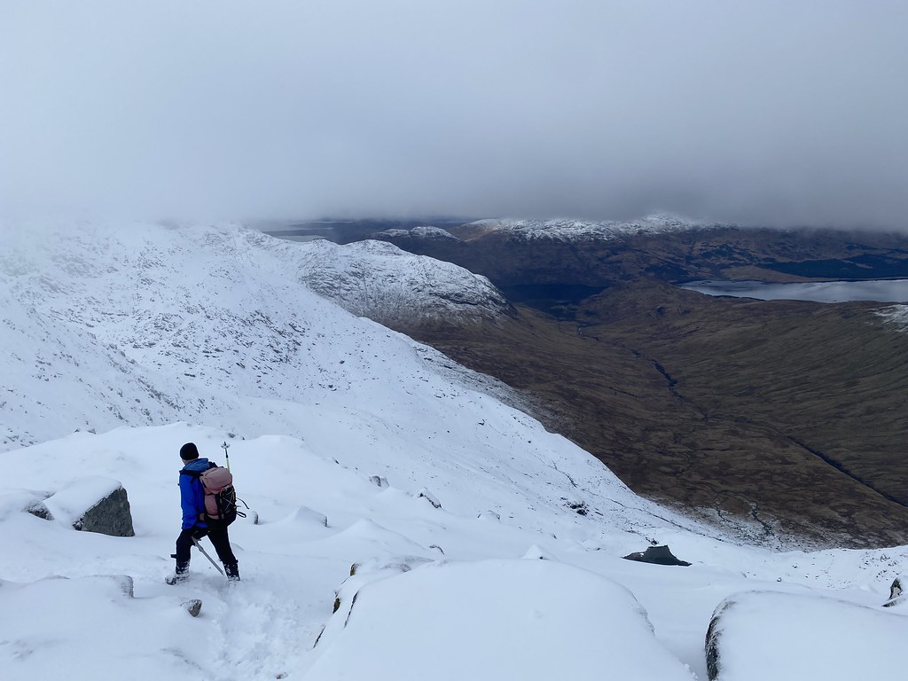
It had been tough going on the ascent but from here things were even tougher. The snow was amazingly deep even on the crest of the ridge. It was incredibly hard work bashing through and breaking trail (we were pretty much the only people we saw up here all day) even though I didn’t actually do any (I slunk to the back of the group using my lack of height as a very weak excuse).
Despite the grey skies the views were still pretty decent and Ben Cruachan is a spectacular mountain. Rocky with narrow ridges, unlike most of the rest of the south east highlands.
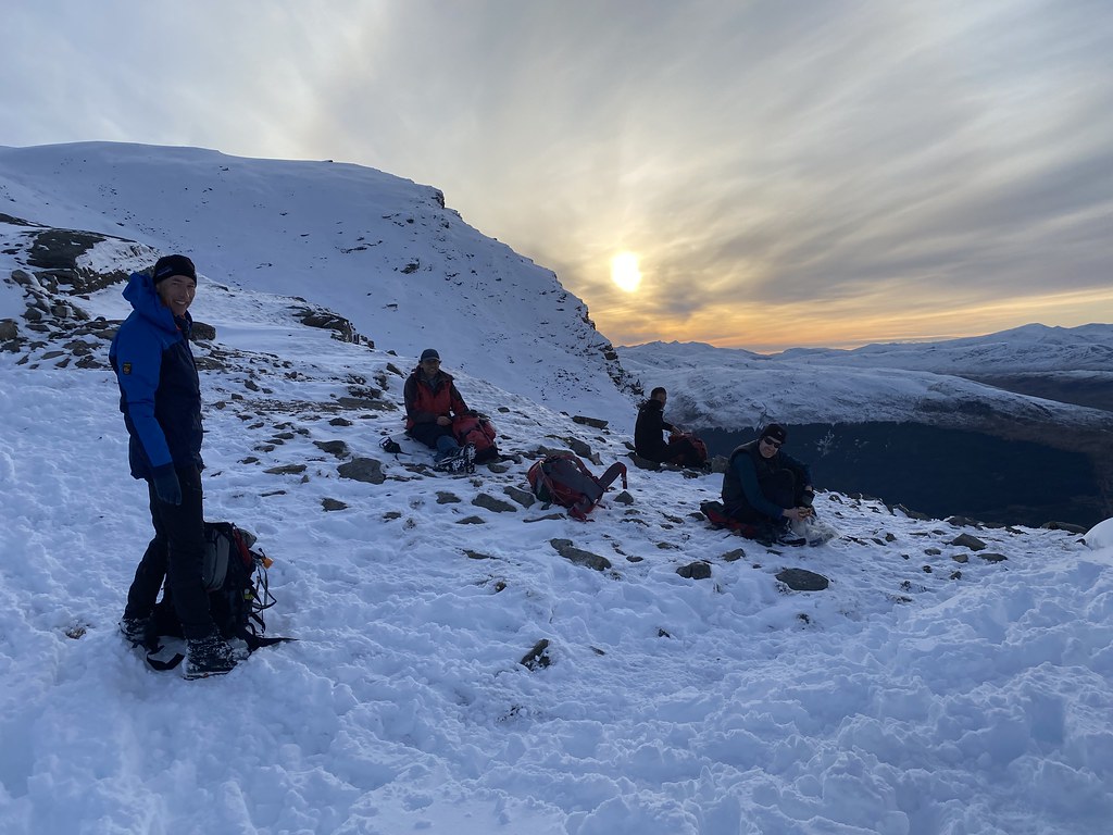
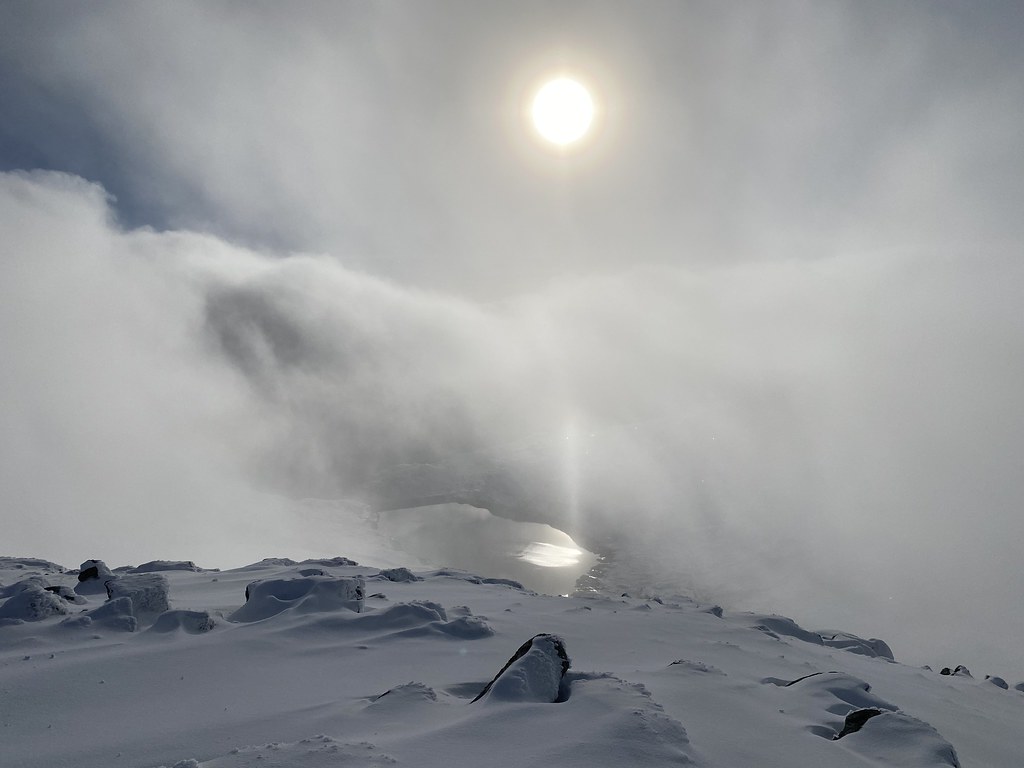
We stopped for a break on the final summit of Stob Garbh. Despite the relatively short distance it had taken us 5 hours to reach this point.
As we sat on the top the skies began to clear a little and the sun even came out. We were half in and half out of the cloud, the sunlight reflecting off the Cruachan Power Station reservoir far below.
After a grey day the skies began to clear to dramatic effect. Selfie with the highest summit of Ben Cruachan behind.
Within the space of a few minutes, gloomy grey skies were replaced with blue ones.
We even had a couple of fog-bows!
We went our separate ways from the summit, me and JB heading back to the car, the rest taking on the extra Corbett of Beinn a Bhuiridh.
As we headed down the skies became clearer and the late afternoon views across the southern highlands were magnificent. Another concerned face selfie.
It was a long and tiring descent in deep and slippery snow but with views like this no complaints.
JB takes a pause to survey the grandeur.
By the time we reached the lower slopes the skies had pretty much cleared and the light contrasts were just stunning.
Looking back to Beinn a Bhuiridh. At this point the rest of the party were only just heading away from the summit and likley to completing their descent in the dark.
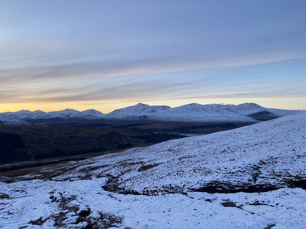
We eventually reached the track just as the last pink alpenglow faded from Ben Lui.
We had to wait at the car for well over an hour for the rest of party to make it down but the moonlight views over the mountains, this is Beinn Mich Mhonaidh, was more thn enough to keep us happy.
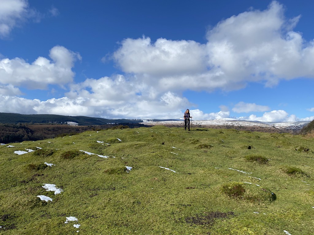
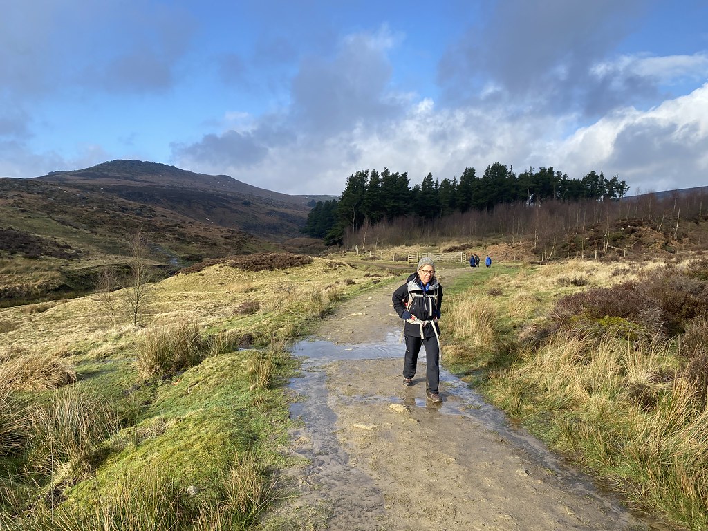
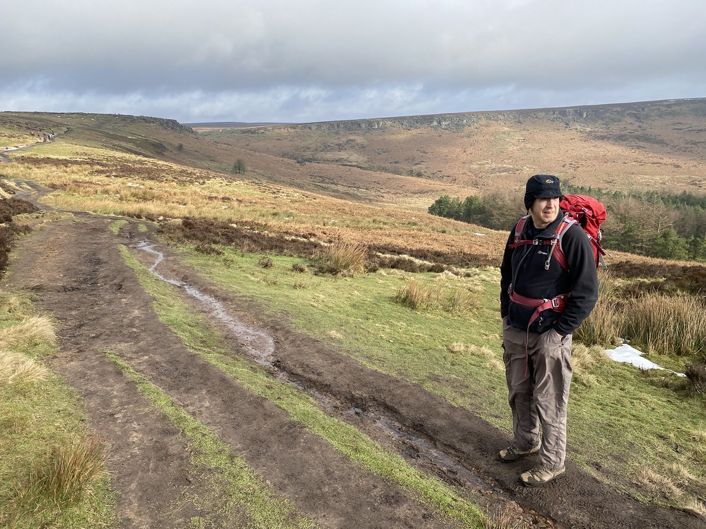
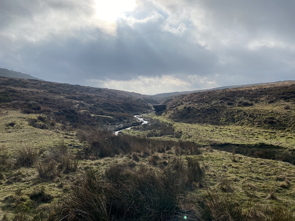
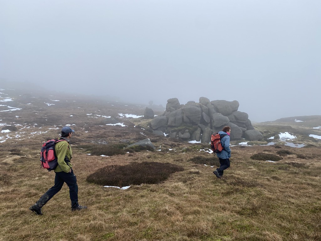
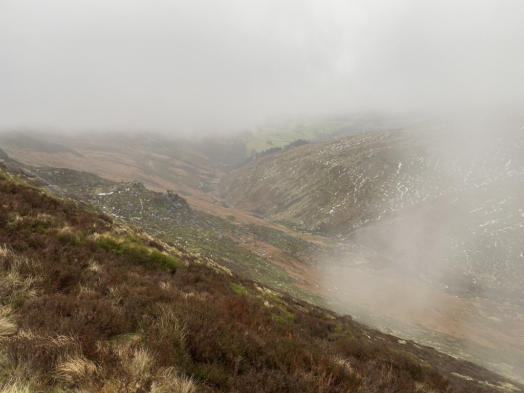
Second day of our little Peak District excursion. Started off as a nice frosty morning but by the time we met with UF for a walk around Burbage Rocks, we were in deep thick clouds.
We walked along Millstone Edge and past Over Owler Tor and saw nothing. We decided to skip Carl Wark as it didn’t seem worth the trouble in swirling fog.
We decided to have an early lunch on Higger Tor. While we brewed up the wind picked up a bit and seemed to clear the fog. We were treated to some views across the broad valley of Burbage Brook and Burbage Rocks.
By the time we set off the weather had improved markedly. There was even some watery sunshine.
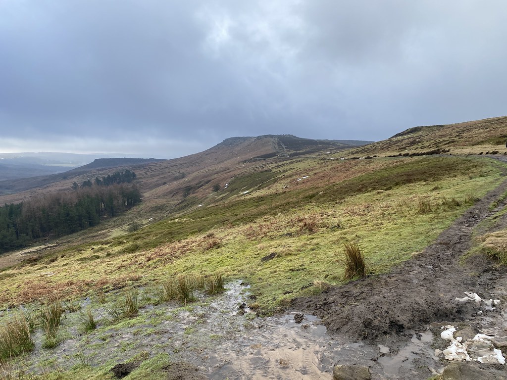
Looking back to Higger Tor and Carl Wark.
As it was now quite cold and windy we decided to stay low and head down the path alongside Burbage Brook.
None of us had ever walked along by the river so thought it would make a pleasant – and warmer – change.
Heading down the muddy path (all paths are muddy these days) down to the river.
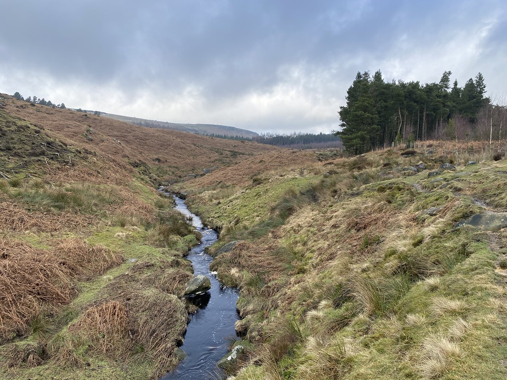
An inspired decision as its really rather lovely down by the river.
Lots of of small cascades and green swathes of turf. Most unlike the Dark Peak.
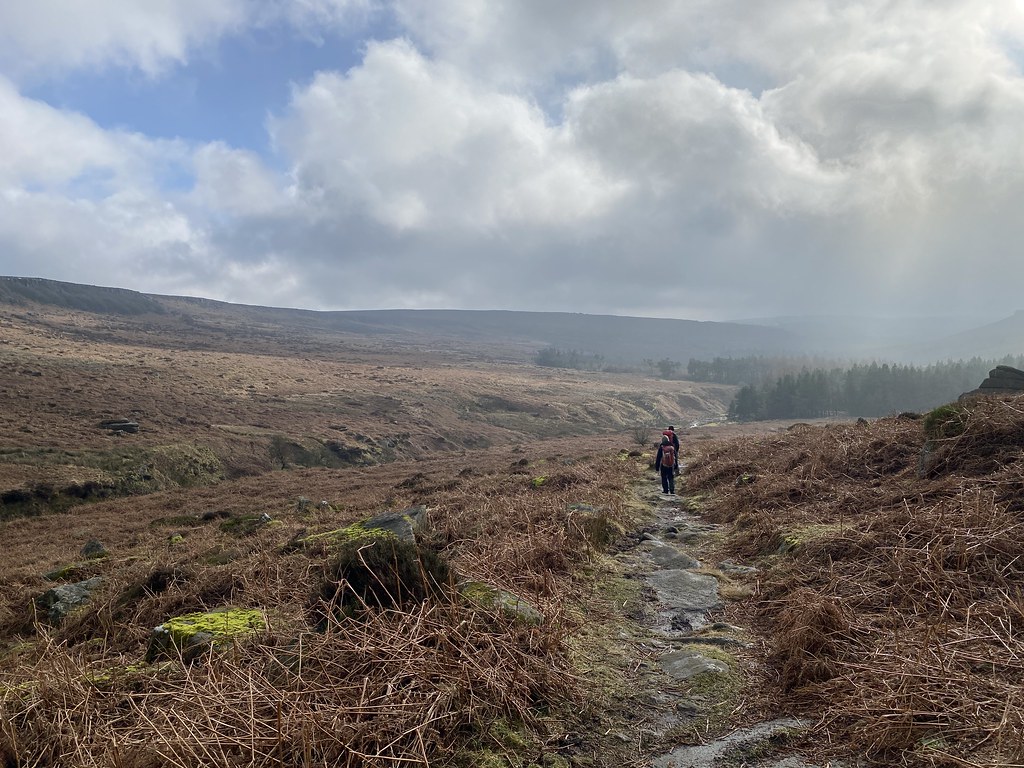
Its always fun to follow a river, small or large.
Apart from a few sections of squelching bog and mud – some of which required some delicate moves and hanging from fences to bypass, it was an excellent walk.
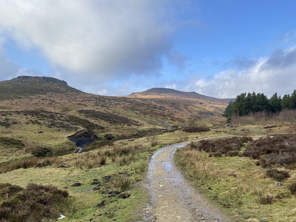
Th weather continued to improve as we walked. Some very decent views back to Higger Tor.
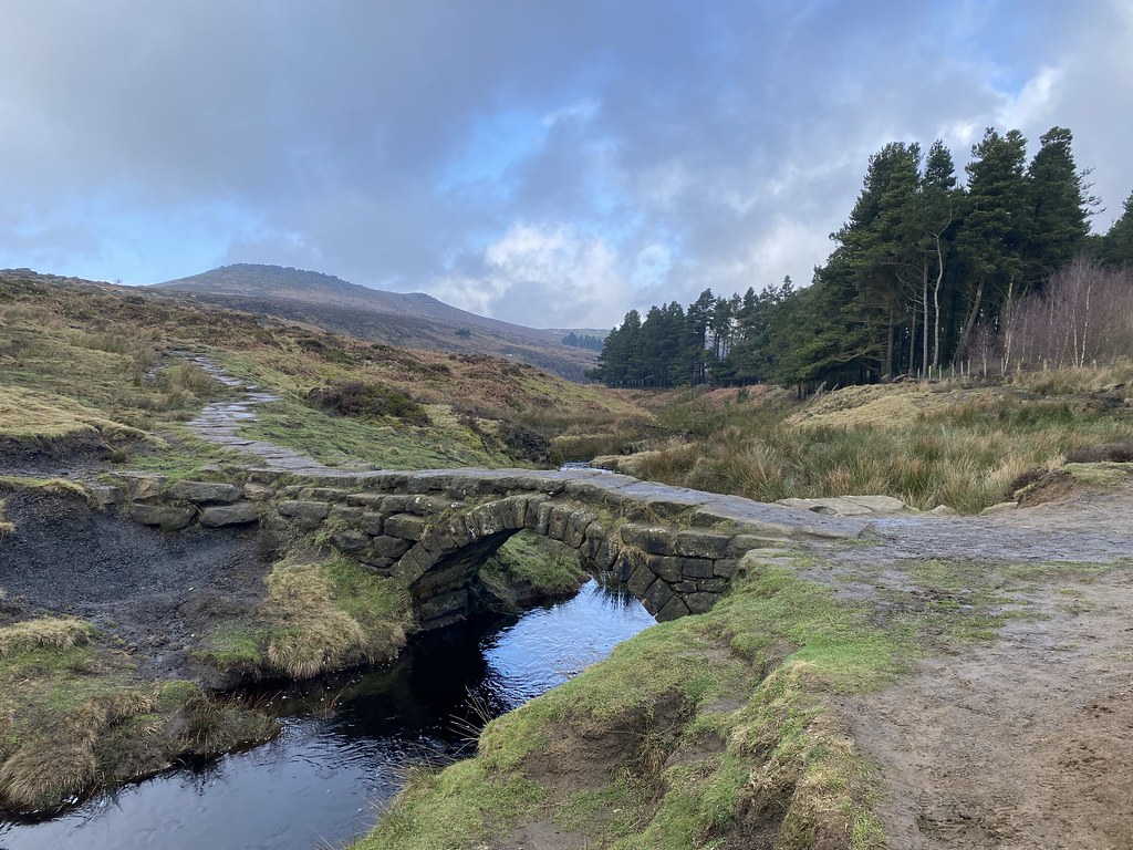
The lower part of the valley towards Burbage Bridge
A lovely little bridge near the main track.
Carl Wark and Higger Tor (and blue sky!)
From an extremely gloomy start it had turned into a really fine afternoon.
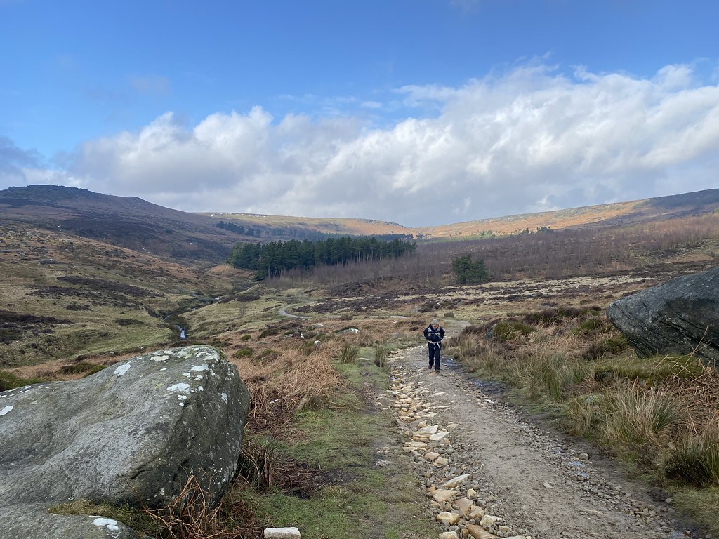
We crossed the main road and followed the Burbage Brook back towards the van.
Some lovely winter shots dark clouds and low angled sunlight.
As ever, dodging the slimy mud was the biggest challenge.
I used to love walking this stretch when we lived in Derbyshire many years ago. The path runs right next to the river through a delightful meadow studded with trees.
We reached the van and decided on brew and cake before the long journey home.
We even had time for a quick wander back out to Millstone Edge – this time we had the view!
Another fine weekend away in the Peak District – really enjoying re-acquainting myself with the area over the past couple of years.
After all that blue sky, sunshine and snow in the Alps, we had a burst of winter in the UK. Not what I had in mind though. I was up in Yorkshire for a van service and we’d decided to stay over for the weekend in the Peak District. While waiting for the Service it started snowing quite heavily. It didn’t look too bad so I set off for the drive from Barnsley to Castleton. A distance of 27 miles that should have taken less than an hour took me over 3 hours and many more miles trying to avoid the highest roads and some awful traffic. We really don’t cope with snow in the UK at all!
I had a calm down evening in the van and a day working in the van. TBF joined me and we had a nice meal out in one of Castleton’s many fine pubs. We’d arranged to meet some friends for a walk on the Saturday. Everything was plastered white on Thursday into Friday but by the time we set off for a walk it had pretty much all melted.
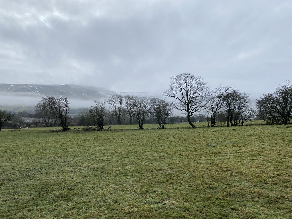
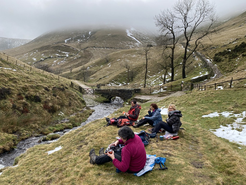
We had a walk planned along the Pennine Way, up to Jacobs Ladder and back along the southern edges of Kinder.
The forecast was for it to brighten a little as the day went on and there were signs of promise on an albeit grey and damp day.
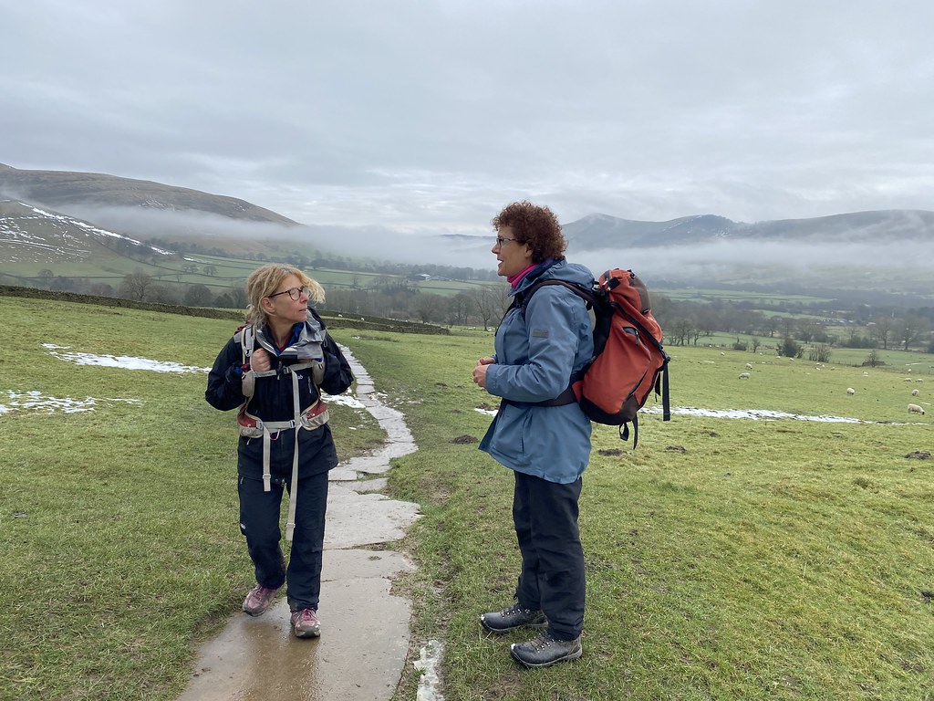
When you’re meeting friends you don’t see all that often, the weather doesn’t matter so much. Its great just to walk and have a natter.
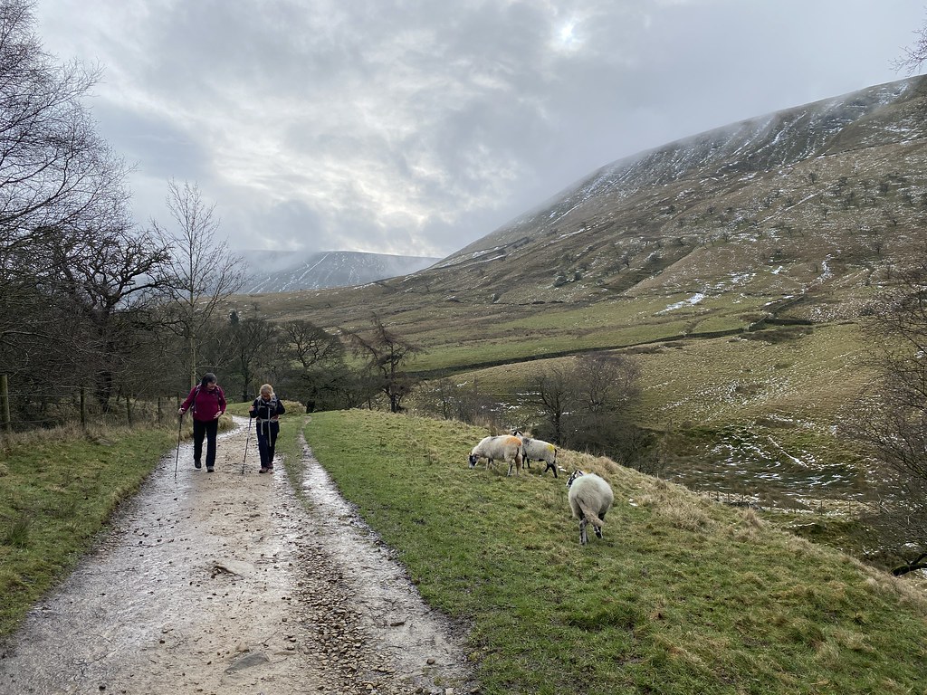
On the path from Upper Booth.
Approaching Jacobs Ladder.
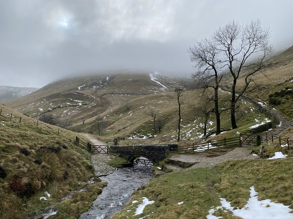
The small bridge at the bottom of Jacobs Ladder is a lovely spot even on a grey winters day.
Top place for a lunch stop.
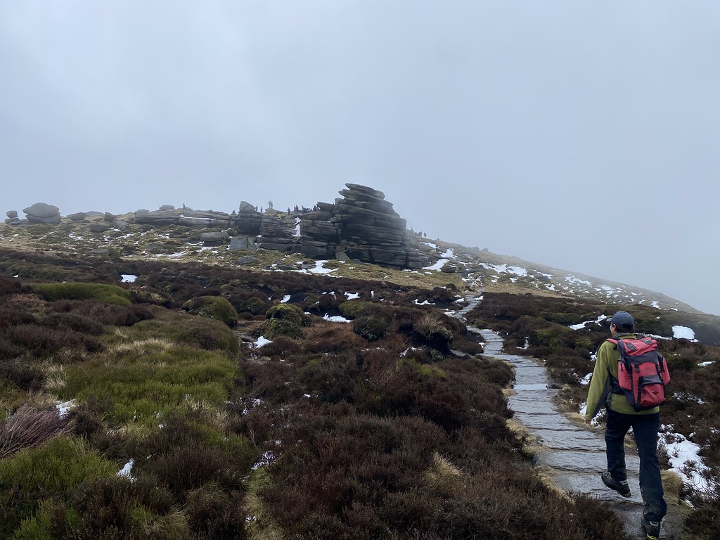
TBF and J wanted to take a lower level route back so me, EWO and TYG carried on up to the plateau. Here approaching Edale Rocks.
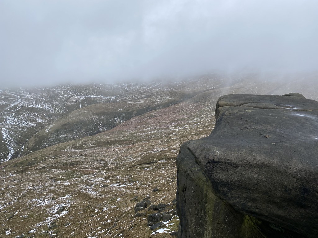
The earlier promise of better weather was ill-forecasted and we spent most of the rest of the day in the cloud with regular showers of cold rain.
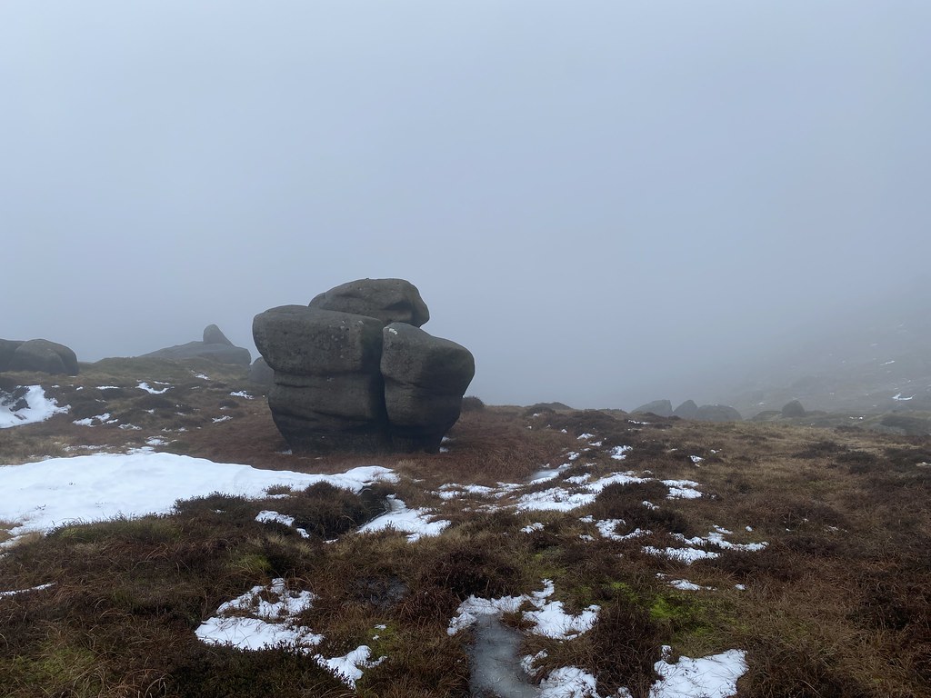
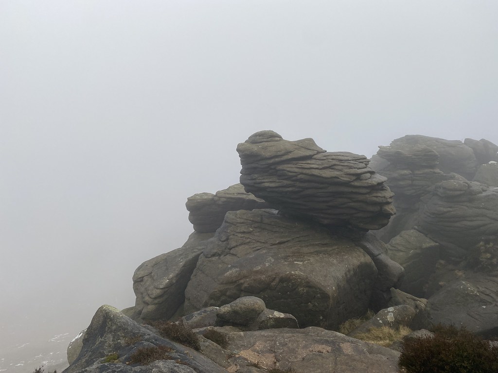
The many boulders and rocky outcrops maintained the interest though.
The look quite atmospheric in the swirling clouds.
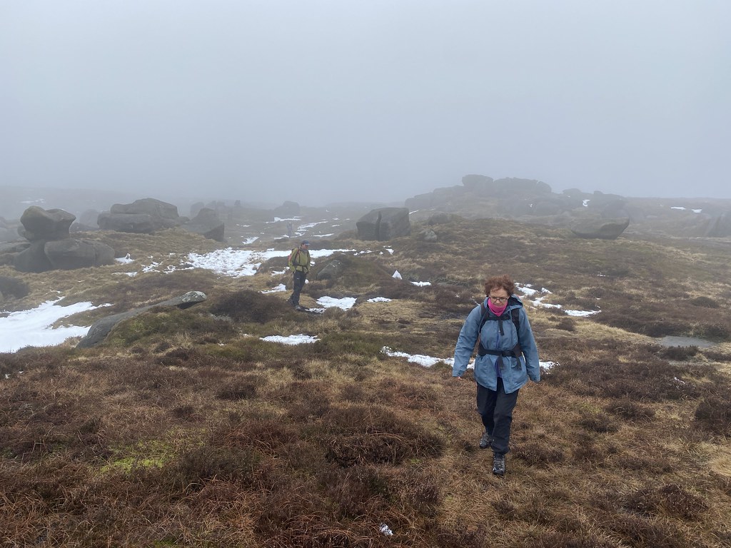
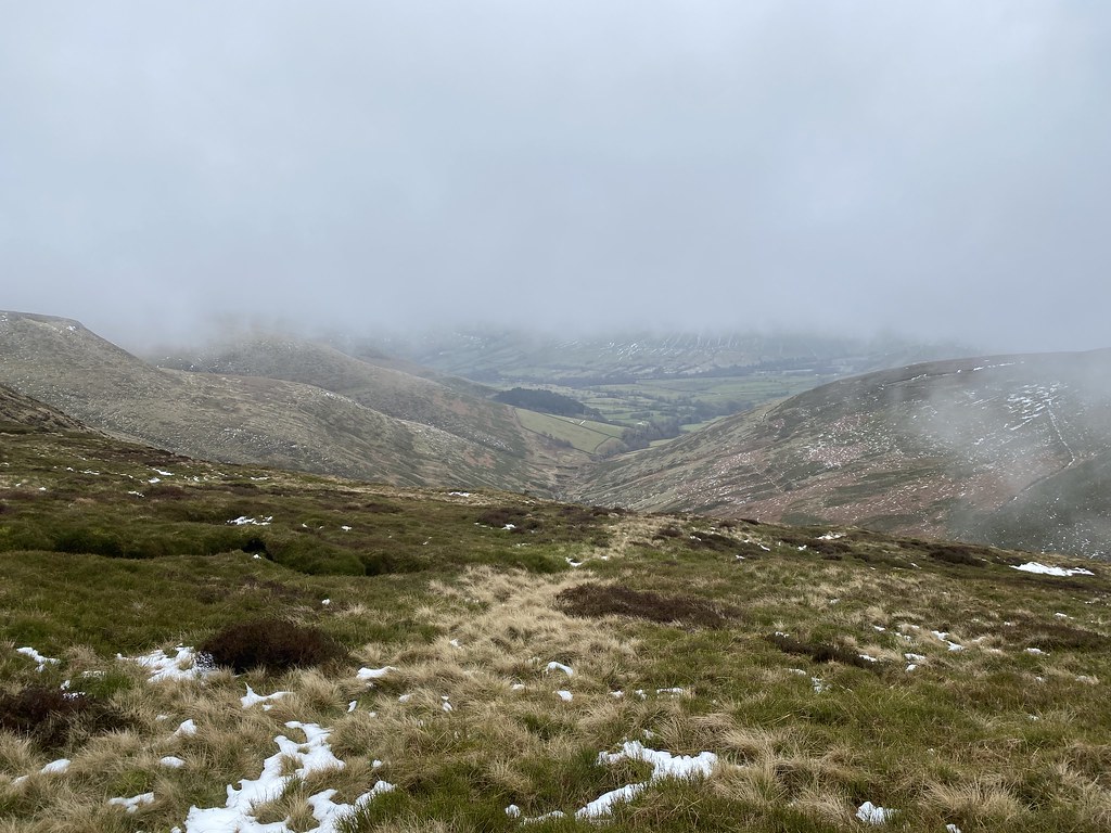
And we did have a few fleeting views of the Edale valley below.
I’d forgotten just how much rock there is up here and how impressive they are.
Its been over 20 years since I’ve walked up here so I was a little disappointed the weather wasn’t better.
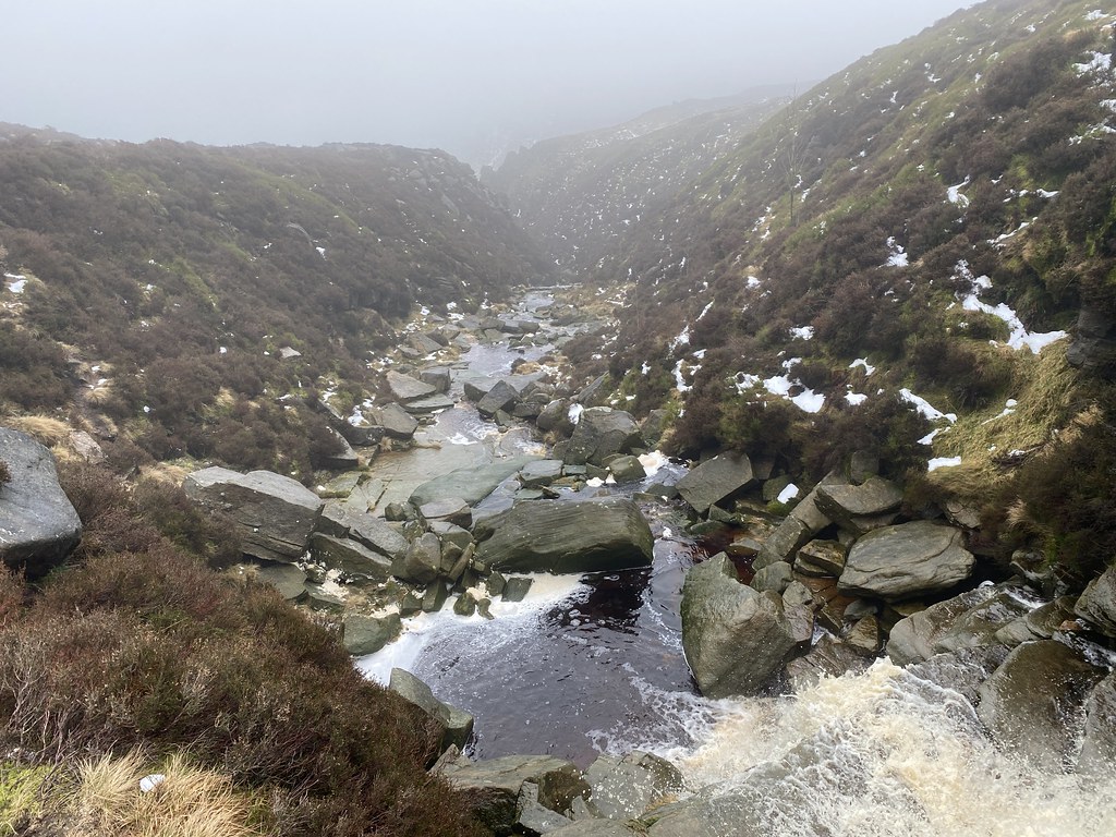
Grindsbrook Clough is always impressive though.
We had thought of pushing on round to Ringing Roger but another bout of rain and a pressing engagement with the curry house in Hathersage forced our hand.
We descended Golden Clough. If you are thinking of using this as a quick and easy route down to Edale village then my advice is – don’t. Its steep, muddy, overgrown and the path on the map barely exists.
Still a great day out, nice to meet up with friends and finsihed off in style with a superb curry.
Back to the endless grey skies of the UK winter and a chance for an overnight in the van.
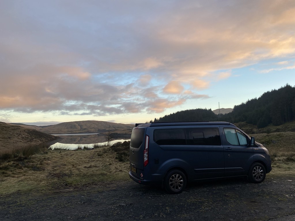
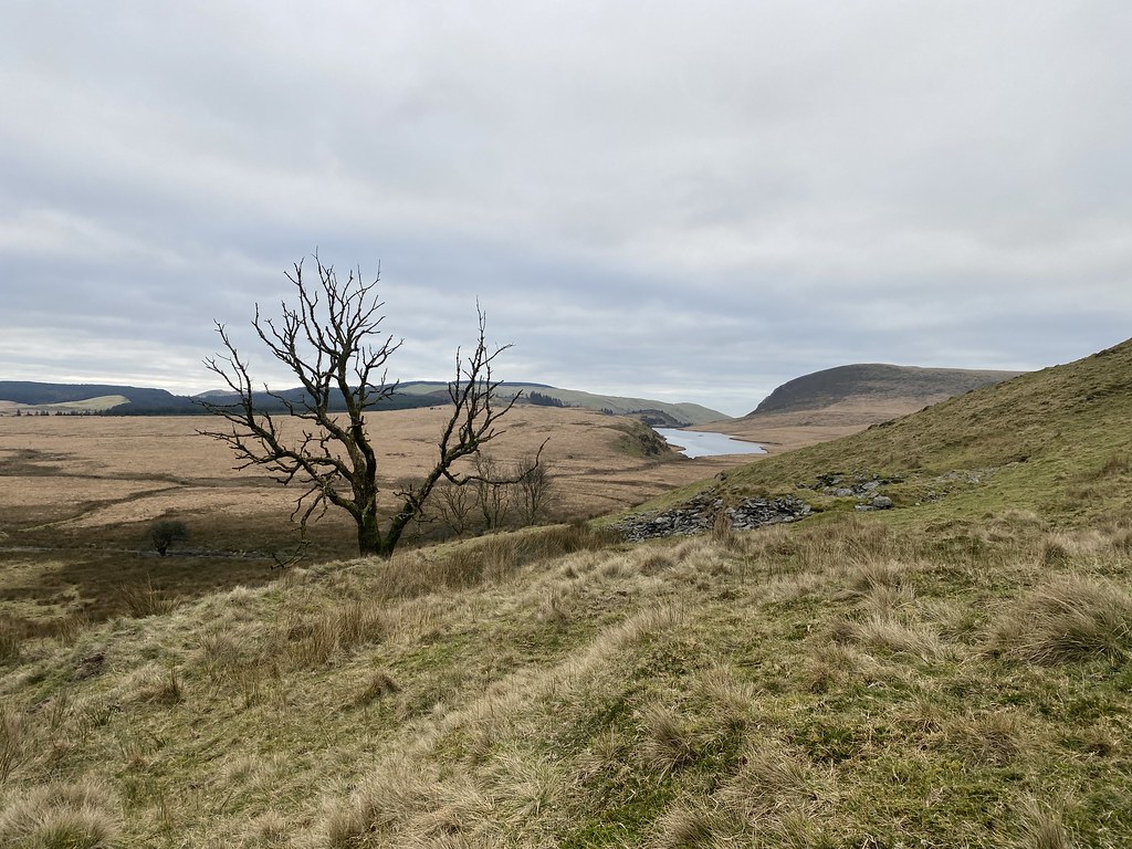
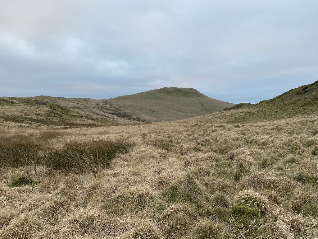
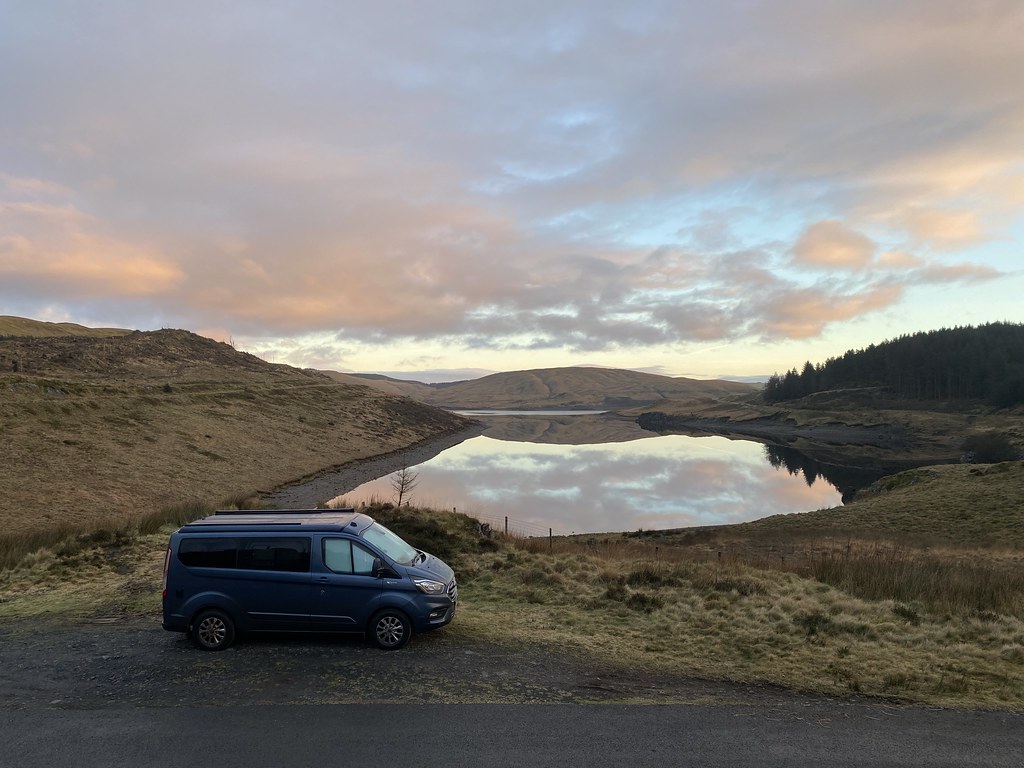
Back out to the wilds of mid-Wales and the hills around the Nant-y-Moch reservoir.
We parked up in decent spot with a view across the lake, had a spot of lunch and then headed out for awander.
Last time we walked around here we were in the cloud the entire time so it was nice to see it it in all its austere glory.
Our objective (well, primarily mine actually) was this small hill, Disgwylfa Fawr, a Marilyn missing from my collection.
Once we left the main track I’d feared we were in for a serious bout of tussock and bog bashing, in fact we found a decent sheep track on to the flanks of the hills and very little sogginess.
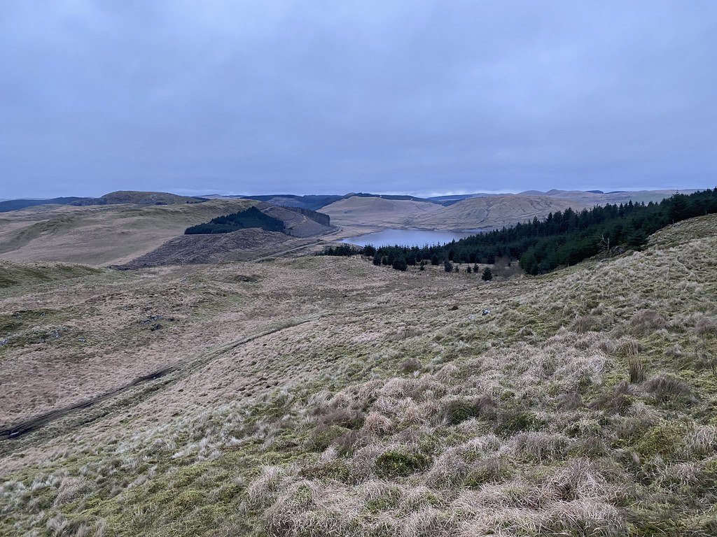
Views over the collection of small lakes towards the coast from the top.
We took a more off piste route back to the van. Something of a gamble in these parts especially with fading light.
With some judicious use of small ridges we avoided most of the tussocks and again it seemed mostly dry.
Looking back to Disgwylfa Fawr.
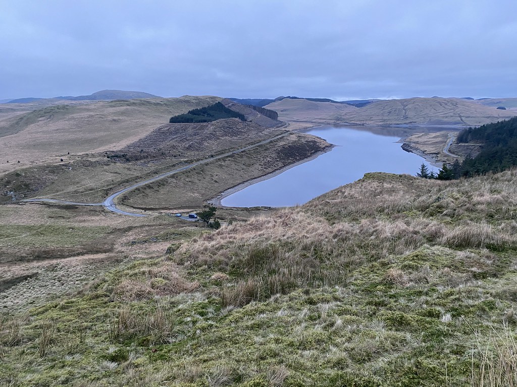
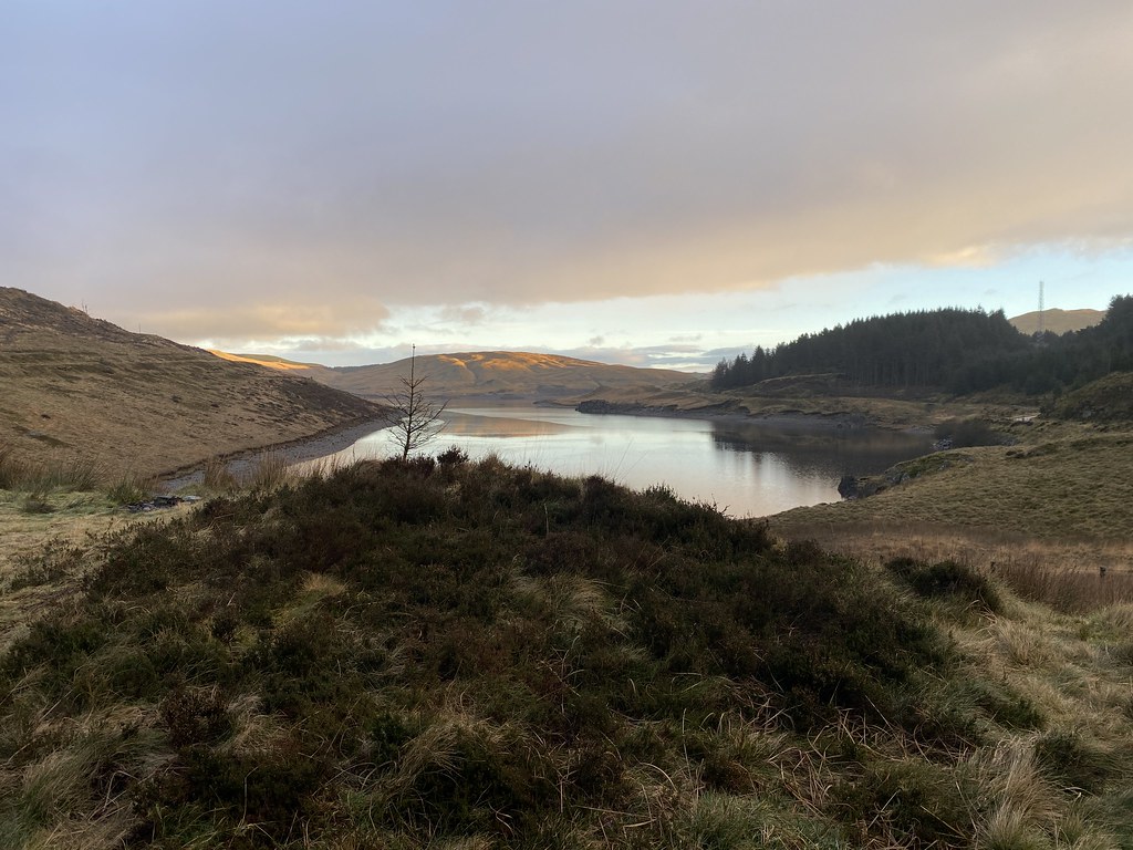
Nant y Moch reservoir.
And the final stretch down to the van parked up below.
A nice little stroll over some little walked terrain but I quite like it round these parts.
We settled in for a pleasant evening, a nice meal and a couple of beers for me.
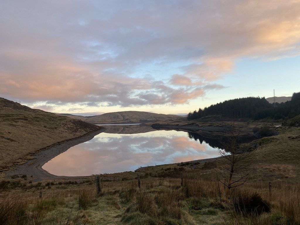
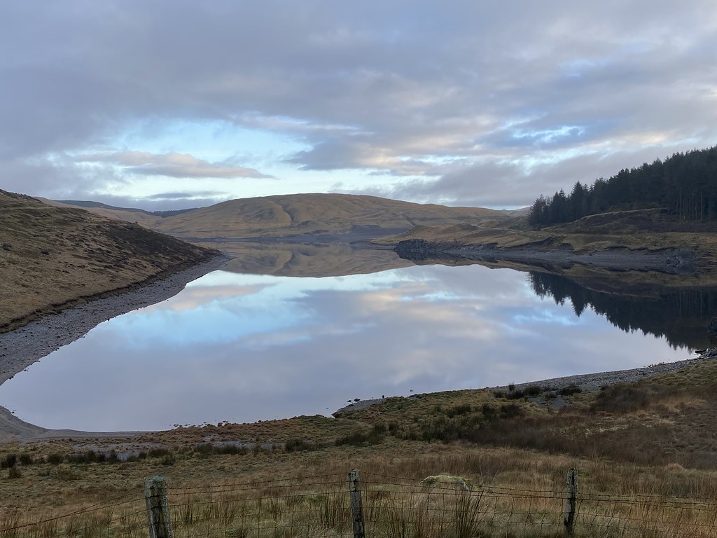
Next morning was glorious when we awoke with a light frost.
Beautiful early morning pink skies and a mirror calm lake with reflections.
Its a lovely spot by the reservoir and we were enjoying our good fortune for such a splendid morning.
Until within a few minutes of these images it started raining and stayed wet for a good part of the rest of the day.
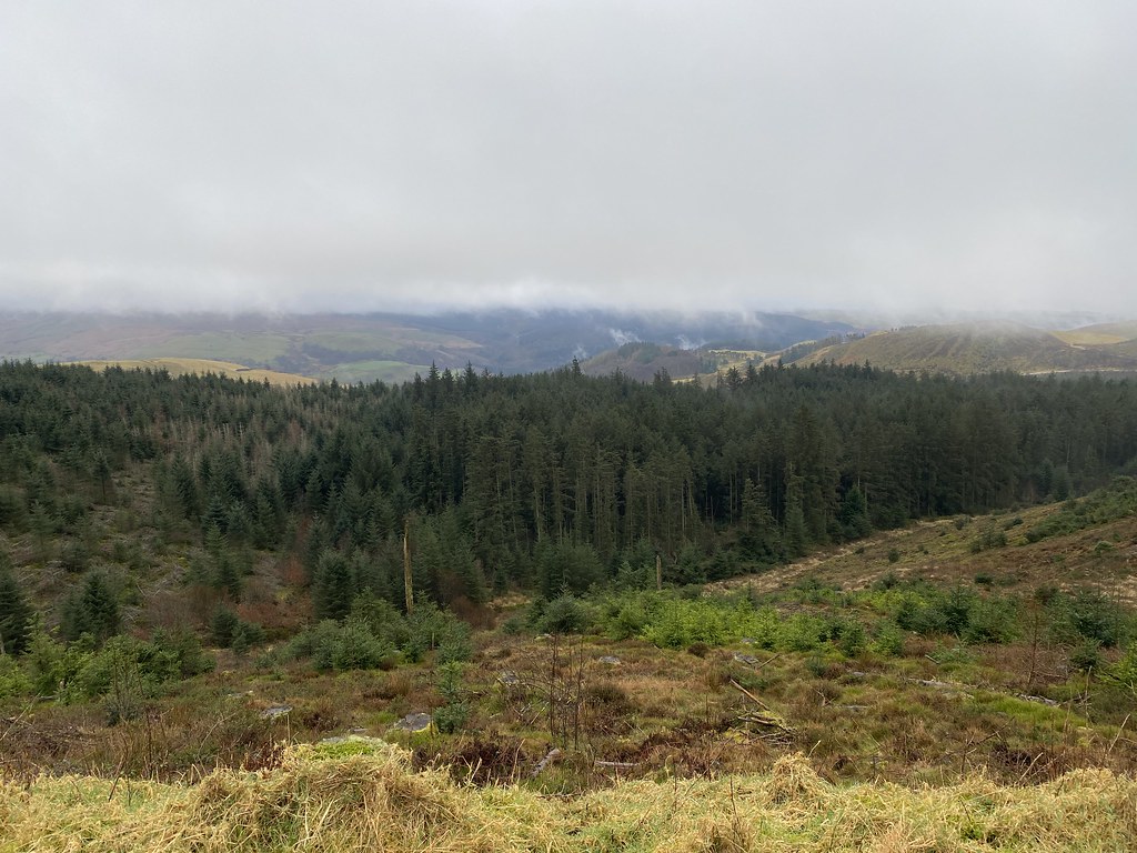
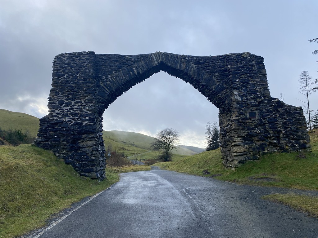
Still keen for a bit of walk we drove over to a car park at The Arch near Devils Bridge.
It was actually a pretty miserable and dreary trudge, out and back on a seemingly endless forest track. Just the occasional view over the steep valleys below the forest.
These wind turbines loomed out of the mist with their eerie sound as they turn.
And we eventually reached our/my goal of another un-ticked Marilyn and Nuttall, Pen y Garn, in a sleet shower. Its the highest point in this part of Wales but on a day like this a grim achievement.
We headed back to the van and unsurprisingly the rain stopped and the sun came out weakly.
The Arch after which the car park is named. You used to drive through it when I was a kid. A somewhat grey and damp weekend but fun nonetheless.
A an extra bonus addition to the post for you.
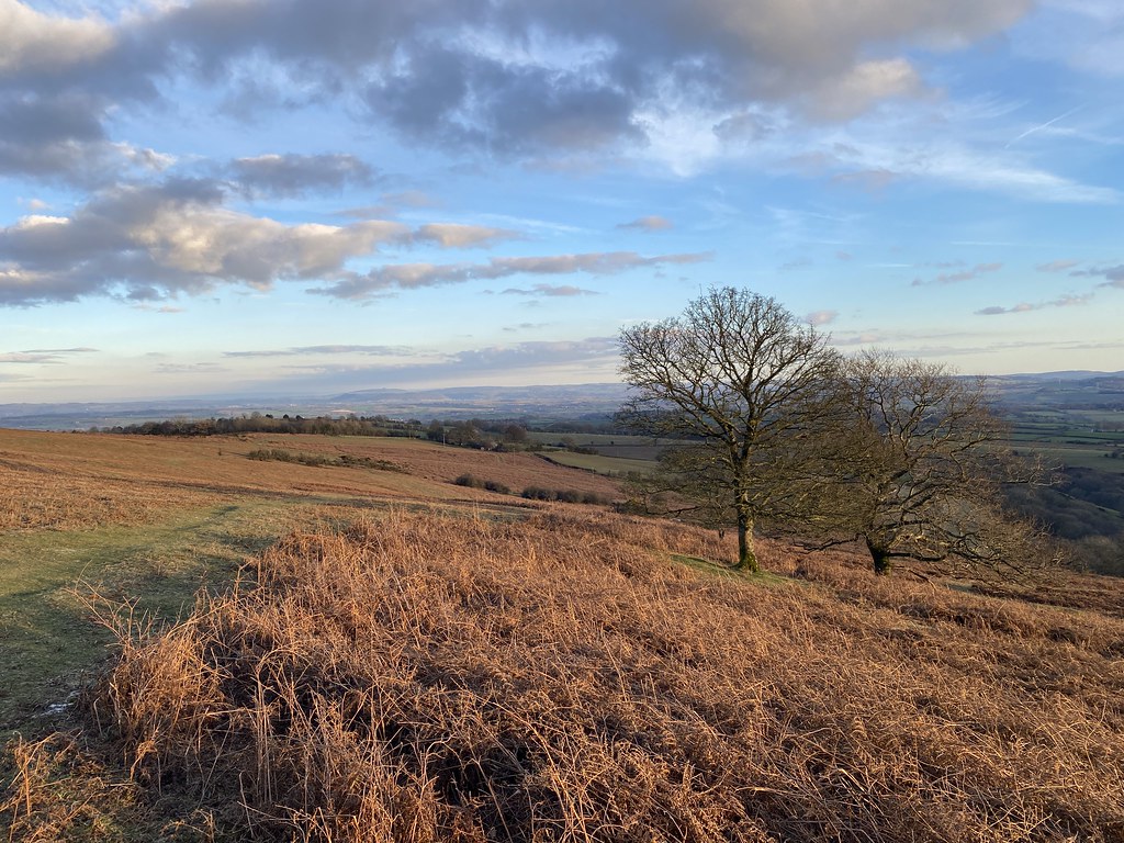
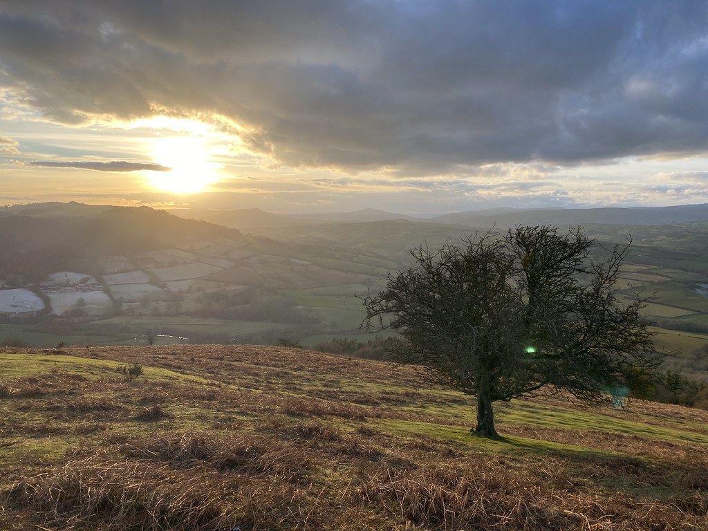
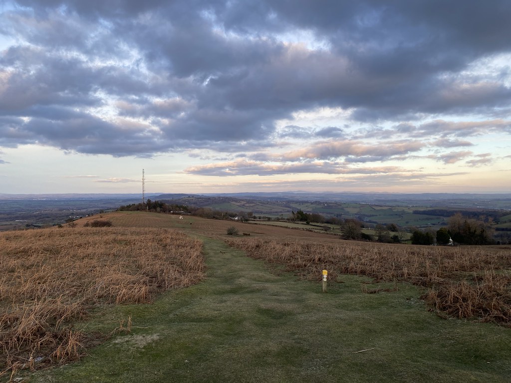
From a few weeks later some photos from a local stroll up Garway Hill.
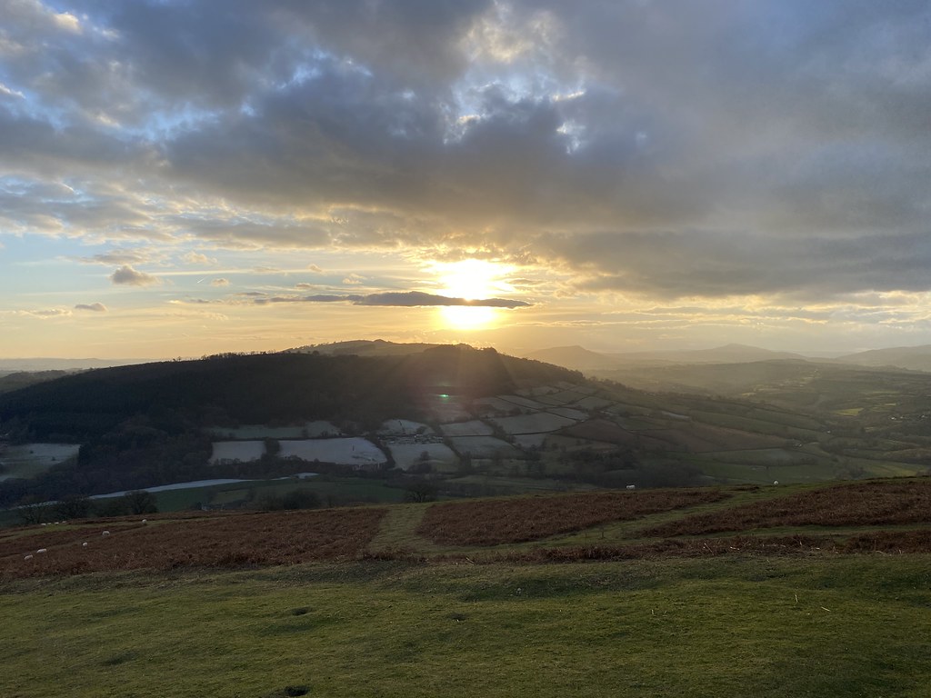
Sun setting over a hill, it has a name with not enough vowels which I can’t be bothered to type!
Not as warm as the summer visits where we watch the sunset with a beer.
I’d forgotten about these photos and the walk until Im opened the Flickr album to write the post.
I spend alot of my time surfing the web looking for ideas on places to go, walking routes, travel ideas and tips to plan the perfect holiday or day out. (I'm a project manager I like to plan). I thought it was time to share my own experiences and contribute to the vast amounts in information that's already out there.
I'll also add in some gear and tech reviews and when something irks me I may even use this forum to have a rant - I do that pretty well I'm told.There are a few pages at the top that give a bit of background to what I like to get up to and what you can expect to see in my posts. I'm not exactly a creative writer but I hope some people will find my stuff useful or inpsiring or at least enjoy some of my photos.