Back to the endless grey skies of the UK winter and a chance for an overnight in the van.
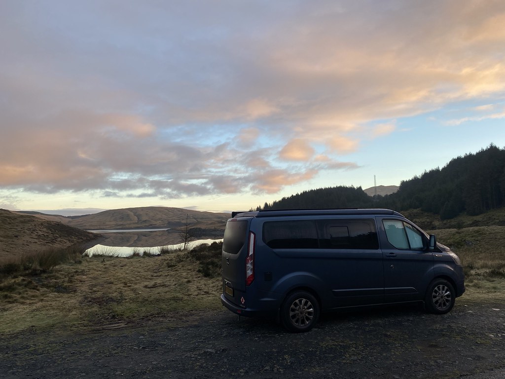
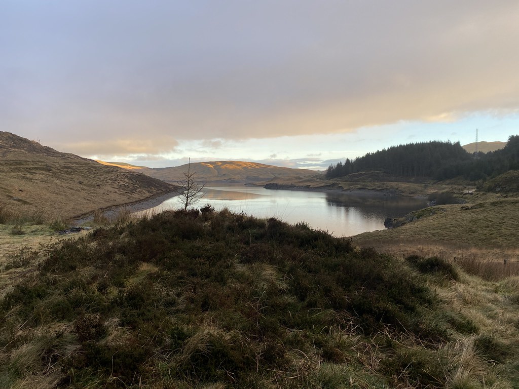
Back out to the wilds of mid-Wales and the hills around the Nant-y-Moch reservoir.
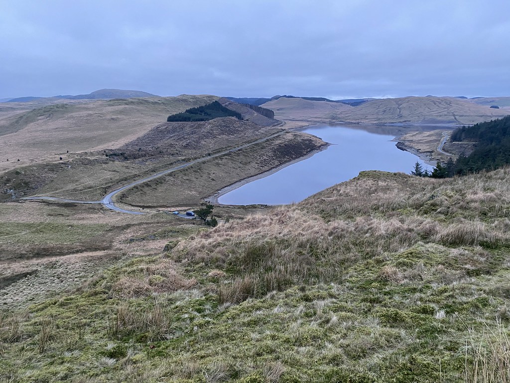
We parked up in decent spot with a view across the lake, had a spot of lunch and then headed out for awander.
Last time we walked around here we were in the cloud the entire time so it was nice to see it it in all its austere glory.
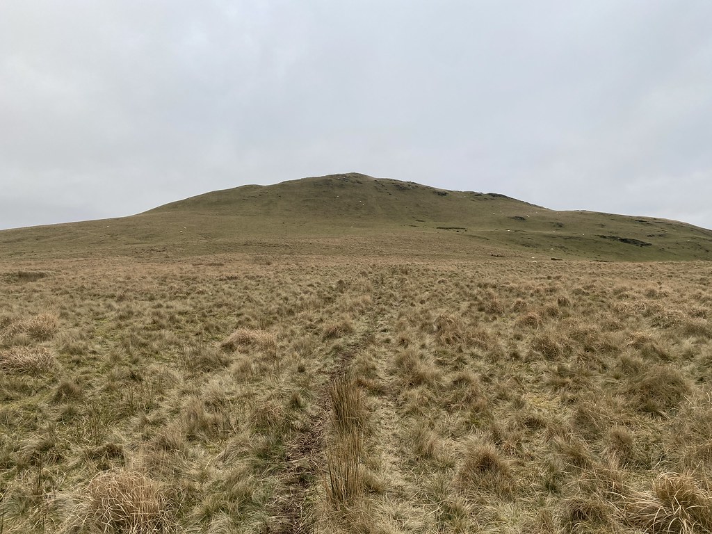
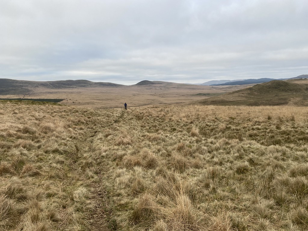
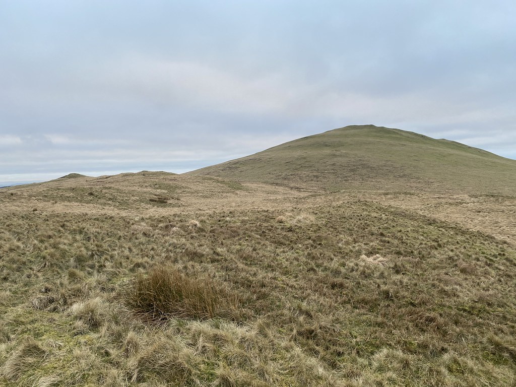
Our objective (well, primarily mine actually) was this small hill, Disgwylfa Fawr, a Marilyn missing from my collection.
Once we left the main track I’d feared we were in for a serious bout of tussock and bog bashing, in fact we found a decent sheep track on to the flanks of the hills and very little sogginess.
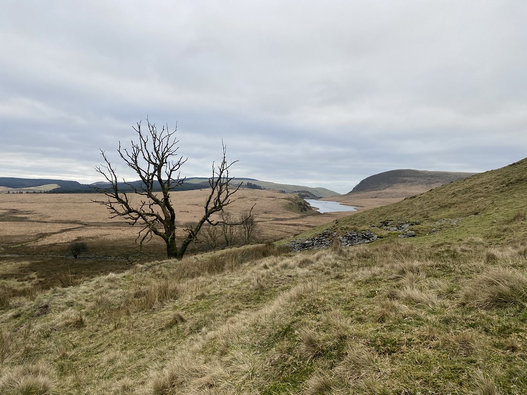
Views over the collection of small lakes towards the coast from the top.
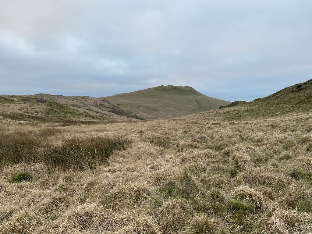
We took a more off piste route back to the van. Something of a gamble in these parts especially with fading light.
With some judicious use of small ridges we avoided most of the tussocks and again it seemed mostly dry.
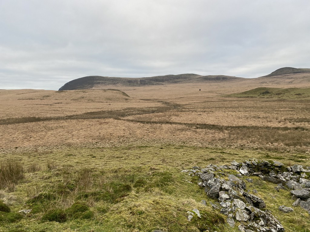
Looking back to Disgwylfa Fawr.
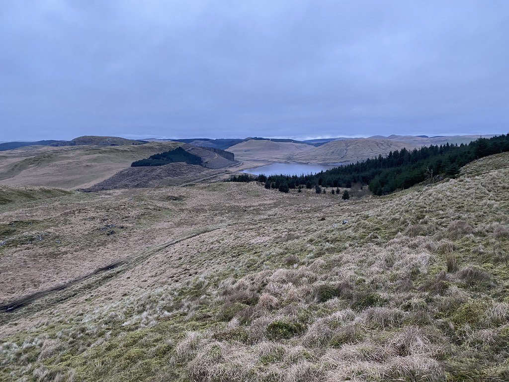
Nant y Moch reservoir.
And the final stretch down to the van parked up below.
A nice little stroll over some little walked terrain but I quite like it round these parts.
We settled in for a pleasant evening, a nice meal and a couple of beers for me.
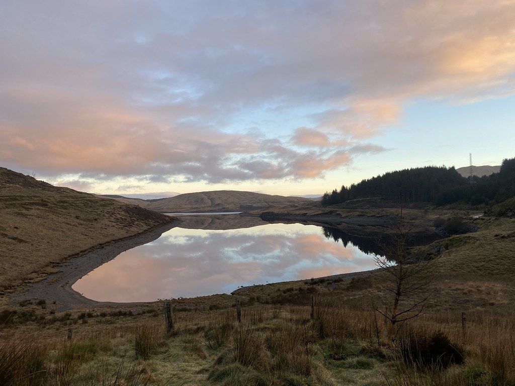
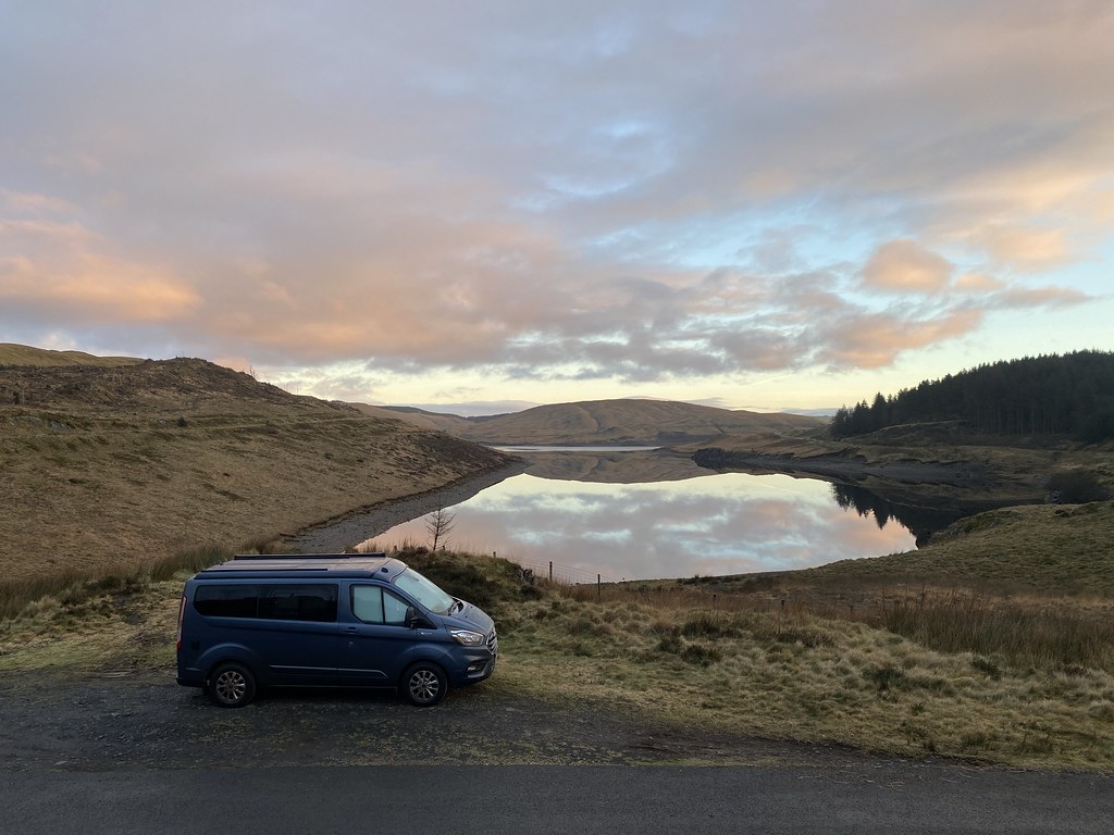
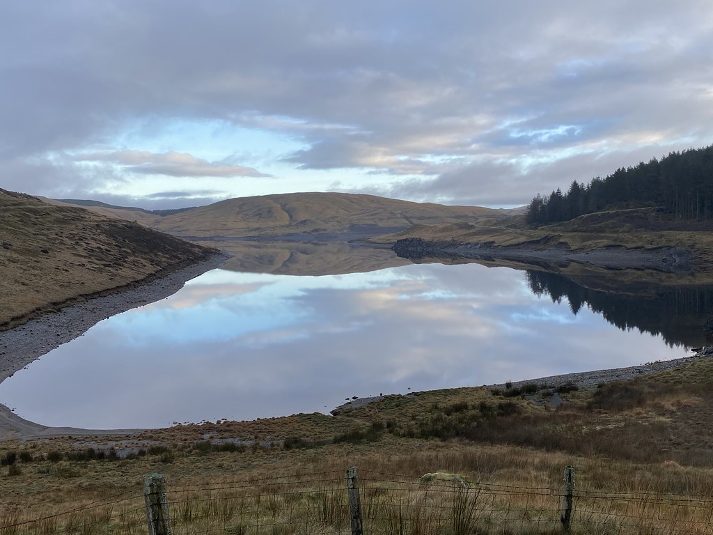
Next morning was glorious when we awoke with a light frost.
Beautiful early morning pink skies and a mirror calm lake with reflections.
Its a lovely spot by the reservoir and we were enjoying our good fortune for such a splendid morning.
Until within a few minutes of these images it started raining and stayed wet for a good part of the rest of the day.
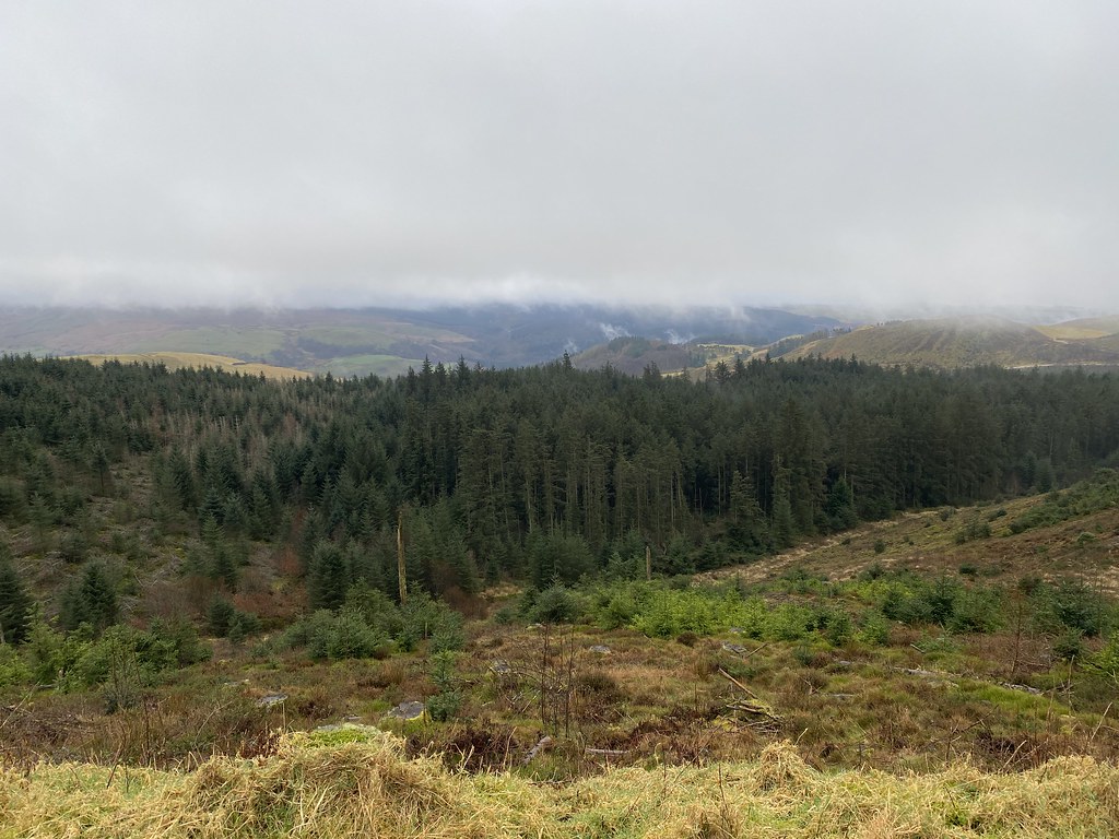
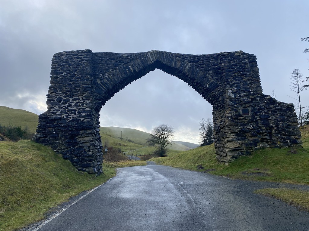
Still keen for a bit of walk we drove over to a car park at The Arch near Devils Bridge.
It was actually a pretty miserable and dreary trudge, out and back on a seemingly endless forest track. Just the occasional view over the steep valleys below the forest.
These wind turbines loomed out of the mist with their eerie sound as they turn.
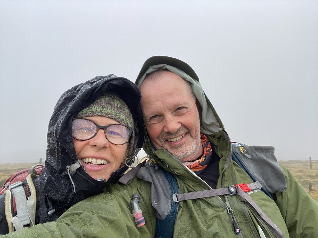
And we eventually reached our/my goal of another un-ticked Marilyn and Nuttall, Pen y Garn, in a sleet shower. Its the highest point in this part of Wales but on a day like this a grim achievement.
We headed back to the van and unsurprisingly the rain stopped and the sun came out weakly.
The Arch after which the car park is named. You used to drive through it when I was a kid. A somewhat grey and damp weekend but fun nonetheless.
A an extra bonus addition to the post for you.
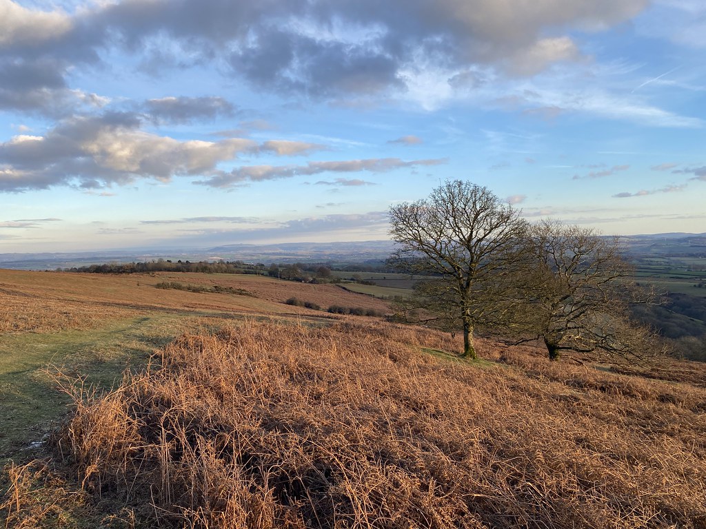
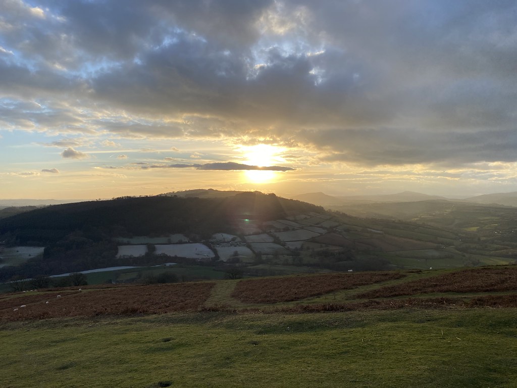
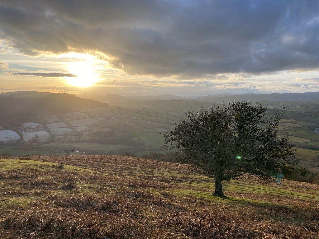
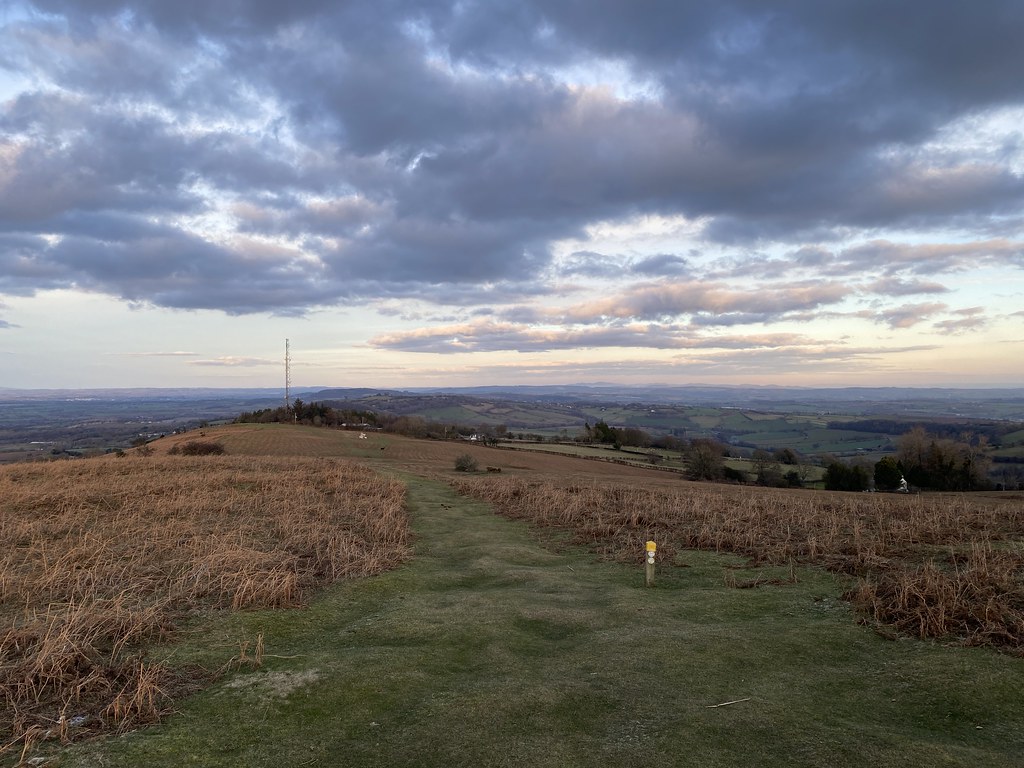
From a few weeks later some photos from a local stroll up Garway Hill.
Sun setting over a hill, it has a name with not enough vowels which I can’t be bothered to type!
Not as warm as the summer visits where we watch the sunset with a beer.
I’d forgotten about these photos and the walk until Im opened the Flickr album to write the post.
I’ve been thinking that I need to broaden the appeal my blog, expand the readership, cover new ground, appeal to a broader cross-section of the blogosphere. Perhaps give a new, upcoming writer a chance to shine. I sat down and drafted my criteria and performed an exhaustive search of suitable candidates. After reviewing each one in turn I’ve settled on what I feel is the best person to give the blog a much-needed dose of new ideas and perspectives. So without further ado let me hand you over to the one, the only…..
Mrs Surfnslide, also known as my lovely wife Jane who will proceed to show up my own limited writing skills with her account of a trip along the Marches Way in Herefordshire with my son D during July this year. Over to you dear…..
I thought I’d like to write about our adventures on The Marches Way but haven’t really got the inclination to keep a regular blog going like Andy has, it seems quite a commitment to me and the ‘techie’ bits put me off. I think I may just ‘guest blog’ occasionally and let Andy do the hard work.
For the last three years or so D and I have spent weekends walking sections of The Wye Valley Walk. Lovely as it was, we fancied a change this year. Whilst looking at a map one day, D happened to notice that The Marches Way comes to within a couple of miles of our house. That observation grew into an idea; “Mum, do you think we could walk home from Abergavenny?” It seemed like a good plan to me.
The weather forecast for our weekend was appalling and when we awoke to torrential rain on the Saturday morning, I was beginning to wonder if it was a good idea after all. However, D wanted to go ahead so I was not about to disappoint him. We dug out some over-trousers he’d never worn and I borrowed some enormous ones from Andy and we set off for Ysgyryd Fawr. (Abergavenny itself was too far, we thought the Skirrid would be a neat place to start.)
Ready for the off
Unbelievably, when we got there the rain stopped and the sun came out. We soon began to roast in our cagoules and over-trousers so took them off, packed them away in our rucksacks and that’s where they stayed. I still can’t believe how lucky we were. I put it down to finding a four-leafed clover; luck had to be on our side.
D was pretty keen to get off the summit ridge ASAP and so was I. I know it catches the wind up there, but both of us are quite slight and had difficulty staying on our feet, I’ve been up there a few times and don’t remember it ever being quite as windy before.
D on the way to Ysgyryd Fawr summit
"It's windy up here"
D spotted a possible shower heading our way so, anxious to avoid it, we cut down off the side. You could hear the wind roaring through the valley below, but on the flanks of the mountain it was sunny and still. Feeling warm and serene, we enjoyed the view as we took the gently sloping path down.
Heading down into the shelter and the sunshine
According to Wikipedia, The Marches Way goes from Chester to Cardiff. I have walked parts of the route in North Herefordshire as sections of day walks, where I seem to remember it was clearly marked as ‘The Marches Way’ on every stile. This does not appear to be the case in South Herefordshire or Monmouthshire, although it was marked on our maps. Part of the route was signed as ‘The Beacons Way’, part of it as ‘The Herefordshire Trail’ and parts of it as nothing at all. And I mean nothing at all. In many places we would come to a clapped-out old stile or rusty gate hanging off its hinges, with no indication of a footpath whatsoever. It’s quite disconcerting even when you’re sure you’re right and always a relief to spot a stile with a little yellow arrow on. D had his work cut out with the navigating and, considering how bad the way-marking was, did an excellent job. I did hang my head over his shoulder occasionally just to double-check, but he was always right.
Handing over the reins
We made a mental note of where we crossed the main Abergavenny to Hereford road so we can bore anybody with that fact every time we wiz through in the car, then stopped for lunch in a sun trap at Llanvihangel Crucornay church yard.
Lunchtime
Eighteen years ago I passed through this area with my friend, who Andy refers to as The Yorkshire Gardener, when we back-packed our own route from the Severn Bridge (the old one and the only one then) to Conwy. I can remember the walk as a series of snapshots (probably because the only souvenir I have of the walk is a series of snapshots, having lost my diary) but don’t remember too many specific details. I racked my brains to find some things familiar, but just couldn’t. Andy would be able to remember details such as what we had for tea each night and whether we were able to supplement it with an onion or a carrot. Such minutiae were lost to me years ago.
At Llanvihangel Crucornay we passed the ancient, and supposedly haunted, Skirrid Inn. A moment after telling this to D, we glanced in the doorway and were both startled by a character with a green face dressed in 17th Century costume. How tempting it would be to say we had seen a ghost, but I would be lying, it was only a model.
Several pleasant fields later, we were stopped and admonished by a woman (Mrs Farmer?) who informed us we should be walking round the field edges and not diagonally through it. Well, I’m sorry, she was wrong. If the map shows the path going diagonally through the field and if the yellow arrow points diagonally through the field, then you are perfectly entitled to go diagonally through it. There, I’ve said it and I feel better. D told me I didn’t look cross, of which I am proud.
Across to the Black Mountains
Quiet Lanes
We camped at Rowlestone Court. Now I’m a bit past carrying enormous back-packing rucksacks weighed down with tent, stove etc. so here was where a bit of planning and a phone call during the week really paid off. Living nearby also helps, of course. So, when we arrived, the tent was already up and ready for us, with sleeping bags, stove, food etc. I’d come the day before, put up the tent, filled it with stuff and had some locally famous Rowlestone Court ice-cream.
No pot of gold - a tent will have to do
Peace and quiet
Unfortunately for D, we arrived too late for ice-cream, but as the tent was ready for us we could start faffing about making our tea on the Trangia. They say the sense most closely linked to memory is the sense of smell and as I began to unpack the stove, the smell of meth’s reminded me of back-packing trips of twenty or more years ago; camping by a remote lake or stream, when my level of fitness meant that I was able to carry enormous rucksacks and when I was much less concerned about comfort, cleanliness and being warm. I really didn’t mind discomfort then, I do now. I wish I didn’t, but there you go.
Now, as I was unpacking the stove and its bits and pieces, we hit upon a major problem. We simply could not unscrew the cap to the burner unit. We tried warming it up, using damp cloths etc., but it was no good. It was time to ask for help. When a burly man in a campervan couldn’t unscrew it either, I thought I’d have to ring Andy to come and rescue us. However, campervan man produced a tool kit and eventually got it open. I was so very grateful!
If it hadn’t been for the Trangia crisis, we would never have found out about the adventure playground. Campervan man and his wife pointed in the direction of the woods and told us about an excellent zip wire they’d been on earlier. This had to be sampled, so after tea we set off to find it. Wearing crocs now, we slopped our way through mud and God-knows-what and found the adventure playground. The zip wire was excellent – a proper adult one – and we played on it until it started to get dark.
All campsites should have one
All adults need to play
We slopped our way back again, cleaned our feet on the wet grass of the camping field and got ready for bed. D wanted to read ‘Mind Trap’ (lateral thinking) questions to me but my mind felt like mush, the words started to swim together and not mean much and I think I went to sleep as he was still reading questions.
For EWO: "where do they bury the survivors?"
Well, on to Day 2.
A carpet of flowers
Now, I’m a little reluctant to start describing what happened next as I know my reputation when it comes to sense of direction (yeah, I know, I lost the skiing flat that time in Val Thorens), but I do know how to read a map. Right, imagine the scenario; you are faced with two stiles right next to each other. One leads into a field and is the right of way because your map says it is, but the stile is in a poor state of repair and is marked with absolutely nothing. Right next to it is a lovely new stile leading into the woods, marked with a ‘permission path’ sign. The path through the woods is not marked on your map but you assume this is the way they want you to go and that it would eventually join up with the right of way. You head off into the woods in a direction roughly parallel with the right of way. And then it begins to meander. Your son pipes up. “This is bending round too much, I told you we should have gone the other way.” Eventually you emerge into a beautiful flower meadow that looks remarkably similar to the one you left half an hour ago… In fact, it’s the same one… Please tell me anybody would have done the same…
So good we went back for another look!
After a few moments of head-in-hands despair, we recovered and took the stile we should have taken earlier and made our way to Ewyas Harold and its lovely common.
Ewyas Harold Common
Ewyas Harold Common
We felt very close to home here as we come here a lot, but still had a long way to go. I came up here once with a class of children who were being introduced to snakes by ‘the snake man’. The class teacher didn’t like snakes so arranged the snake man trip for when the supply teacher was in. Sneaky, but it was fine by me. He was really interesting, very knowledgeable and knew exactly where to find them; he impressed us all by disappearing into the bushes every now and again and returning with an adder or some other kind of snake.
Abbey Dore
We came down past Dore Abbey, through some fields to Kerry’s Gate then ended up walking along the road for longer than we wanted to. Some of the footpaths, we attempted but retreated; they were so appallingly lacking in signs and so badly overgrown that it was becoming torturous.
"Fields of Barley"
Kingstone - the final stretch
The lanes are pleasant and relatively quiet, but our feet were pretty sore, so it was with some relief that the huge satellite dishes that mark our home village started to loom overhead. You can see these for miles as they are so distinctive and, strangely, I don’t really consider them an eyesore. They are a back-up to the more famous ones at Goonhilly in Cornwall. D is quite proud of them; he believes they put our village on the map. I think I agree with him.
Madley Satellite Earth Station
We were home in time to wiz back up to Rowlestone Court to pick up the tent, L coming along for the ride. Unfortunately for D the ice cream place was shut again and unfortunately for L it was getting a bit late for zip wires. I promised them both that we’d be up there again before too long for an ice cream and a play.
It came as a surprise and, I guess, a disappointment to me that ‘The Marches Way’ only seems to exist on maps. Obviously someone thought it was a good route but never got round to marking it out. I’m not really sure who maintains all the long-distance footpaths that seem to criss-cross every map we’ve got but it seems ‘The Marches Way’ has been put on the back burner. It’s a shame really as the route is always scenic and often exhilarating.
There is little slideshow of our adventure below, lovingly created by Andy
This is one of my all-time favourite walks in the Black Mountains. I’ve done it perhaps half-a-dozen times since I moved to Herefordshire in 2002. Whenever I’m stuck for an idea or struggling for choice this one always seems to win. I have numerous walking guides but this walk or a derivative doesn’t appear in any of them. I find this strange as it’s such an obvious looking circuit when seen from Ysgyryd Fawr as in this photo taken a few years ago:
Hatterall Hill from Ysgyrd Fawr
It’s a relatively short walk and having got lucky with a chance to leave work early I took my chance, parking at Cwmyoy village hall. After crossing the river and fields you come to the sleepy heart of the village with its ancient church, leaning tower and bent roof to the fore.
Cwmyoy Church
Cwmyoy Church
The views across the fields to Ysgyrd Fawr are top notch.
Ysgyryd Fawr
The walk goes past a small table-top hill created by an old landslip.
I must take an alternative route and actually climb this one day. For reasons I’m not entirely sure of I always do this walk in the same direction. If I reversed it I’d see the path up this little knoll on the way down rather than on the way up when I’m already above it. Lesson learned. In no time the path is high up on one of the arms of the valley and it’s an easy stroll towards the main ridge, passing some excellent views up the Vale of Ewyas towards Capel-y- Ffin and the Gospel Pass.
Vale of Ewyas
The ridge was incredibly windy as it has been for several weeks so I had to drop down on the far side to get some shelter and admire the views over the Herefordshire countryside. In this photo you can make out Clodock Church which we passed by on our Longtown Lambs walk a couple of months back.
I spend alot of my time surfing the web looking for ideas on places to go, walking routes, travel ideas and tips to plan the perfect holiday or day out. (I'm a project manager I like to plan). I thought it was time to share my own experiences and contribute to the vast amounts in information that's already out there.
I'll also add in some gear and tech reviews and when something irks me I may even use this forum to have a rant - I do that pretty well I'm told.There are a few pages at the top that give a bit of background to what I like to get up to and what you can expect to see in my posts. I'm not exactly a creative writer but I hope some people will find my stuff useful or inpsiring or at least enjoy some of my photos.