Back to early March and after our adventures in Scotland and all that snow, we had a little more of the white stuff in our backyard.
We headed out to find some snow in the Black Mountains on a gloriously clear and blue sunny morning.
Its been a rare event over the past few months (longer in fact) to have such a glorious day.
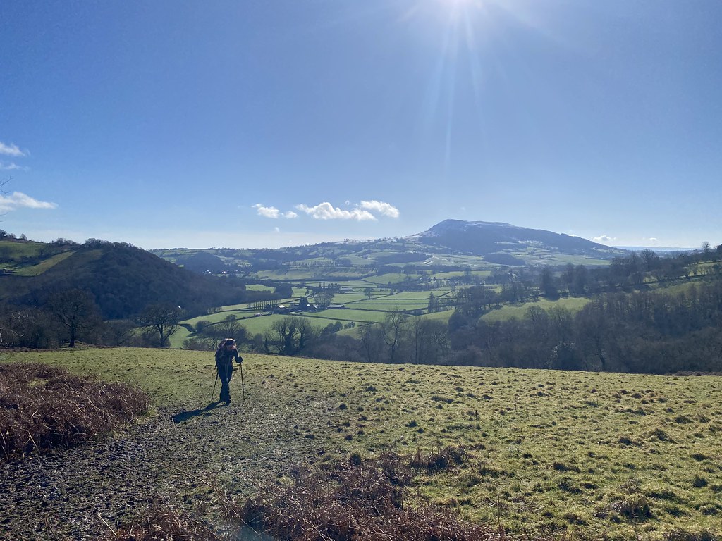
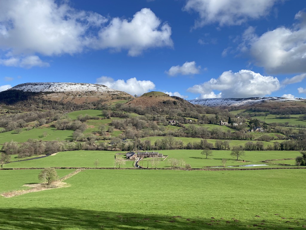
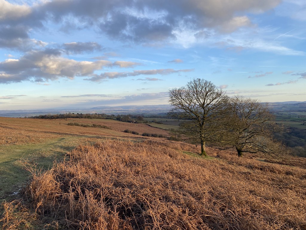
Ysgyryd Fawr dominates the start of this walk.
Distant views of the Bristol Channel and the Mendips on the skyline.
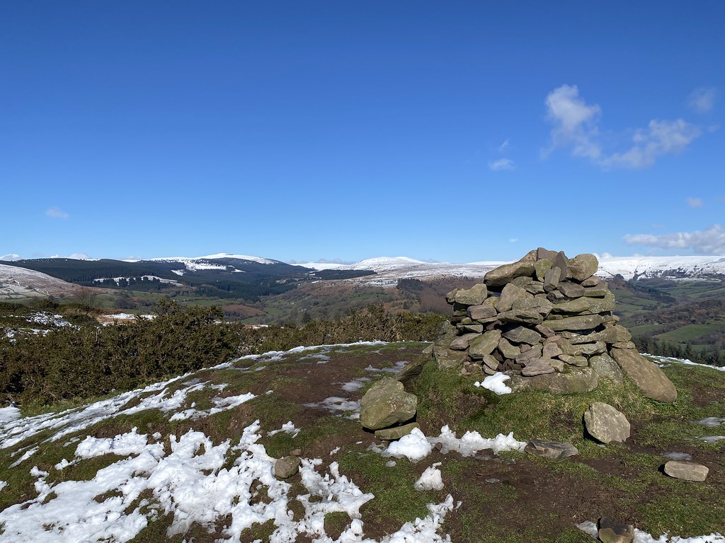
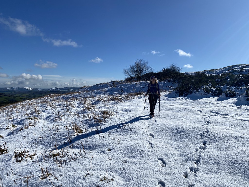
We were heading up to the hill fort at Twyn y Gaer. The Black Mountains looking quite white.
TBF enjoying the snowy walking.
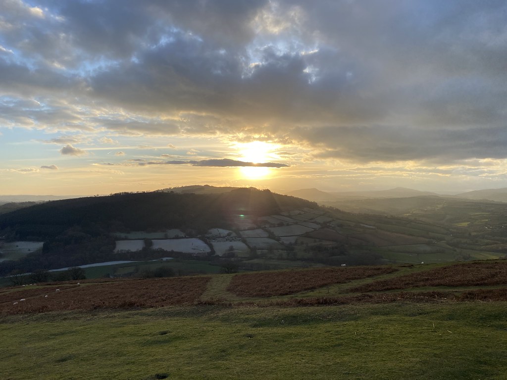
The summit view from Twyn y Gaer.
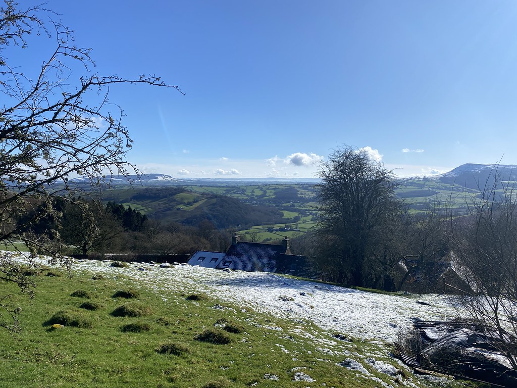
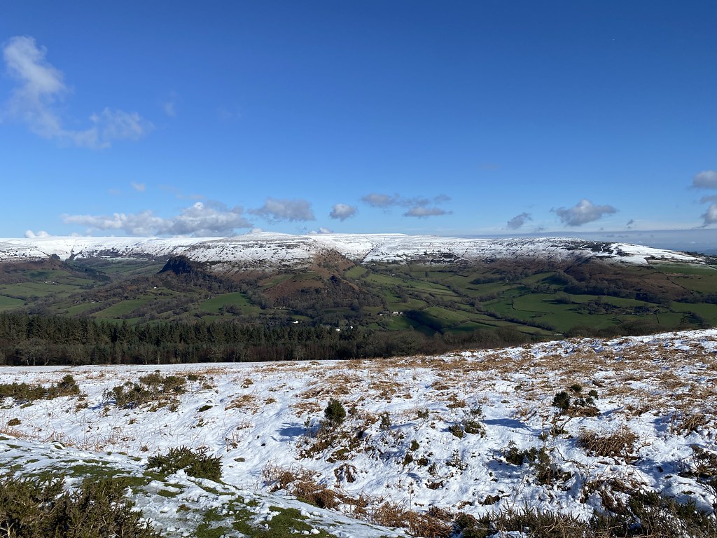
Across to Hatterrall Hill at the southern end of Black Mountains – the ridge we can just about see from home.
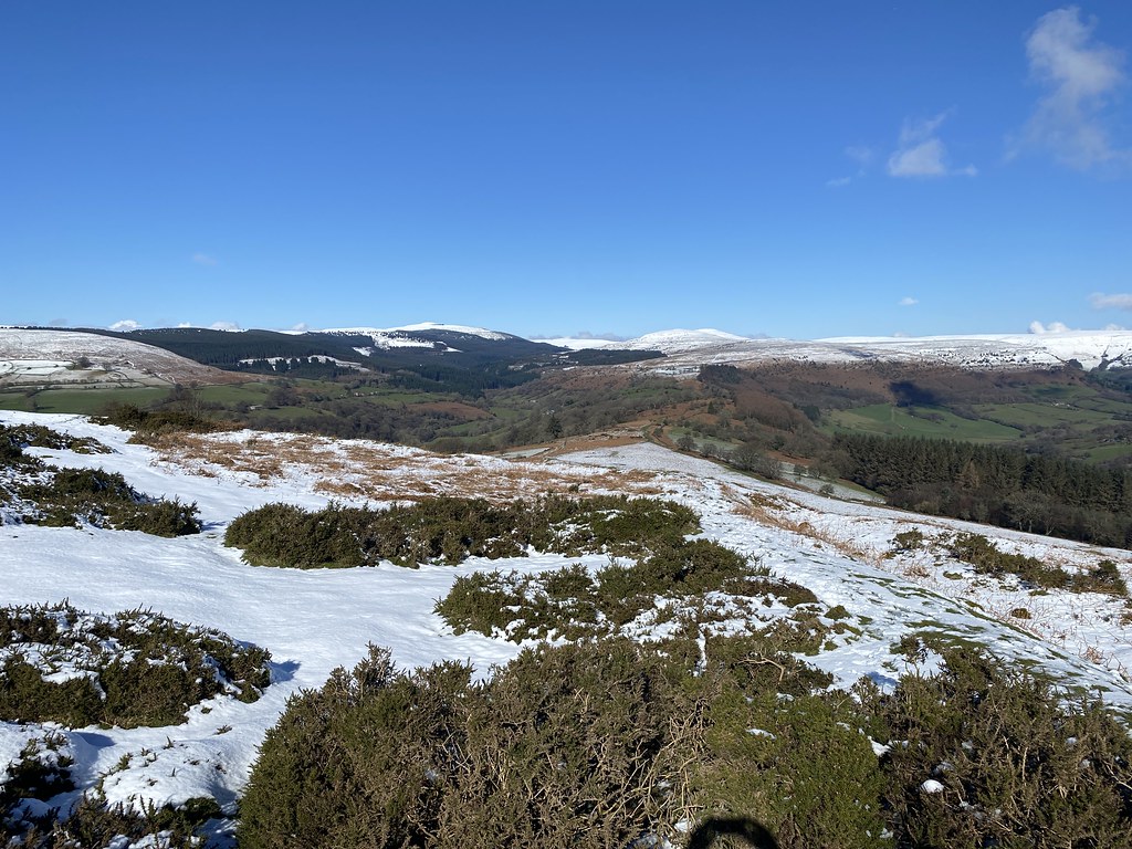
Highest peaks of the Black Mountains.
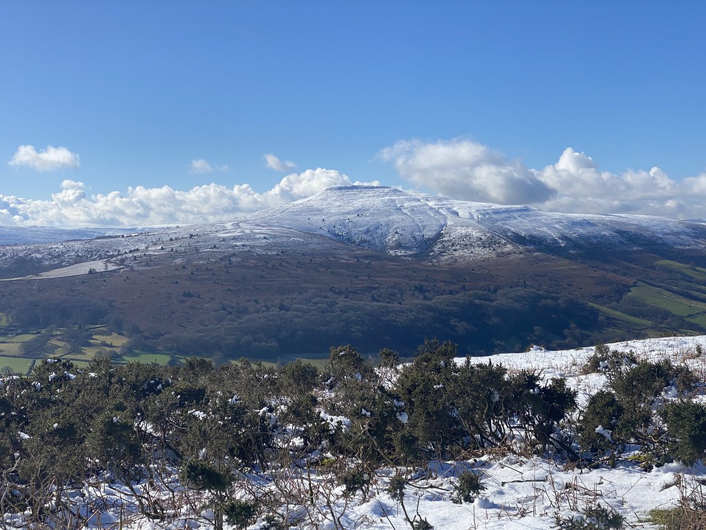
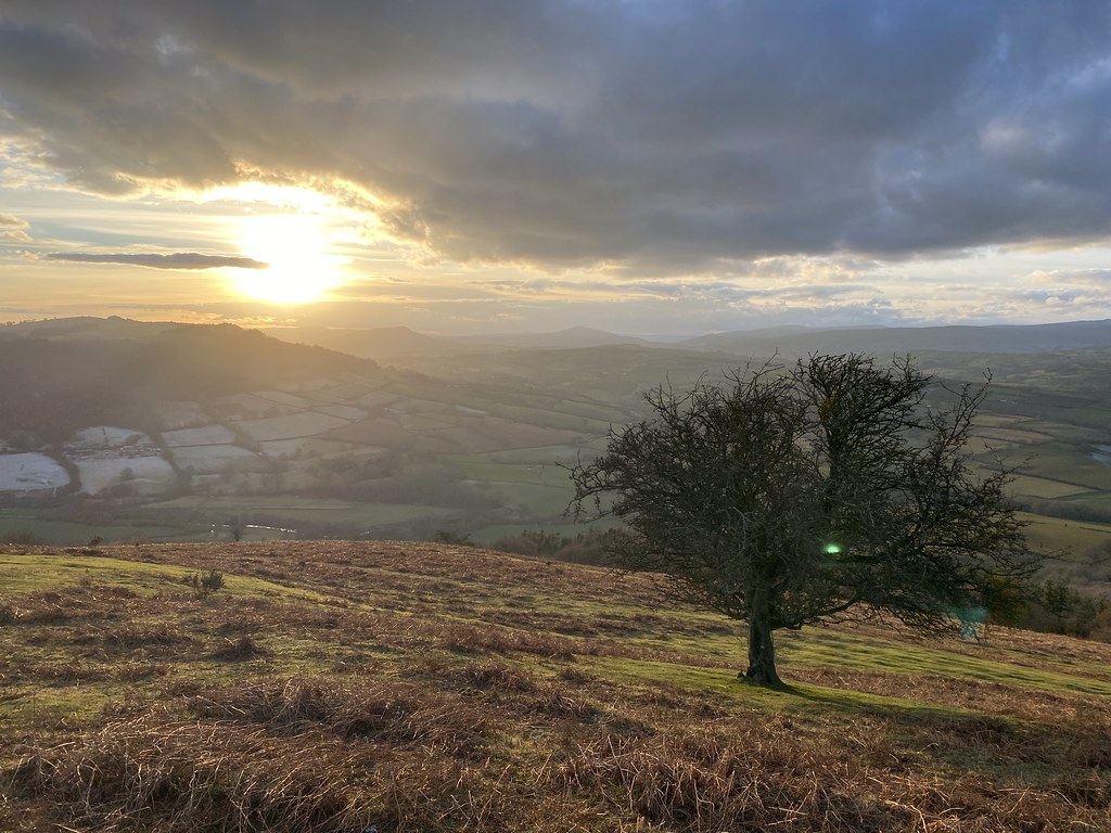
The Sugar Loaf.
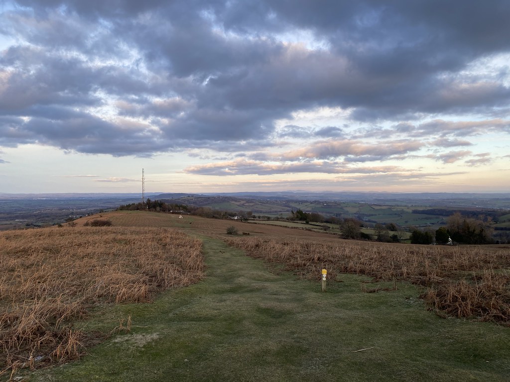
In truth, the snow cover was pretty thin and melting quickly. It was mostly all gone by the end of the day.
Still, it was nice to hear the crunch of crisp (and slop of wet) snow underfoot.
The village of Cwnyoy and its wonky church.
The green fields were lush (and wet) after a winter of ceaseless rain.
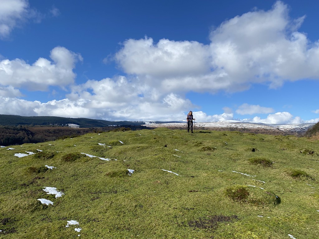
We scrambled up onto the small peak above Cwmyoy, created from an ancient landslip.
Its a favourite spot of ours for a lunch break when we are in the vicinity.
Our plan was to walk the usual circuit around Hatterrall Hill but TBF was out of sorts with a cold and I was suffering with a bad back so we decided this was more than enough for the day.
We took a leisurely stroll down through Cwmyoy on our way to the car.
Stopping to admire this fine and ostentatious feathered specimen.
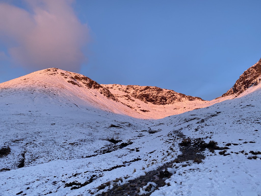
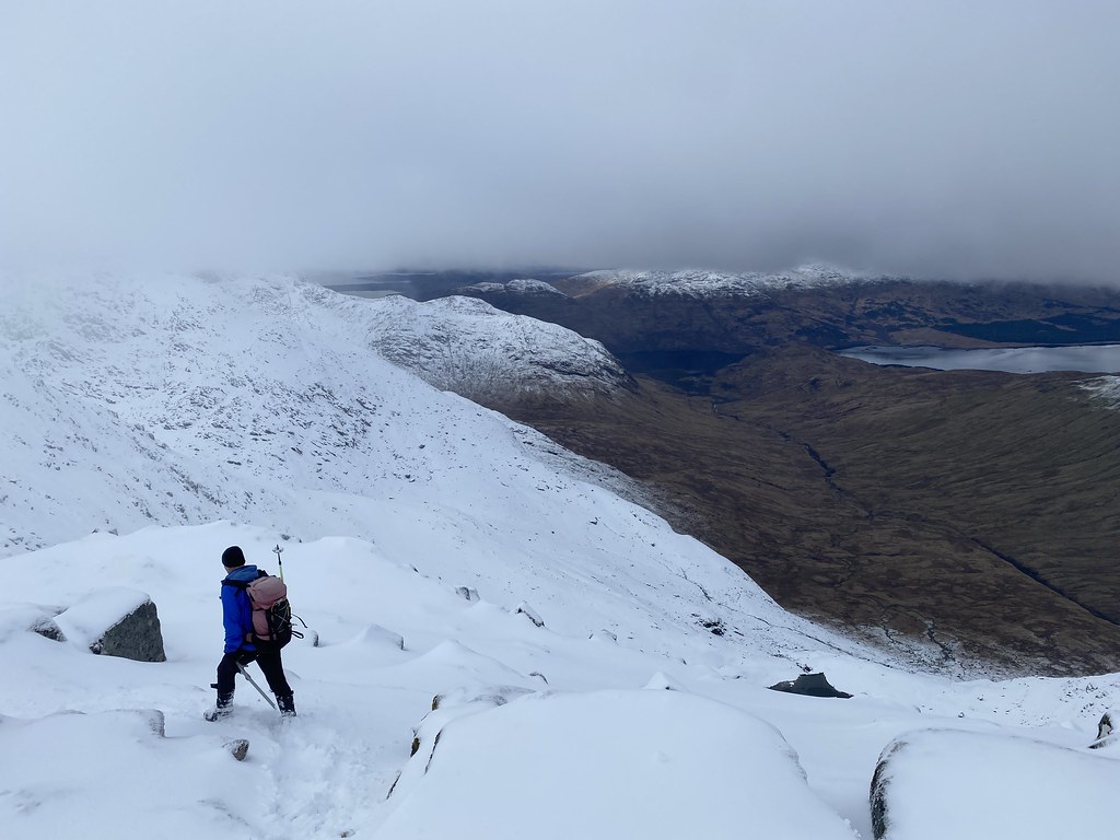
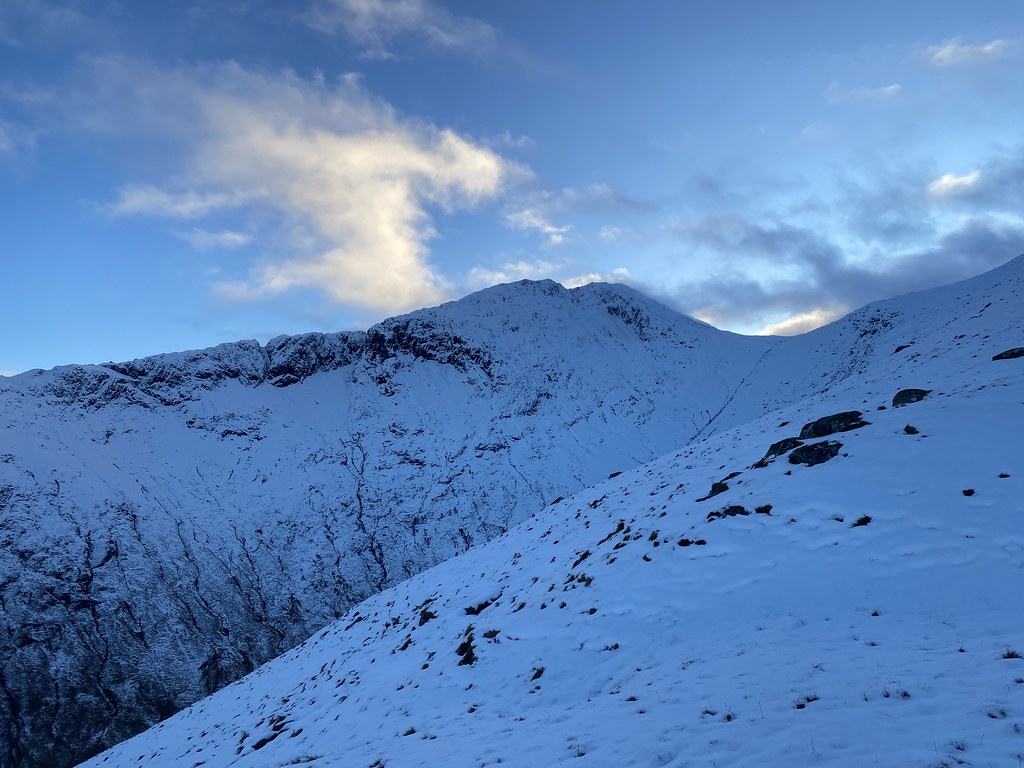
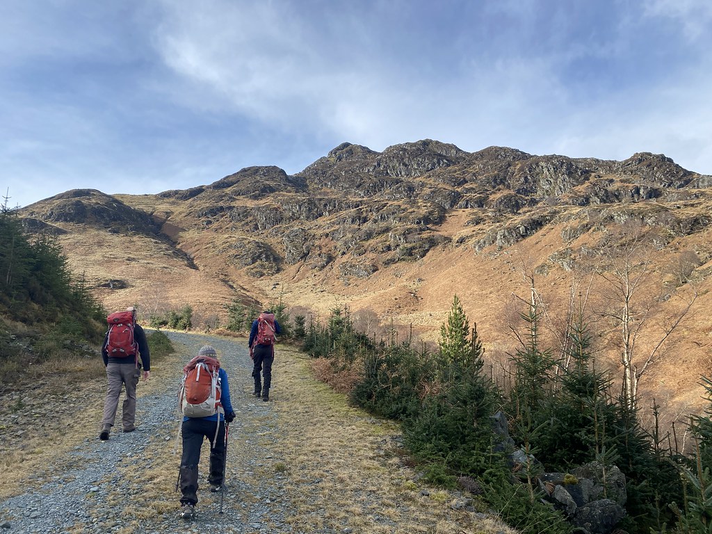
After the long day and exertions of Ben Cruachan we wanted a something a little easier for our last day in Scotland (easier is a relative term in Scottish winter conditions)
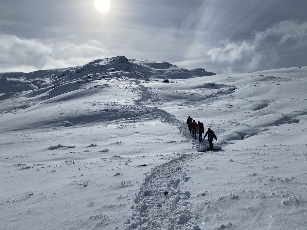
The weather was stunning and the forecast settled and we agreed on Ben Dorain. Its sits directly above the hotel (no need for any driving) and as its very popular, we guessed it might have a trail stomped out through the deep snow.
The ground was frosty but the sun warm as we started out for the long climb through Coire and Dothaidh up to the ridge.
The views out over the south-west highlands was magnificent.
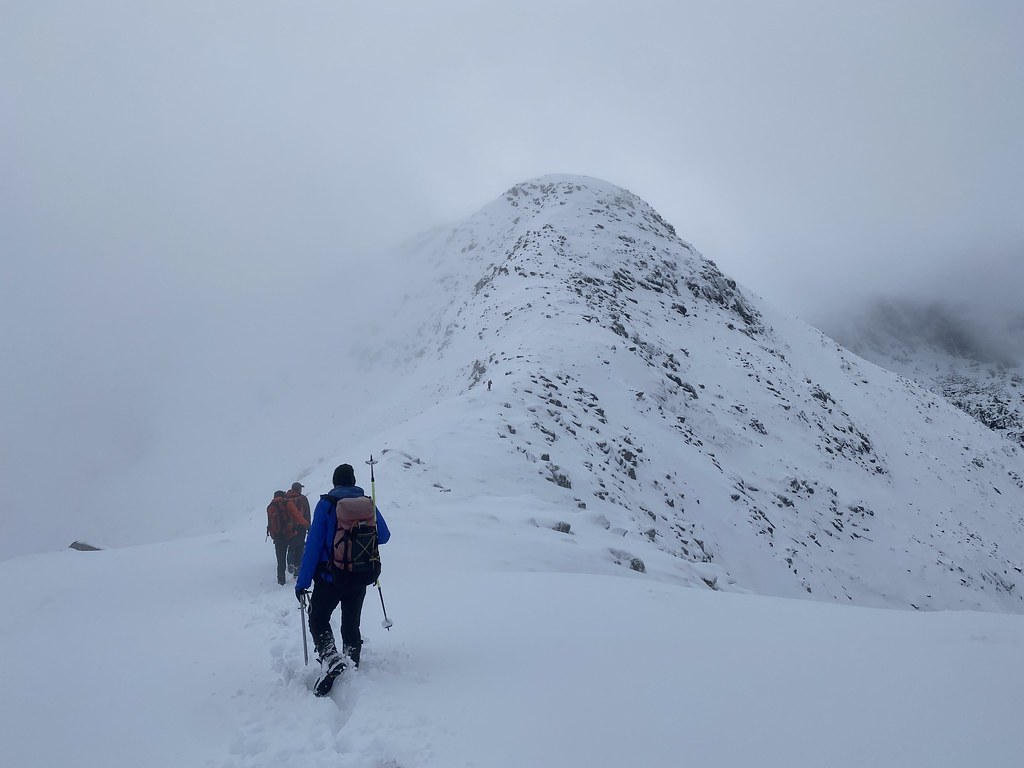
Other than one short steep stretch where the party ahead of us had been sliding about on the snow and obliterated the trail (thanks!) it was easy going to the col.
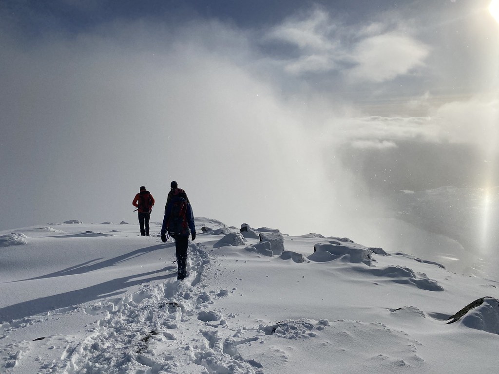
From there it was a winter wonderland!
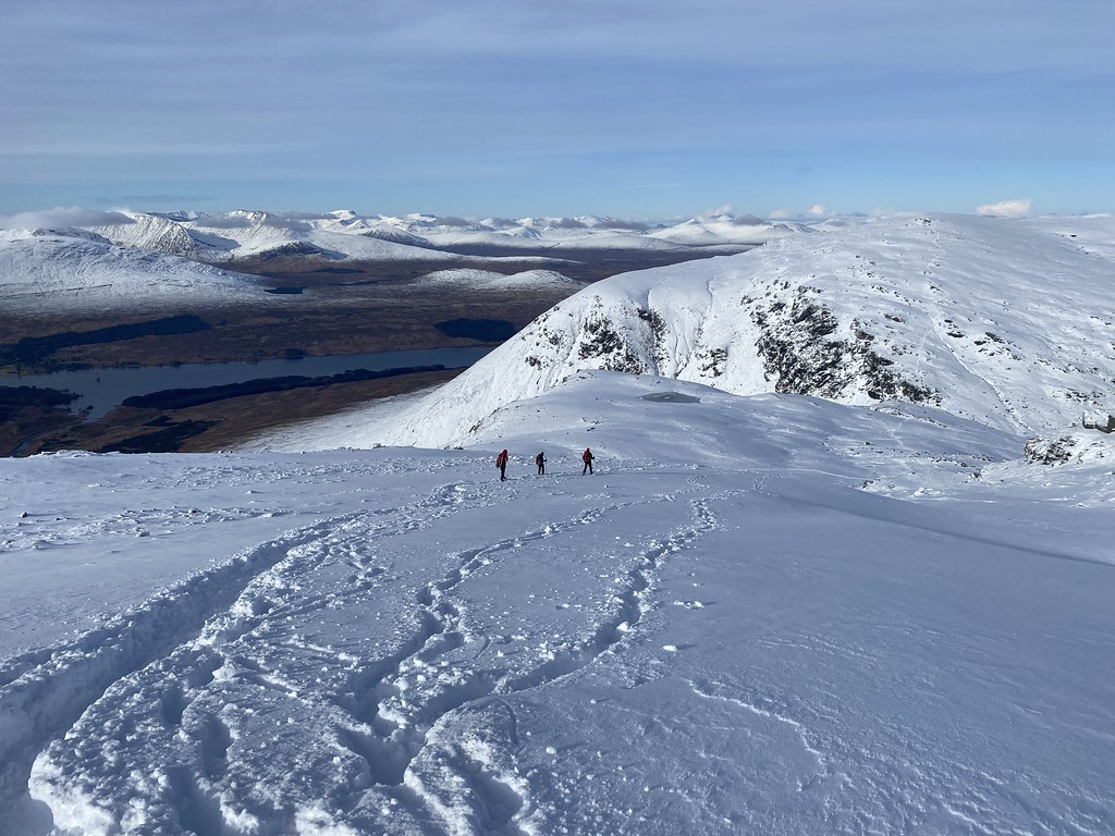
Our guess was correct and there was a deep and compacted trail through the snow that made the walk along the surprisingly long ridge an absolute delight.
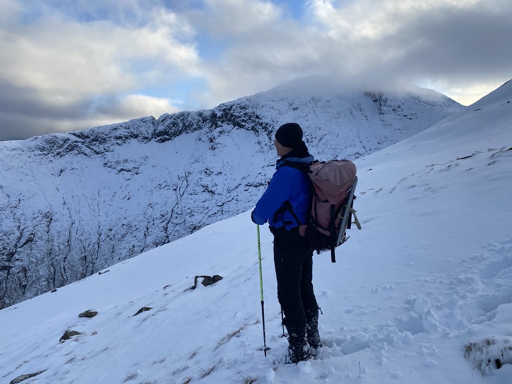
TBF with Beinn an Dothaidh behind.
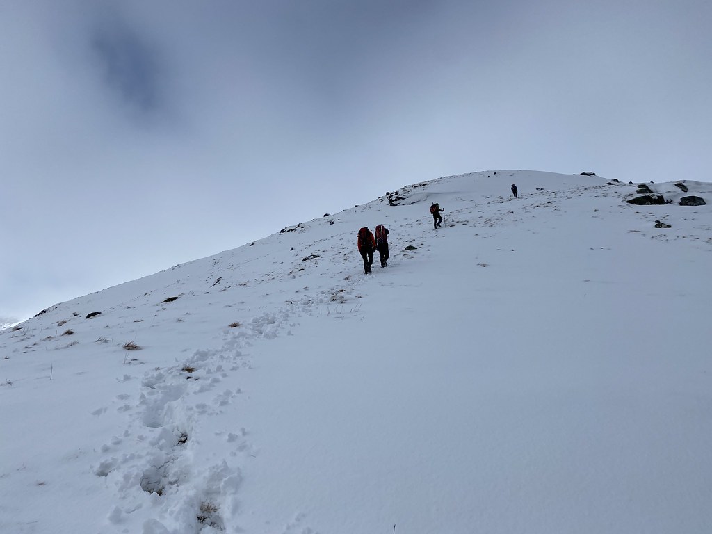
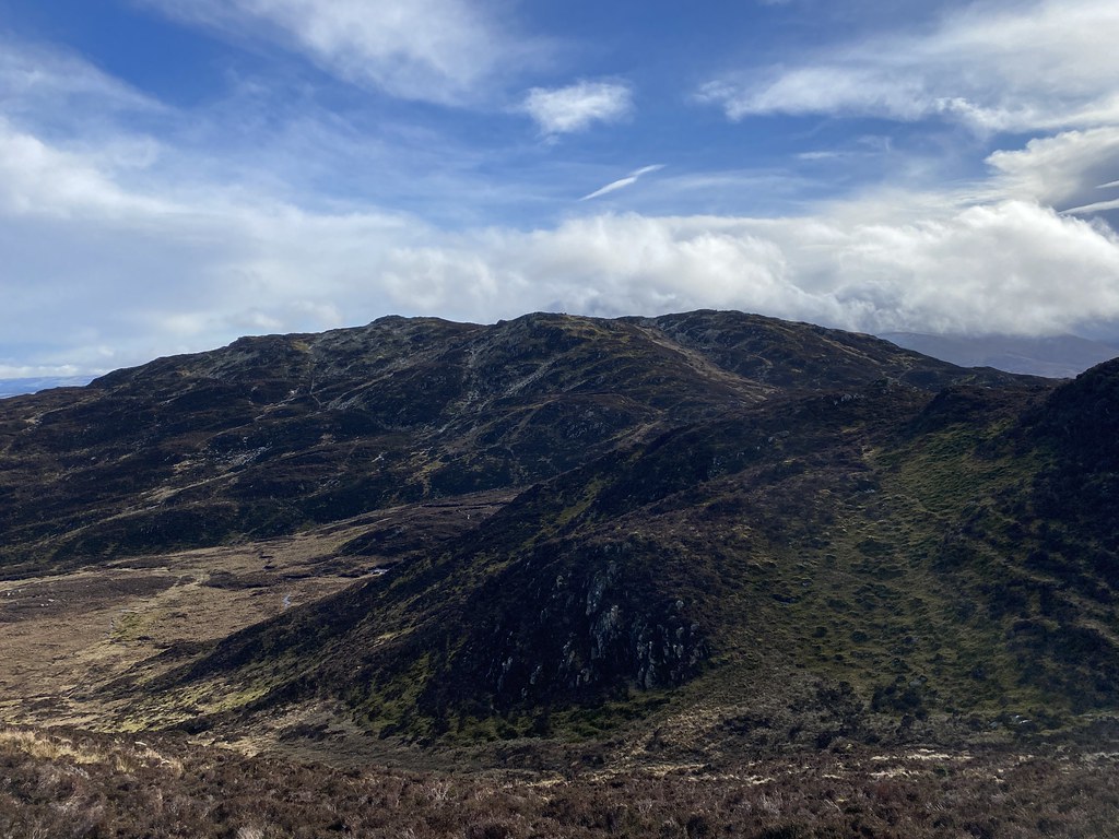
Ben Dorain looks fairly simple in terms of its topography from afar. On closer inspection it has a long ridge with several small spurs and corries/depressions holding deep snow. It would have been a hard work breaking trail up here the day before.
With this excellent trail (compacted and frozen so micro-spikes were very handy) we just strolled to the top,.
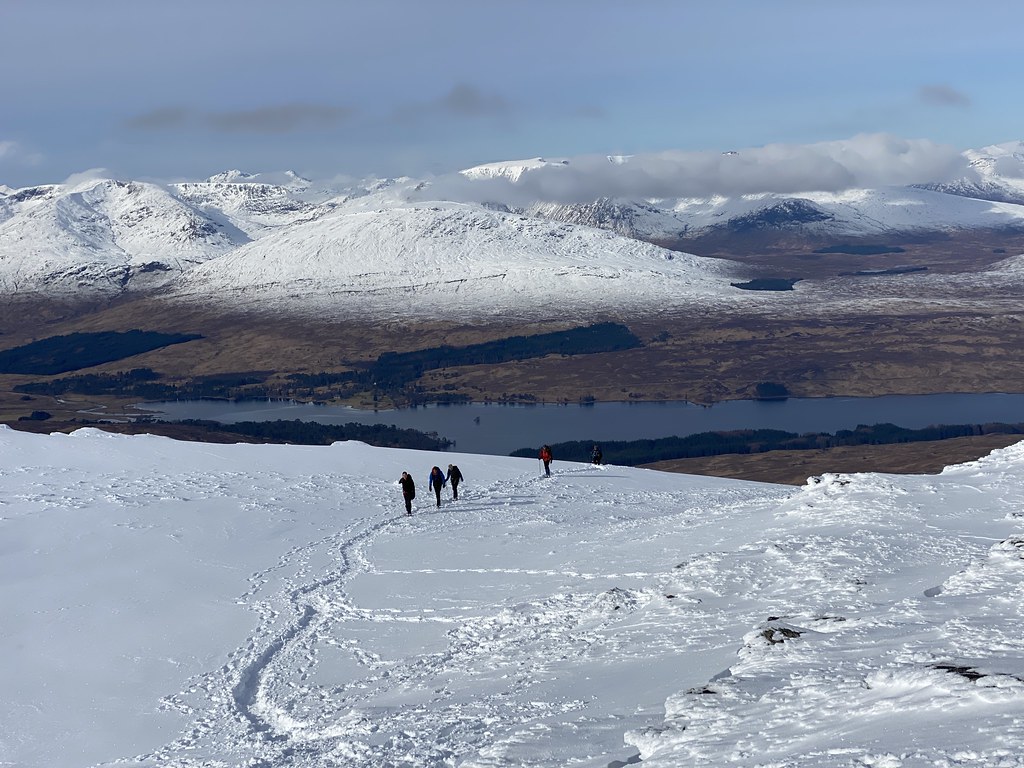
As we climbed the views just got better and better. Mountains as far as the eye could see, interspersed with lower clouds.
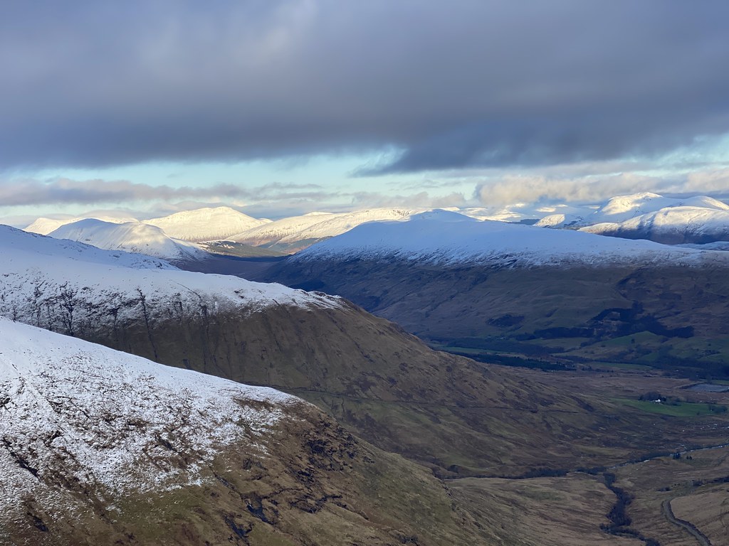
Glen Orchy and Ben Cruachan, our mountain from the previous day.
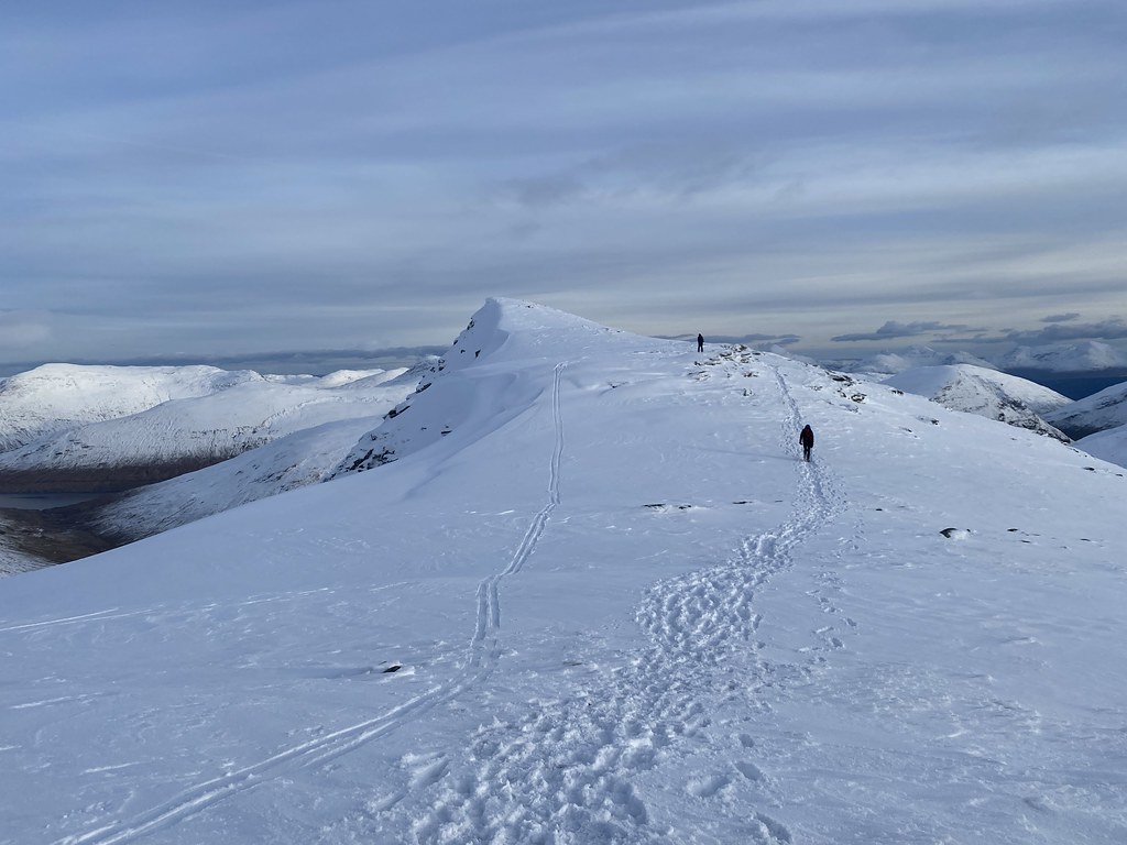
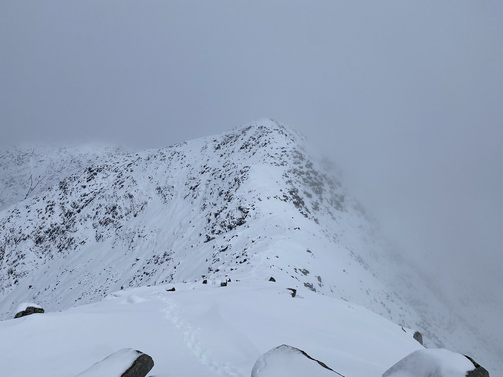
A look along the long ridge to the top.
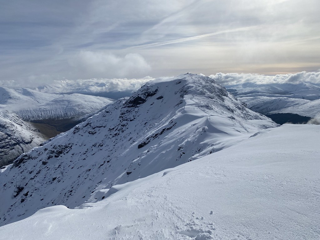
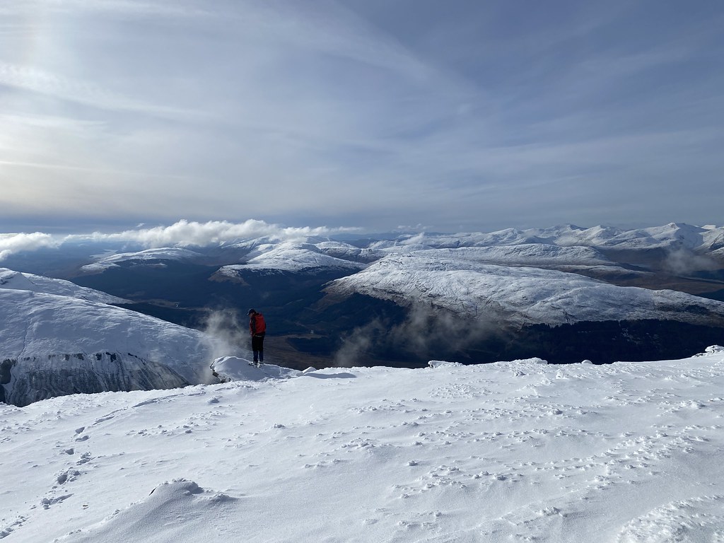
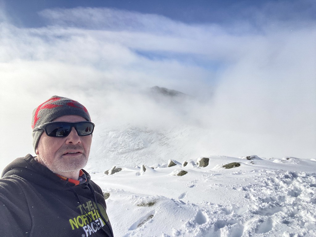
I’ve been up here a couple of times before, both in dense cloud. When you arrive on the subsidiary top of Carn Sassunaich, you’d have to check the map closely to realise that despite the massive cairn, its not actually the highest point, seen here beyond. Indeed on my first visit I’m not 100% sure I did go to main top!
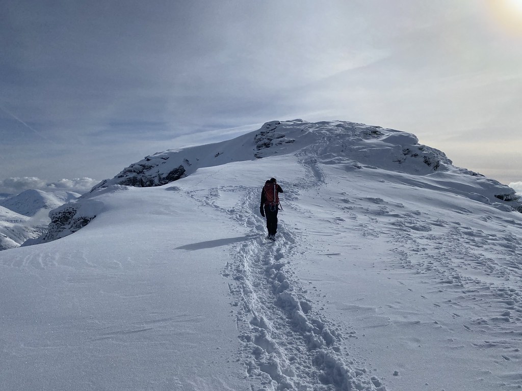
Its a nice albeit short ridge across to the summit.
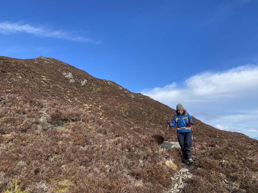
Here’s Danish Matt approaching the final climb.
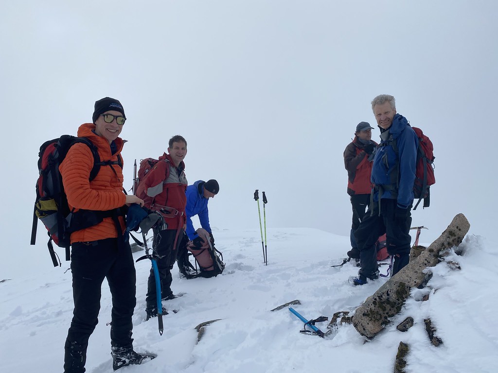
And a team photo (minus me) on the summit.
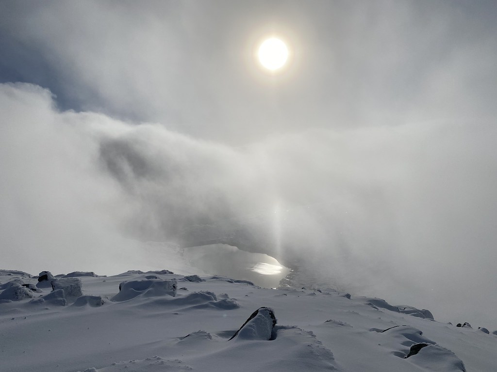
Its pretty steep on all sides so the views are airy and spectacular, well at least I know that now having been to the top on a clear day at last.
We lingered on the top for an extended lunch and spent a while wandering about and taking in the amazing vistas.
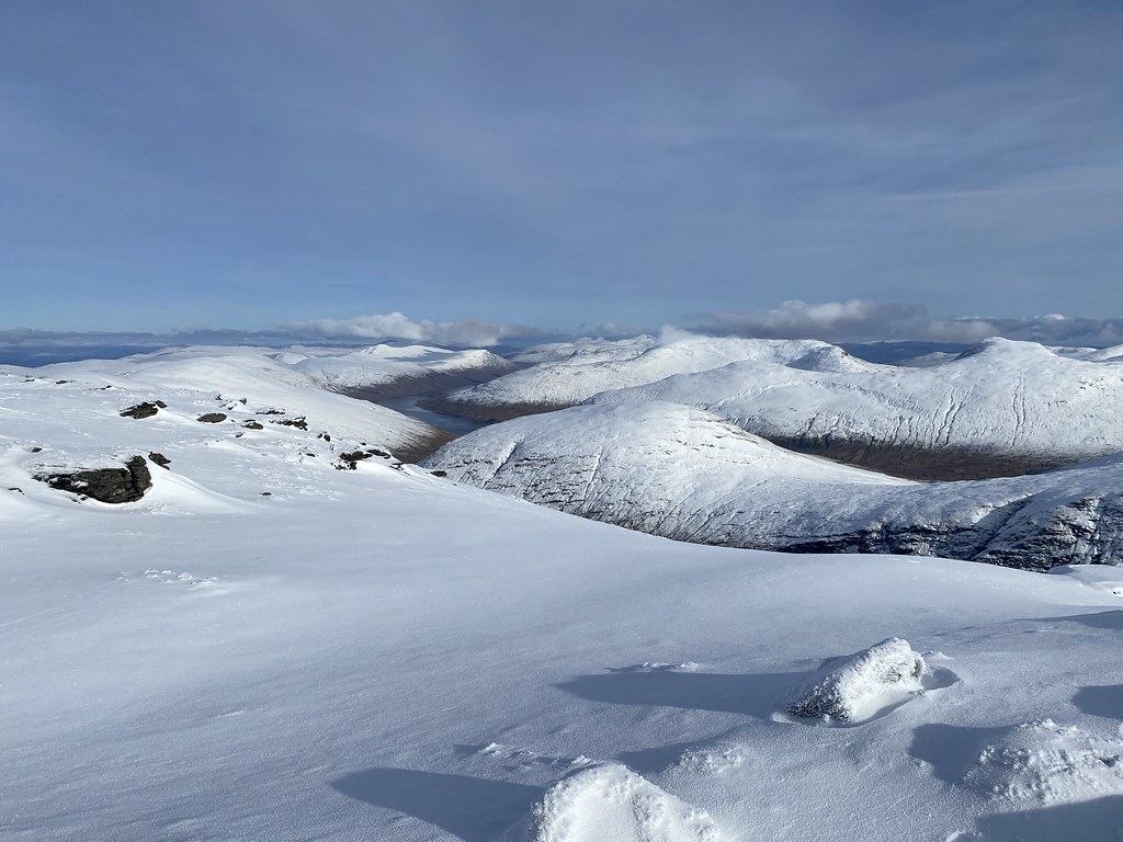
East over towards Glen Lyon, Glen Lochay and the Ben Lawers range.
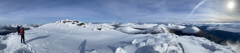
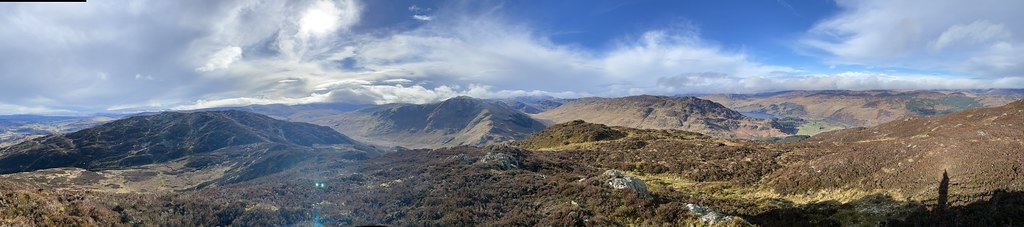
Panorama looking east.
And one looking west.
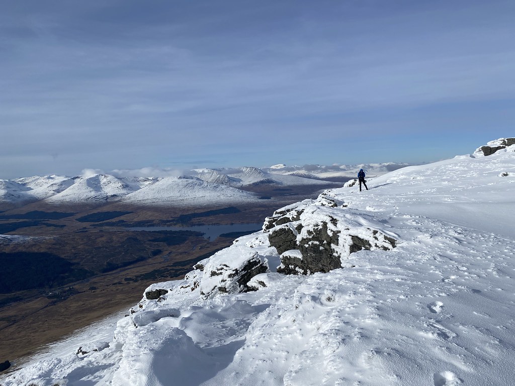
The edge that faces west is quite dramatic looking out over Glen Orchy and Loch Tulla.
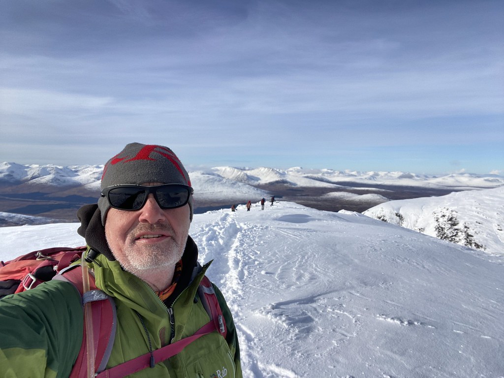
Very much satisfied with our lot and our choice of summit we began the route down. Summit selfie (well a Carn Sassunaich selfie anyway).
The walk down was as much a delight as the walk up as the sun began lower and change the lighting.
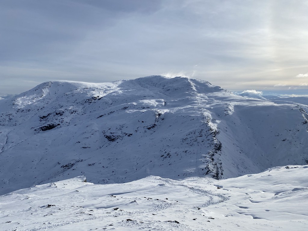
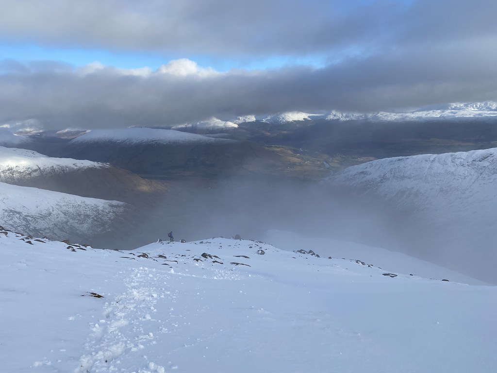
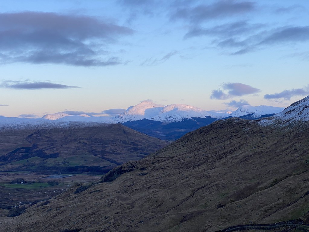
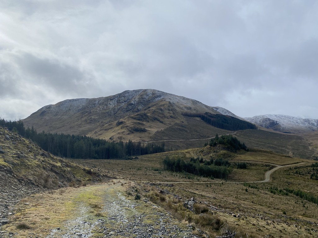
We felt we had enough time to tackle Beinn an Dothaidh. It was a tougher climb as its less popular and the trail hadn’t be stamped out quite as well. Looking back to Beinn Dorain from the way up.
Well worth the extra effort as the view over Rannoch Moor to Lochaber and Ben Nevis (close to the left edge of the skyline in the above photo) is stupendous
There had been a thin veil of cirrus cloud all day and as the sun went down it lit those clouds up to dramatic effect.
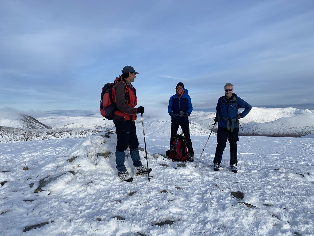
Happy lads on the summit.
Highest point of Beinn an Dothaidh.
One of its other summit points and the best one for views.
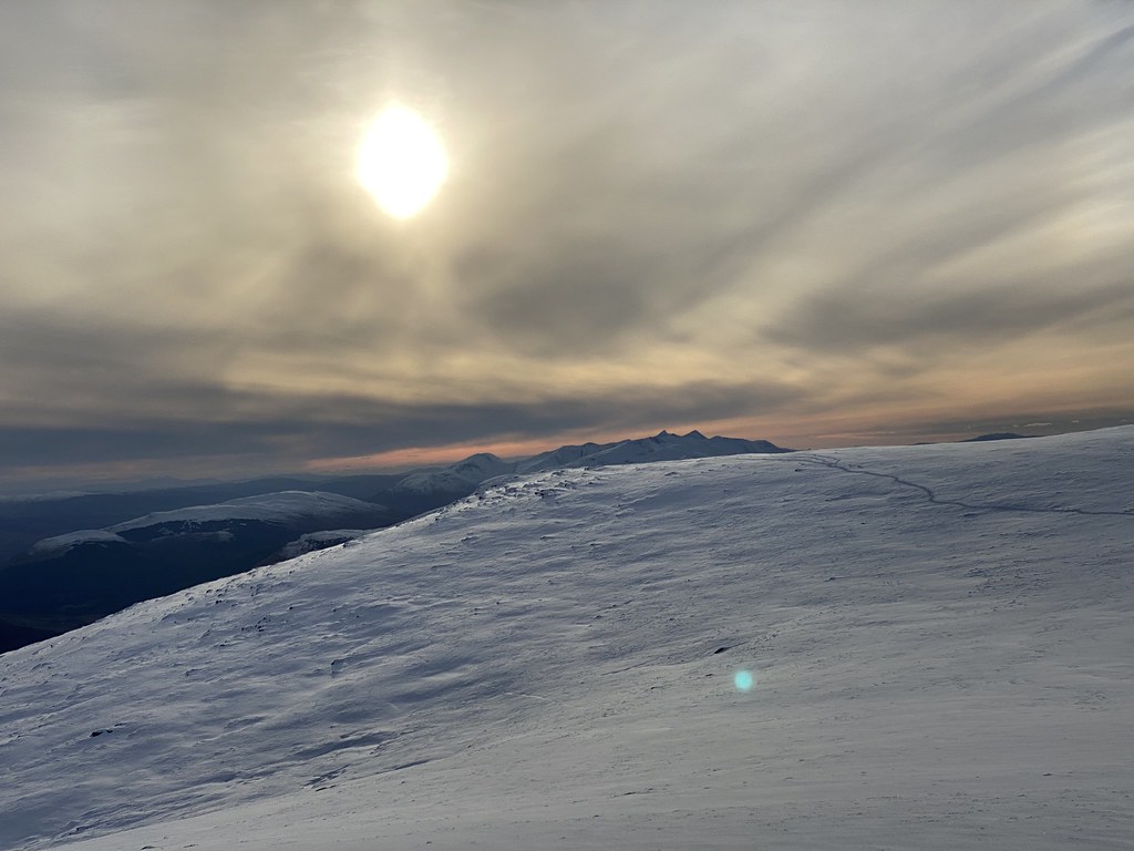
The light was fading fast and we had to head down. The temperature was dropping fast and its no place to get caught out in the dark.
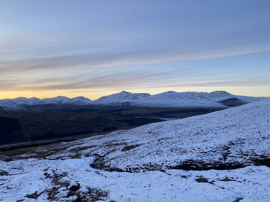
Magificent skies as we headed down to the hotel.
Sunset over the the south west highlands.
One final treat with a period of pink Alpenglow as the sun finally set for the day.
Map of the route – well, sort of. Just ignore the leg off to the north (from a previous trip), I couldn’t be bothered to do an up to date version.
The walk ended on a bit of a downer. Danish Matt slipped over within sight of the hotel and looked in a good deal of pain, saying he felt something “go”. A visit to hospital the next day confirmed he’s broken a bone in his foot. In one way unlucky that it happened so close to the end of the walk, but look another way and lucky it didn’t happen much higher up where the situation would have been much more serious.
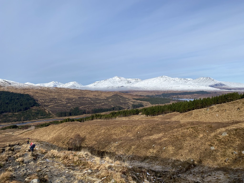
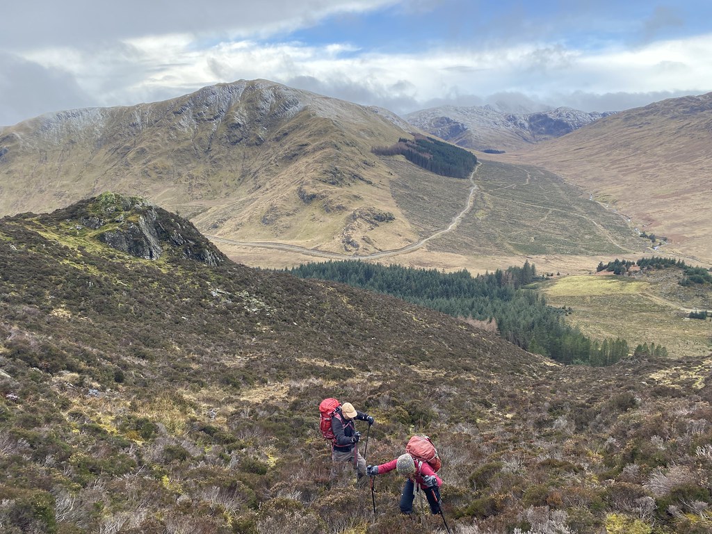
Next day of our Scottish adventure and the usual round of endless discussions around where to go. My mate JC suggested Ben Cruachan which I haven’t done for years. Its a big bugger so we went for the shorter and lower eastern side and the Dalmally horseshoe.
Even though its a shorter day, you start at sea level and its still a substantial undertaking of 8 miles and 3,500 feet of ascent.
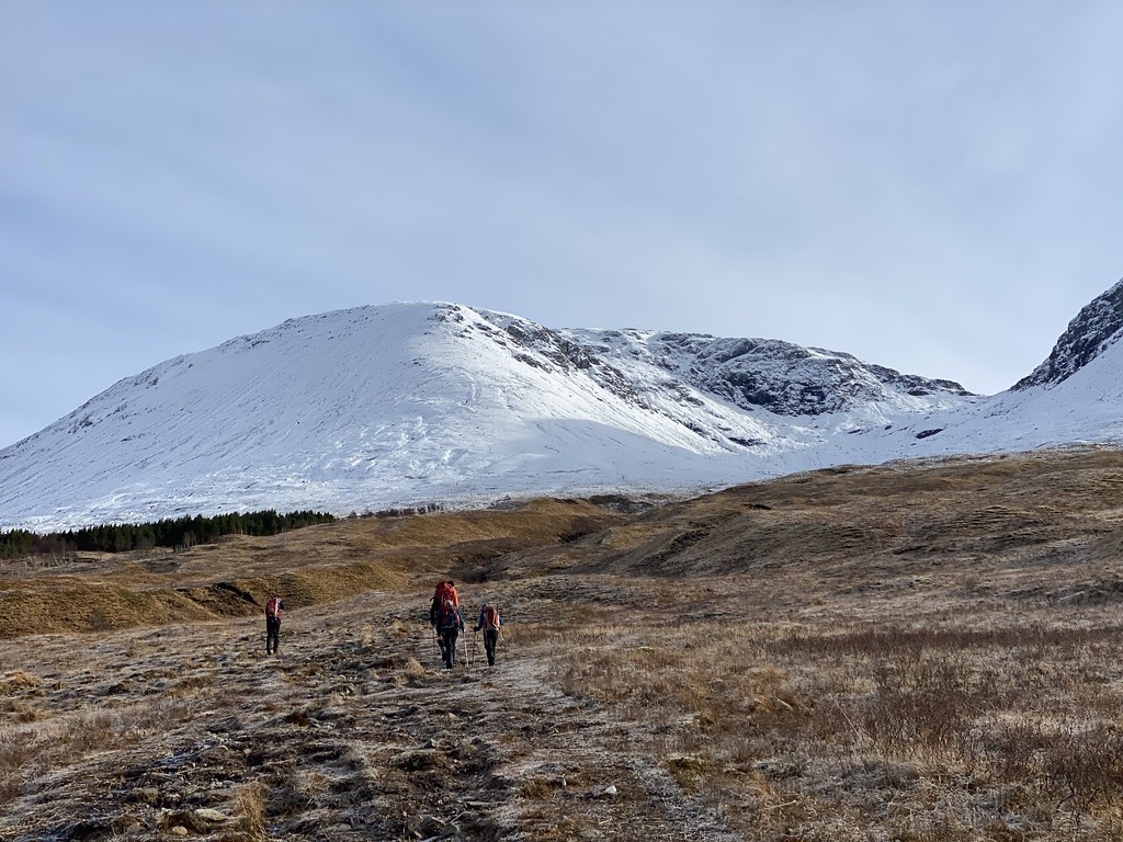
Our group 6 set off on the track into the heart of the horseshoe. The Hydro track went much further into Coire Chreachainn than the map showed which was helpful.
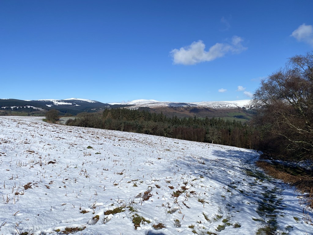
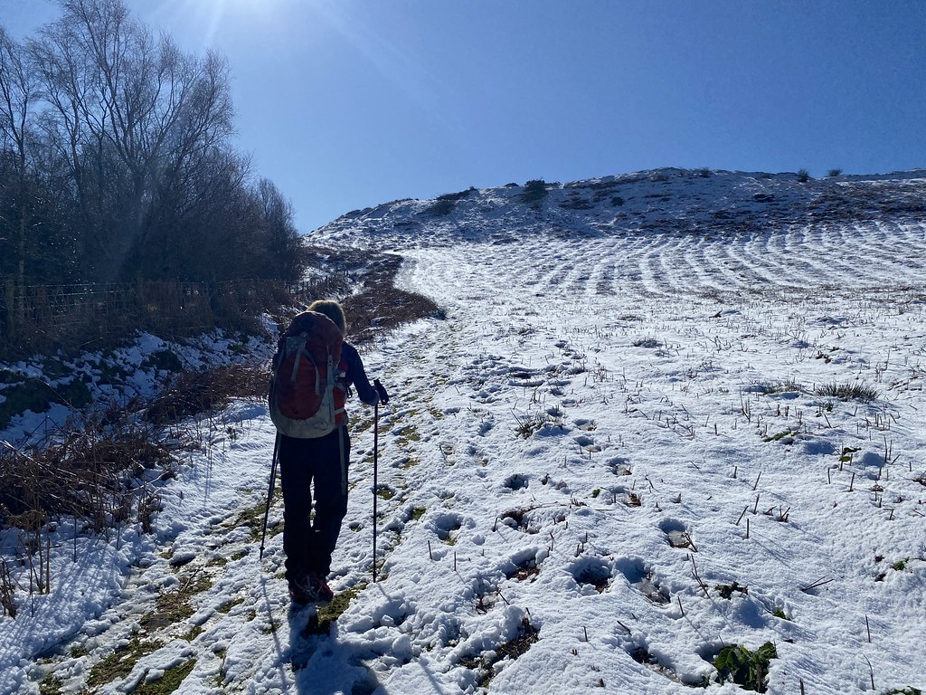
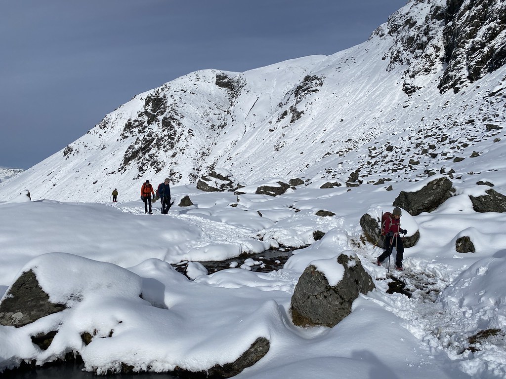
After which the real work began. Steep grass and then ever deepening snow. The forecast was for the grey skies to clear and as we climbed things looked promising. However the grey skies soon returned.
It was a very long climb and in deep snow with no new tracks to follow it was tough going.
JC puts a happy perspective on things.
Approaching the first top of Sron an Isean.
The happy gang on the first summit.
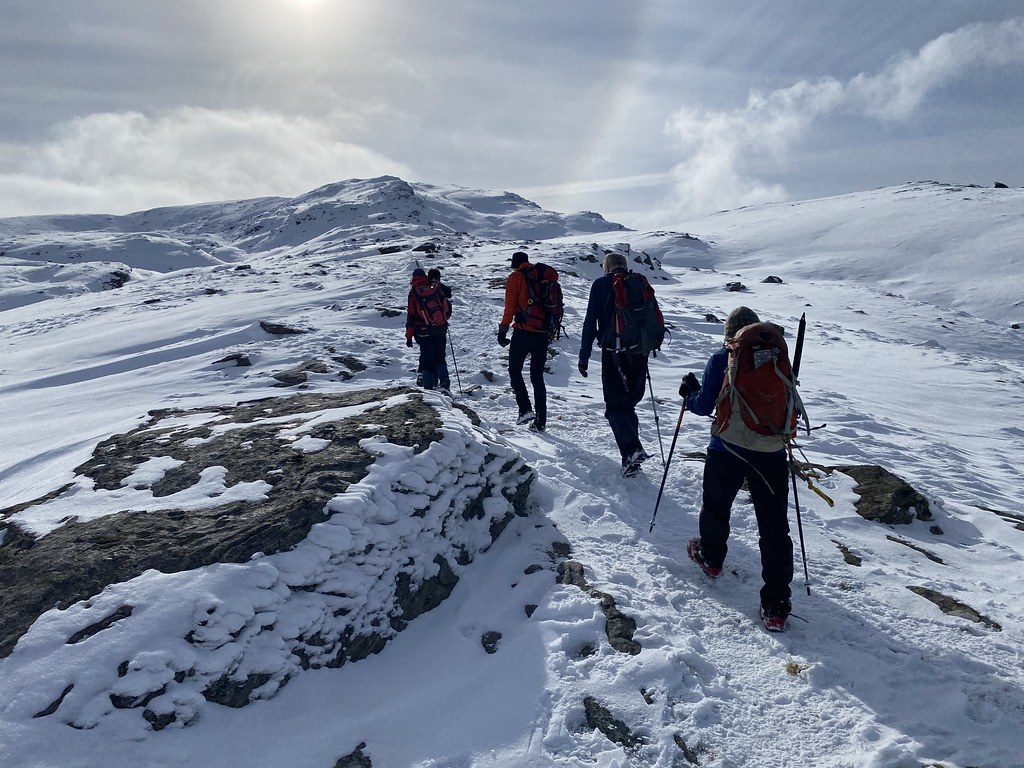
The weather was still overcast and we were in and out of the cloud. We still had some decent views and in this grim spell of weather it was at least dry which is always a win in Scotland.
It had been tough going on the ascent but from here things were even tougher. The snow was amazingly deep even on the crest of the ridge. It was incredibly hard work bashing through and breaking trail (we were pretty much the only people we saw up here all day) even though I didn’t actually do any (I slunk to the back of the group using my lack of height as a very weak excuse).
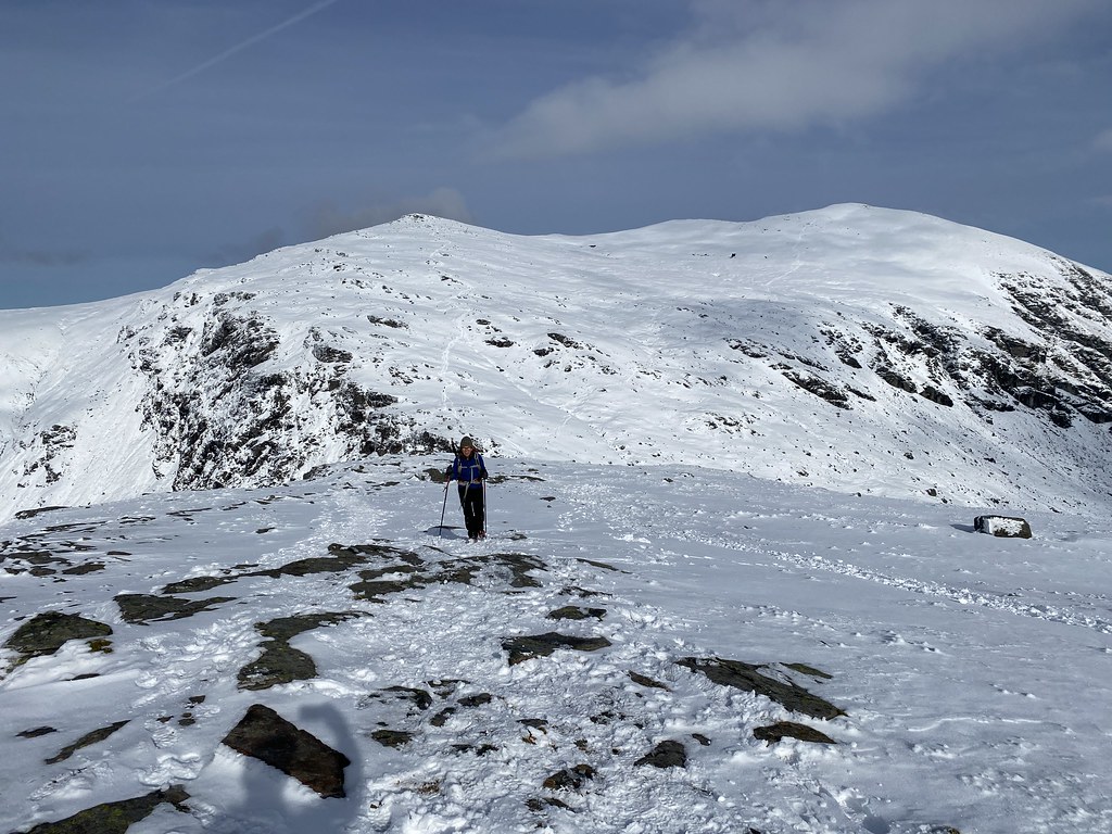
Despite the grey skies the views were still pretty decent and Ben Cruachan is a spectacular mountain. Rocky with narrow ridges, unlike most of the rest of the south east highlands.
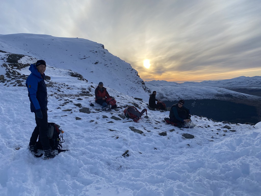
We stopped for a break on the final summit of Stob Garbh. Despite the relatively short distance it had taken us 5 hours to reach this point.
As we sat on the top the skies began to clear a little and the sun even came out. We were half in and half out of the cloud, the sunlight reflecting off the Cruachan Power Station reservoir far below.
After a grey day the skies began to clear to dramatic effect. Selfie with the highest summit of Ben Cruachan behind.
Within the space of a few minutes, gloomy grey skies were replaced with blue ones.
We even had a couple of fog-bows!
We went our separate ways from the summit, me and JB heading back to the car, the rest taking on the extra Corbett of Beinn a Bhuiridh.
As we headed down the skies became clearer and the late afternoon views across the southern highlands were magnificent. Another concerned face selfie.
It was a long and tiring descent in deep and slippery snow but with views like this no complaints.
JB takes a pause to survey the grandeur.
By the time we reached the lower slopes the skies had pretty much cleared and the light contrasts were just stunning.
Looking back to Beinn a Bhuiridh. At this point the rest of the party were only just heading away from the summit and likley to completing their descent in the dark.
We eventually reached the track just as the last pink alpenglow faded from Ben Lui.
We had to wait at the car for well over an hour for the rest of party to make it down but the moonlight views over the mountains, this is Beinn Mich Mhonaidh, was more thn enough to keep us happy.
I missed our annual Scotland winter weekend last year so it was great to be heading back up north again at the end of February.
Its a long drive but heading up a day early on the Thursday evening not only makes it worth the effort for 3 days walking but the traffic is good deal easier.
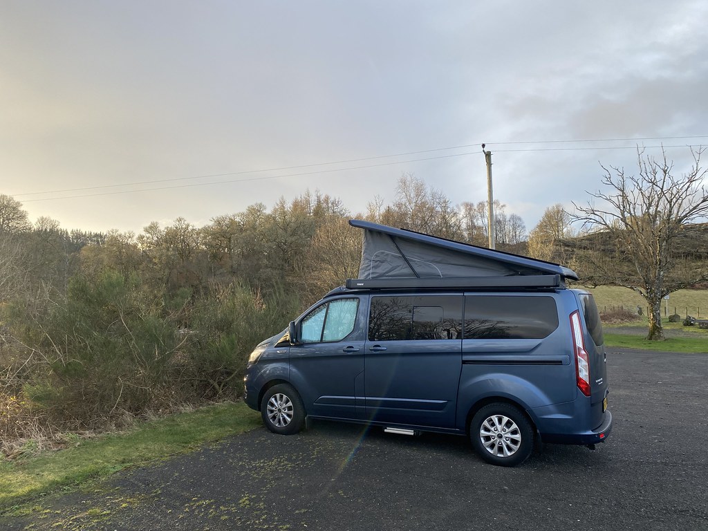
As we were in the van we were able to park up for the night at a really nice quiet little spot just outside Comrie.
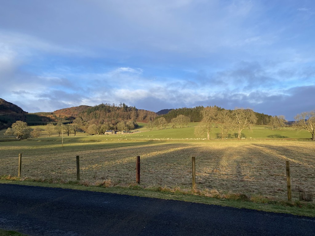
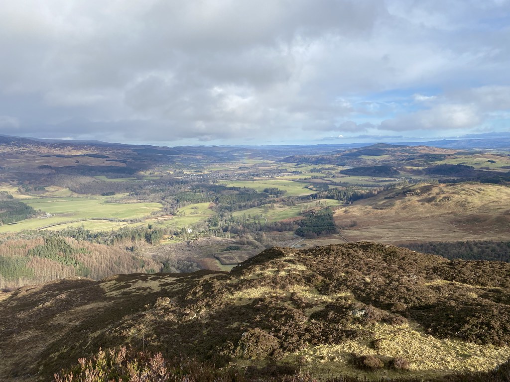
Not a part of Scotland I’ve visited before over on the eastern side, very much more pastoral the then highland mountains.
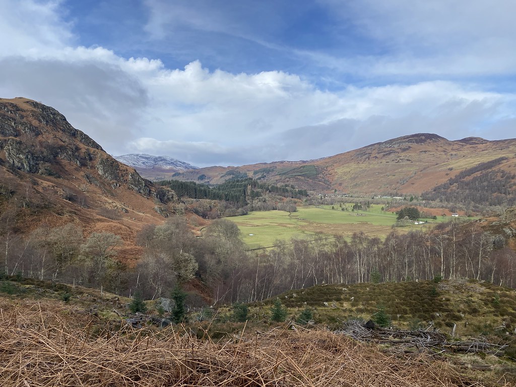
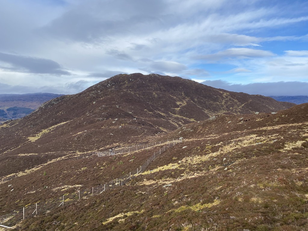
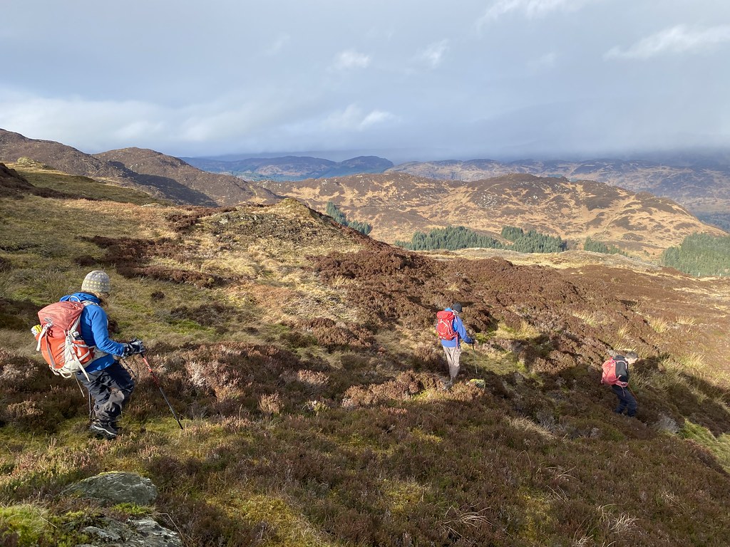
We met up with a couple of the team for a Friday walk. The forecast was very uncertain with mention of heavy and frequent wintry showers out west so we stayed east and low, picking the interesting small mountain of Mor Bheinn just east of Loch Earn.
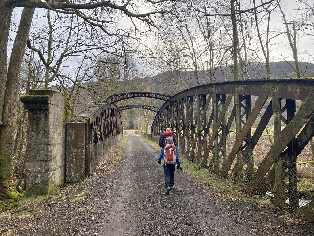
A nice easy introduction along the old railway line and forestry tracks. The Am Bioran ridge to Beinn Fuath looked very inviting although it looks a challenge to actually get to it.
The weather was much better than expected with plenty of blue sky and patches of sunshine replacing what we thought would be regular and squally showers.
The scenery was very unlike most of the highlands I’m used to walking in. Lots of green fields and lower slopes of bracken and heather.
Having a wide forest track to follow through those lower slopes was a real bonus. Trackless heather is not the easiest of mountain terrain.
Exiting the forest we had a fine view of one of Scotlands many Beinn Deargs – noted for a future day out.
The forestry track took us up to almost 400m leaving us only a couple of hundred meters to the top. Whilst there was some heather bashing, it wasn’t nearly as bad as we thought it might be.
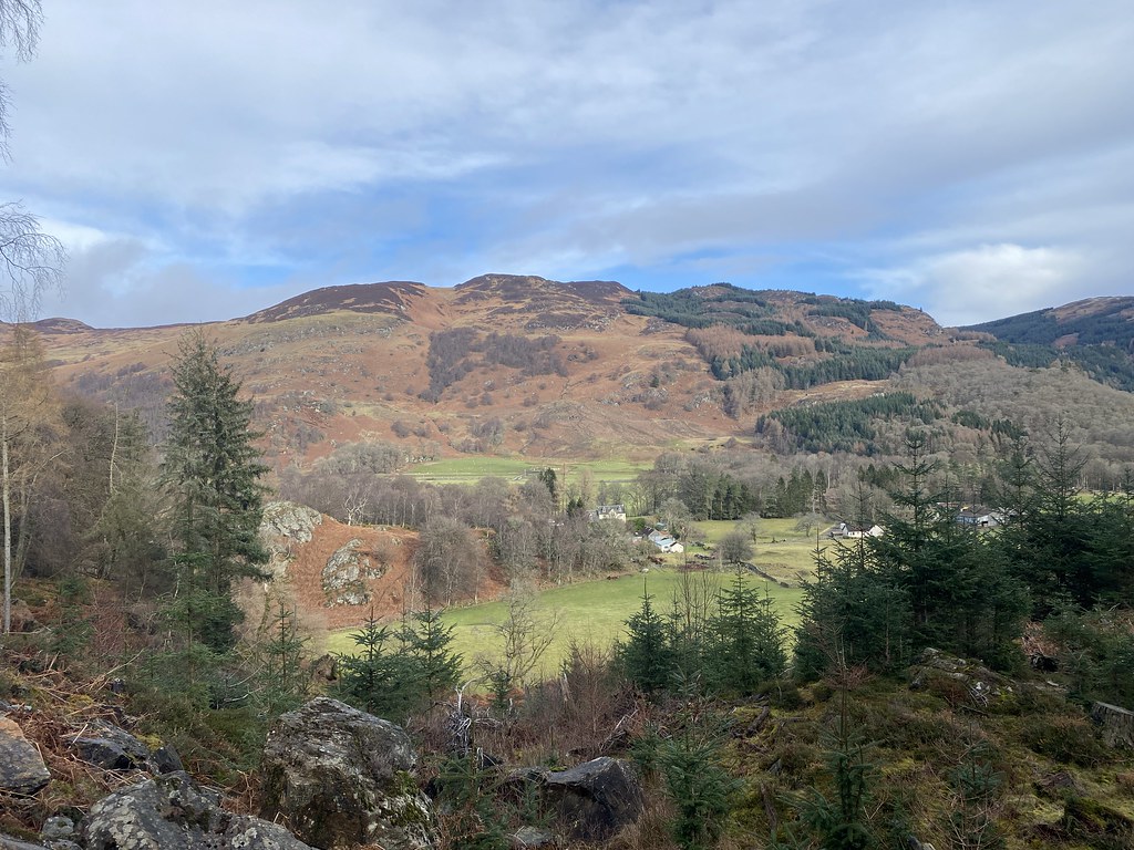
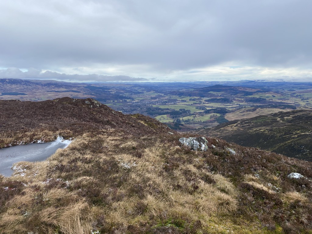
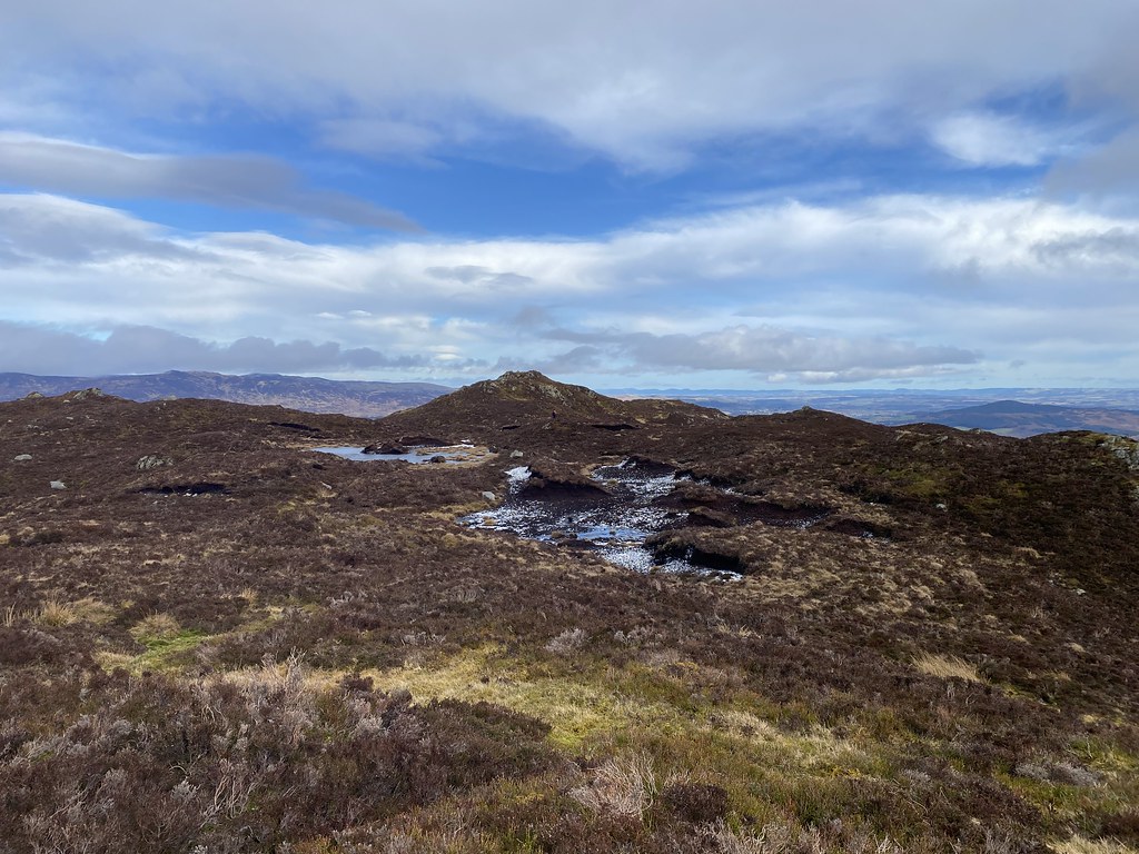
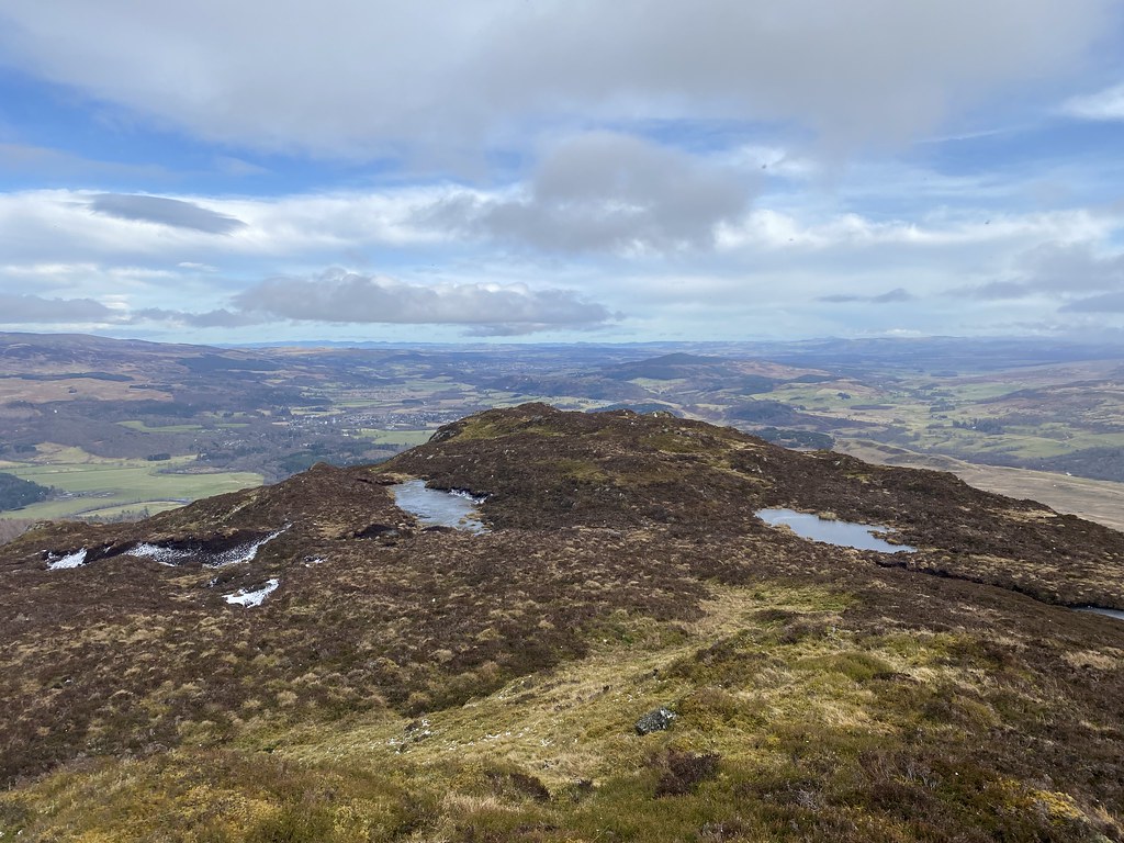
The views really started to open out as we reached the summit, Loch Earn visible in the distance.
The low cloud that had been shrouding the bigger summits was starting to clear. Not sure if this group of hills that overlook Doune and Dunblane have a name but they looked impressive with their cloud cloaks.
We crested the summit with grand views out east over eastern Scotland. I really liked this panorama as its not what you normally associate with Scottish mountain walking.
To the west, the munro summit of Ben Vorlich was clearing.
TBF and UF on the summit of Mor Bhienn.
We found a sheltered spot out of the cold wind for lunch.
We lucked in as while we ate, a large patch of blue sky cleared above us and we were treated to some superb views.
Loch Earn and Beinn Fuath
Panorama of the southern highlands.
Summit selfie.
A good lunch stop is an essential part of any days hiking.
It was such a decent day that we decided to add the small neighbouring hill of Ben Halton to our intinerary.
This photo makes it look bigger than it really is.
A steep descent but we found a small path to follow through the deep heather.
The eastern views improving all the time and proving on days when the showers are battering the west coast, that staying on the east side can sometimes deliver a huge contrast.
Mor Bhienn from the slopes of Ben Halton.
Ben Halton proved to be well worth the extra small effort. A nice little summit ridge, studded with small outcrops and pools.
And a summit with grand views out over the east.
UF descending Ben Halton in a light snow shower. This one, and a light rain shower on the track out were the only showers we had all day.
And in between we had some lovely spells of sunshine.
Those marvellous eastern views again. Sometimes the ranks of mountains can make the view somewhat “samey”. Its nice to be up high and see something altogether different to contrast the mountain views.
We passed Aberuchill Castle on our way down, likely now converted to expensive holiday flats I’d guess.
To complete the day, a long walk along the disused railway track which I really enjoyed. The temperatures seemed to drop quite suddenly as the sky darkened and we drove through a huge snowstorm on our way over to the Bridge of Orchy hotel. It looked like the western highlands had seen a hell of snow dump, something we’d discover the following day.
Back up to our now regular visits to Liverpool to see the Prof.
We have a kind of routine for these trips now. A day in the city and day out and about in the wider area.
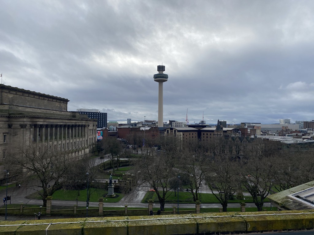
We took our usual trip into the Central Library and its splendid Picton Reading Room. A nice view across the city from the top floor.
After a cuppa and lunch in a very fine cafe near Lime Street Station and a walk up to the Philharmonic Rooms for a lunchtime pint we headed for our objective for the day, a tour of the Royal Liver Building on the waterfront.
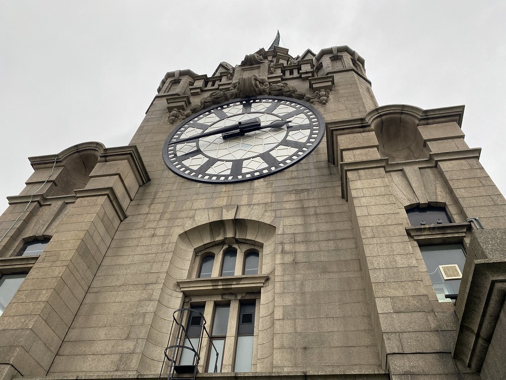
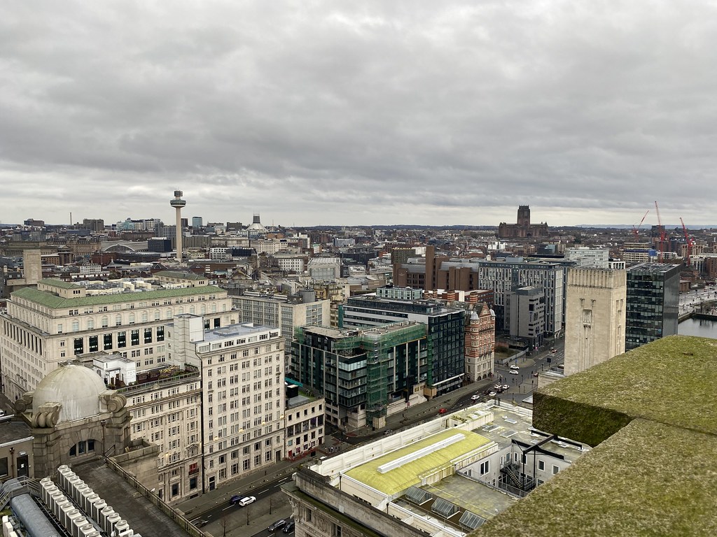
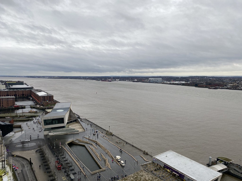
Its an interesting building and an iconic sight from the outside. Whilst the inside is mostly rented office space they do let you go up to the roof where you get a close up view of the two main towers.
And some great views across the city.
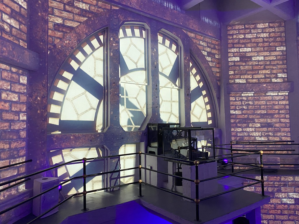
There was also a 10 minute audio visual presentation on the inside of the walls of one of the towers. It was about the history of the city and extremely well done.
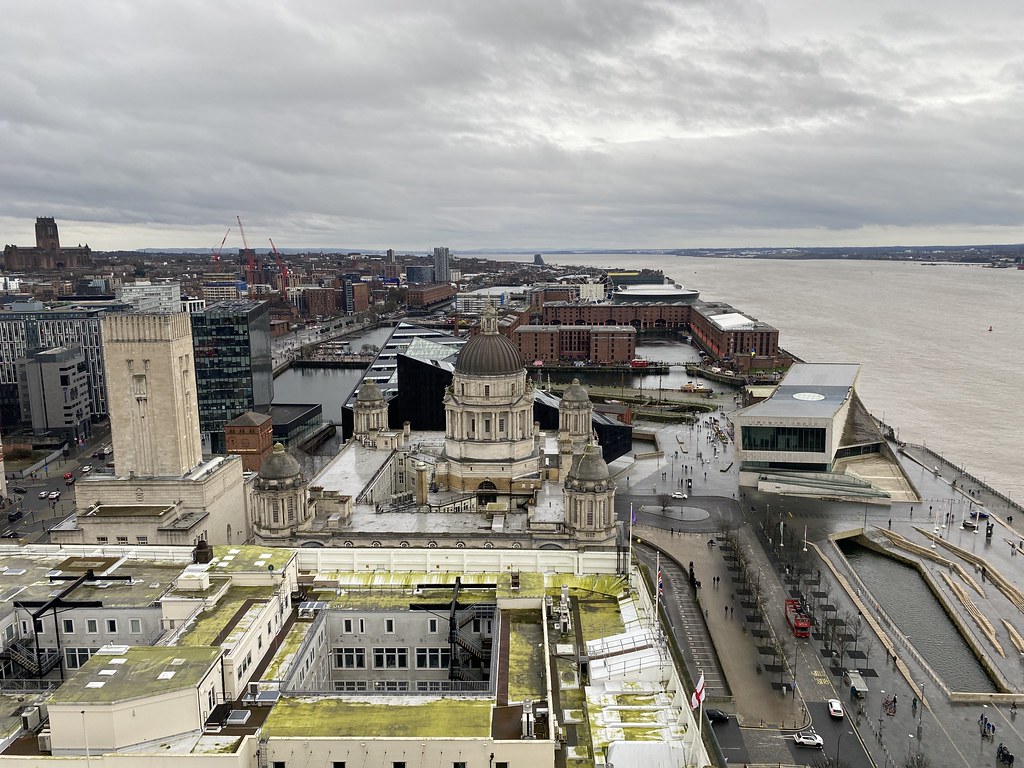
You can then climb to the higher point of one of the towers from where the views are even better. Looking out across the Port of Liverpool and Cunard Buildings towards Albert Dock.
Across the Mersey to the Wirral.
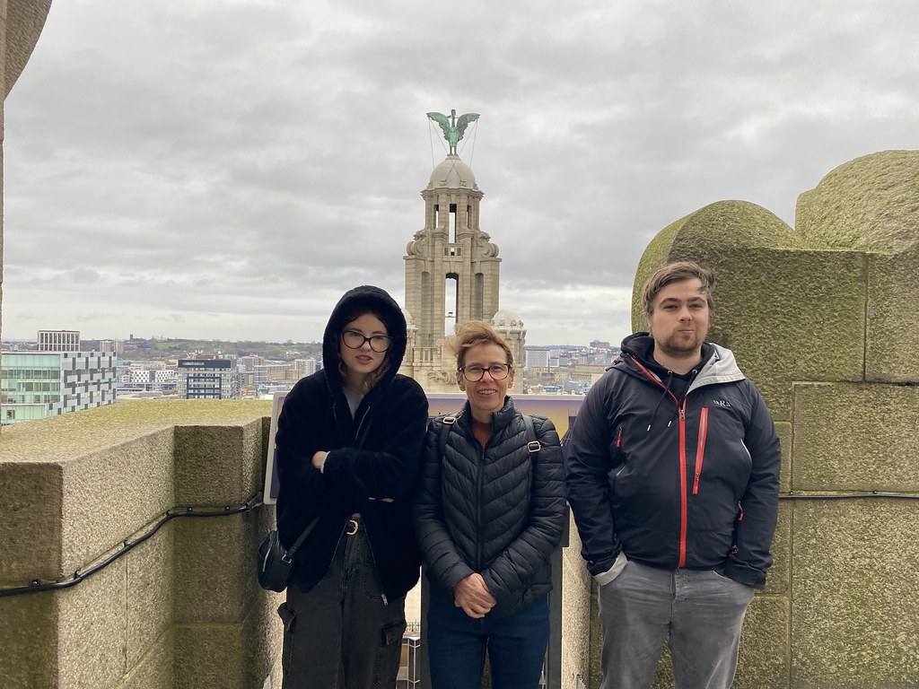
Close up of the Tower.
And North out towards Bootle and Crosby where the Prof lives. For the footy fans you can see the new Everton Stadium – who knows what division they will be in when they play their first game.
We lucked out with the weather and it was raining while we were up top. It was also cold as the family are making a good job of looking.
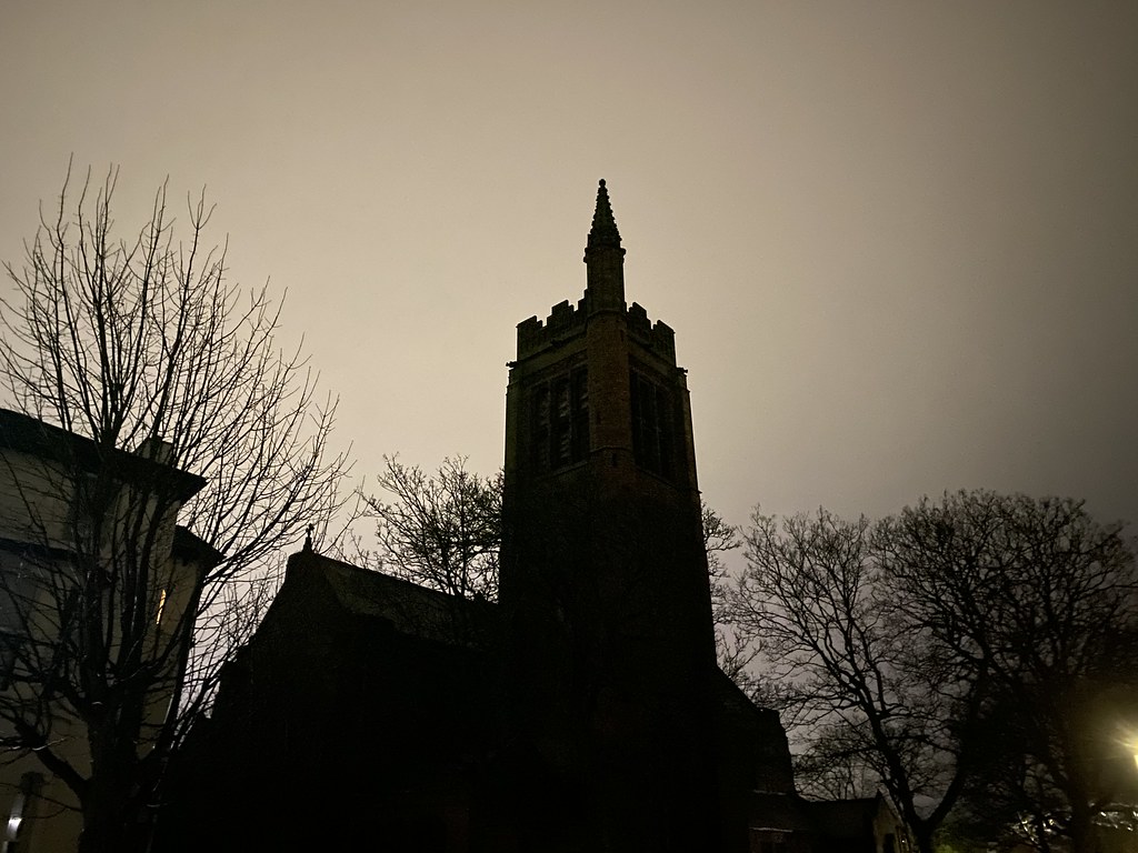
After our visit we just headed home for a chill out and then back out for a fine Greek meal in a local restaurant. This is the very spooky looking church across the road from the Prof’s flat. I expect to see Dracula and vampire bats swooping down to take us to the dark side of the after-life.
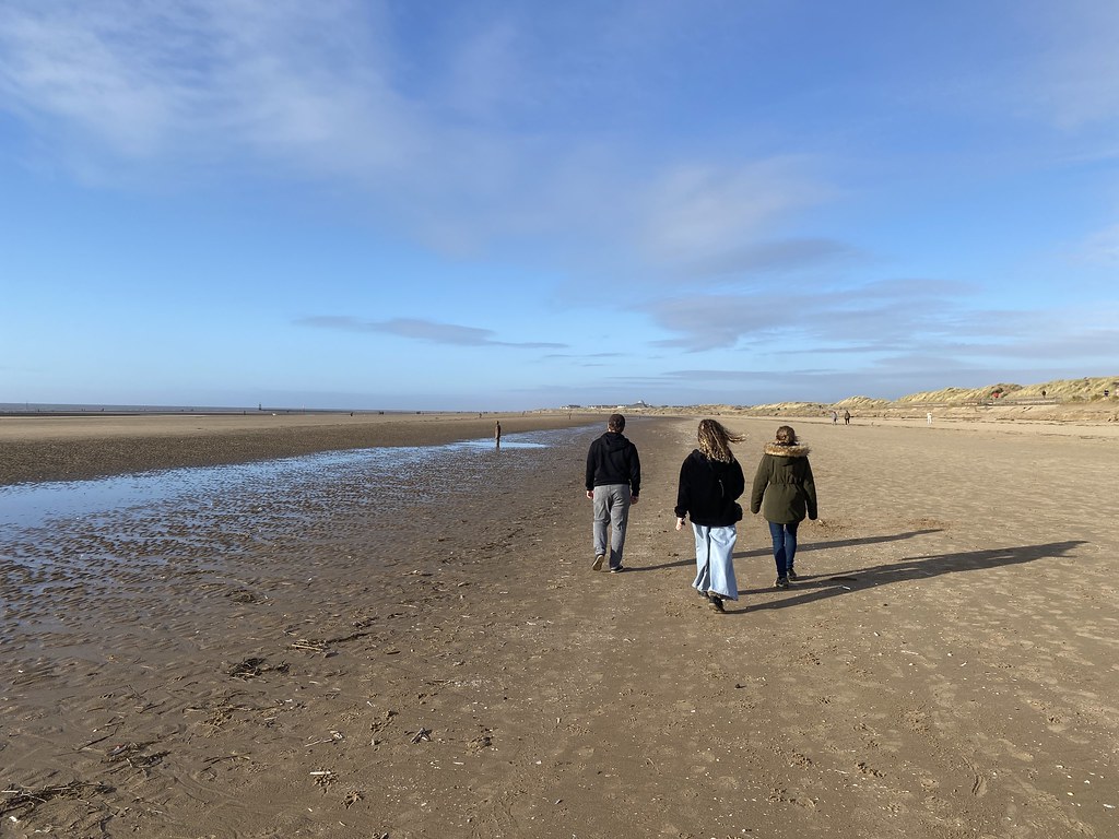
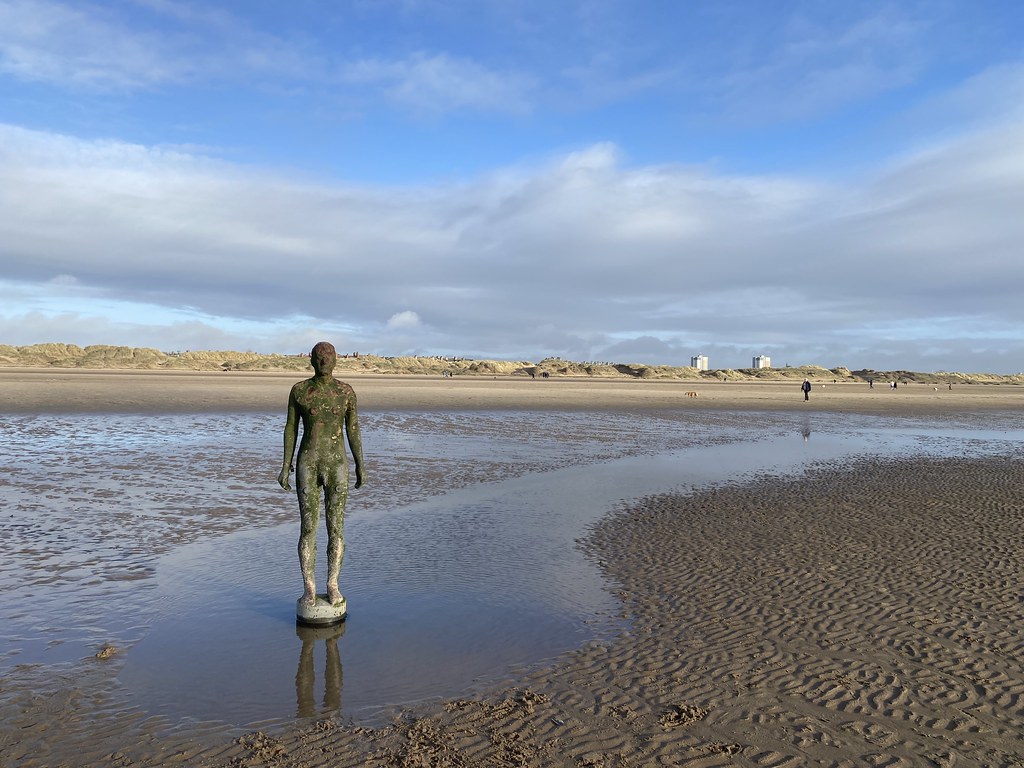
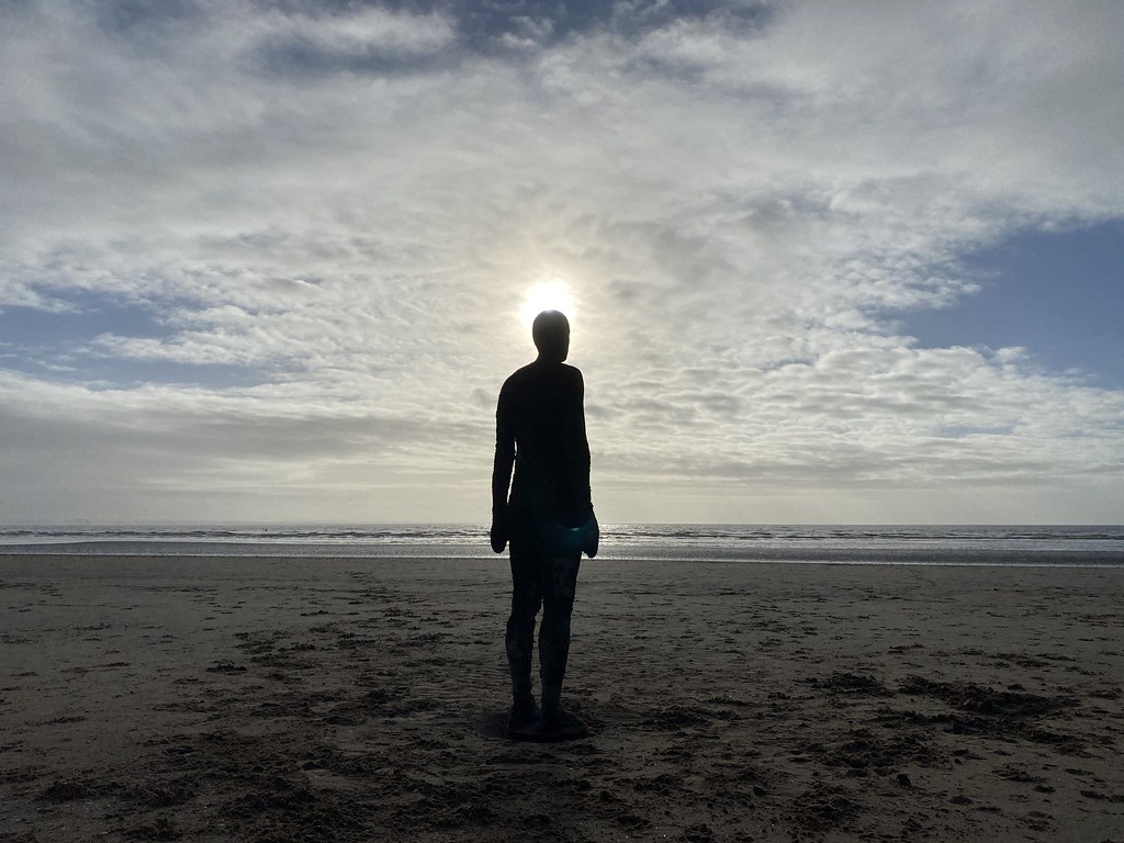
Next day, as part of our routine we headed for a breakfast and walk around Sefton Park before heading back to Crosby for a walk on the beach.
The Prof has landed on his feet with a very nice flat just 10 mins walk from the beach. What I’d give to be able to live this close to a fine walk.
We watched sun start to set with the Antony Gormley “Another Place” sculptures and then headed back home after another great city weekend. Several more trips planned hopefully with some better weather as we’ve only ever visited in autumn and winter.
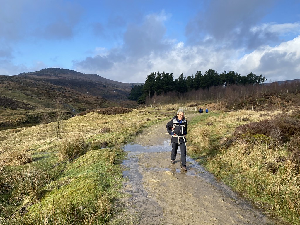
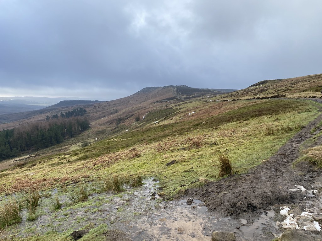
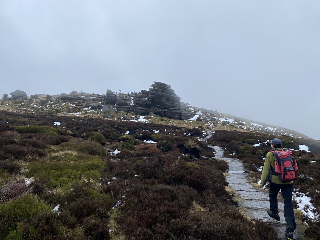
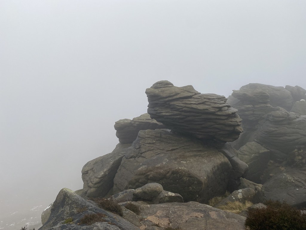
Second day of our little Peak District excursion. Started off as a nice frosty morning but by the time we met with UF for a walk around Burbage Rocks, we were in deep thick clouds.
We walked along Millstone Edge and past Over Owler Tor and saw nothing. We decided to skip Carl Wark as it didn’t seem worth the trouble in swirling fog.
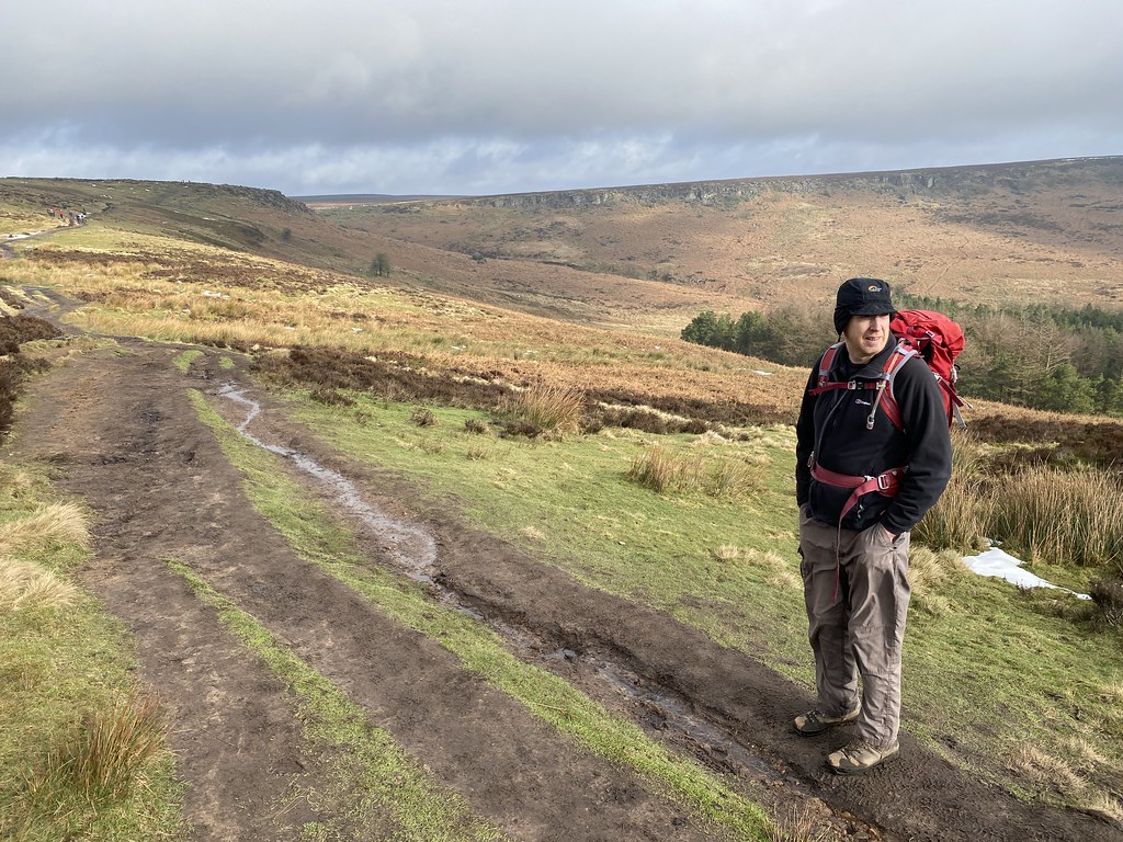
We decided to have an early lunch on Higger Tor. While we brewed up the wind picked up a bit and seemed to clear the fog. We were treated to some views across the broad valley of Burbage Brook and Burbage Rocks.
By the time we set off the weather had improved markedly. There was even some watery sunshine.
Looking back to Higger Tor and Carl Wark.
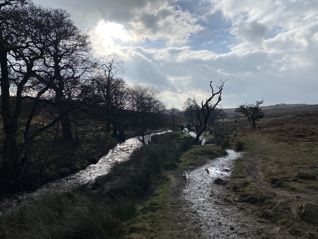
As it was now quite cold and windy we decided to stay low and head down the path alongside Burbage Brook.
None of us had ever walked along by the river so thought it would make a pleasant – and warmer – change.
Heading down the muddy path (all paths are muddy these days) down to the river.
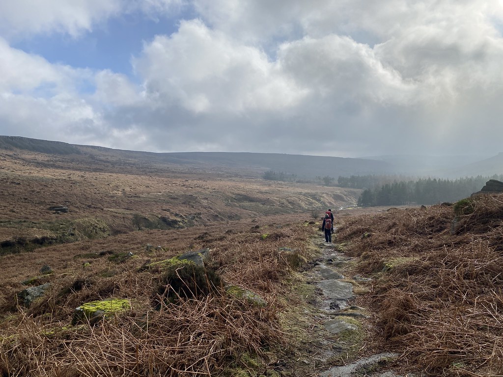
An inspired decision as its really rather lovely down by the river.
Lots of of small cascades and green swathes of turf. Most unlike the Dark Peak.
Its always fun to follow a river, small or large.
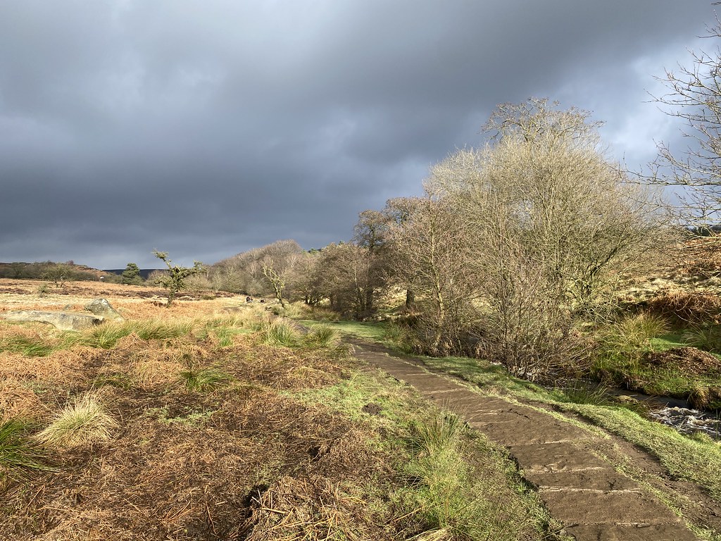
Apart from a few sections of squelching bog and mud – some of which required some delicate moves and hanging from fences to bypass, it was an excellent walk.
Th weather continued to improve as we walked. Some very decent views back to Higger Tor.
The lower part of the valley towards Burbage Bridge
A lovely little bridge near the main track.
Carl Wark and Higger Tor (and blue sky!)
From an extremely gloomy start it had turned into a really fine afternoon.
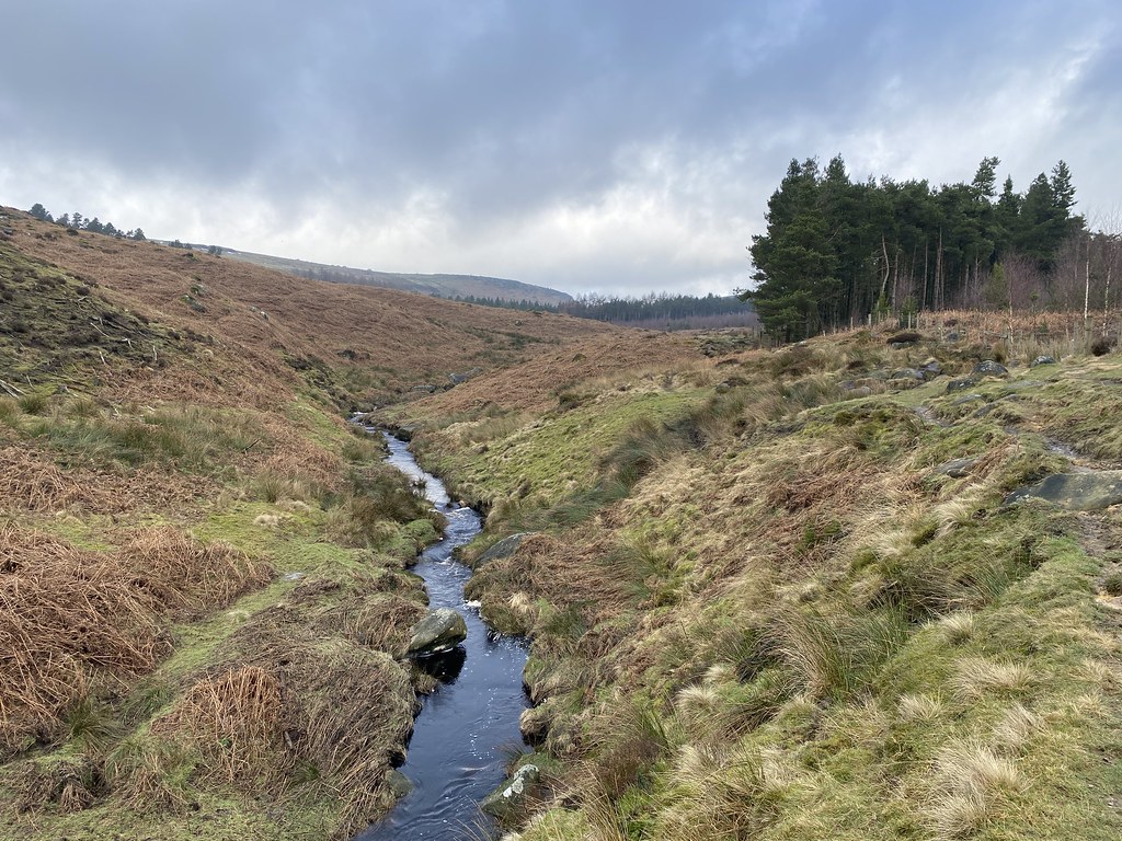
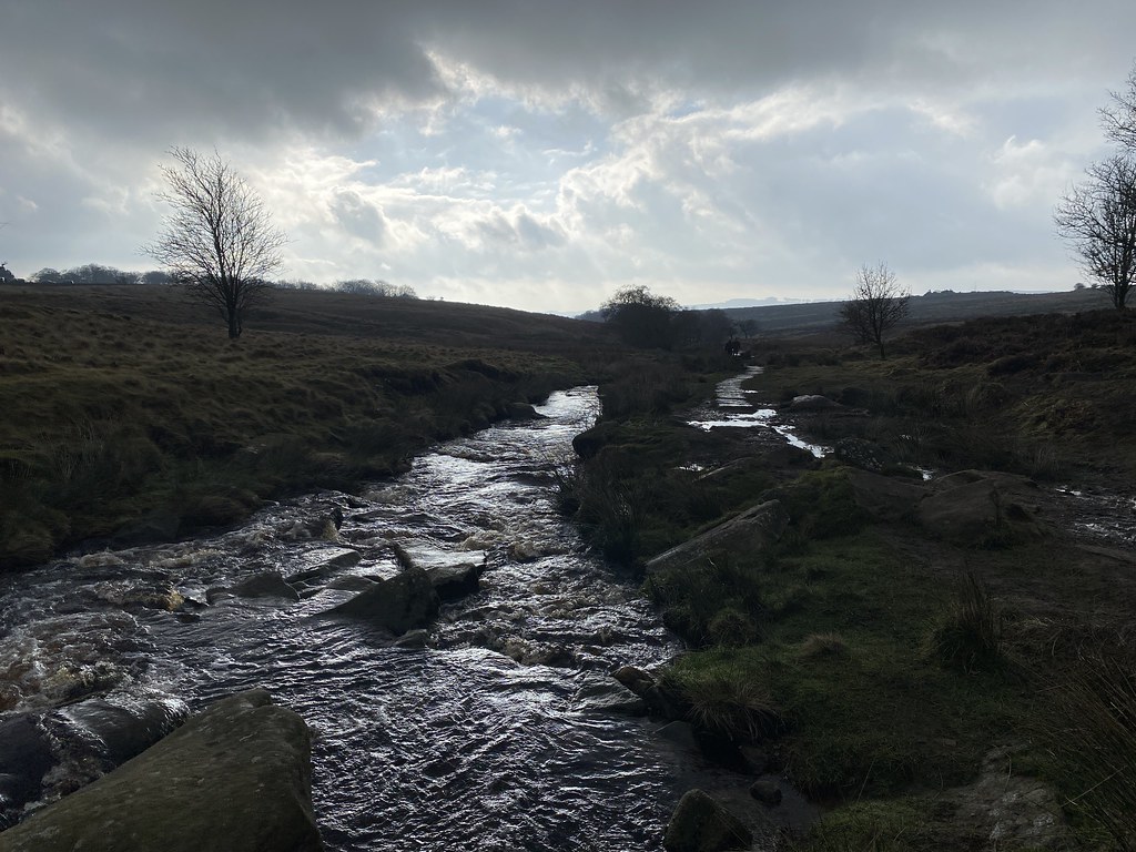
We crossed the main road and followed the Burbage Brook back towards the van.
Some lovely winter shots dark clouds and low angled sunlight.
As ever, dodging the slimy mud was the biggest challenge.
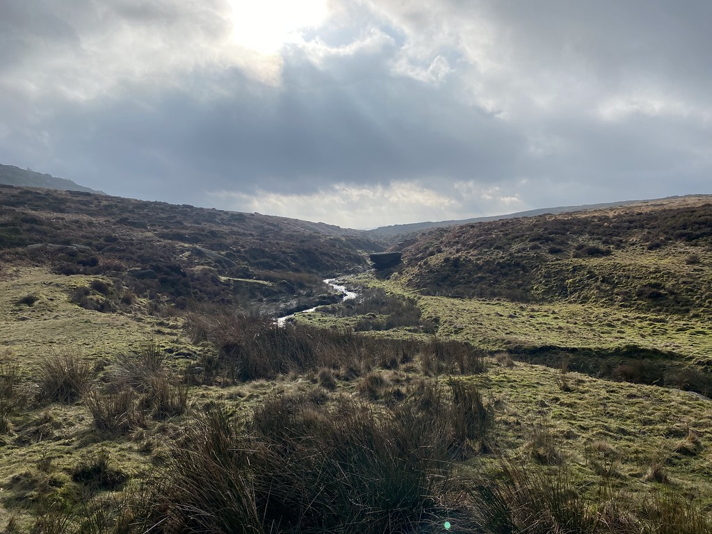
I used to love walking this stretch when we lived in Derbyshire many years ago. The path runs right next to the river through a delightful meadow studded with trees.
We reached the van and decided on brew and cake before the long journey home.
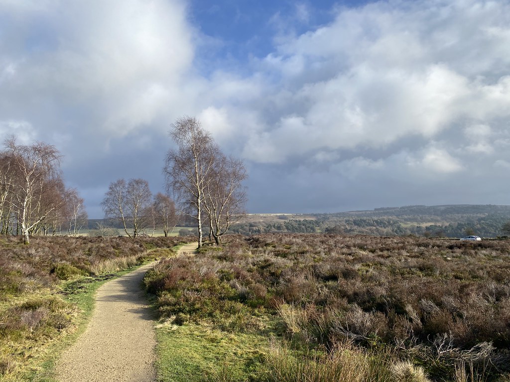
We even had time for a quick wander back out to Millstone Edge – this time we had the view!
Another fine weekend away in the Peak District – really enjoying re-acquainting myself with the area over the past couple of years.
After all that blue sky, sunshine and snow in the Alps, we had a burst of winter in the UK. Not what I had in mind though. I was up in Yorkshire for a van service and we’d decided to stay over for the weekend in the Peak District. While waiting for the Service it started snowing quite heavily. It didn’t look too bad so I set off for the drive from Barnsley to Castleton. A distance of 27 miles that should have taken less than an hour took me over 3 hours and many more miles trying to avoid the highest roads and some awful traffic. We really don’t cope with snow in the UK at all!
I had a calm down evening in the van and a day working in the van. TBF joined me and we had a nice meal out in one of Castleton’s many fine pubs. We’d arranged to meet some friends for a walk on the Saturday. Everything was plastered white on Thursday into Friday but by the time we set off for a walk it had pretty much all melted.
We had a walk planned along the Pennine Way, up to Jacobs Ladder and back along the southern edges of Kinder.
The forecast was for it to brighten a little as the day went on and there were signs of promise on an albeit grey and damp day.
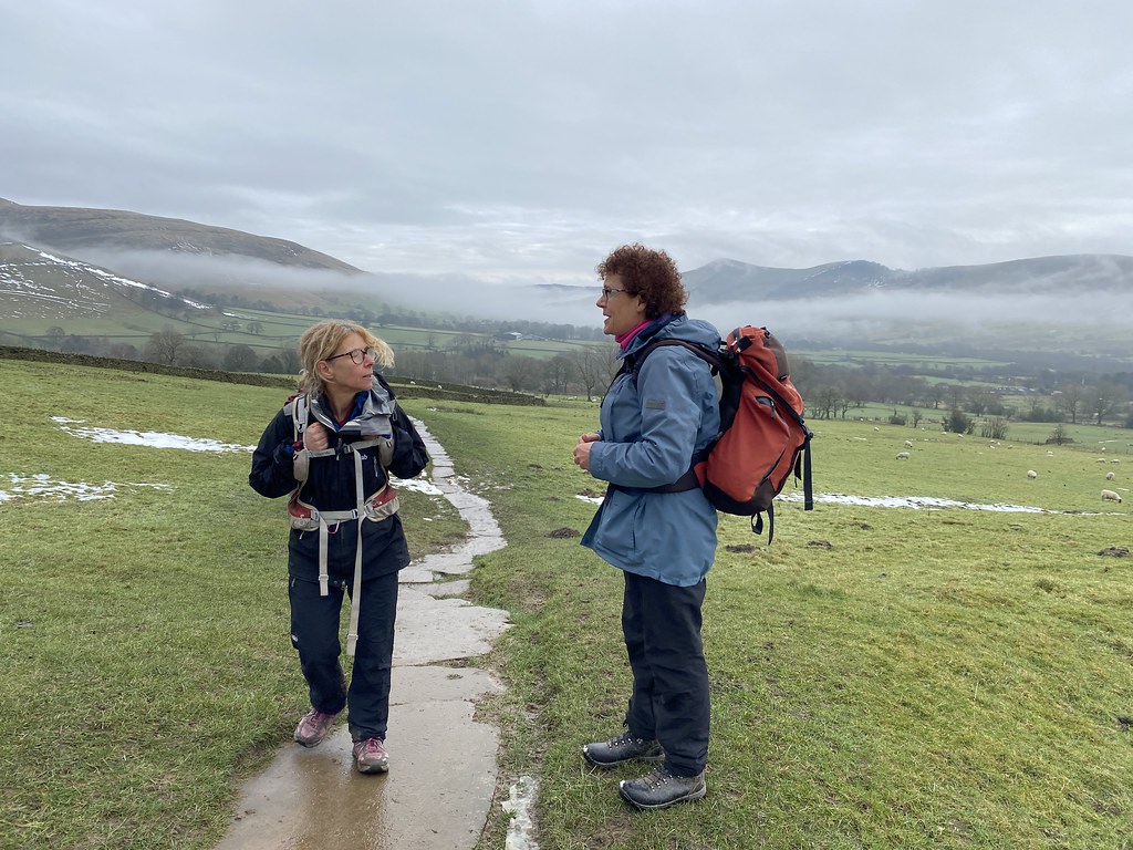
When you’re meeting friends you don’t see all that often, the weather doesn’t matter so much. Its great just to walk and have a natter.
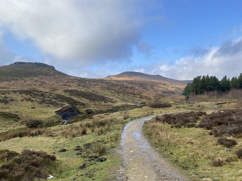
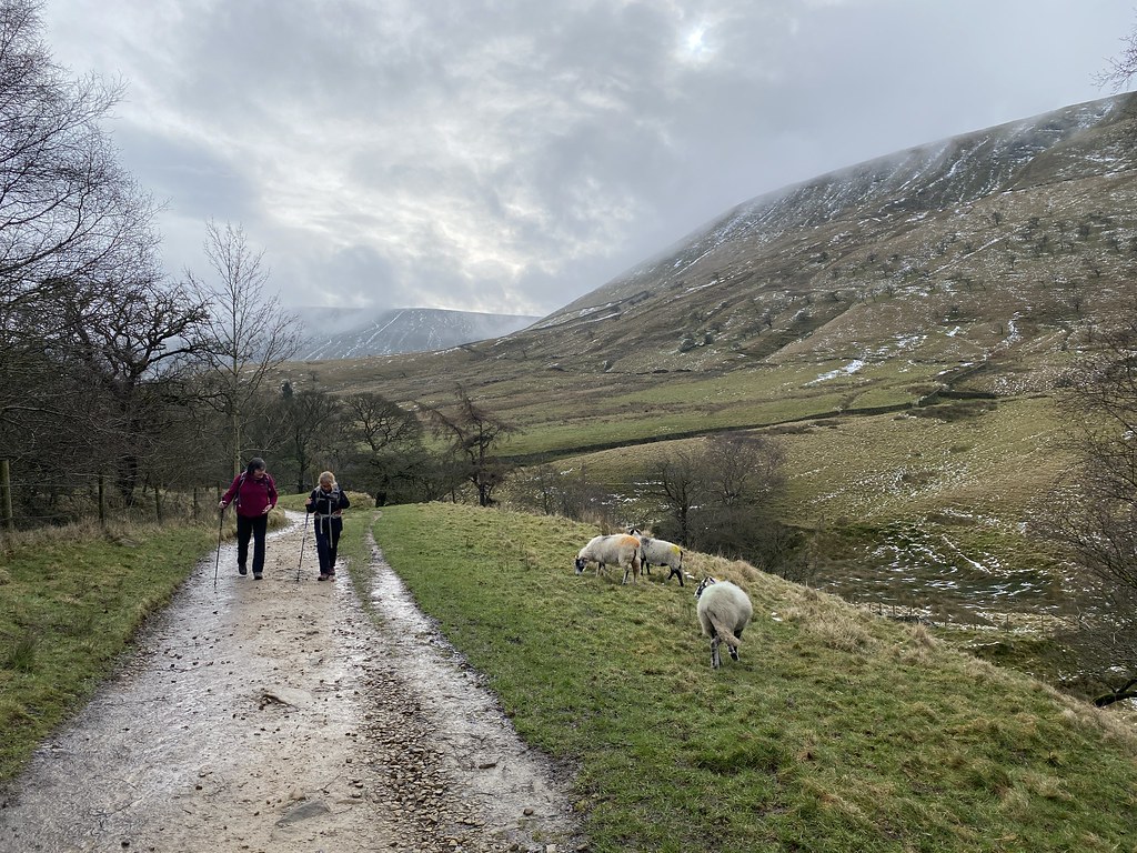
On the path from Upper Booth.
Approaching Jacobs Ladder.
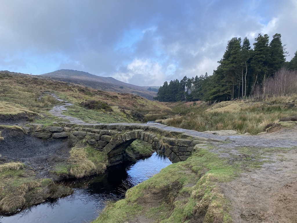
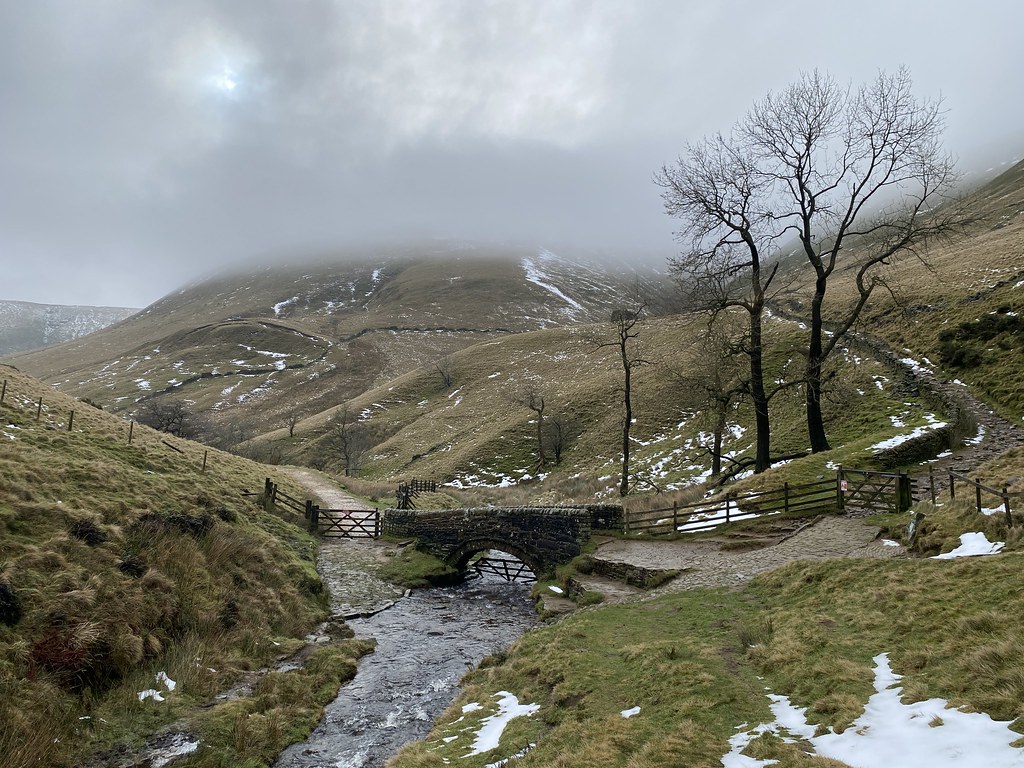
The small bridge at the bottom of Jacobs Ladder is a lovely spot even on a grey winters day.
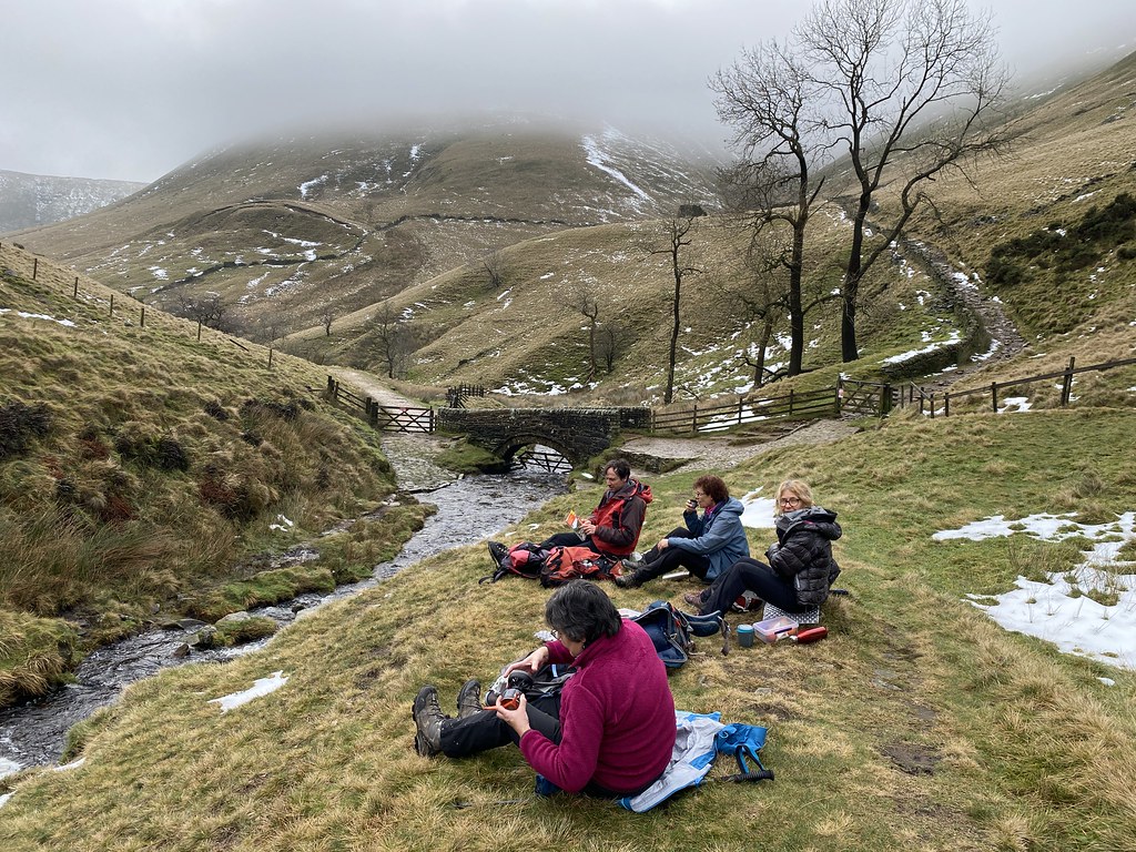
Top place for a lunch stop.
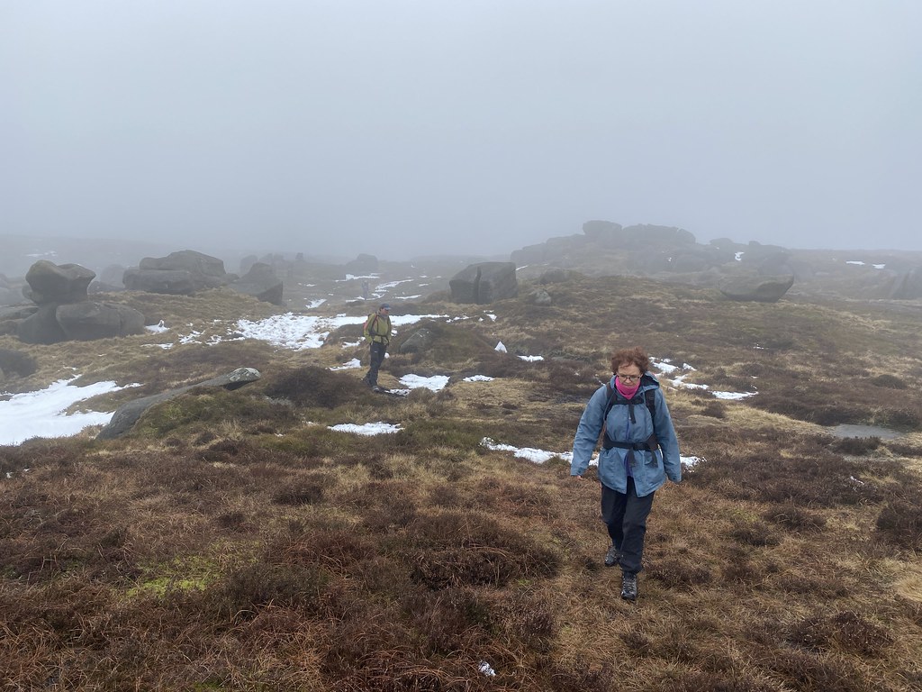
TBF and J wanted to take a lower level route back so me, EWO and TYG carried on up to the plateau. Here approaching Edale Rocks.
The earlier promise of better weather was ill-forecasted and we spent most of the rest of the day in the cloud with regular showers of cold rain.
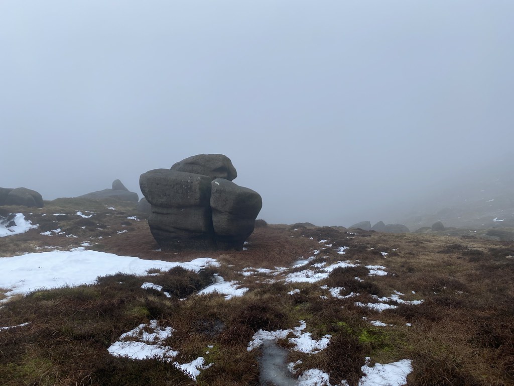
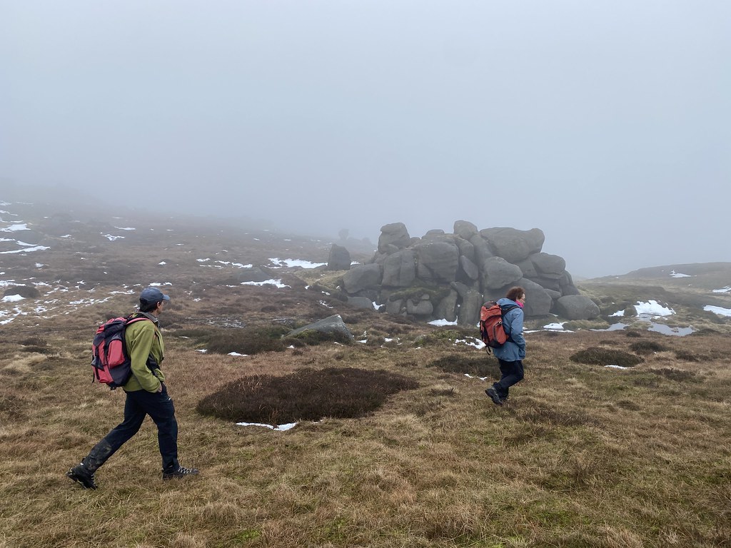
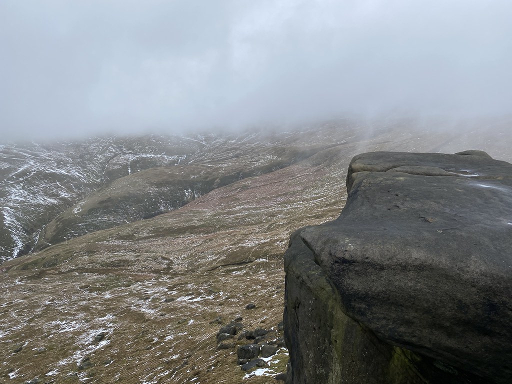
The many boulders and rocky outcrops maintained the interest though.
The look quite atmospheric in the swirling clouds.
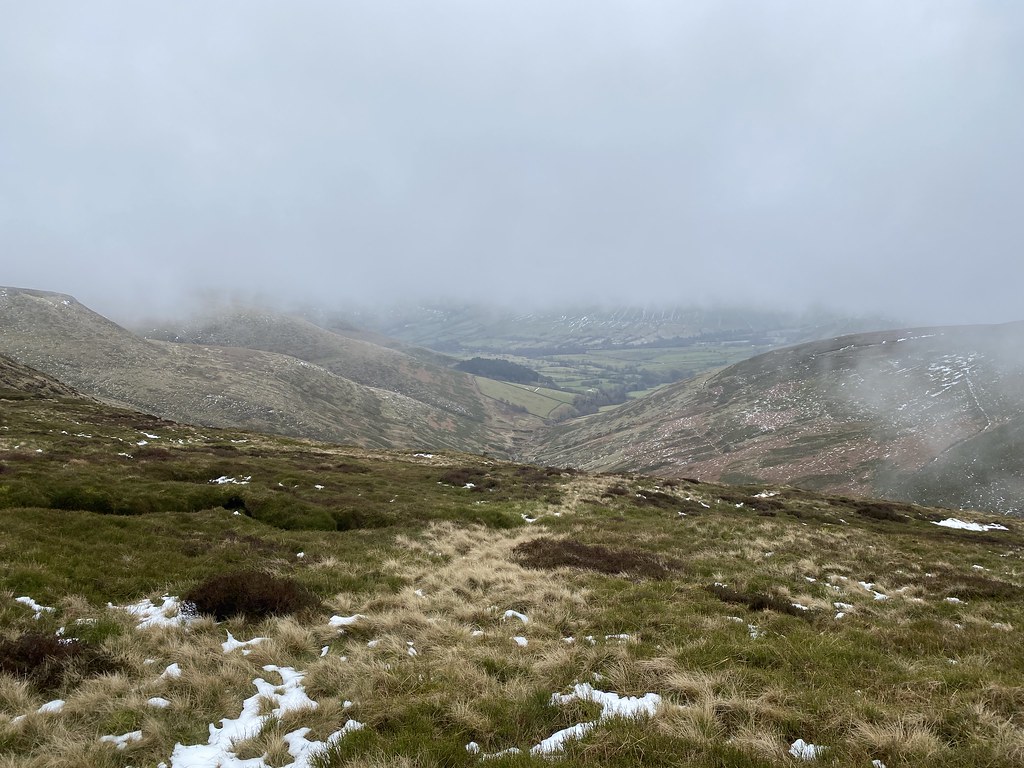
And we did have a few fleeting views of the Edale valley below.
I’d forgotten just how much rock there is up here and how impressive they are.
Its been over 20 years since I’ve walked up here so I was a little disappointed the weather wasn’t better.
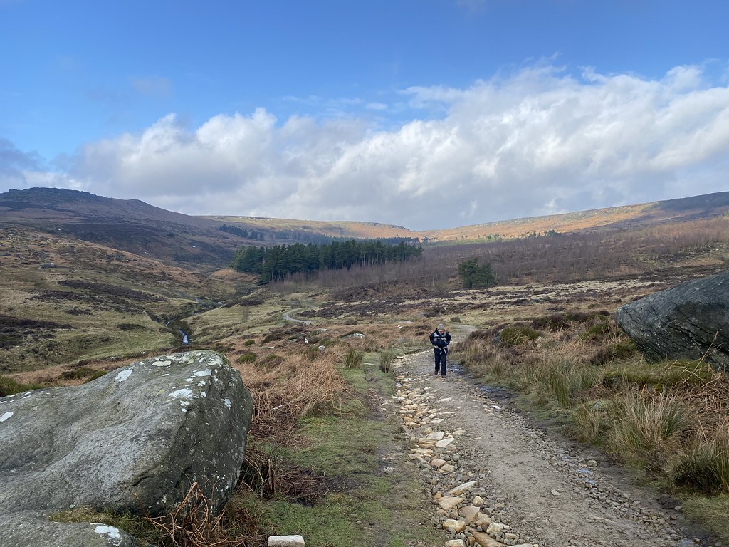
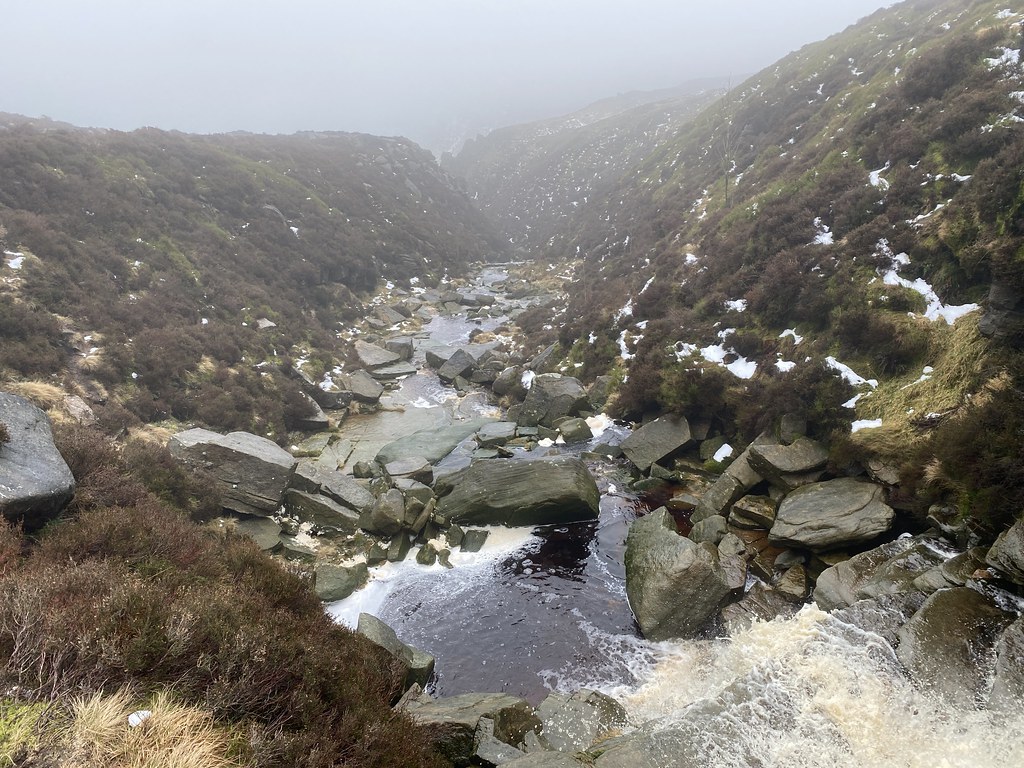
Grindsbrook Clough is always impressive though.
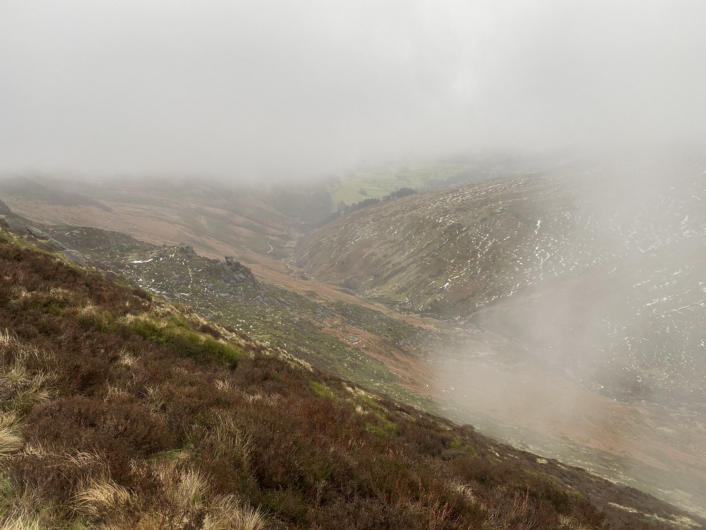
We had thought of pushing on round to Ringing Roger but another bout of rain and a pressing engagement with the curry house in Hathersage forced our hand.
We descended Golden Clough. If you are thinking of using this as a quick and easy route down to Edale village then my advice is – don’t. Its steep, muddy, overgrown and the path on the map barely exists.
Still a great day out, nice to meet up with friends and finsihed off in style with a superb curry.
Let me put some blue sky and snow into your life in the middle of the endless wet spell that is the UKs weather at the moment.
My annual ski trip to the Three Valley’s in the French Alps.
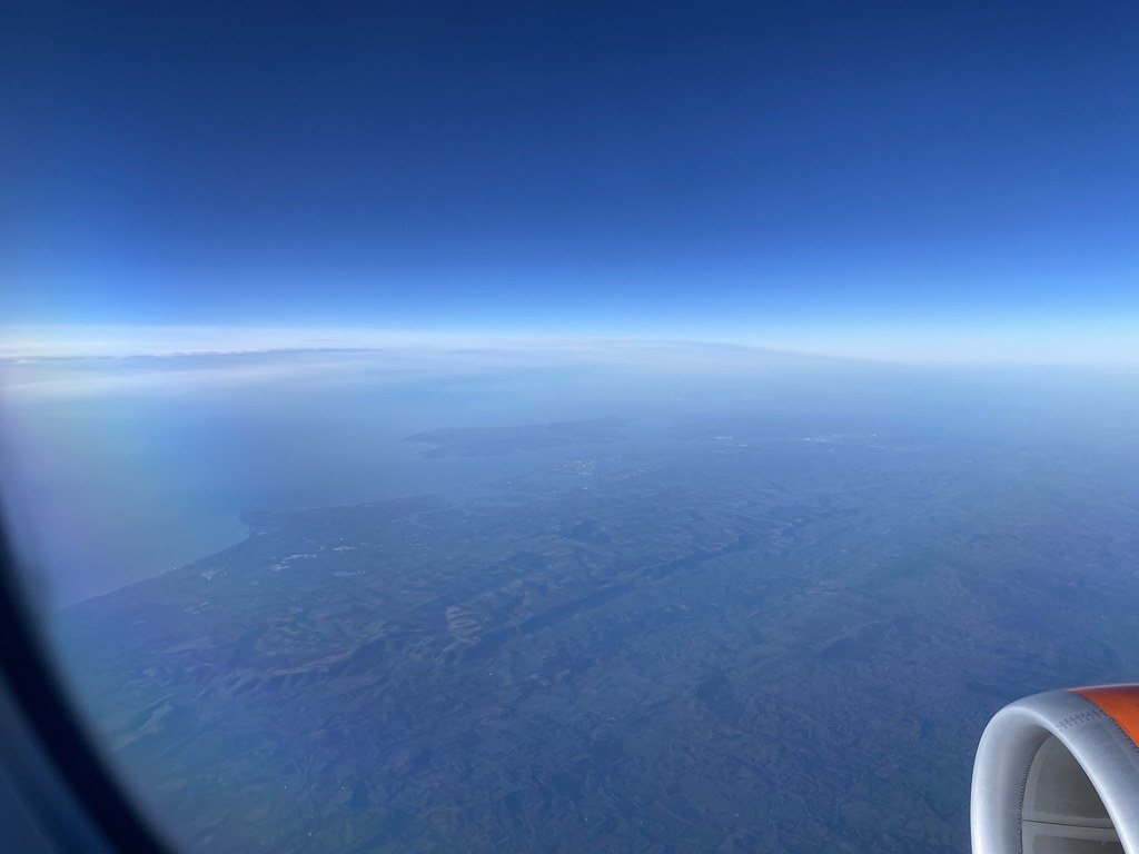
Off to a good start with nice clear views over the UK from the flight to Geneva, here looking over Birmingham.
South Coast of England and the Isle of Wight.
Lake Geneva and the Jura. I don’t think I’ve ever landed at Geneva from this direction before. Luckily our pilot didn’t make the same mistake as en Easyjet pilot a few weeks earlier when he had to abort his landing after being told by Air Traffic Control that he was far too low and close to the water!
I like this shot as I managed to get the shadow of the plane on the ground below.
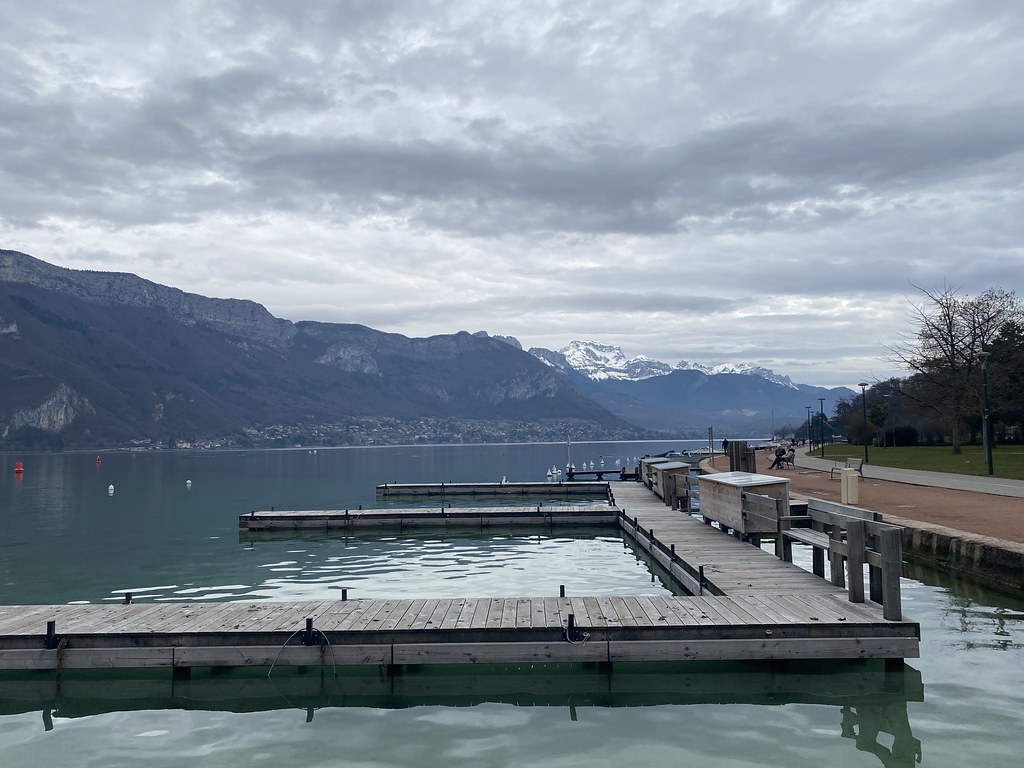
Our now regular stop off in Annecy for lunch.
Warm enough to dispense with a jacket and it rained for most of the drive to the resort and was still raining at 1800m when we arrived, never a good thing in a ski resort as it turns the snow to wet mush which then freezes bone hard overnight.
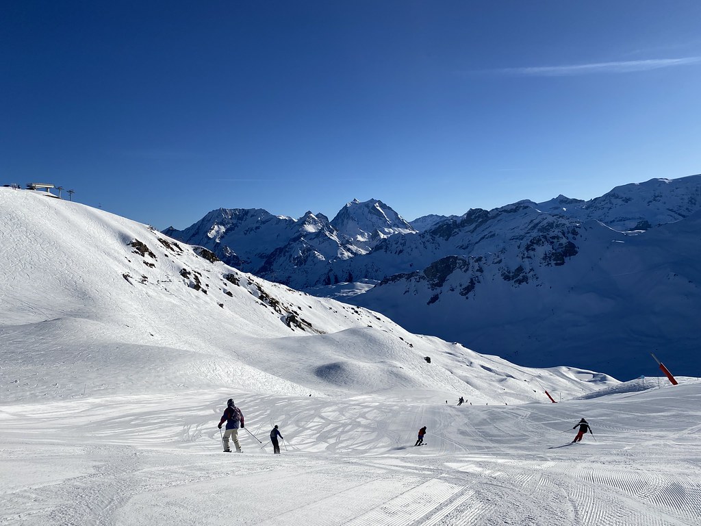
First ski day was beautiful though.
Snow low down was icy as hell but up top it was still in good shape. This was top of our favourite long run down to St Martin de Belleville.
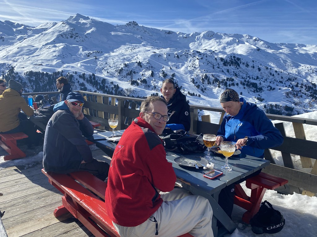
Eating is of equal importance to skiing on these trips. The slightly warmer weather, while not great for snow conditions does mean you can eat outside in the sunshine.
Sun sets on our first day.
Mont Blanc towering over the rest of the Alps.
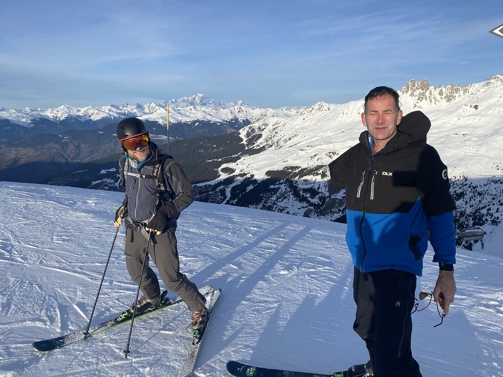
Like last year it was a week with nothing in the way of fresh snow but plenty of sunshine by way of compensation.
As the years go by I find skiing in fresh powder tougher on the legs so I don’t miss it all that much. Just being out in the sunshine and clear air is more than enough for me.
Another of our favourite lunch stops with a fine sunny terrace overlooking the slopes.
THO and MM at the end of another day’s skiing.
One of my favourite end of day views as the sun casts shadows on the mountains.
We had a couple of gorgeous mornings with pink skies.
These are taken from the apartment balcony.
A new find for lunch – a fantastic burger place on the slopes with another sunny terrace.
Evening sunset.
Taken from a walk up the hill to do some shopping.
I say shopping but it was a lame excuse to head to our much frequented little local bar for a couple of early evening beers.
The Minchin brothers.
The view from the top of the slopes before we head down to the apartment at the end of the day
And yet another food consumption photo!
The slopes of Val Thorens, one of Europes highest ski resorts.
MM, THO and the Aiguille du Peclet.
THO and Mont Vallon.
More eating!
After which we did actually do a little skiing!
On our last day we stopped off at the top to admire the views before the final run down. As the lifts stop running and everyone heads home its a beautiful and peaceful spot. We stayed for half an hour and would have stayed longer but the lift attendants make you ski down before it gets dark for safety reasons.
It was a great way to finish the trip and the first time we’ve ever done it. I think we’ll be doing this more often in future.
A nice, clear sunny day for our flight home. A view of the CERN complex especially for the Prof.
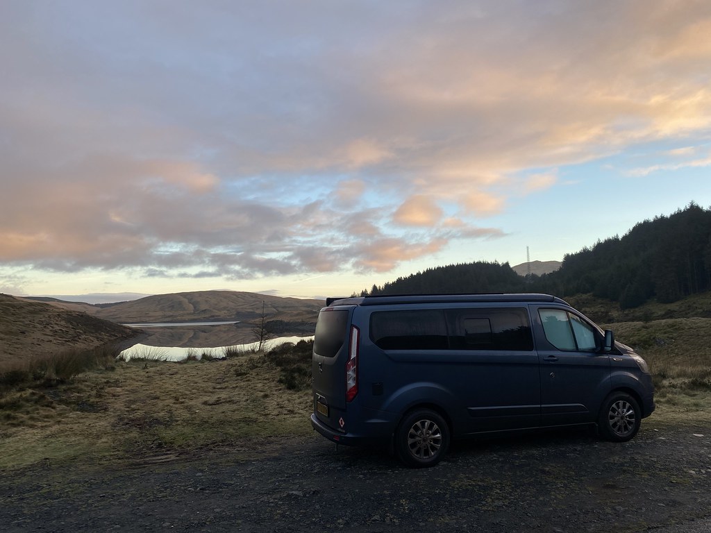
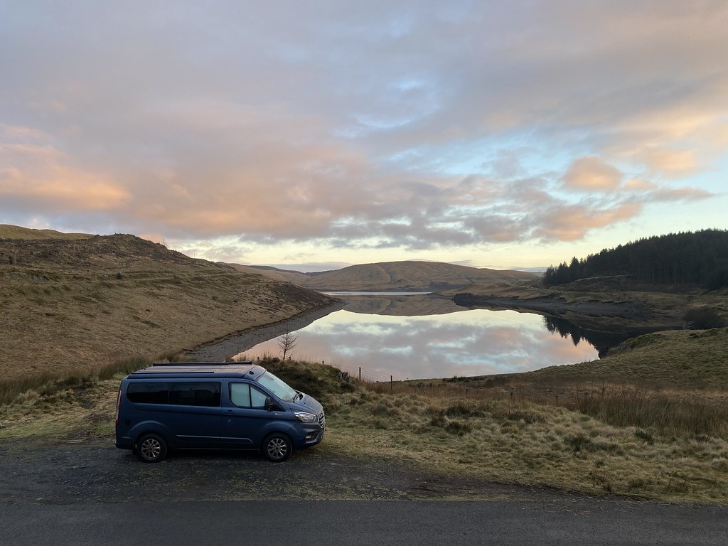
Back to the endless grey skies of the UK winter and a chance for an overnight in the van.
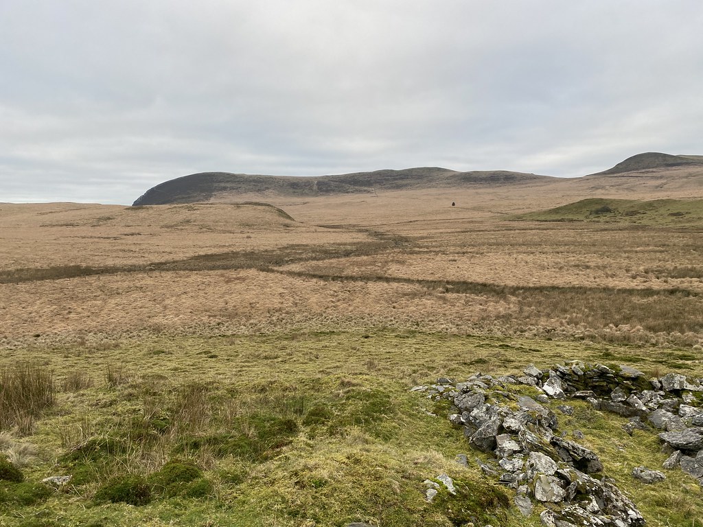
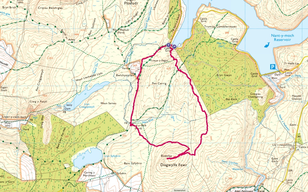
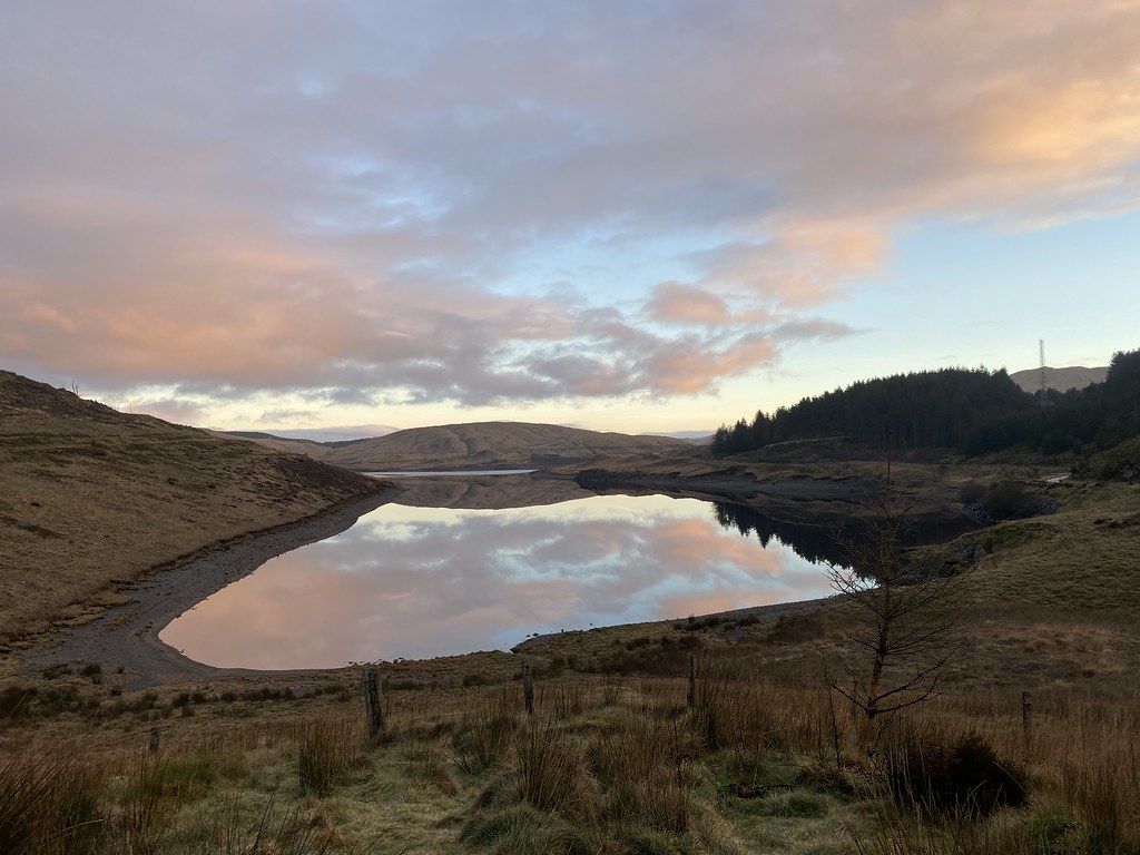
Back out to the wilds of mid-Wales and the hills around the Nant-y-Moch reservoir.
We parked up in decent spot with a view across the lake, had a spot of lunch and then headed out for awander.
Last time we walked around here we were in the cloud the entire time so it was nice to see it it in all its austere glory.
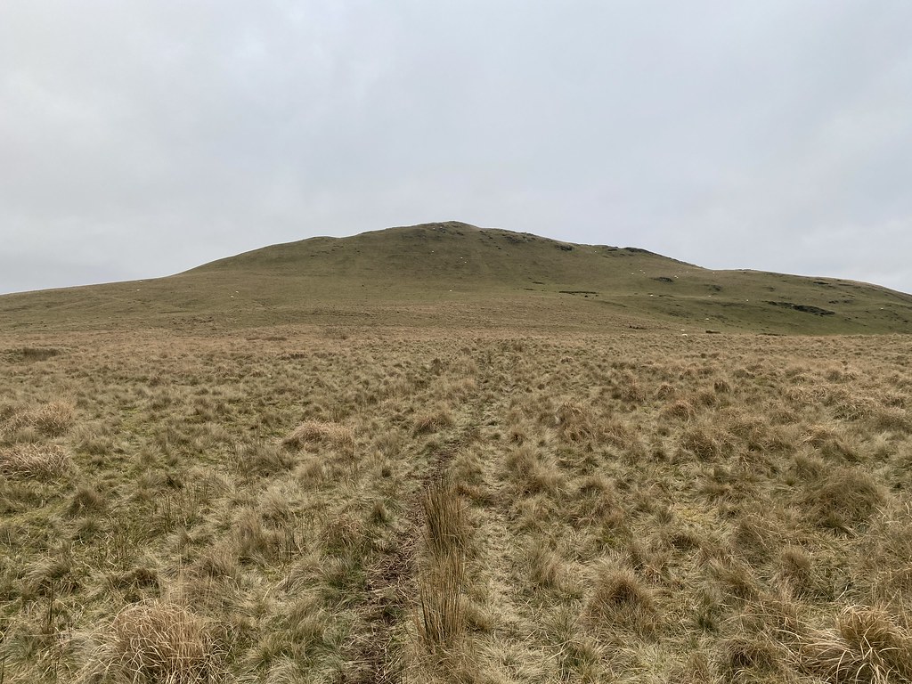
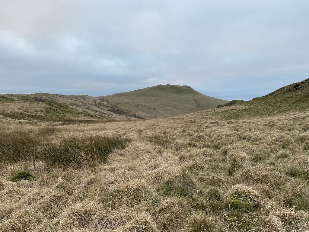
Our objective (well, primarily mine actually) was this small hill, Disgwylfa Fawr, a Marilyn missing from my collection.
Once we left the main track I’d feared we were in for a serious bout of tussock and bog bashing, in fact we found a decent sheep track on to the flanks of the hills and very little sogginess.
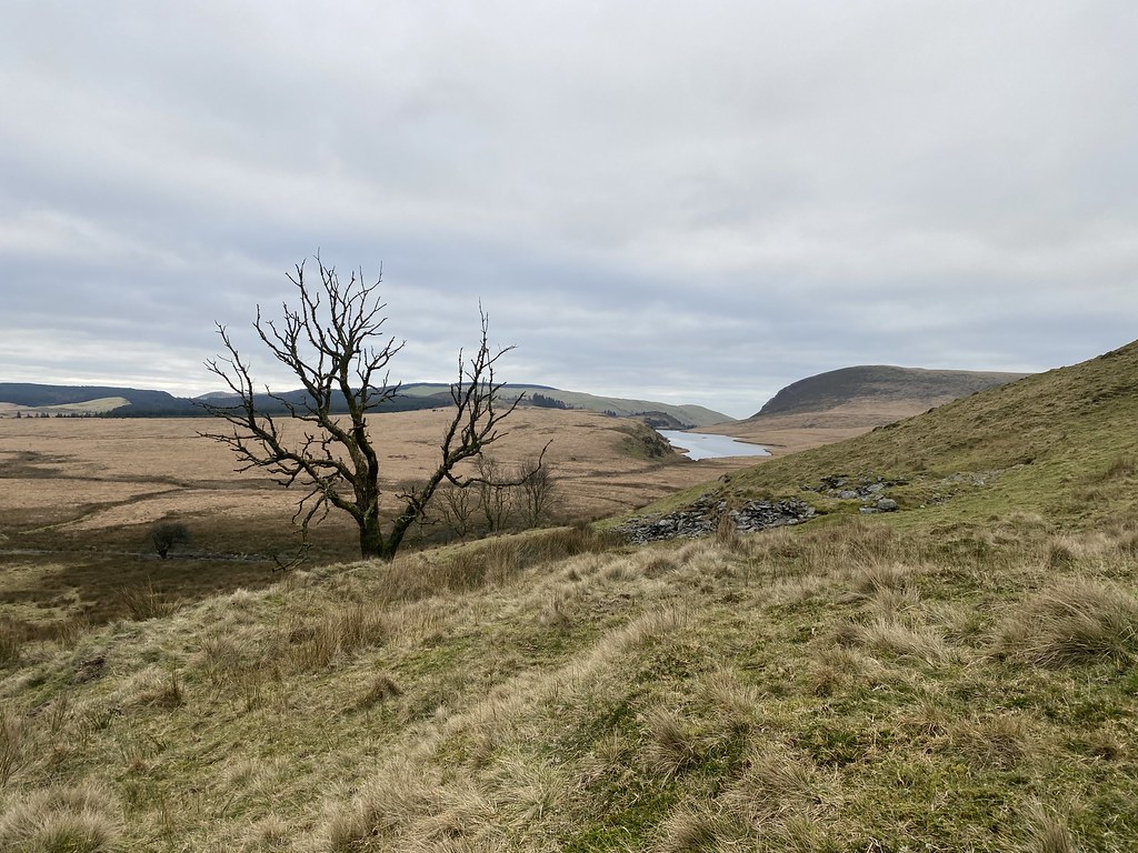
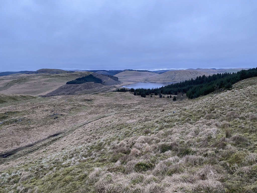
Views over the collection of small lakes towards the coast from the top.
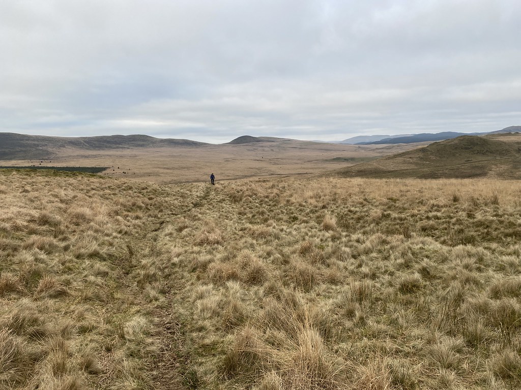
We took a more off piste route back to the van. Something of a gamble in these parts especially with fading light.
With some judicious use of small ridges we avoided most of the tussocks and again it seemed mostly dry.
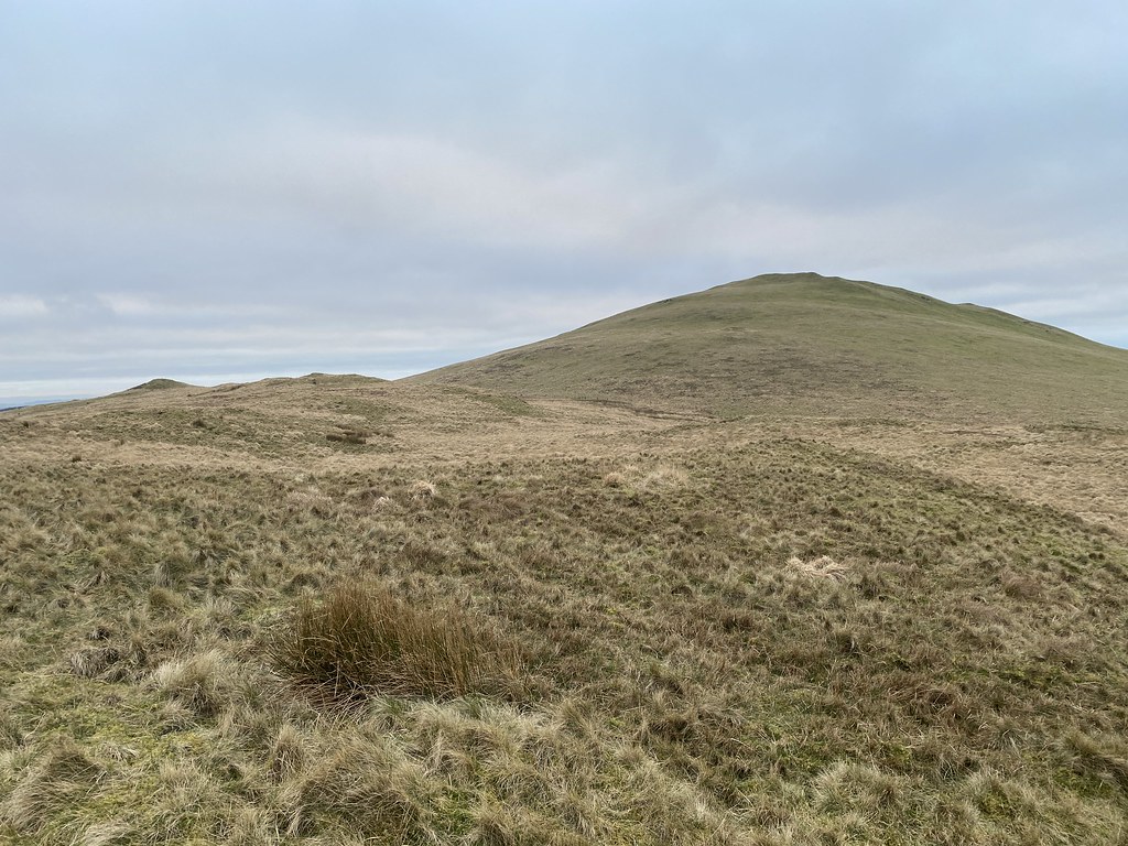
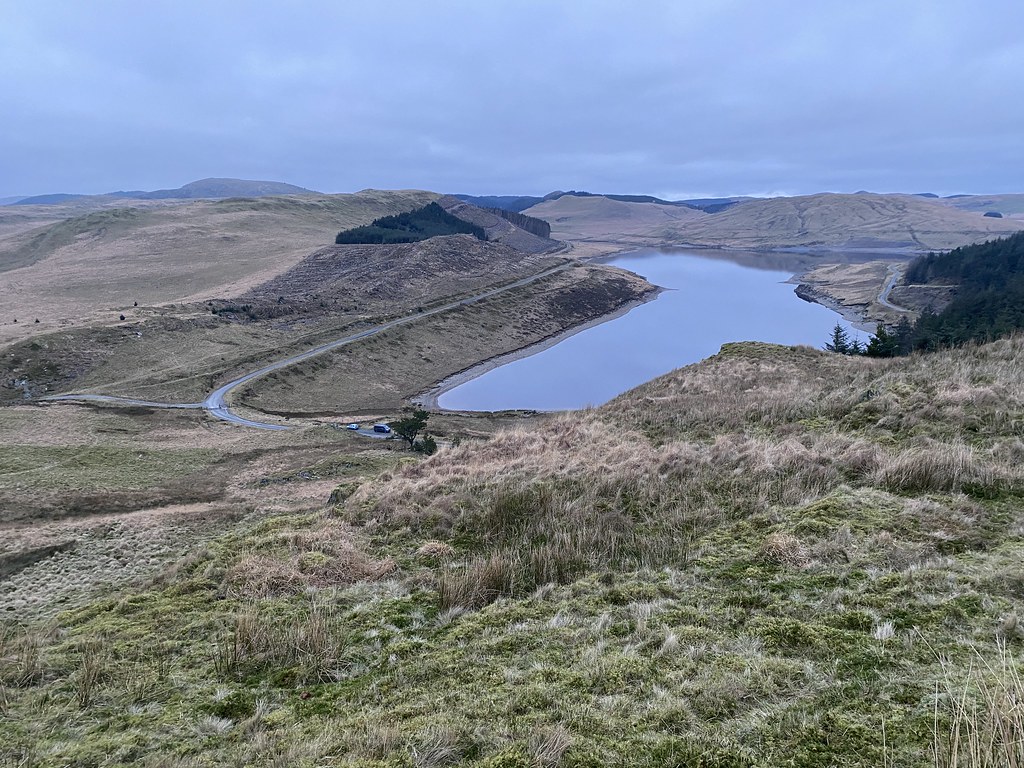
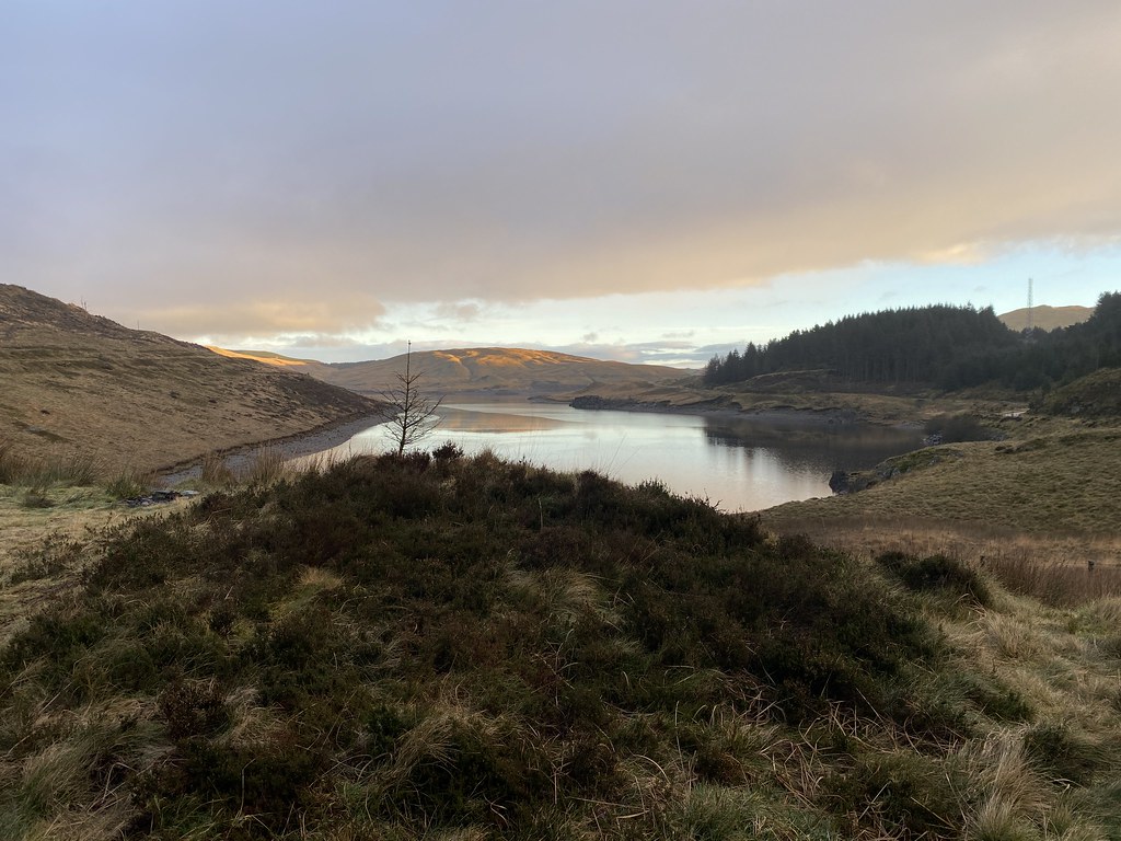
Looking back to Disgwylfa Fawr.
Nant y Moch reservoir.
And the final stretch down to the van parked up below.
A nice little stroll over some little walked terrain but I quite like it round these parts.
We settled in for a pleasant evening, a nice meal and a couple of beers for me.
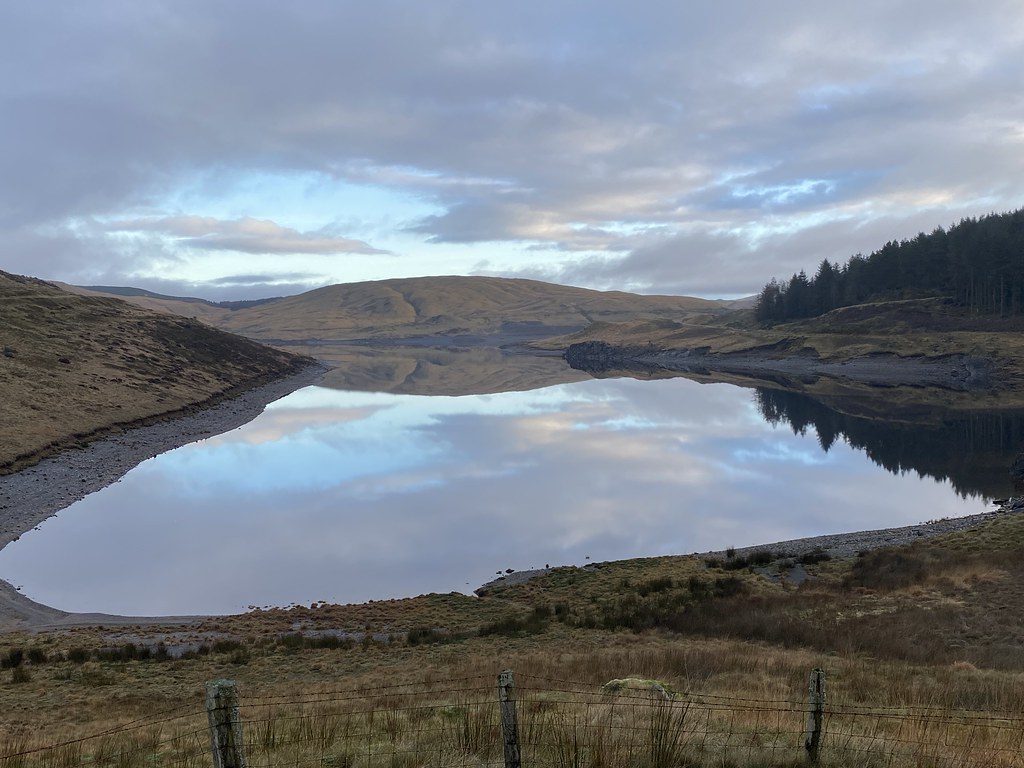
Next morning was glorious when we awoke with a light frost.
Beautiful early morning pink skies and a mirror calm lake with reflections.
Its a lovely spot by the reservoir and we were enjoying our good fortune for such a splendid morning.
Until within a few minutes of these images it started raining and stayed wet for a good part of the rest of the day.
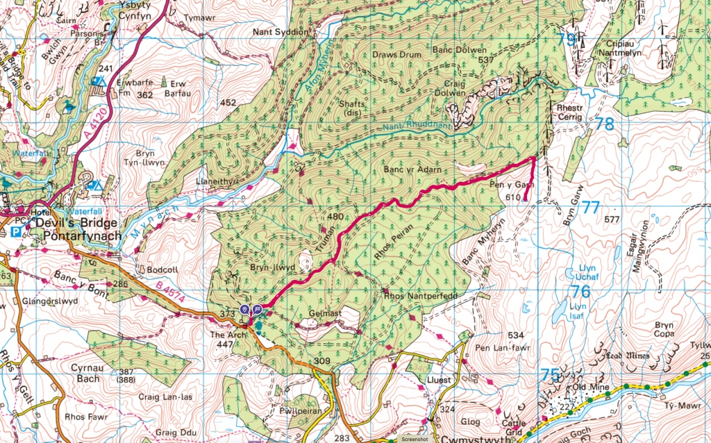
Still keen for a bit of walk we drove over to a car park at The Arch near Devils Bridge.
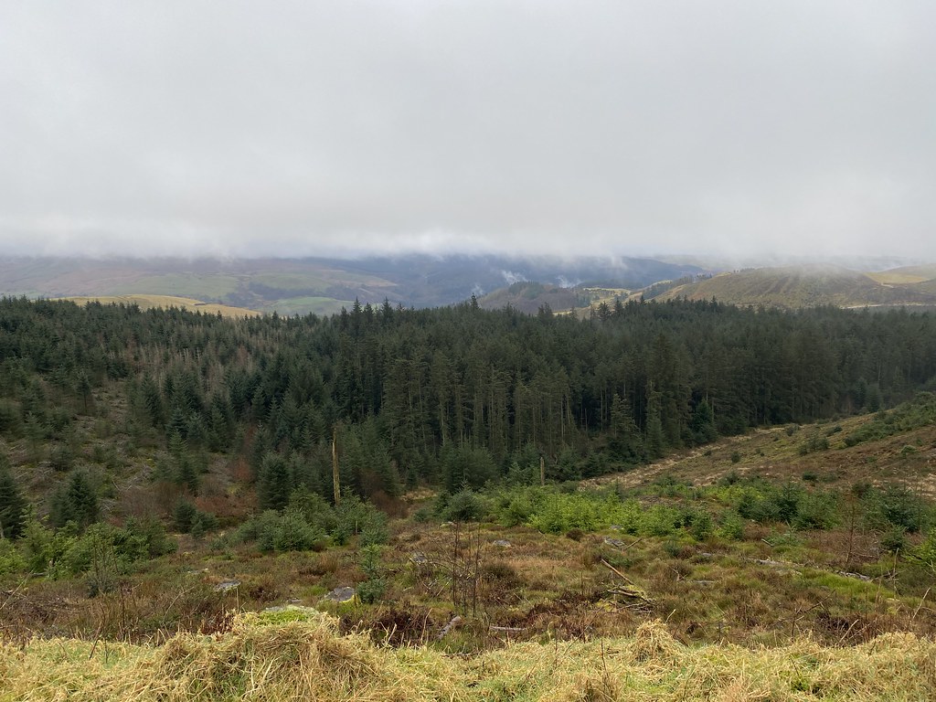
It was actually a pretty miserable and dreary trudge, out and back on a seemingly endless forest track. Just the occasional view over the steep valleys below the forest.
These wind turbines loomed out of the mist with their eerie sound as they turn.
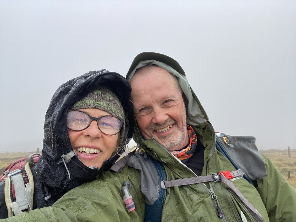
And we eventually reached our/my goal of another un-ticked Marilyn and Nuttall, Pen y Garn, in a sleet shower. Its the highest point in this part of Wales but on a day like this a grim achievement.
We headed back to the van and unsurprisingly the rain stopped and the sun came out weakly.
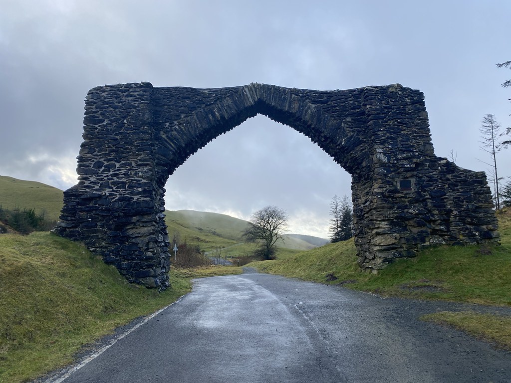
The Arch after which the car park is named. You used to drive through it when I was a kid. A somewhat grey and damp weekend but fun nonetheless.
A an extra bonus addition to the post for you.
From a few weeks later some photos from a local stroll up Garway Hill.
Sun setting over a hill, it has a name with not enough vowels which I can’t be bothered to type!
Not as warm as the summer visits where we watch the sunset with a beer.
I’d forgotten about these photos and the walk until Im opened the Flickr album to write the post.
I mentioned in my last post that on our last day we were heading to other side of the city, metaphorically and literally speaking. Metaphorically as we were heading from the old town to the more contemporary beach area and literally as the beach is on the opposite side of the narrow peninsula the city is built on.
When we visited the city for the day on our last trip everything was a bit rushed especially as the beach and the old town are a few km apart and require a bus trip to travel between them. This time we had an opportunity to enjoy both the old town and beach area at leisure.
Our last day was Epiphany which is the major Spanish Christmas Holiday celebrating the arrival of the three wise men and the exchanging of gifts. We heard the excited screams of the young children in the flat across from ours, clearly opening presents and I saw one of the parades of cars with people dressed up as the three wise men when checking out the bus times.
I was a bit worried that everything might be closed up for the holiday but while conventional shops are shut, everyone else goes out for the day (much easier in sunnier climes than a dank December day in the UK) so all the restaurants and bars were open (and busy) and the buses ran as normal.
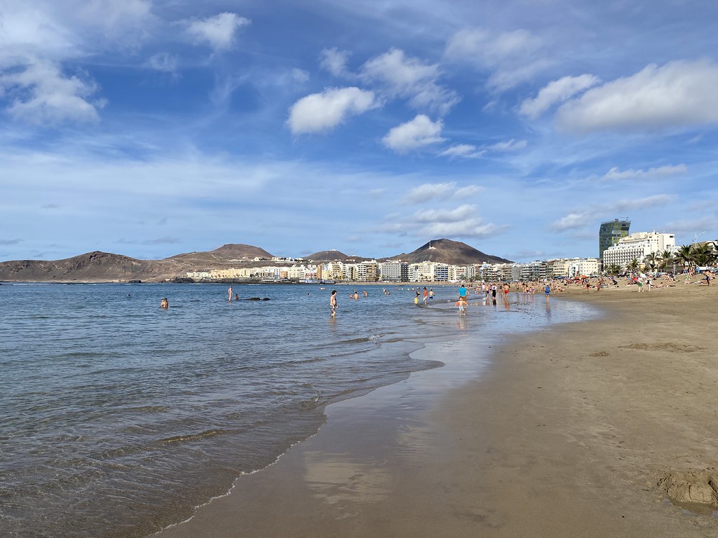
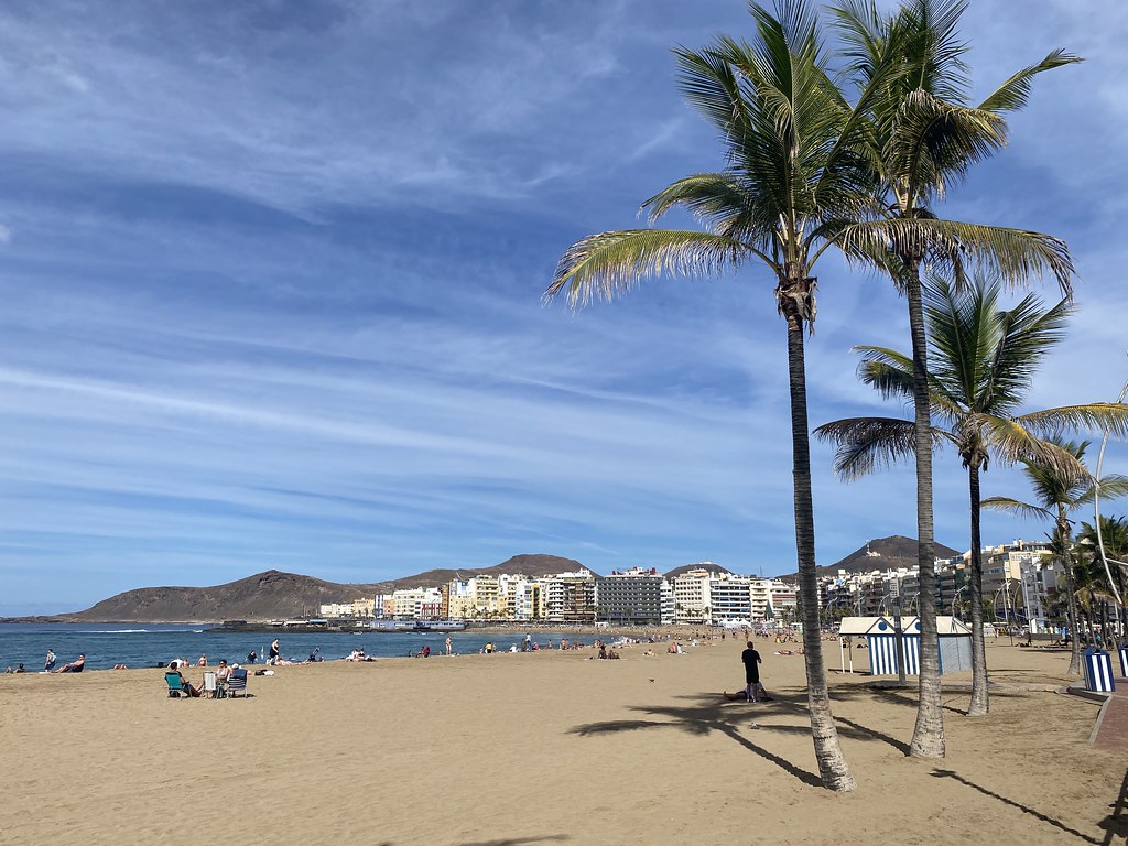
We had a nice leisurely morning stroll along the promenade to the north.
The weather seemed to improving slowly, excellent views along the coast towards Galdar and Tenerife in. the distance.
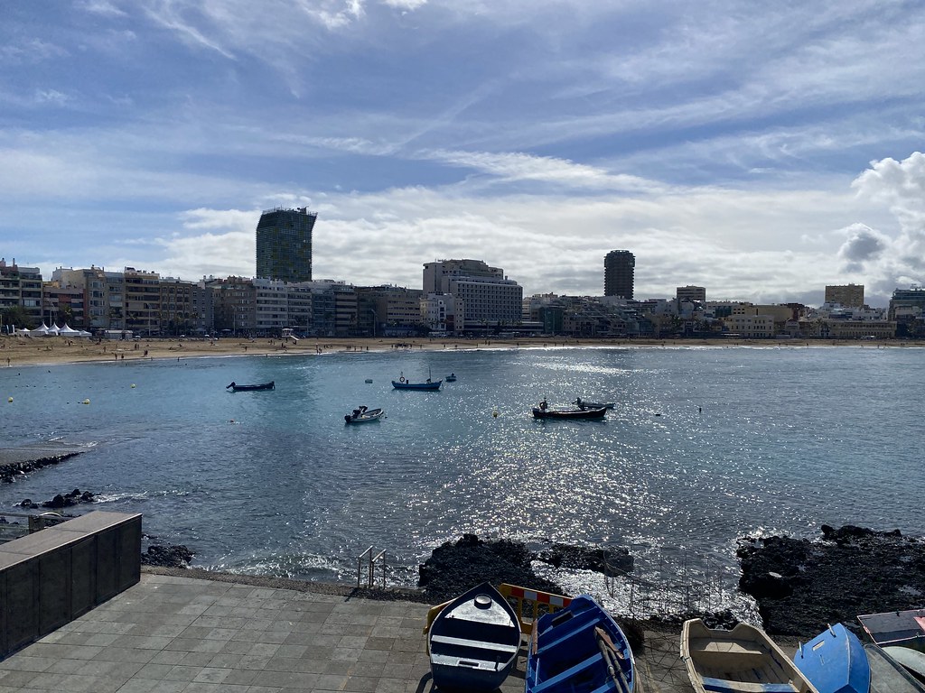
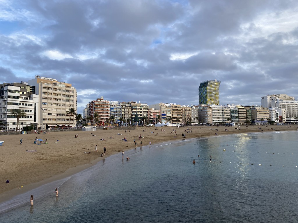
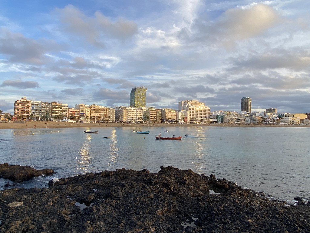
Looking back to the main beachfront.
Time for lunch. Hard choice among the many restaurants on the seafront, but we picked a superb little Tapas bar with friendly staff for our final lunch of the holiday. Clinking glasses with a teapot is not something I’ve done before!
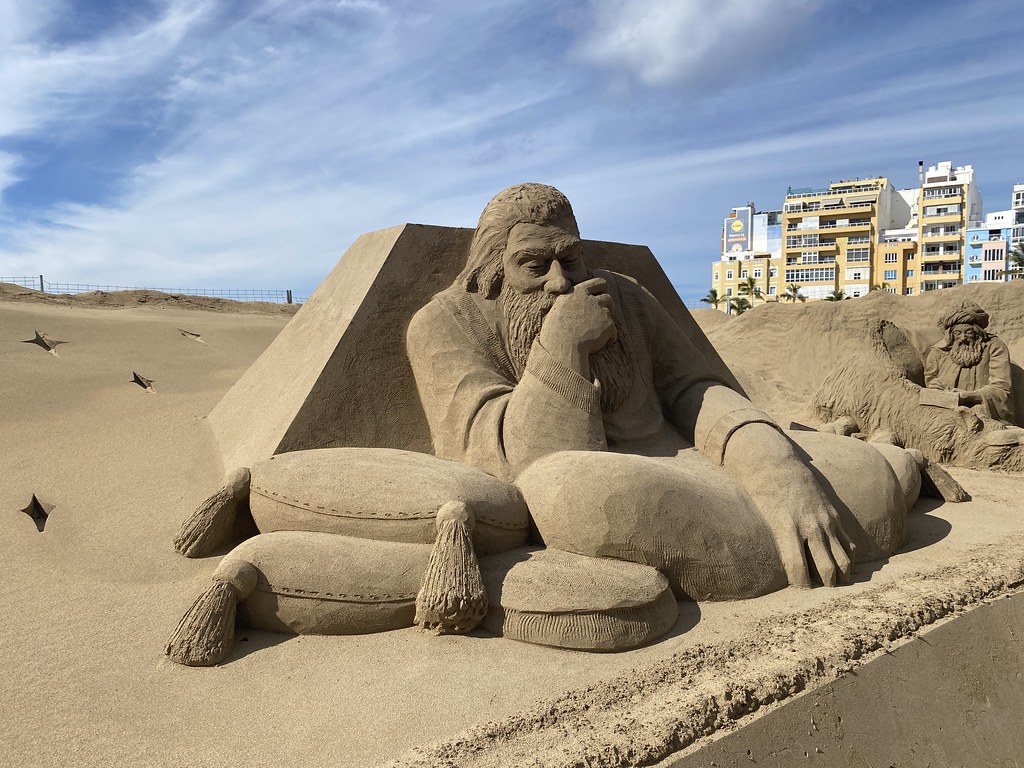
After lunch we took a wander along the sandy beachfront, stopping off to look at the sand sculptures of the Nativity.
They were really rather good.
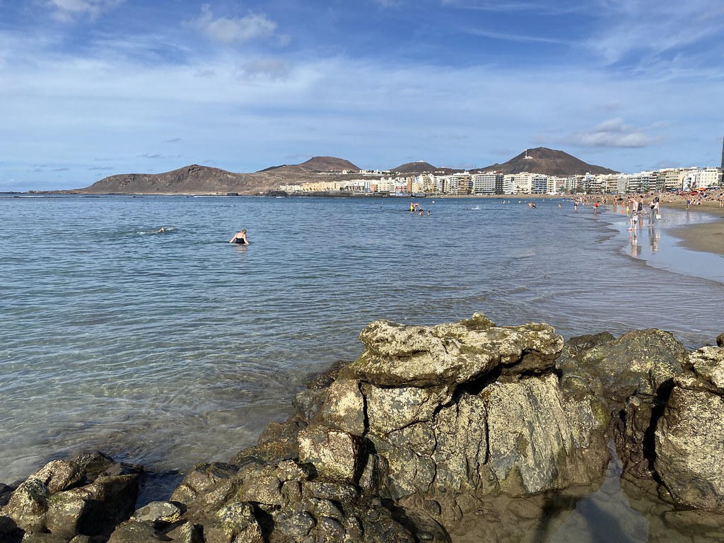
Its a huge beach and the only golden sand stretch in this part of the island.
Time to sit for a while and have a swim. The beach is protected from the bouncy waves by a natural reef just offshore so the water is calm and clear and perfect for an easy swim. Lots of fish as well.
While the family sunbathed I took a wander along the sands.
Even though its quite a modern seafront, I really love the place.
Happy family atmosphere and still some fine views.
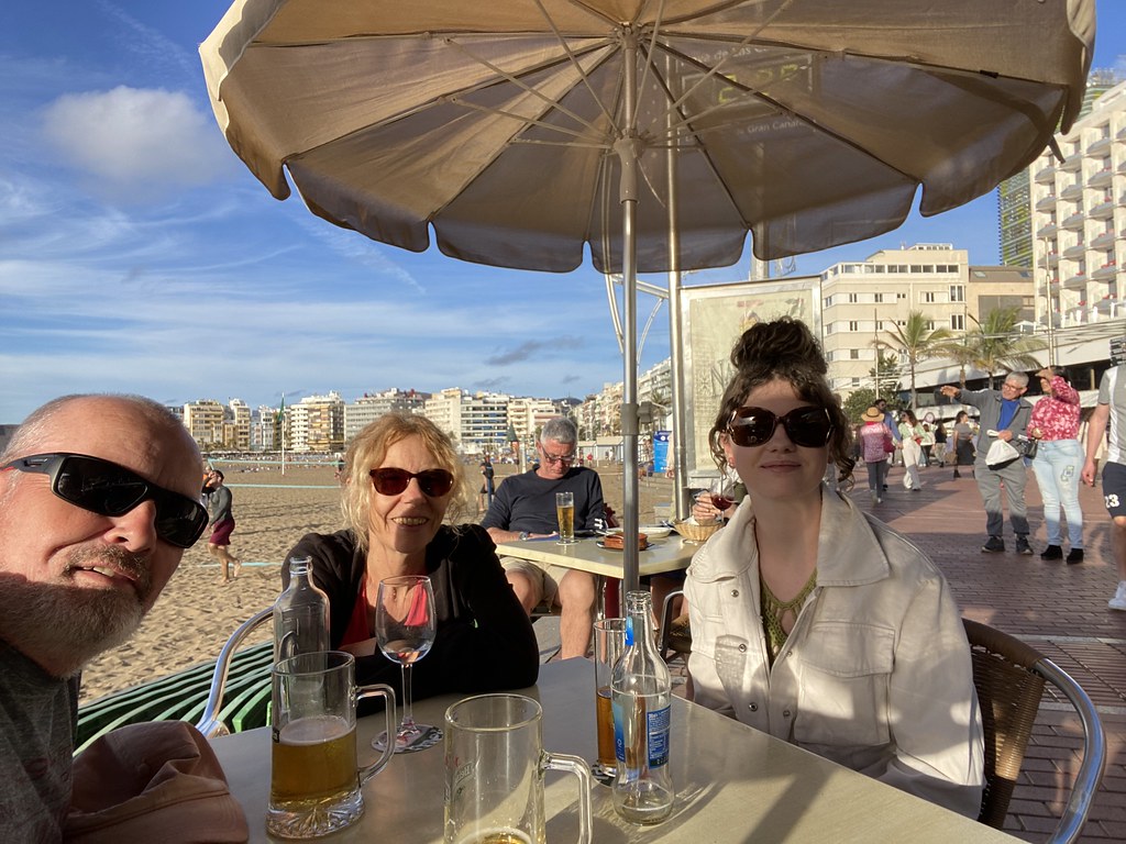
All that swimming and walking is thirsty work so it was time for another sit down and an afternoon beer or two.
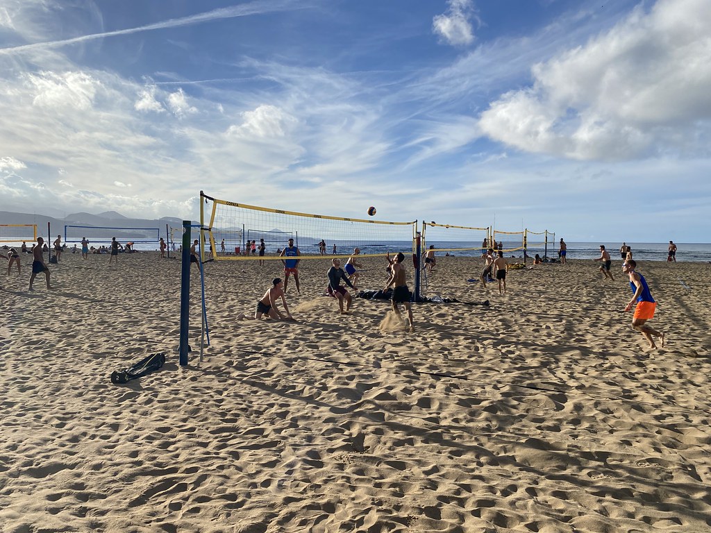
We bagged a spot by the Volleyball courts and enjoyed watching these guys play – they were seriously good.
On the adjacent court was a family enjoying their epiphany day – they were seriously bad!
Such was the quality of our little spot we stayed for a couple of hours and by the time we moved on the sun was starting to go down.
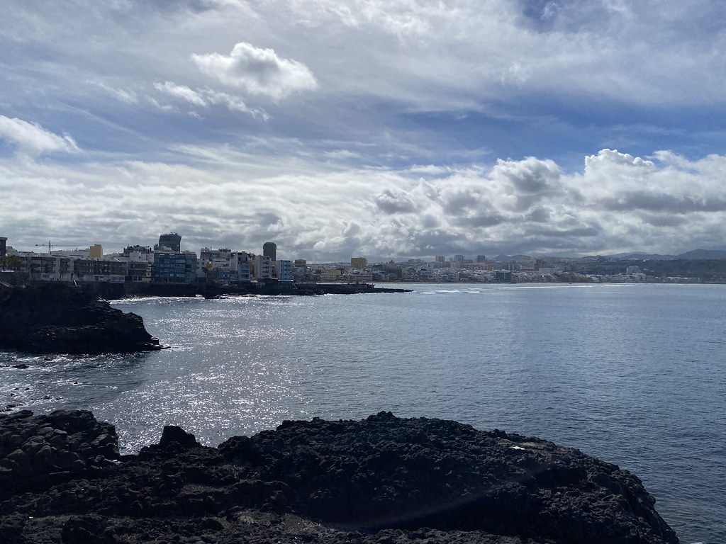
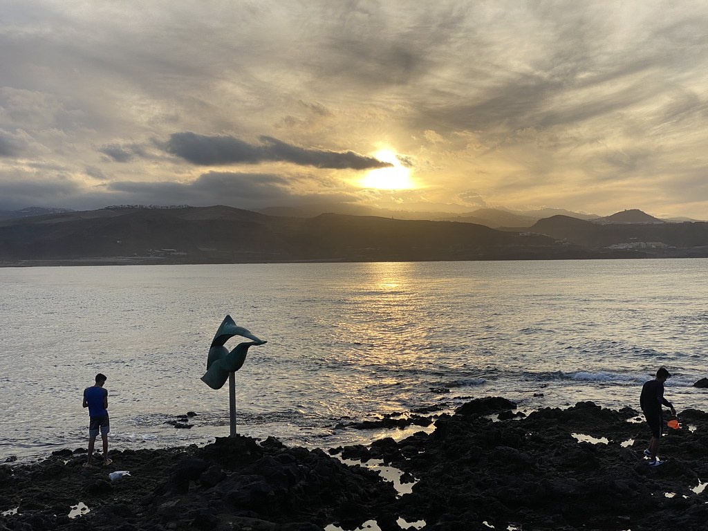
We strolled back up to the rockier part of the promenade to watch the people surfing and fishing.
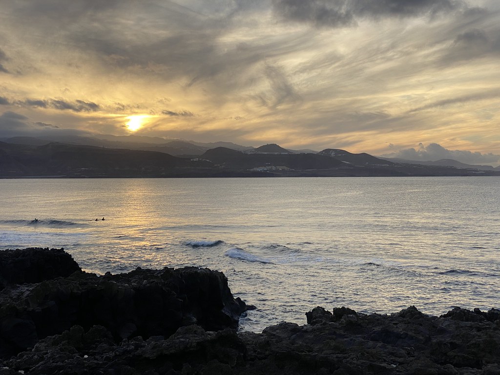
It was too cloudy for a truly awesome sunset but the views were still pretty decent across the coast.
And across to the main promenade with the sun lighting up beachfront buildings.
Reluctantly we tore ourselves away to catch the bus back to apartment with packing to be done ready for our flight home in the morning. A brilliant last day to end another superb winter holiday.
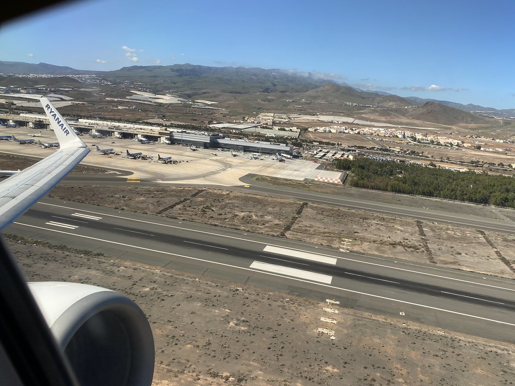
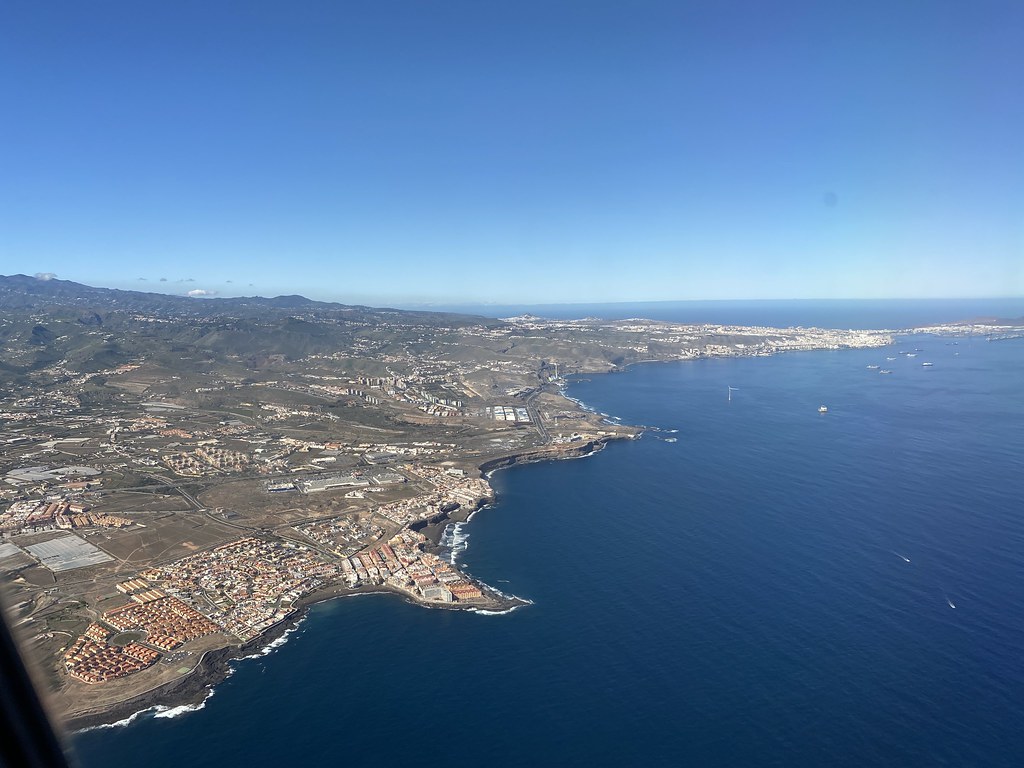
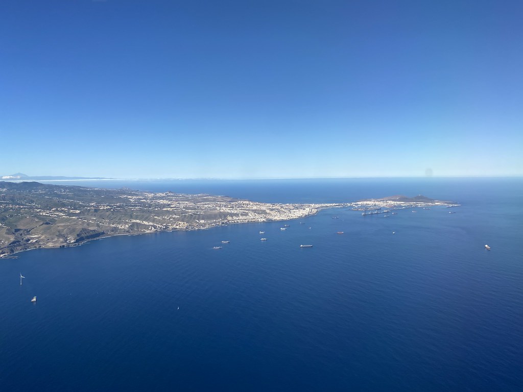
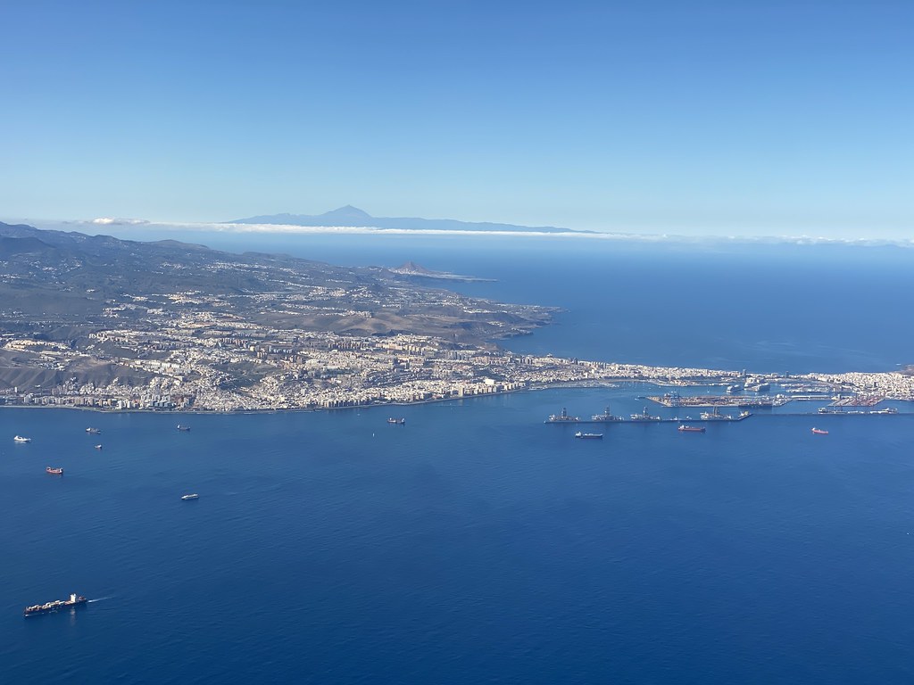
The weather for the flight home was superb so we had some great views of the island as we departed.
La Garita and La Bufadero are in the bottom part of this photo.
Las Palmas city
Tenerife looming large on the horizon above Las Palmas.
The crescent shaped bay on the far side of the peninsula is Las Canteras beach.
Mountains of northern Portugal (I think)
And the sun sets over the UK (and our holiday) as we approach Luton Airport.
I spend alot of my time surfing the web looking for ideas on places to go, walking routes, travel ideas and tips to plan the perfect holiday or day out. (I'm a project manager I like to plan). I thought it was time to share my own experiences and contribute to the vast amounts in information that's already out there.
I'll also add in some gear and tech reviews and when something irks me I may even use this forum to have a rant - I do that pretty well I'm told.There are a few pages at the top that give a bit of background to what I like to get up to and what you can expect to see in my posts. I'm not exactly a creative writer but I hope some people will find my stuff useful or inpsiring or at least enjoy some of my photos.