
I’m behind again – just when I’d caught up as well. Back to the last weekend in March for a rare trip out to Snowdonia with The Hardman. He’s planning on a run over the Welsh 3’s and some of his friends haven’t done the narrow ridge of Crib Goch so he wanted a reconnaissance mission. I agreed to join him as the forecast looked like it might be a decent day and worth the 5 hours return trip in the car.
Things didn’t start well. TH wasn’t at the appointed spot we’d agreed to meet (a very handy lay-by that’s free to park and only a few hundred yards from where you have to pay £4). After 45 minutes he still hadn’t arrived and I was worried he might have had some car problems (or maybe just forgotten that the clocks went forward!).

With no phone signal there was nothing I could do but set off and see what transpired. As I reached the start of the new path up to Pen y Pass from Pen y Gwryd there he was! He’d decided to completely ignore my well written instructions and paid to park. Ah well, times to set off and the increasingly good views soon had us back in tune with the day.

The weather improved markedly, much more than expected such that by the time we started up the PYG Track there was abundant blue sky. On decent days the path is normally a long train of people but the gloomy start seemed to have kept the crowds at bay.
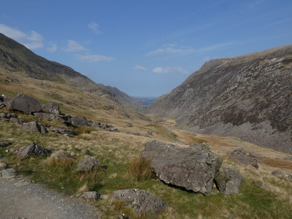
The views down the Llanberis Pass and across to the Glyders were amazing.

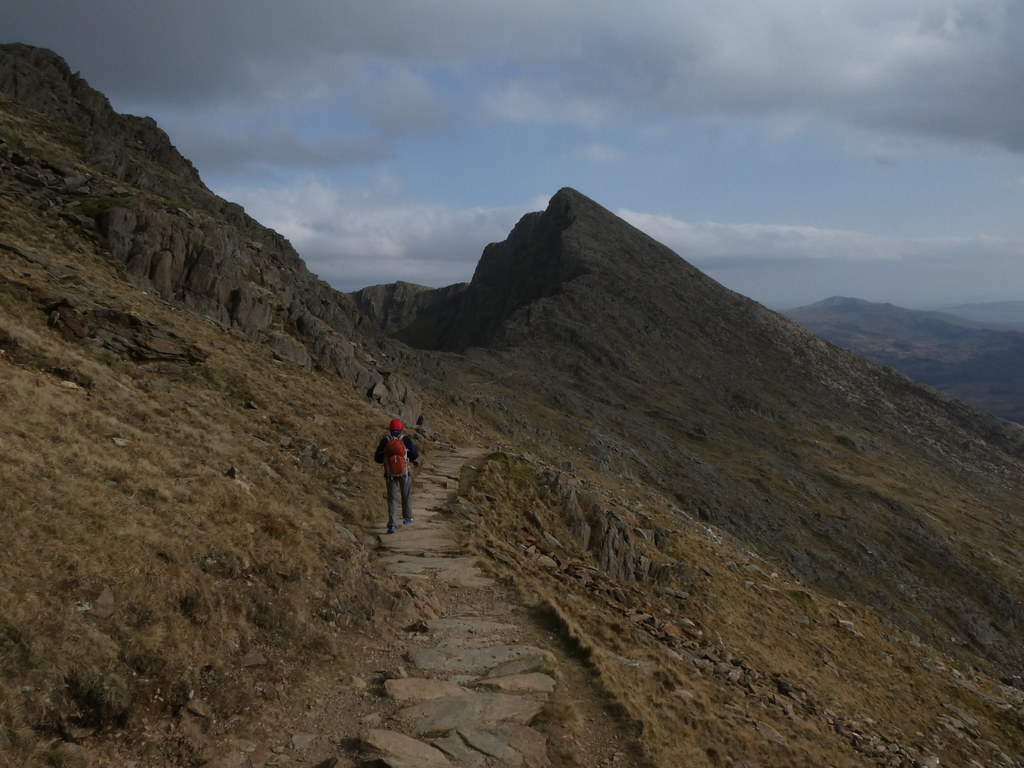
And of course Crib Goch looms large and dramatic in the view from here. East Ridge (our route) on the left, North Ridge on the right.

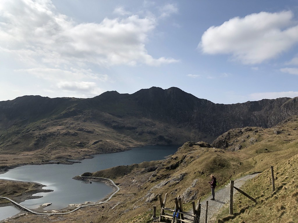
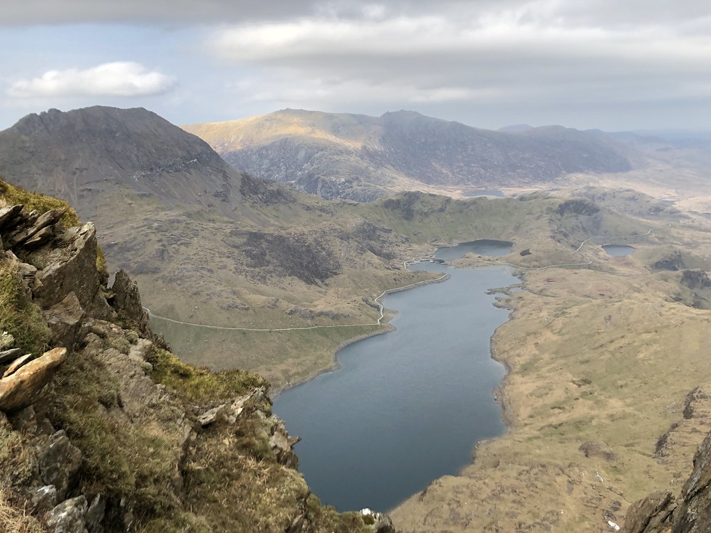
Fine views across Llyn Llydaw and to Y Lliwedd from Bwlch y Moch.
Onwards with the steep climb up to Crib Goch. A tough undertaking at the best of times but at Hardman pace even more so! The rocky spur halfway up gives some great, easy scrambling.


The final section of the ridge pulls you up towards the summit.


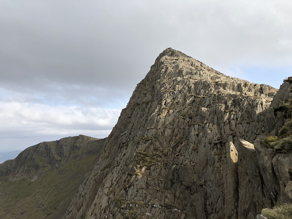
The summit is one of the few in England or Wales with a real sense of narrow exposure. This is looking down the North Ridge. I did this one a couple of years back. Harder and narrower than the East Ridge but its a real pain to get to.

And the the highlight of the day, the narrow crest of the ridge. In my youth I was able to hop along the crest, mostly only a foot wide but in these less nimble days I prefer the handrail approach.

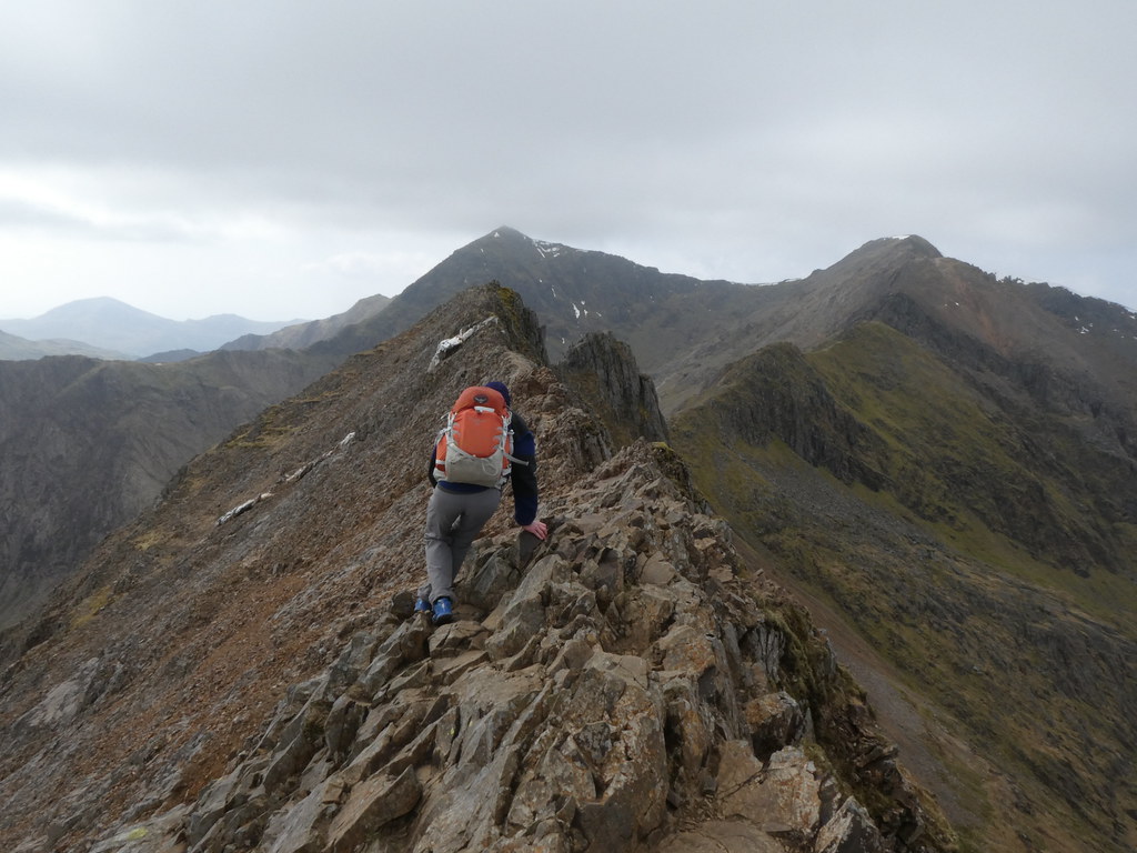
It really is quite narrow and exposed and you’d have to head to Lochaber or Skye to find anything quite as challenging in the UK.

Looking back from the final pinnacle.

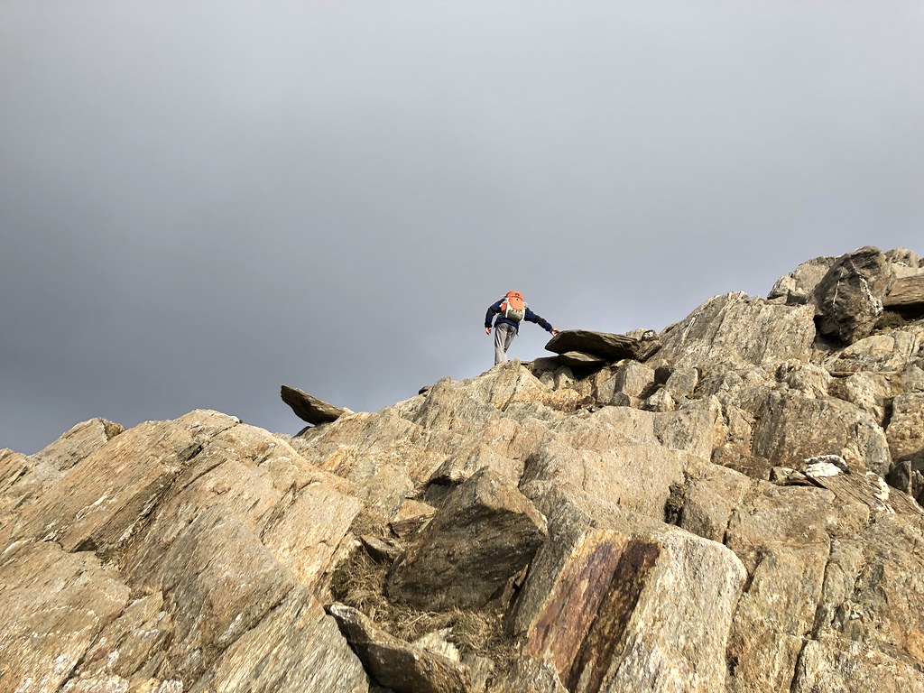
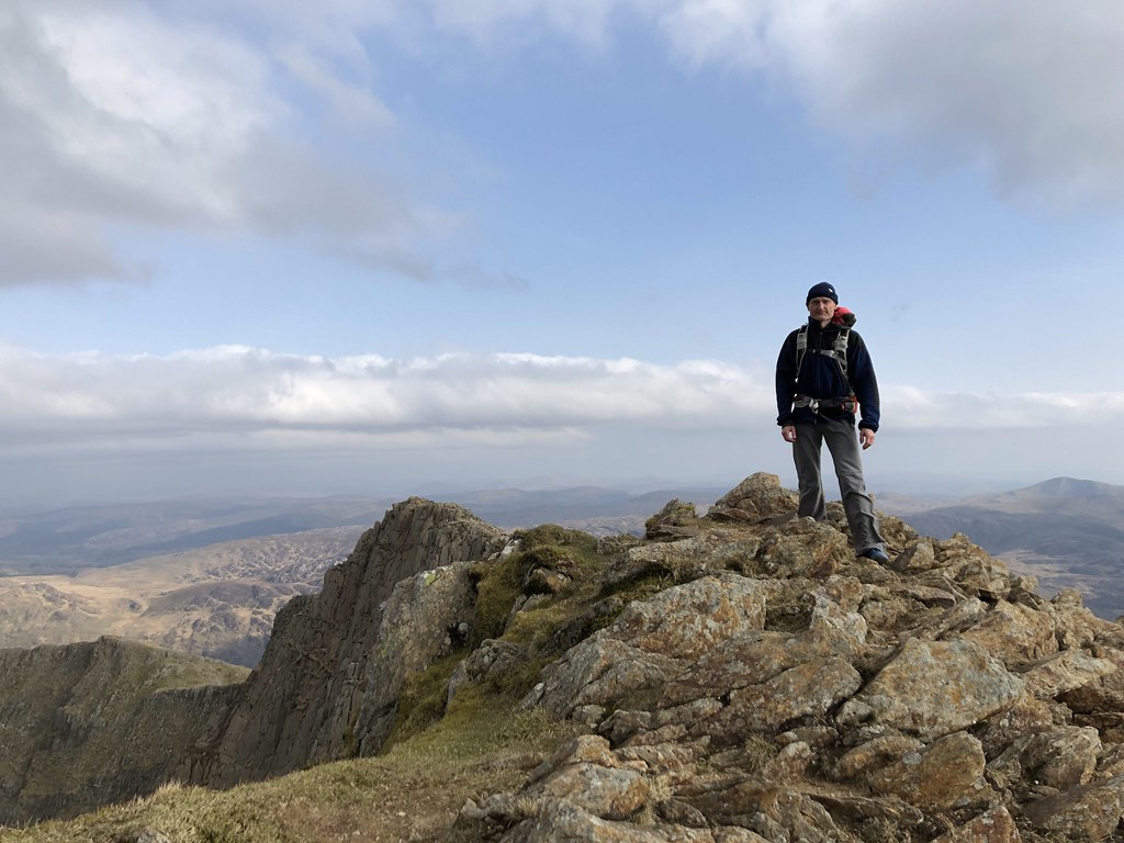
The Hardman on the short steep (and exposed scramble) over the final pinnacle.

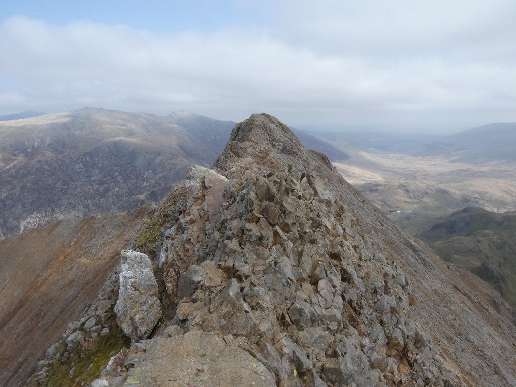
A brief stop for first lunch and onwards to the ridge of Crib y Ddysgl, not as narrow but with plenty of interesting scrambling moves of its own.


Over the summit of Garnedd Ugain and on to to join the masses on the main Snowdon routes to the summit.

Not as crowded as it can be, but still the usual comical mixture of under-equipped and unhappy people clearly surprised by just what a long climb it is and how cold it was up there. We didn’t linger and just walked straight over the top heading away from the crowds and towards the other half of the horseshoe (the full route enclosing the dramatic east corries of Snowdon).

The distant views were a bit hazy and for most of the day we were under a cap of dark cloud. However it was localised and as the sun dropped into the western sky where clouds were less we had some extensive sunny spells and dramatic light effects. The route down to Bwlch Ciliau is still under improvement and the final section is very loose and unpleasant.

As we reached the bottom the sun came out and we stopped for lunch number two.
Y Lliwedd is a wonderful peak but its always quiet whenever I’ve done it no matter how busy Snowdon is. Probably its just too much extra effort for the main mob and possibly as its not over 3000 feet. Whatever the climb up its west ridge is a delight with lots of scrambling if you have the energy to seek it out.
Looking back to Crib Goch.

And Snowdon.

Watching you, watching Crib Goch.


The ridge is not narrow but the views from the edge are magnificent and precipitous.
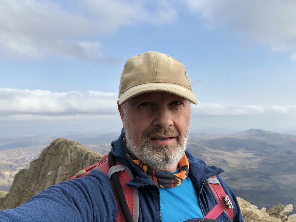
And our two heroes on the final summit.
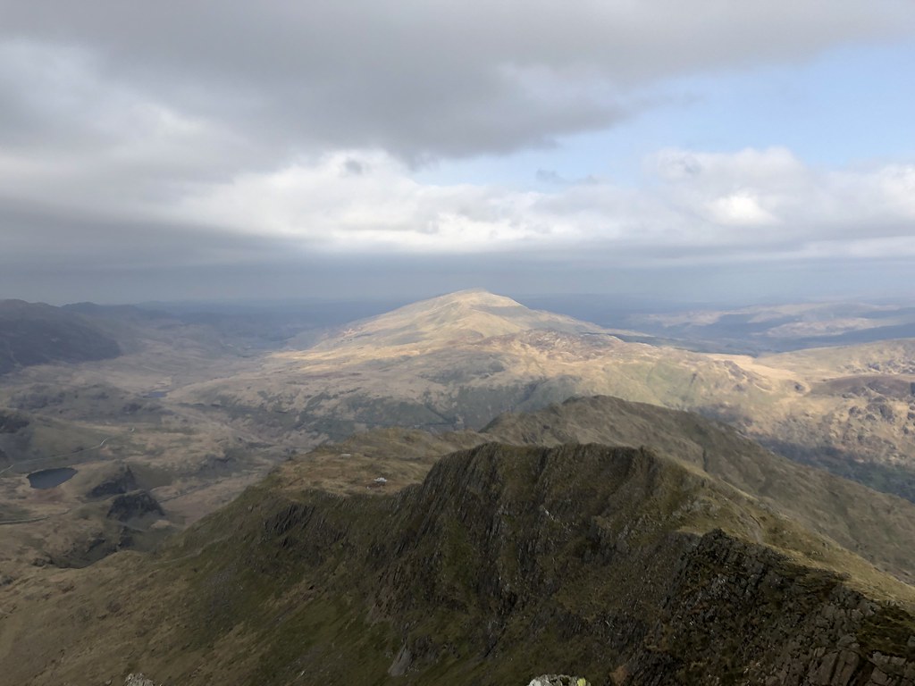
Moel Siabod cast in sunshine in the distance.

Just the matter of a long descent back to the car.

And see final sunshine on the Glyders to finish an awesome day on one of the UK’s finest (if not its quietest) mountaineering routes.

I drew the route into my OS Map software. It told me there was over 6000 feet of ascent so I’m now rather unsure of any figures it comes up with. The the 10 miles distance seems about right though at least.

Thanks to TH for convincing me it was worth the drive.


Excellent circuit. Definitely handrail style for me on the edge.
Software ascent figures are usually very inaccurate, often wildly so, it’s inherent in the way elevation data is stored.
LikeLike
I don’t quite have the balance or the nerve that I had in my youth. Never quite sure how accurate the mapping software is but this one seemed hugely erroneous by a factor of 1.5 -2 x
LikeLike
Would take more than a handrail to get me on Crib Gogh. Well done yourself but definitely not for me 😬
LikeLike
It does a head for heights but if you can find a time to avoid the crowd there are some magnificent routes on Snowdon, a majestic mountain
LikeLiked by 1 person
I’m staying in a youth hostel (youth!!!) at the foot of Snowdon and am thinking of trying the Watkin Path. The longest way up! I’ve been up the Pyg path then down the Miners path about 17 years ago. It was a work outing to celebrate our 10th year! One colleague was pregnant so caught the train and met us at the top! We had a meal in Bedgelert the previous evening and stayed overnight in a hotel.
LikeLike
The Watkin path is one of the best. Its quite a long and gradual climb and there is stretch across the flanks of Snowdon that is pretty loose and tough especially in descent. There are some lovely waterfalls and pools near the bottom – great for swimming. The routes on the west side are much quieter especially the south ridge which was pretty much deserted when I did it a couple of years back
LikeLiked by 1 person
I think this is a challenge I can cope with, at least going up. Is there an alternative way down to make it a circular route?
LikeLike
You could descend the South ridge which is pretty easy angled and there is path back down to the Watkin route from the col before the climb to Yr Aran (a great little peak in its own right). I’ve done that route in reverse including taking in Yr Aran but its better to ascend the Watkin path than descend the part that flanks Snowdon as its a bit loose and slippery (they are improving it but its Work in Progress)
Otherwise you could descend any of the western routes and use the bus service to return to the start point. If you head up in summer be prepared to share the summit with several hundred people – I’m serious!
LikeLiked by 1 person
Thanks for the advice. You’ve given me some ideas to work on. Roll on July!
P.s. I remember the crowds when we went up all those years ago 😉
LikeLiked by 1 person
“He’s planning on a run over the Welsh 3’s”. Oh, of course, like you do. Well, if you’re the Hardman. I assume we’re both invited? Will they run Crib Goch (I did that once to get away from an MUHC party). What about on Tryfan? The mind boggles. We’d better get into training! And take out substantial insurance in my case.
Well done btw. I only tried to keep up with him once, that I can remember, on Derry Caingorm. I failed miserably, but even the attempt nearly killed me. Of course, he’s slowing down these days – merely running the Welsh 3’s for example.
LikeLike
He does tend to laze around and sleep on hikes when the sun is out – when you can get him to stop anyway. It was break neck on this walk – had me suffering a few times although I’m a bit quicker on the scrambles. Just in case you were wondering I have no plans to run the welsh 3’s with the Hardman. I was just a consultant! 🙂
LikeLiked by 1 person
Guess you were well up with Naismith’s pace on this round!! What a walk though, I’ll get to do these eventually, I tend to take a beeline to junction 40 on the M6 and then turn off, need to train the car that Snowdonia and the Peak District are nearer!!
LikeLike
I always walk at Jones pace. Like Naismiths rule only with extra time for brews, food, photos etc 🙂
I don’t visit Snowdonia as often as I’d like. Its odd that I find it just a bit too far for a day out and not far enough for a weekend away. Looking at maps earlier I realised just how many summits and ridges I haven’t done. Need to fix that – as do you! 🙂
LikeLiked by 1 person
6000 feet of ascent? Wow that’s one hard core hike! Wonderful sweeping views.
LikeLike
I wish! My mapping software didn’t get that anywhere close to right. I’m guessing its more like 3500 feet of ascent but I’ll take whatever I can get! 🙂
LikeLike
Only climbed it once (maybe twice) but its 30 years ago now. A great outing.
Bob.
LikeLike
I’ve done the round of the horseshoe several times and been up Snowdon more times than I can remember. Its a shame it attracts such crowds as its a magnificent mountain complex of ridges, corries and tarns, a fitting mountain for a highest peak. The Horseshoe avoids most of the crowds so is one of the better routes.
LikeLike
Wow, wow, wow! Now that is some hike! Just a tad ruggard and your friend is not only going to ‘run’ here, but in a ‘race’!
All that and a 5 hour trip either side. Hopefully an over nighter. I’ve just had fun with google maps trying to see where you climbed in regard to our journey from Llanberis to Betsy-y-Coed. Some of the peaks and outcrops reminded me of that drive. I see now that we would have driven through your starting point.
LikeLike
Sorry it was a 5 hour round trip (2.5 hours each way)! 🙂
It’s a classic UK walk and yes if you’d driven that route it would take you right past the bottom of this route (there is a large youth hostel at the head of the pass where the main routes to the summit start from
LikeLike
Beautiful place, I did Crib Goch few years ago and enjoyed it.
LikeLike
Crib Goch is wonderful if you have the head for heights it needs. Just hard enough to be challenging without too much technical difficulty
LikeLiked by 1 person